When a person goes missing in the vast Australian bush or out on the turbulent southern seas, the clock starts ticking immediately. For our search and rescue (SAR) teams, this is the reality of their work—an immense pressure to locate and assist people in some of the world's most unforgiving environments. Success often comes down to how quickly and precisely you can cover ground.
Table of Contents
- Australian Search and Rescue in the Modern Era
- Understanding the Risks of Australian Search and Rescue
- Thinking Like a Rescuer to Find the Lost
- Operating Within Australia’s SAR Framework
- Training to Become an SAR Drone Pilot
- FAQ: Drones in Search and Rescue
- What qualifications do I need to fly a search and rescue drone in Australia?
- Can I just show up with my drone to help in a search?
- What kind of drone is best for search and rescue?
- Do search and rescue drone pilots get paid?
- Is it difficult to learn how to fly a drone for search and rescue?
- How does an organisation get certified to perform drone SAR operations?
Australian Search and Rescue in the Modern Era
Australia’s search and rescue operations are as varied and demanding as the continent itself. Whether it’s dense forest, a sprawling coastline, or the aftermath of a natural disaster, traditional ground-based searches can be incredibly slow, dangerous for the rescuers, and a huge drain on resources. In these high-stakes situations, having the right tools can literally be the difference between life and death.
It’s in this challenging operational landscape that drone technology has become so critical. Key agencies like the Australian Maritime Safety Authority (AMSA) and the various State Emergency Services (SES) are no longer just experimenting; they are actively integrating drones into their standard response procedures.
The Role of Drones in SAR Operations
Think of a drone, or Remotely Piloted Aircraft (RPA), as an immediate 'eye in the sky' that gives SAR teams a powerful advantage. In many scenarios, they can do things that are simply impossible for ground crews or even manned aircraft.
Here’s how they make a tangible difference on a mission:
- Rapid Deployment: A drone can be in the air within minutes of a call-out. This allows teams to start searching remote or inaccessible locations long before ground crews or a helicopter could even get there.
- Better Situational Awareness: The high-resolution video feed is streamed in real-time to a command post. This gives decision-makers a clear, live picture of the entire scene, allowing them to coordinate the response more effectively.
- Improved Team Safety: Sending a person to scout an unstable cliff face, enter a flooded river, or approach a fire front is incredibly risky. A drone can assess these hazards from a safe distance, so rescuers only go in when it's confirmed to be necessary and as safe as possible.
By covering vast areas quickly and safely, drones don't just supplement traditional search and rescue methods; they fundamentally improve the chances of a positive outcome. They are a modern solution to a timeless problem.
This capability is completely changing how search missions are planned and run. The real power, however, comes from integrating advanced sensors—something we'll dive into shortly—which elevates a drone from a simple camera to a highly sophisticated search tool. As the technology matures, it's creating new career opportunities for skilled pilots across the Australian drone ecosystem.
Understanding the Risks of Australian Search and Rescue
Australia's sheer size and raw beauty are also what make it so dangerous. From our vast, unforgiving outback to thousands of kilometres of perilous coastline, the need for search and rescue is a constant reality. For emergency services, every mission is a race against the clock where having the right information can literally mean the difference between life and death.
The landscapes themselves present unique challenges. A simple day hike in one of our stunning national parks can quickly become a life-or-death scenario if someone gets disoriented, injured, or runs out of water. But it's not just the wilderness; urban search and rescue teams face their own complex dangers, from incidents at industrial sites to the aftermath of a structural collapse.
Common Incidents and Their Impact
To prepare effectively, SAR teams need to understand the patterns of risk in each environment.
- Lost Hikers and Bushwalkers: People often get into trouble by misjudging a trail's difficulty, losing their way, or having a sudden medical issue far from help. The potential search area can be enormous, which is why eyes in the sky are so vital.
- Coastal Emergencies: Our beaches and coastlines are a major focus for SAR operations. Swimmers caught in rips, rock fishers swept off ledges, and boaters in distress are all-too-common scenarios demanding a fast, coordinated response from both air and sea.
- Medical Evacuations: When someone has a serious medical emergency in a remote town or rugged country, SAR teams are often the only ones who can get them out and on their way to a hospital.
These situations tragically highlight the risks that come with enjoying our country's natural playgrounds. According to the 2024 National Coastal Safety Report, there were 258 coastal deaths recorded across Australia, with an alarming 57% of those directly caused by drowning. Statistics like these are a stark reminder of the dangers that organisations like Surf Life Saving Australia work tirelessly to prevent.
The core challenge in every search and rescue operation is time. The longer a person is missing, the lower their chance of survival, making tools that accelerate discovery invaluable for both the lost and the rescuers themselves.
For drone pilots, knowing these risk profiles isn't just an academic exercise. It directly influences how you plan a mission and fly effective search patterns. It also reinforces just how critical robust safety protocols are, a topic we dive into in our guide to drone safety around critical infrastructure. When you truly grasp the 'why' behind these missions, you're better equipped to help deliver a successful outcome.
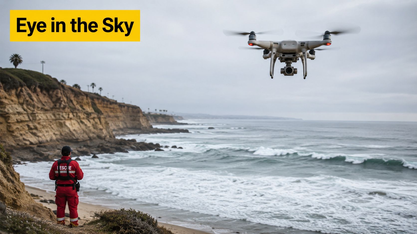
When a search and rescue call comes in, the clock starts ticking immediately. In the past, the first response often involved dispatching ground crews into potentially unknown and hazardous terrain, a process that is slow, dangerous, and physically demanding. Today, Remotely Piloted Aircraft (RPA), or drones, have completely changed the equation.
Imagine a hiker lost in dense bushland or a swimmer swept out by a rip. A drone can be launched in minutes, giving incident commanders a crucial "eye in the sky" before the first rescuer even leaves the command post. This immediate aerial perspective provides vital situational awareness, helps identify hazards, and allows for faster, more effective decision-making when every second counts.
More Than Just a Flying Camera: The Power of Payloads
While a standard camera is useful, the true strength of a search and rescue drone lies in its ability to carry specialised sensor payloads. These tools turn a simple drone into a sophisticated search platform that can be adapted for any mission.
The most common payloads are thermal and high-zoom cameras, but other specialised sensors like LiDAR are becoming more common for complex scenarios. Each has a specific job to do, and choosing the right one is key to a successful mission.
To understand how these tools fit into an operation, here’s a breakdown of the most common sensor payloads and their roles in search and rescue.
Drone Sensor Payloads for Search and Rescue Missions
| Sensor Type | Primary Function | Optimal Use Case | Limitation |
|---|---|---|---|
| Thermal Imager | Detects heat signatures, creating an image based on temperature differences. | Finding people in low light, darkness, heavy foliage, or through smoke. Locating heat sources in fire-affected areas. | Less effective in warm environments where ambient and body temperatures are similar. Can be confused by residual heat from rocks or animals. |
| High-Zoom Camera | Provides detailed visual inspection from a safe distance without losing image quality. | Assessing a person's condition, identifying specific clothing or features, and inspecting terrain hazards from a standoff altitude. | Requires good lighting conditions. Can be affected by atmospheric haze or fog. |
| LiDAR Sensor | Uses laser pulses to create highly accurate 3D maps and elevation models of the terrain. | Mapping disaster sites like landslides or building collapses to assess stability and find safe entry points for ground teams. | Data processing can be complex and time-consuming. Not ideal for locating a person directly but for analysing the environment. |
| Accessory Payloads | Carry and deploy equipment like spotlights, loudspeakers, or small supply drops. | Illuminating a scene for night operations, communicating with a conscious victim, or delivering a radio, water, or medical kit. | Limited by the drone's carrying capacity. Can affect flight time and stability. |
By combining these technologies, a drone becomes an invaluable force multiplier. It's no longer just about observation; it’s about collecting specific, actionable data that can guide the entire rescue effort.
How Real-Time Data Shapes the Mission
This flow of live information fundamentally changes how a mission is run on the ground. A command centre can watch a live feed from a drone's thermal camera, spot a heat signature, and instantly send a ground team to that exact GPS coordinate. This is worlds away from the slow, traditional grid search patterns that consume precious time and energy.
With this data, commanders can deploy resources far more efficiently, understand the dangers on the ground before sending people in, and ultimately keep everyone safer. Instead of working with old information, they're directing the operation proactively based on what’s happening in real time.
Thinking Like a Rescuer to Find the Lost
Finding a missing person is rarely a matter of luck. Success in search and rescue hinges on a specialised field known as lost person behaviour, which is all about understanding how people act when they’re disoriented, injured, or in distress. This isn't just theory; it’s the science that turns a blind grid search into an intelligent, targeted operation.
As a drone pilot, this knowledge is just as vital as your flying skills. It shapes where you look, what you search for, and how you make sense of what your sensors are telling you. You stop just flying over a patch of land and start thinking like a rescuer, predicting the most likely places a person might be based on who they are and what happened.
How to Predict a Lost Person’s Actions
The fundamental principle is that different groups of people behave in statistically predictable ways when lost. Key factors like age, physical fitness, mental state, and the surrounding environment all create patterns that can point a search team in the right direction. For example, a lost toddler is almost always found very close to where they were last seen, whereas a fit and experienced hiker could cover a surprising amount of ground.
These predictive models are built on hard data from thousands of past incidents. A landmark Australian Missing Person Behaviour Study offered some fascinating local insights. The analysis of incidents in the Australian bush found that a person’s physical condition was a huge factor; those in poorer physical shape were more likely to stick to a track, while fitter people were more prone to moving erratically off-trail.
The infographic below breaks down how this behavioural science translates into a practical mission plan.
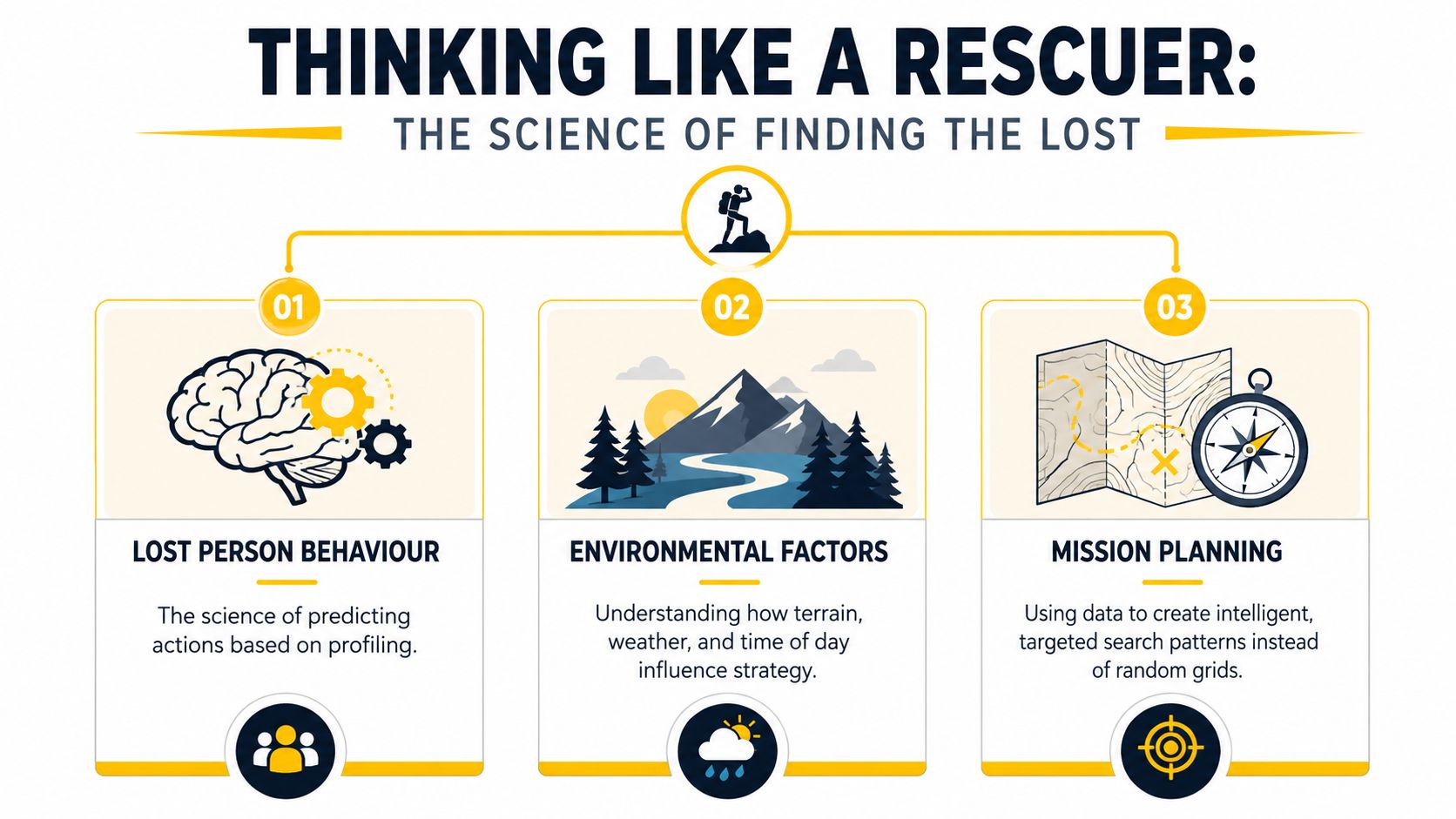
This methodical approach—profiling the person, analysing the environment, and planning strategically—is what consistently leads to successful rescues.
By building a mission plan around lost person behaviour, drone operators can concentrate their search on high-probability areas first. This makes the entire operation more efficient and dramatically boosts the chances of finding someone before it’s too late.
Ultimately, adopting this mindset is what separates a drone operator from a true aerial search specialist. It’s about using the technology not just to see, but to understand, anticipate, and locate.
Operating Within Australia’s SAR Framework
If you’re thinking about flying a drone in a search and rescue operation, the first thing to understand is that it’s not a freelance gig. You’re not a rogue hero—you’re a specialist operating within a highly structured, multi-agency system. For any pilot wanting to work in this field, knowing your place in Australia’s emergency response framework is the first, most crucial step to operating safely, legally, and effectively.
Think of commercial drone pilots not as first responders, but as skilled contractors. We’re brought in to provide a specific, critical capability under the direction of an official agency. When a large-scale search is underway, it’s a coordinated effort led by government bodies—usually the state or territory police for land-based incidents.
Who Is in Charge
During a major search, you won’t be working alone. Multiple agencies come together under a single command structure, ensuring that every asset—from ground crews to helicopters and drone teams—is working in perfect sync.
The key players you’ll be working alongside include:
- State Police: As the lead agency for most land-based SAR missions, they are responsible for the overall command and coordination of the operation.
- State Emergency Service (SES): The SES provides the majority of trained volunteers for ground search teams, along with vital logistical support.
- Australian Maritime Safety Authority (AMSA): AMSA is in charge of all civilian maritime and aviation search and rescue responses across the country.
A professional drone pilot’s job is to slot seamlessly into this command structure. Your role is to deliver aerial intelligence that serves the mission objectives set by the incident controller. You are a specialist asset, deployed to gather specific data.
Understanding this hierarchy isn't just theory; it's practical. You need to be ready to follow directions, deliver clear and concise reports, and operate within the mission's strict safety and communication protocols. This is where qualifications become non-negotiable. You can’t just show up and expect to fly. Operations under the Excluded Category are simply not sufficient for this level of professional work, as our guide on Excluded Category drone operations explains in more detail.
The real value that professional drone teams bring to the table is efficiency and cost-effectiveness. Traditional search methods are still essential, but they come with a hefty price tag. According to an analysis of bush search and rescue in Australia, helicopter assets can cost upwards of $5,000 per hour, and a single complex extraction can potentially cost an individual as much as $45,000. You can find out more about the costs and coordination of bush search and rescue efforts on Trail Hiking Australia. This financial reality is exactly why cost-effective, rapidly deployable drone teams are fast becoming an indispensable part of the modern SAR toolkit.
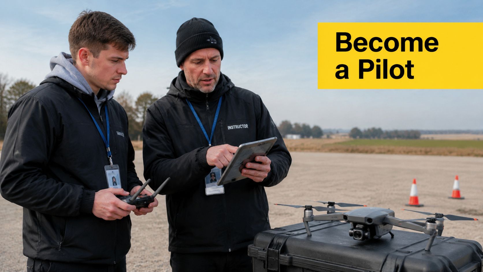
Training to Become an SAR Drone Pilot
Becoming a drone pilot for search and rescue operations is a serious role that demands nationally recognised qualifications. It's about more than just flying; it's about operating professionally and safely when the stakes are at their highest.
The first, non-negotiable step is obtaining your Remote Pilot Licence (RePL). This is the foundational qualification required by the Civil Aviation Safety Authority (CASA) for all commercial drone work in Australia. Your RePL demonstrates that you understand air law, safety protocols, and mission planning to a professional standard.
Beyond Flying: Communication and Organisational Certification
A pilot's licence alone isn't enough. During an emergency, the airspace is a busy, shared environment. Pilots must communicate effectively with helicopters, planes, and ground crews to ensure operational safety.
This is why the Aeronautical Radio Operator Certificate (AROC) is essential. An AROC authorises you to use an aeronautical radio, enabling you to integrate into the communications network of a multi-agency response. It is crucial for deconflicting airspace and maintaining situational awareness for all parties.
For an individual, the RePL and AROC are your entry tickets. They prove you have the core competencies to be considered for professional SAR work.
For organisations—be it a company, government agency, or a volunteer group—the requirements extend to organisational certification. To conduct SAR missions as a group, you must operate under a CASA-issued ReOC (Remotely Piloted Aircraft Operator’s Certificate). The ReOC is for the organisation, not the individual, and details its approved procedures, risk management plans, and training standards. Learn more in our ultimate guide to obtaining a ReOC in Australia.
Developing Specialised Search and Rescue Skills
With the fundamental licences secured, the next step is to build the specialised skills that make a pilot truly effective in the field. This is achieved through advanced training.
- Corporate Drone Training: For government bodies or large organisations, tailored training ensures team-wide standardisation. It covers creating standard operating procedures (SOPs), advanced flight planning, and data handling specific to SAR scenarios.
- Advanced Operational Skills: An SAR pilot needs to be more than just a good flyer. You must be an expert with thermal cameras, confident in conducting night operations, and methodical when flying complex search patterns. These practical skills are developed in dedicated, hands-on courses that go beyond the basic RePL syllabus.
This pathway—from individual licences like a RePL and AROC to organisational certification and specialised training—is what creates a genuinely capable search and rescue drone pilot. It’s a commitment, but it’s how you build the trust and skill needed to make a real difference.
FAQ: Drones in Search and Rescue
Here are answers to some common questions about using drones in search and rescue.
What qualifications do I need to fly a search and rescue drone in Australia?
The baseline qualification for any professional drone operation in Australia, including search and rescue, is a Remote Pilot Licence (RePL). However, for effective participation in multi-agency emergency responses, an Aeronautical Radio Operator Certificate (AROC) is also essential for safe and clear communication in shared airspace. Ace Aviation Aerospace Academy offers both the RePL and AROC courses.
Can I just show up with my drone to help in a search?
No. While the intention to help is admirable, emergency services operate under strict protocols for safety, insurance, and liability. Unauthorised drone operations can interfere with official air traffic and pose a significant risk. The proper way to contribute is to get qualified and join a recognised volunteer organisation or offer your services professionally through official channels.
What kind of drone is best for search and rescue?
Professional search and rescue drones are specialised tools, not consumer models. They require high weather resistance (IP rating), long flight times (over 30 minutes), and the ability to carry interchangeable payloads. Key payloads include thermal imagers for detecting heat signatures at night or in dense foliage, and high-zoom cameras for identifying subjects from a safe distance.
Do search and rescue drone pilots get paid?
It depends on the context. Pilots who are employees of emergency services (e.g., police, fire brigades) are salaried professionals for whom drone operation is part of their duties. Others operate as specialist commercial contractors hired by agencies for their expertise. Many highly skilled pilots also volunteer their time and skills with organisations like the State Emergency Service (SES).
Is it difficult to learn how to fly a drone for search and rescue?
Learning the basic controls of a drone is relatively straightforward. However, becoming a proficient SAR pilot requires specialised training beyond standard licensing. You need to master flying in challenging conditions, operating advanced payloads like thermal cameras, executing precise search patterns, and understanding emergency procedures. Specialised Corporate Drone Training can equip teams with these advanced, mission-specific skills.
How does an organisation get certified to perform drone SAR operations?
An organisation wanting to conduct drone operations for search and rescue must obtain a Remotely Piloted Aircraft Operator’s Certificate (ReOC) from CASA. This certifies that the organisation has documented procedures, maintenance logs, and a safety management system suitable for complex operations. Ace Aviation offers ReOC Consulting to guide organisations through this comprehensive process.