

In Australian real estate, listings with professional aerial drone photography sell 68% faster than listings using only standard ground-level images, according to UberRE's 2026 market commentary. That single figure changes the conversation. Drone photos for real estate aren't a novelty add-on anymore. They're part of the sales workflow.
The operators who do this work well don't just turn up, launch, and hope for a dramatic sunset. They plan the job, assess the site, fly within the law, capture a disciplined set of images, and deliver files that an agent can use immediately. In Australia, that rigour matters because the commercial drone environment sits inside CASA rules, local constraints, client expectations, and practical on-site risk.
A professional workflow usually breaks into three phases. Plan. Fly. Deliver. That sequence sounds simple, but each part separates a reliable commercial operator from somebody taking hobby-level shortcuts. For a broader view of where that work sits in the local industry, Australia's drone ecosystem gives useful context.
Table of Contents
- Why Professional Drone Photography Sells Property Faster
- Pre-Flight Planning and On-Site Assessment
- The Essential Shot List for Real Estate Marketing
- In-Field Camera Settings and Flight Workflow
- CASA Compliance for Australian Drone Operators
- Post-Processing and Professional Client Delivery
- Frequently Asked Questions
Why Professional Drone Photography Sells Property Faster
The reason drone photos for real estate work is straightforward. Buyers understand a property faster when they can see the block layout, access, surrounding streets, outdoor environment, and nearby features in a single frame. Ground photography handles finishes and interiors well. It usually doesn't explain context.
That context is where aerial work earns its place in the campaign. A suburban home with a park behind it, a coastal property with a clear line to the water, or a rural holding with visible access roads all benefit from altitude and angle. The image answers questions before the first inspection is booked.
Professional aerial work helps buyers qualify themselves early. That saves time for agents and reduces low-quality enquiries.
There's also a market expectation issue. Drone use is now common enough across Australian real estate that operators and agencies who omit it can make a listing feel under-marketed, especially when the property has land, views, frontage, or a strong neighbourhood story.
What makes the service professional
A strong result doesn't come from “cool shots” alone. It comes from an organised workflow:
- Planning before arrival: confirming airspace, access, neighbours, hazards, and the exact brief
- Flying with intent: capturing a defined set of sale-focused angles instead of random passes
- Delivering usable files: edited images that are realistic, clearly named, and ready for web or print
What doesn't work
A few habits keep turning up in poor real estate aerial work:
- Flying first and thinking later: this usually creates compliance problems or missed shots
- Over-editing the property: unrealistic skies and misleading changes undermine trust
- Treating every listing the same: a townhouse, acreage block, and waterfront home need different visual priorities
The commercial standard is simple. The drone is only one tool in the job. The actual service is planning, risk management, image capture, and delivery.
Pre-Flight Planning and On-Site Assessment
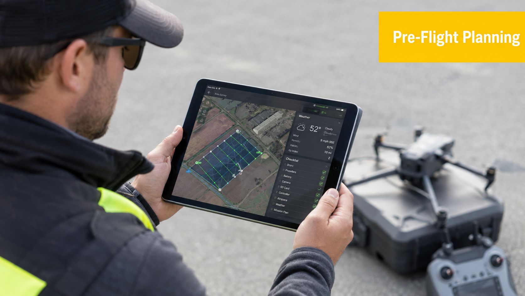
Good real estate drone work is usually decided before the aircraft leaves the case. The operator who arrives with a full site plan, a confirmed brief, and a fallback option for wind or access issues will outperform the pilot who relies on improvisation.
Start with airspace, not the camera bag
The first job is checking whether the flight can happen legally and safely at all. That means reviewing the location for nearby airports, helipads, controlled airspace, and any local conditions that affect launch or route selection. Emergency scenarios should also be thought through before arrival, not during a battery swap. AAA's drone pilot emergency handbook overview is a useful reminder that response planning is part of normal operations, not an afterthought.
A professional pre-flight review usually covers:
- Airspace status: whether the site sits near controlled or otherwise sensitive areas
- Ground hazards: power lines, trees, antennas, narrow access paths, pets, and moving vehicles
- People exposure: footpaths, neighbours, trades, children, and anyone likely to enter the operating area
- Launch and recovery points: clear space, stable footing, and line of sight throughout the mission
Practical rule: If the site can't be explained clearly on a map before arrival, it probably can't be flown cleanly on the day.
Inspect the property like an operator, not a photographer
Once on site, the operator should walk the property boundary, confirm the shot priorities, and identify anything the client wants included or avoided. Agents often think in selling points. Pilots need to translate those selling points into safe flight paths and image sequences.
That means checking things such as:
- Boundary clarity: where the lot ends, and whether fences or landscaping make that obvious from the air
- Feature priority: pool, shed, entertaining area, water frontage, vehicle access, or development context
- Neighbour sensitivity: whether adjacent homes are close enough to require tighter framing and more careful flight paths
- Sun position: whether the front elevation or outdoor area will read better earlier or later in the session
A simple pre-shoot conversation prevents many delivery problems later. If the agent wants the nearby reserve visible, the pilot needs to know that before planning height and angle. If the seller doesn't want neighbouring construction highlighted, that also affects framing choices.
For beginners, ACE READY covers drone fundamentals, aviation safety, CASA regulations, flight operations, and preparation for later RePL training. That sort of foundation is relevant because real estate work looks simple from the outside, but the on-site decisions are operational, not just creative.
The Essential Shot List for Real Estate Marketing
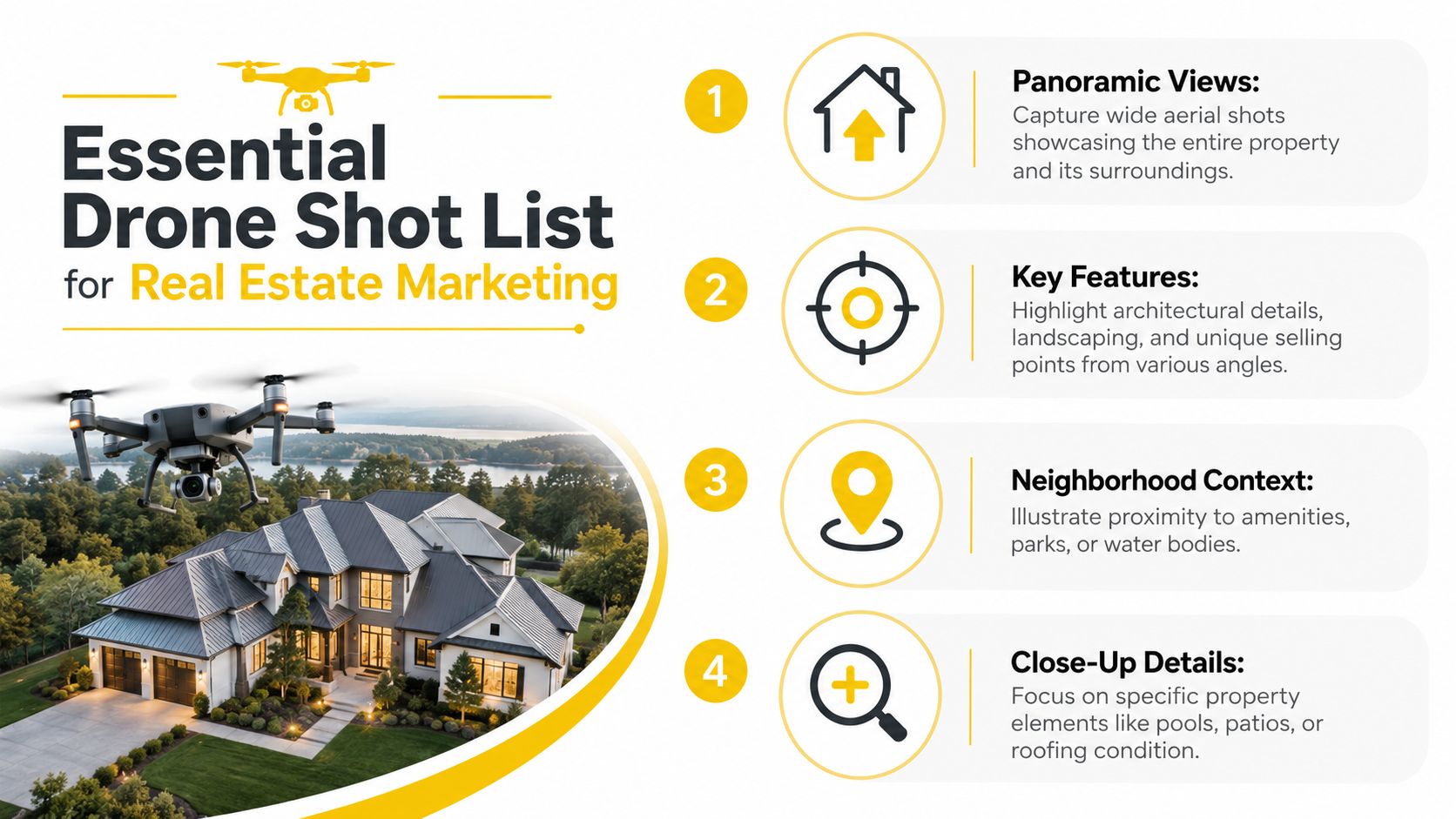
Real estate aerials work best when each image answers a buyer question. The best operators don't chase variety for its own sake. They build a visual sequence that shows the property, then explains the property.
Four shots that actually help sell the listing
The standard kit usually starts with the hero oblique. This is the front-facing aerial image that shows the home, driveway, roofline, and immediate surroundings in one clean frame. It's often the image that earns the click because it looks polished without feeling exaggerated.
The top-down view does a different job. It shows shape, boundaries, access, and relationship between structures. For corner blocks, pools, large sheds, or irregular parcels, this is often the frame that removes confusion.
Then come context shots. These show what the buyer gains beyond the fence line. A nearby beach, reserve, café strip, school approach, or tree-lined street can change how the listing reads. The aerial image should show relevance, not just distance.
The last category is the detail aerial. This isn't a close-up in the traditional ground-photography sense. It's a tighter higher frame that isolates one feature such as a pool zone, alfresco area, roof condition, or landscaping layout.
Timing and sequence matter
A useful shot list is less about quantity than order. A practical sequence often looks like this:
- Start wide: establish the property in its setting while batteries are full and wind is usually calmer.
- Move to mid-height obliques: these often become the marketing selects.
- Capture true top-downs: use these while the operator still has a clean mental picture of boundaries and hazards.
- Finish with selective feature frames: these are easier once the core campaign images are secured.
A poor shot list usually shows the drone pilot's range. A strong shot list shows the property's value.
Light changes what matters. Morning often suits east-facing frontages and cleaner street scenes. Late afternoon can be better for rear yards, outdoor entertaining areas, and softer roof detail. Operators should choose the window that flatters the most sale-critical side of the property, not just the most dramatic sky.
In-Field Camera Settings and Flight Workflow
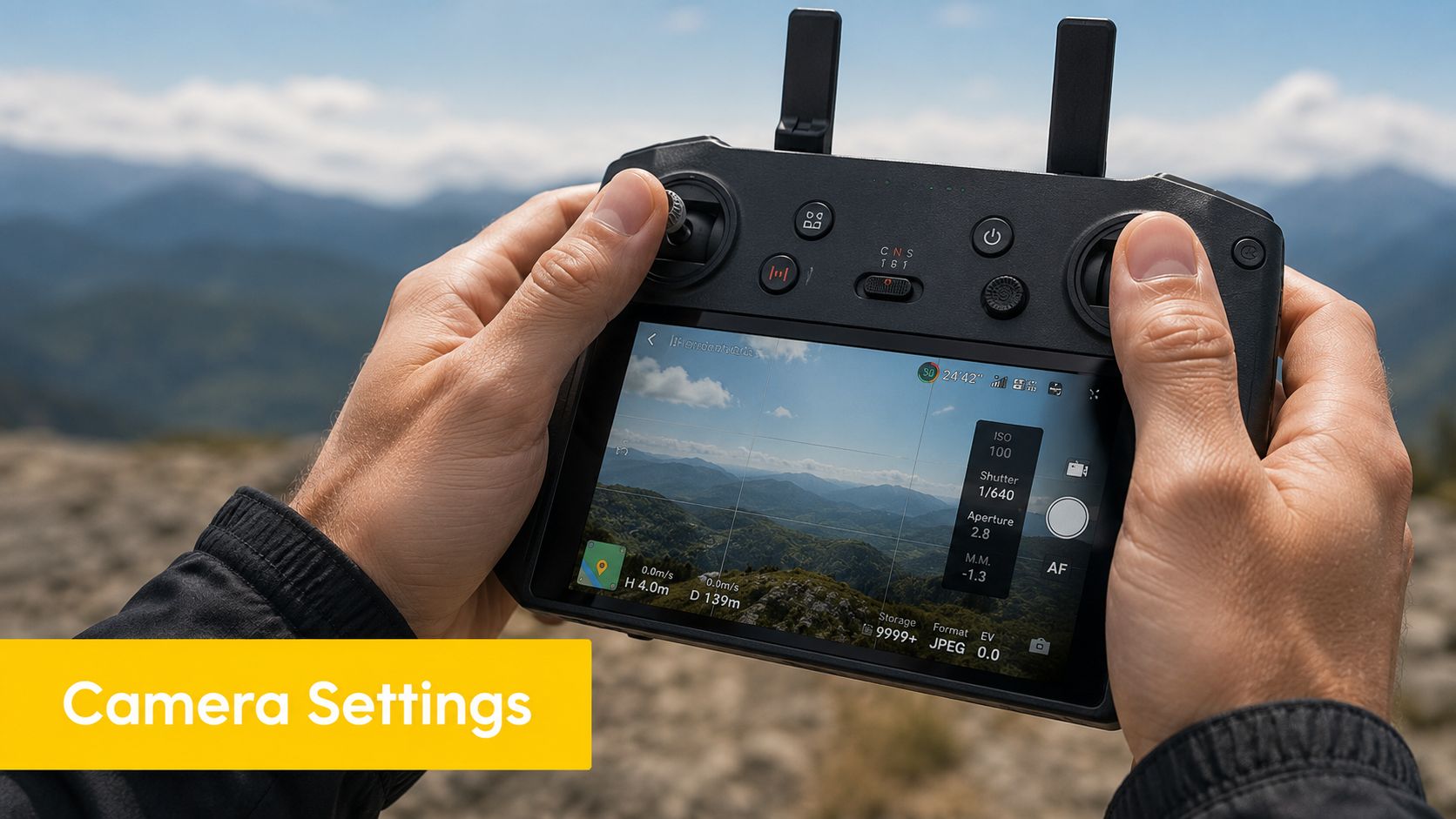
A lot of bad real estate aerial work comes from one decision. Leaving the camera in auto and hoping software fixes the rest. That approach produces inconsistent exposure, clipped highlights, muddy shadows, and soft frames during movement.
Manual settings beat auto mode
For professional results, the working baseline is clear. Use a sensor of at least 24MP and manually lock ISO at 100 to 400 with shutter speed at 1/100s or faster to avoid the motion blur common in auto-mode orbital shots, as outlined by Remark Visions on real estate drone photography technique.
That matters because real estate images need edge definition. Roof lines, fences, paving, trees, and boundary cues all lose value when the image softens. The blur might look minor on a controller screen, but it shows up quickly in editing and even more on listing portals.
A practical in-field camera setup usually includes:
- RAW capture: gives more room for highlight and shadow control in post-production
- Manual ISO: keeps noise predictable
- Manual shutter speed: protects sharpness during slow or orbiting movement
- Exposure bracketing where needed: useful when bright sky and shaded building surfaces sit in the same frame
Pilots operating near sensitive aviation environments should also understand local proximity issues before launch. AAA's guide to drone safety around airports and helicopter landing sites in Australia is relevant for suburban operators who may work close to infrastructure they don't immediately recognise as operationally significant.
A practical flight pattern for consistent results
A repeatable workflow improves output more than chasing fancy manoeuvres. Many professionals use a disciplined sequence per battery rather than improvising.
| Flight stage | Main purpose | Common mistake |
|---|---|---|
| Establishing pass | Secure the wide context image early | Flying too high and making the home look small |
| Mid-level obliques | Produce the core marketing images | Tilting too steeply and flattening the façade |
| Nadir or top-down pass | Show layout and land use clearly | Forgetting to square the frame to boundaries |
| Feature orbit or angled detail | Isolate high-value exterior features | Moving too fast and creating blur |
The key is smooth, deliberate movement. Real estate stills don't need aggressive manoeuvres. They need stable positioning, careful framing, and enough patience to let the composition settle before capture.
CASA Compliance for Australian Drone Operators
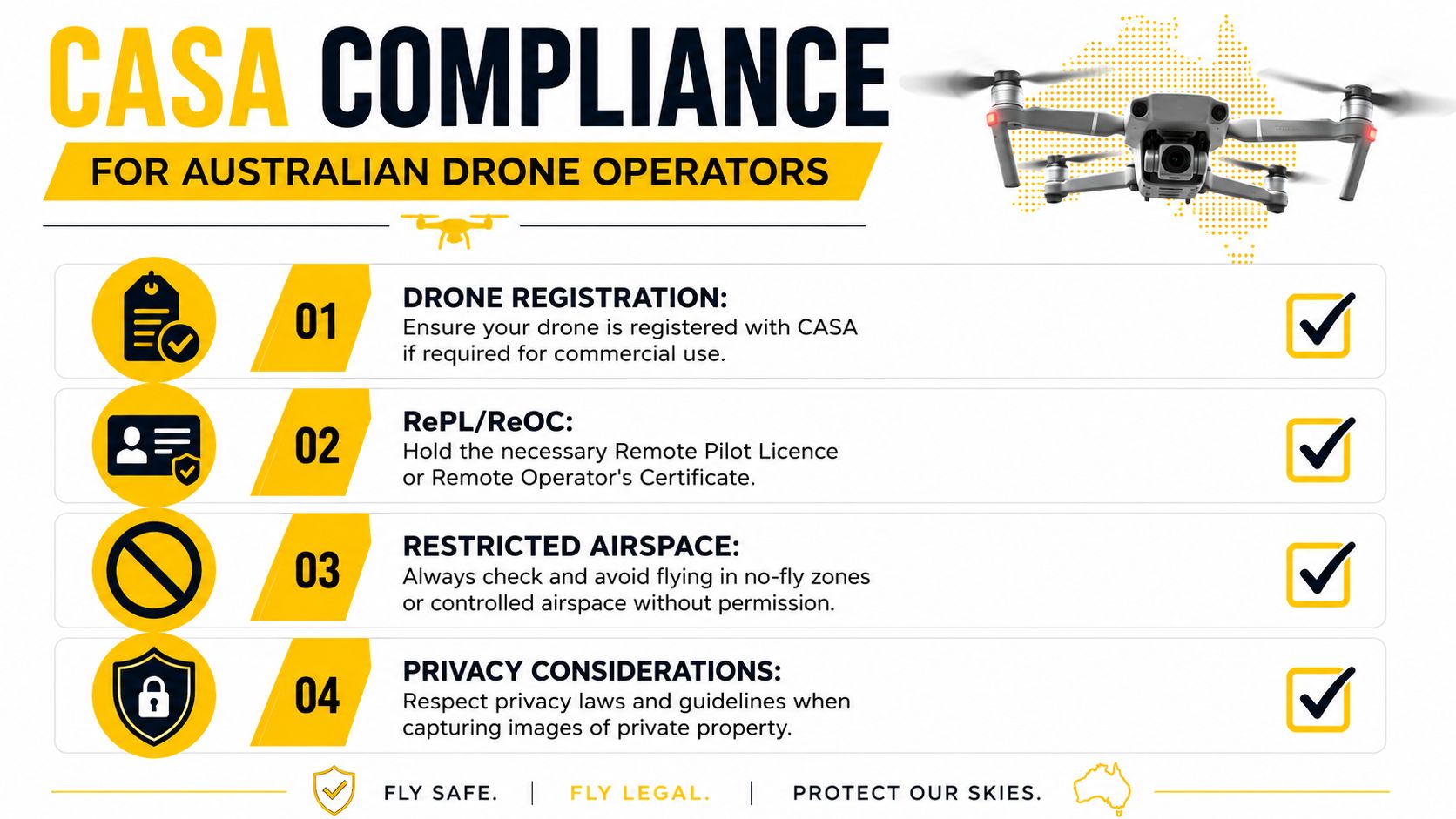
This is the part that determines whether an operator has a business or a problem. Drone photos for real estate sit inside commercial aviation activity. That means the operator isn't just creating marketing content. The operator is conducting paid drone operations under Australian rules.
Commercial real estate work means aviation obligations
One point is often missed by new entrants. Any drone used commercially in Australia must be registered with CASA, regardless of weight, as explained in Avian's summary of CASA drone rules for commercial use. If the flight is part of a paid real estate service, registration is not optional.
Industry adoption also explains why compliance now matters commercially as well as legally. As of 2025, 82% of real estate agencies in Australia incorporate drone technology, and 43% of those who use drones hire professional operators, according to Matterport's Australian real estate drone statistics. Clients increasingly expect a lawful and organised operator, not just someone with a consumer drone.
A practical compliance checklist includes:
- Commercial registration: confirm the aircraft is properly registered for paid operations
- Pilot qualifications: know when the planned operation requires a RePL and associated approvals
- Operational review: assess whether the flight can be conducted under standard conditions
- Documentation: keep records, permissions, and job details in order
Urban property work is where operators get caught out
Australian real estate operators often underestimate the difference between sparse rural work and built-up suburban work. Earlier coverage highlighted rural property use with lighter aircraft in simpler environments, but ABC reporting on real estate drone use in rural Australia sits in a very different context from today's dense residential operations.
A semi-rural acreage with open launch space is one thing. A suburban listing with neighbours on both sides, traffic on the street, pedestrians nearby, and possibly controlled airspace overhead is another. That second scenario is where untrained DIY operators get into trouble.
Compliance is a selling point. Agents notice the difference between an operator who asks the right aviation questions and one who only talks about camera specs.
Training matters when the work gets more complex
For many commercial scenarios, a Remote Pilot Licence (RePL) is the relevant step. In more structured or advanced operating models, operator-level compliance can also become important, which is where a practical guide to the ReOC in Australia helps clarify the bigger picture.
Where radio procedures or controlled environments are part of the operating context, an Aeronautical Radio Operator Certificate (AROC) can also become relevant. For organisations building internal capability rather than relying on freelancers, Enterprise Drone Training and Corporate Drone Training fit the operational side of governance, standardisation, and staff competency.
Ace Aviation Aerospace Academy provides CASA-compliant training options in these areas, including RePL, AROC, and ReOC Consulting. In this segment, that sort of training isn't about prestige. It's about conducting legal work, reducing risk, and being able to accept jobs that hobby-level operators should decline.
Post-Processing and Professional Client Delivery
The drone landing isn't the end of the job. Clients pay for usable output. The last stage is where many operators either look professional or expose every weakness in their process.
Edit for accuracy, not fantasy
Real estate editing should be clean and restrained. Colour correction, horizon levelling, lens distortion correction, exposure balancing, and selective contrast adjustments are all normal. Misrepresenting the property is not.
A sound editing approach usually includes:
- Correcting geometry: keep roof lines and verticals believable
- Balancing exposure: recover sky detail without making the house look artificially dark
- Cleaning distractions cautiously: remove temporary issues only if that aligns with ethical and client expectations
- Maintaining permanent features: don't erase neighbouring buildings, roads, power infrastructure, or fixed site conditions
If an image looks spectacular but inaccurate, it's not professional real estate work. It's misleading advertising.
Delivery standards shape repeat business
Agents want speed, but they also want order. A messy file handover slows everyone down and makes future work less likely.
A reliable package usually includes both high-resolution files for print use and web-optimised versions for listings and social posts. Naming conventions should make sense at a glance. For example, front hero, top-down, rear context, and pool detail are more useful than random camera file numbers.
Deliver images so an agent can identify, upload, and brief a designer without opening every file one by one.
Online galleries can work well if the structure is simple. Whether the operator uses a gallery platform, cloud folder, or direct transfer service, the standard should be the same. The client should know what each file is for, what has been edited, and which images are the primary selects.
Frequently Asked Questions
Listings with aerial imagery often get more attention, but attention alone does not win work. In Australian real estate drone operations, the questions that matter are about legality, quoting, risk, and whether the pilot can deliver usable files on deadline without creating problems for the agent.
FAQ Quick Guide
| Question | Answer Summary |
|---|---|
| Do drone photos help properties sell faster? | Professional aerial imagery can improve listing performance and buyer engagement, especially where land size, setting, access, or surrounding amenities matter. |
| Do drone photos increase the final sale price? | There is no clear, recent Australian urban study that supports quoting a fixed percentage uplift in sale price. |
| Is a licence always required for paid real estate drone work? | Paid work can trigger CASA requirements around registration, accreditation, licensing, and operating limits. The correct setup depends on the aircraft and operation. |
| What should agents look for in an operator? | Compliance, insurance, planning discipline, safe flight decisions, and an organised delivery process. |
| How can a new pilot work out the right pathway? | Start with the type of work, aircraft, and location, then check the right training and approval path before taking bookings. |
Do drone photos for real estate increase the final sale price?
Be careful with this claim. Australian operators can reasonably say aerial images often improve how a property is presented and can support stronger campaign performance, but a fixed sale-price increase is not something a careful pilot or agency should promise.
Current discussion in the local market supports the marketing value of drone content more strongly than any precise sale-price uplift. That distinction matters. Good operators protect the client by keeping claims defensible.
How much does a professional drone service usually cost?
Pricing varies with the work involved, not just flight time. A small suburban block with clear airspace and a simple shot list is one job. A larger site near controlled airspace, with road traffic, neighbouring privacy concerns, and extra stills or video deliverables is another.
For many Australian jobs, agents will see standalone drone pricing land somewhere in the low hundreds, but serious quoting should be job-specific. Travel, approvals, reshoots, turnaround time, editing standards, and risk controls all affect cost. Cheap pricing usually means corners are being cut somewhere, often in planning, compliance, or post-production.
Is a licence always required for paid real estate drone work?
Not every job follows the same CASA pathway, but paid work is where new pilots get into trouble if they rely on guesswork. The aircraft category, where you fly, how close you are to people, and whether controlled airspace is involved all change the legal position.
Before offering services, use a proper decision tool such as AAA's drone licence finder for Australian operators. It is a practical starting point for working out whether the planned operation points toward excluded category rules, accreditation, RePL, or further approvals.
What should a real estate agency ask before booking an operator?
Ask direct questions. Is the pilot set up for commercial work? Can they explain the site assessment process? Do they carry insurance? What happens if the property sits near an airport, heliport, people, or busy roads? How are files named, delivered, and licensed for marketing use?
A capable operator answers those questions plainly and without hesitation. If the response is vague, the agency may be taking on avoidable legal and reputational risk along with the pilot.
Ace Aviation Aerospace Academy provides Australian drone training and aviation education for operators who need a structured path into compliant commercial work. For real estate operators, that can include training relevant to RePL, AROC, and broader operational readiness depending on the type of work being planned.
