

An infrared camera drone is not just a standard drone with a different lens. It is a specialised tool that allows operators to see a world invisible to the naked eye by capturing thermal energy rather than visible light. This ability to visualise temperature differences and display them as a clear thermal image, or thermogram, is what sets this technology apart.
Table of Contents
- Seeing a World Beyond Visible Light
- How Thermal Technology Sees Heat
- Real-World Commercial Uses for Thermal Drones
- Picking the Right Thermal Drone and Payload
- Best Practices for Data Capture
- Australian Licensing for Thermal Drone Pilots
- Frequently Asked Questions
Seeing a World Beyond Visible Light
Imagine possessing the ability to see temperature. That is the core capability an infrared camera drone provides. This is not simply about taking a different type of photograph; it is about making the invisible world of heat visible, a capability that is fundamentally changing how professionals across Australia perform their work.
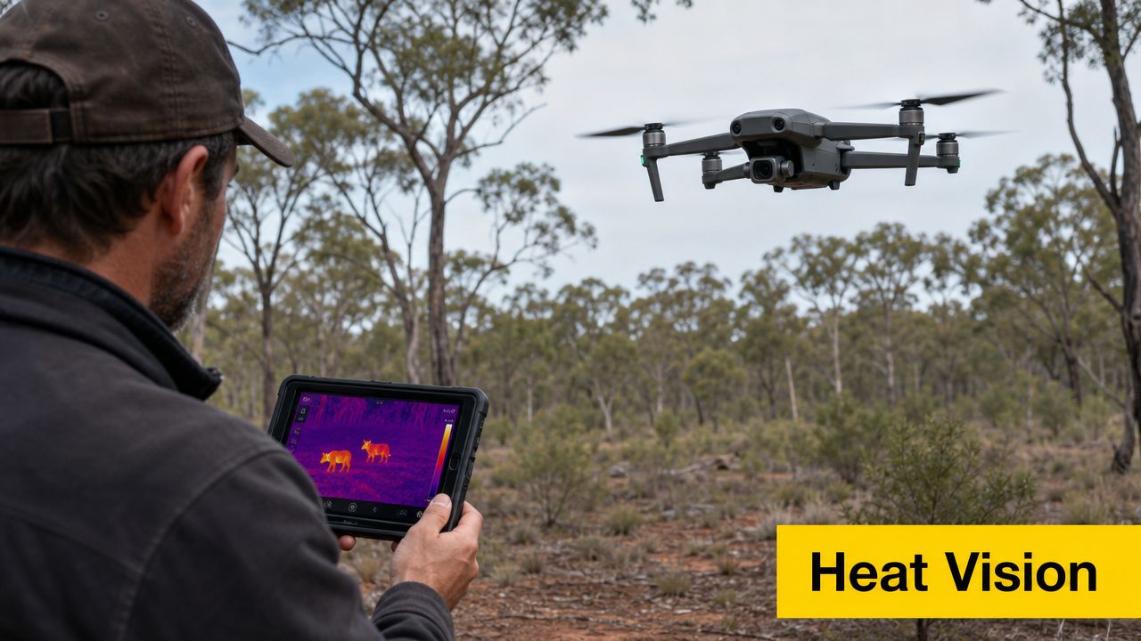
Consider the difference. The standard camera on a phone or drone—an RGB (Red, Green, Blue) sensor—captures reflected light, the same way our eyes do. A thermal sensor, conversely, is entirely different. It detects the thermal energy, or infrared radiation, that every object above absolute zero emits. This is the key distinction that makes it such a powerful and versatile tool.
Unlocking New Capabilities
Once you can "see" heat, you can spot anomalies and identify issues that are completely hidden from view. A thermal drone reveals points of interest that would otherwise go unnoticed, unlocking a broad range of commercial applications.
Some of the most common uses include:
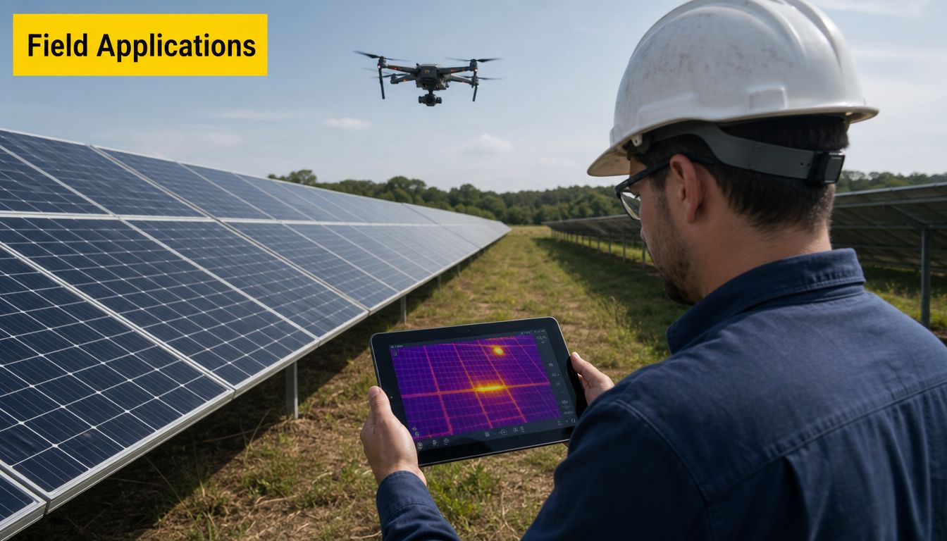
- Detecting Hidden Faults: Pinpointing an overheating circuit on a powerline or identifying a cracked, underperforming cell in a solar panel array long before it leads to a catastrophic failure.
- Enhancing Search and Rescue: A person’s body heat stands out dramatically against a cool nighttime landscape, making it possible to locate missing people in dense bushland or after dark when a visual search would be impossible.
- Improving Agricultural Efficiency: Quickly assessing crop health across vast paddocks by identifying temperature variations that indicate water stress, disease, or pest infestations.
An infrared camera drone does not just take pictures; it captures data. It translates the thermal energy every object emits into actionable intelligence, revealing everything from a faulty circuit to the location of hidden wildlife.
This technology is already having a significant impact on Australian industries. Consequently, there is a growing demand for pilots who have moved beyond basic flying skills to master thermal operations. For any commercial drone pilot, learning to fly and interpret data from a thermal drone is a game-changer, opening the door to more specialised and high-value services.
How Thermal Technology Sees Heat
You do not need an engineering degree to understand how a thermal drone works. At its core, the concept is simple: everything with a temperature above absolute zero (–273.15°C) gives off thermal energy. While our eyes cannot see this infrared radiation, a thermal camera's sensor is built specifically to detect it.
It is helpful to think of it as a camera that sees in a world of heat instead of light. The sensor, known as a microbolometer, detects this invisible energy. As different objects radiate more or less heat, they cause tiny pixels on the sensor to warm up by different amounts. The camera then translates these variations into an electrical signal and creates a visual image, or thermogram. In most cases, warmer objects appear as bright colours like red, orange, or white, while cooler areas show up as darker blues or blacks.
Understanding Emissivity in the Field
This is where the subject becomes more technical for a professional pilot. You must understand a concept called emissivity. It is a measure of how effectively a surface radiates the thermal energy it holds, ranked on a scale from 0 to 1. A perfect emitter receives a score of 1.
This is why two objects at the exact same temperature can look completely different through a thermal lens. Imagine pointing your drone at a roof. A section with dull, black asphalt shingles has high emissivity (around 0.9), so it radiates heat very well. Right next to it, a patch of shiny, unpainted metal flashing has very low emissivity (perhaps 0.1), reflecting much more thermal energy than it emits.
To your thermal camera, the metal will look much colder than the shingles, even if a temperature gun shows they are identical. Understanding emissivity is the key to capturing accurate data instead of misleading pictures.
Radiometric vs Non-Radiometric Cameras
When you begin researching thermal payloads, you will find they fall into two main categories: radiometric and non-radiometric. Knowing the difference is crucial for any serious commercial work.
Non-radiometric cameras provide a qualitative image. They are excellent for showing relative differences—a hot spot here, a cold spot there. This is perfect for basic tasks like quickly finding a person in a search and rescue operation.
Radiometric cameras provide quantitative data. Every single pixel in the image contains an actual temperature measurement. This is essential for proper analysis, like confirming if a solar panel is failing or if an electrical component is about to overheat.
For any kind of detailed inspection, energy audit, or survey work, a radiometric camera is a necessity. It is the difference between guessing and knowing. Understanding these technical details is what separates hobbyists from professionals, which is why Ace Aviation Aerospace Academy's specialised drone training focuses heavily on the practical side of thermal imaging operations.
Real-World Commercial Uses for Thermal Drones
It is one thing to understand the technology, but the real value of an infrared camera drone is demonstrated in the field. Across Australia, these drones are changing how business is conducted, helping professionals work faster, more safely, and with a level of precision that was once impossible. As more industries adopt this technology, the demand for skilled thermal drone pilots is climbing.
Public Safety and Emergency Services
In public safety, thermal imaging is not just an advantage—it is a lifesaver. When every second counts, the ability to see heat signatures gives first responders a critical edge.
- Search and Rescue (SAR): Imagine trying to find a missing person in dense bushland at night. A person's body heat glows brightly on a thermal sensor, allowing a drone to scan vast areas and locate someone far more quickly than a ground crew ever could.
- Firefighting: Fire crews use thermal drones to see through thick smoke, revealing hidden hot spots and tracking the movement of a fire front. This intelligence allows for smarter resource deployment and helps keep firefighters safe by identifying unseen dangers.
Asset and Infrastructure Inspection
Maintaining our critical infrastructure is a massive undertaking, and thermal drones have made the job much more manageable. By spotting heat anomalies, inspectors can find faults before they become catastrophic failures—all without shutting down systems or putting people at risk.
For an asset inspector, an infrared camera drone is like having x-ray vision for equipment health. It reveals overheating circuits on powerlines, faulty cells on solar farms, and hidden water leaks under commercial roofs—all from a safe distance.
This proactive approach to maintenance is saving companies millions by preventing costly damage and downtime. It is now standard practice in the energy, construction, and utilities sectors, meaning a pilot with thermal skills can offer a high-value service that is always in demand.
Agriculture and Environmental Management
Australia's agricultural and environmental sectors are also gaining a major boost from thermal technology. Farmers and land managers can now get an incredibly detailed view of vast properties. A drone with a thermal sensor can spot subtle temperature changes in crops, which often points to water stress, pests, or nutrient issues, enabling precise, targeted treatment. You can learn more by reading our guide on the impact of agricultural drones in Australia.
Environmental scientists are using the same technology for wildlife conservation. A single drone survey with a thermal camera can cover roughly ten times the area of a traditional spotlighting team in the same amount of time. In one series of studies, researchers flew over 100 thermal surveys across Victorian forests and detected more than 4,000 animals, including over 400 hard-to-find greater gliders. Applications like these make a powerful business case for adding thermal drone expertise to your professional skill set.
Picking the Right Thermal Drone and Payload
Choosing an infrared camera drone is a serious investment, and it is easy to get caught up in the latest models. The real goal is not to buy the most expensive drone; it is to match the right tool to the job you need to do.
Instead of focusing on specific drone models that may become outdated, let's focus on the core factors that will help you make a smart, future-proof decision.
Your decision primarily comes down to two key camera specifications: sensor resolution and thermal sensitivity. Higher resolution gives you a sharper thermal image, which is critical when you are trying to pinpoint small hotspots or defects from a distance.
Then there is thermal sensitivity, often referred to as Noise Equivalent Temperature Difference (NETD). Think of it as the camera's ability to distinguish between very slight temperature changes. A lower NETD value is better—it means the sensor is more sensitive and produces a cleaner, less "noisy" picture, allowing you to spot subtle thermal anomalies that other cameras might miss.
Integrated vs. Modular Drone Systems
One of the first major decisions you will face is whether to choose an all-in-one integrated drone or a more flexible modular system.
An integrated system, like a DJI Mavic 3 Thermal, has the camera built directly into the drone. They are compact, incredibly fast to deploy, and ideal for jobs where mobility and responsiveness are key, such as public safety operations or quick asset inspections.
On the other hand, you have modular systems. These are typically larger, heavy-lift drones like a DJI Matrice 350 RTK, designed to carry a wide range of interchangeable cameras and sensors. This is where you get ultimate flexibility. You can attach a high-resolution thermal camera for one job, then swap to a powerful zoom camera or even a LiDAR sensor for the next, all using the same drone platform.
The initial investment is much higher, but the versatility is unmatched for specialised commercial work. It is these advanced, multi-purpose platforms that pilots often graduate to after completing our Certificate III in Aviation, preparing them for complex industrial roles.
Comparing Thermal Drone System Types
| Feature | Integrated Systems (e.g., DJI Mavic 3T) | Modular Systems (e.g., DJI M350 RTK + H20T) |
|---|---|---|
| Flexibility | Fixed payload; limited to the built-in camera. | High; payloads can be swapped to suit different jobs. |
| Cost | Lower initial investment. | Significantly higher initial investment. |
| Portability | Excellent; lightweight and can be deployed in minutes. | Bulky; requires more time for setup and more space for transport. |
| Best For | Quick inspections, public safety call-outs, general-purpose use. | Specialised industrial surveys, large-scale mapping, multi-sensor missions. |
Ultimately, an integrated system offers convenience and affordability, while a modular system provides professional-grade flexibility and performance.
Running a Cost-Benefit Analysis
The higher price tag for a modular system can be intimidating, but for many specialised applications, it delivers a significant return in the long run.
A fantastic real-world example is using thermal drones for koala population monitoring in Australia. The initial setup, including the drone, high-end sensor, and professional training, can exceed A$49,900. While that sounds steep, the efficiency gains are enormous. This method brings the average survey cost down to just A$3.84 per hectare.
As recent research on the cost-effectiveness of thermal surveys for conservation shows, thermal drones are proven to be more cost-effective over time and detect more koalas per dollar spent than any traditional on-the-ground method.
This perfectly illustrates the most important principle: the "right" thermal drone is the one that provides the best return on investment for the specific work you plan to do.
Best Practices for Data Capture
Obtaining good, usable data from a thermal drone is what separates professionals from amateurs. It is one thing to get the drone in the air, but it is another skill entirely to plan and fly a mission that yields accurate, reliable information.
Planning a Successful Thermal Mission
It all starts with your mission plan. The environment you fly in has a massive impact on the quality of your thermal imagery. Experienced professionals know that the best time to fly for many jobs is during periods of thermal crossover, which typically happens just before sunrise or right after sunset. At these times, the ambient temperature stabilises, making the specific heat signatures you are looking for stand out with the sharpest contrast.
Optimising Your Flight Parameters
To get consistent data, you need to lock in your flight speed and altitude. Flying too fast risks motion blur and can cause you to miss small hotspots. Flying at different altitudes will change your ground sampling distance (GSD), which can affect your temperature measurements. The key is a slow, steady flight at a constant height above your target.
For example, inspecting a large solar farm for faulty cells requires a very methodical grid pattern at a fixed altitude. This ensures you capture every panel under the same conditions, making it simple to compare the data and spot anomalies. However, searching for koalas in trees for a wildlife survey would require a much slower, lower flight path to penetrate the canopy and detect faint heat signatures.
Remember: The goal of an infrared camera drone mission is not just to fly; it is to collect data. Your entire flight plan—from speed and altitude to the path you take—must be built around what your thermal sensor needs to see.
Working with Environmental Factors
The environment can be your biggest ally or your worst enemy. Direct sunlight, for example, can heat up surfaces and create reflections (solar loading) that mask the true thermal signature you are trying to measure. This is why overcast days are perfect for building and roof inspections—the diffused light creates far more even surface temperatures to analyse.
Wind is another factor to watch. It actively cools surfaces, a phenomenon called convective cooling, which can seriously skew your temperature readings. You should always record the wind speed and direction as part of your mission notes. Having that information is vital when you are back at the office trying to interpret the data. Keeping these factors in mind, along with maintaining total situational awareness, is a core part of professional drone operations. For more on this, check out our comprehensive drone safety guide for operating near airports.
Australian Licensing for Thermal Drone Pilots
Flying a thermal drone for work in Australia is not just about having the right equipment; it is about complying with regulations. The Civil Aviation Safety Authority (CASA) sets the rules for anyone operating a drone for commercial purposes, and understanding these rules is the first step in any professional career.
The absolute baseline for any paid drone work is the Remote Pilot Licence (RePL). This is your professional licence to fly. It proves you have the aeronautical knowledge and practical skill to fly safely in Australian airspace. Without a RePL, you cannot legally charge for any thermal drone service, whether it is an asset inspection or an agricultural survey.
Key Certifications for Professional Work
Once you have your RePL, the specific jobs you undertake will dictate what other certifications you might need.
- Aeronautical Radio Operator Certificate (AROC): If your thermal missions are likely to take you into controlled airspace—such as near airports or in busy flight paths—an AROC is non-negotiable. This certificate authorises you to use an aeronautical radio to communicate with air traffic control, which is essential for safety.
- Remote Operator’s Certificate (ReOC): This certificate is for the business itself. If you are a sole trader or a company looking to perform more complex operations, like flying beyond your visual line-of-sight (BVLOS) or near people, you will need a ReOC. It is CASA's way of certifying that your entire operation has the correct safety procedures and documentation in place.
That is where professional training makes all the difference. Ace Aviation Aerospace Academy's accredited RePL and AROC courses deliver the core qualifications every commercial thermal pilot needs to get started. From there, our specialised Enterprise Drone Training can be built around thermal operations, ensuring your team is not just compliant, but genuinely job-ready. If you are not sure what you need, our helpful licence finder tool can point you in the right direction.
For any commercial thermal drone work in Australia, a Remote Pilot Licence (RePL) is not optional—it is the legal minimum. Failing to hold the correct CASA certification puts you, your clients, and the public at risk.
This technology has a rich history of professional application in Australia. In fact, Australian Aerial Imagery was the first commercial drone company to tackle large-scale drone infrared thermal imaging projects in the country. You can learn more about their pioneering work in drone thermal imaging and see how these early innovators helped shape the professional landscape we have today.
Frequently Asked Questions
Can an infrared drone see through walls?
No, an infrared camera cannot see through solid objects like walls, glass, or heavy fog. It measures the surface temperature of objects. However, it can detect the effects of what is happening behind a wall, such as a hot spot caused by faulty wiring or the different thermal signatures of wall studs compared to the surrounding plasterboard.
What is the best time of day for a thermal drone flight?
The optimal time depends entirely on the mission. For search and rescue or wildlife tracking, night or pre-dawn flights are often ideal because the cooler landscape provides high contrast for body heat signatures. For inspecting solar panels or building facades, an overcast day is preferable to avoid solar reflections that can corrupt the thermal data.
Do I need a special licence to fly a thermal drone in Australia?
Yes. If you are flying an infrared camera drone for any commercial purpose (i.e., for payment or as part of a business), you must hold a Remote Pilot Licence (RePL) issued by CASA. For operations in controlled airspace, you will also need an Aeronautical Radio Operator Certificate (AROC). Ace Aviation Aerospace Academy provides accredited training for both these essential qualifications.
What does "radiometric" mean for a thermal camera?
A radiometric thermal camera captures precise temperature data for every single pixel in the image, rather than just creating a qualitative heat map. This is a critical feature for professional inspection work. For example, it allows an operator to measure the exact temperature of an electrical component to determine if it is exceeding safe operating limits, providing quantitative data for analysis and reporting.
