

Meta description: Explore the 2026 drone licence Australia trends shaping agriculture, mining, surveying and media. Choose your training pathway today.
Direct Answer
To work professionally, a drone licence Australia pathway usually starts with a CASA Remote Pilot Licence (RePL), matched to the aircraft and operation. In 2026, pilots also need practical skills in RF resilience, GPS/RTK, automated safety systems and BVLOS planning. An employer’s or business’s ReOC may be required for higher-risk missions.
Why the Drone Licence Australia Pathway Is Changing in 2026
Australia’s drone industry is moving beyond basic flight skills. Employers now want pilots who can plan safe missions, collect reliable data and work within a documented operating system.
At the same time, drone technology is becoming more automated. Platforms can plan routes, avoid obstacles, maintain position and produce survey data within minutes. However, automation does not replace a qualified remote pilot.
A professional pilot must understand the aircraft, the airspace and the limits of each mission. Therefore, the modern commercial drone licence Australia pathway combines aviation knowledge with technical and operational skills.
CASA’s 2026 work program also places greater focus on scalable operations. This includes more structured pathways for advanced operations, such as extended visual line of sight (EVLOS) and beyond visual line of sight (BVLOS).
For complex missions, technology must support a complete safety case. In other words, a drone with obstacle avoidance is not automatically approved for BVLOS flight. The operator must still show that the entire operation is safe and controlled.
What a Drone Licence Australia Pathway Covers
A Remote Pilot Licence, commonly called a RePL, is an individual qualification. It demonstrates that a pilot has the knowledge and practical skills needed to operate a remotely piloted aircraft within the approved scope.
A RePL is not the same as a ReOC. A ReOC, or Remotely Piloted Aircraft Operator’s Certificate, belongs to the business or organisation. It supports commercial operations that fall outside standard operating conditions.
The correct pathway depends on several factors:
- The aircraft’s weight and category.
- The type of work you plan to perform.
- Whether the flight is within visual line of sight.
- Whether the operation is near people, buildings or controlled airspace.
- Whether the aircraft will operate at night.
- Whether the business needs to conduct complex or repeatable missions.
For example, a pilot flying a small drone for basic media work may have different requirements from a team surveying a railway corridor. A mining operator may also need more advanced procedures, equipment and approvals than a real estate photographer.
RePL, ReOC and Advanced Operations
| Credential or capability | Who holds it? | What it supports | Why it matters in 2026 |
|---|---|---|---|
| RePL | Individual remote pilot | Professional drone operations within the licence scope | It is the foundation for many commercial roles |
| AROC | Individual aviation radio operator | Radio communication in relevant aviation environments | It improves communication and airspace awareness |
| ReOC | Business or organisation | Commercial operations and complex missions | It supports structured, repeatable drone work |
| Night operations training | Pilot or operator pathway | Approved night operations where applicable | Demand is growing in inspection, agriculture and security |
| EVLOS capability | Pilot and operating team | Extended visual line of sight missions | It can support longer corridors with trained observers |
| BVLOS capability | Operator and approved team | Flights beyond the pilot’s direct visual range | It is important for large-area surveys and infrastructure |
| Certificate III in Aviation | Qualified student | A nationally recognised aviation qualification | It can strengthen employment and enterprise applications |
The rules can change as CASA develops new frameworks. Always check the current requirements before operating.
Key Facts Table: Industry and Technology Trends
| Trend | Industries affected | Skills pilots need | Operational benefit |
|---|---|---|---|
| RTK and PPK positioning | Surveying, mining, construction | Correction services, control points and quality checks | More accurate maps and measurements |
| RF interference management | Mining, cities, infrastructure | Link checks, spectrum awareness and contingency planning | Better command-and-control reliability |
| Obstacle avoidance | Cinematography, inspection, construction | Sensor limits, route planning and manual recovery | Reduced collision risk |
| Automated missions | Agriculture, mapping and inspection | Mission setup, monitoring and intervention | Consistent repeatable data collection |
| AI data analysis | Agriculture, mining and asset inspection | Data review, defect detection and reporting | Faster business decisions |
| BVLOS-ready platforms | Infrastructure, resources and logistics | Risk assessment, telemetry and emergency procedures | Larger operating areas |
| Battery intelligence | All commercial sectors | Battery health, charging and transport controls | Fewer power-related incidents |
| Remote identification and tracking | Enterprise and public-sector work | System checks and record keeping | Better accountability and coordination |
Real-World Applications for Licensed Pilots
Agriculture: From Aerial Images to Precision Operations
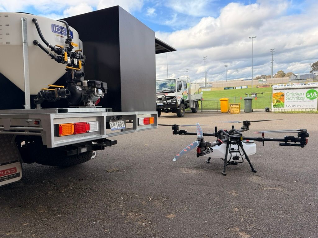
Agricultural drones are becoming larger, smarter and more specialised. Operators may use them for crop mapping, plant health analysis, livestock monitoring and targeted spraying.
Heavy-lift platforms also create new opportunities. However, they require more than basic multirotor control. Pilots must understand payload limits, battery performance, spray drift, weather and ground procedures.
Agricultural work may involve:
- Crop health imaging.
- Weed and disease identification.
- Variable-rate application.
- Water stress monitoring.
- Livestock observation.
- Broad-acre mapping.
- Orchard and vineyard inspection.
The technology is valuable because it can reduce unnecessary vehicle movement across fields. It can also help operators collect data more frequently.
Nevertheless, the pilot remains responsible for the mission. A pre-flight assessment should consider people, livestock, powerlines, nearby roads, weather and chemical handling requirements.

Mining and Resources: Safety, Scale and Data
Mining operations use drones to collect information in places that may be hazardous or difficult to access. Common missions include pit surveys, stockpile measurements, blast planning and infrastructure inspection.
A drone can capture thousands of images across a site. Photogrammetry software can then create a three-dimensional model. In addition, RTK or PPK positioning can improve the accuracy of the final survey.
Mining pilots should understand:
- Site induction and exclusion zones.
- Radio and communication procedures.
- GNSS performance near high walls.
- Dust, wind and temperature effects.
- Emergency landing areas.
- Interaction with manned aircraft.
- Data security and client reporting.
The mining environment may also contain strong radio signals and complex metal structures. Therefore, RF interference and signal multipath should be included in the operational risk assessment.
Surveying and Mapping: Accuracy Is the Product
Surveying clients do not simply buy flight time. They buy accurate, useful information.
That means a pilot must understand the full data chain. It begins with mission planning and ground control. It continues through image capture, processing and quality assurance. Finally, the pilot or survey team delivers a report, map or model.
RTK-enabled aircraft can receive correction data during flight. PPK workflows can correct positioning after the flight. Both approaches can support high-accuracy results when the mission is planned correctly.
A survey pilot should know how to:
- Define the area of interest.
- Select the correct ground sampling distance.
- Set image overlap and flight speed.
- Check satellite and correction status.
- Place or verify ground control points.
- Review image quality.
- Identify gaps, distortion and processing errors.
- Deliver data in the client’s required format.
Ace training includes hands-on exposure to mapping workflows and enterprise equipment. This helps students move from basic flight control to professional data acquisition.

Cinematography: Creative Work Still Needs Aviation Discipline
Aerial cinematography remains one of the most visible drone applications. It includes advertising, television, real estate, events, tourism and independent film.
Creative work can also create complex safety challenges. Productions may involve moving vehicles, crowds, structures, restricted locations and tight schedules.
A professional cinematography pilot must balance the director’s creative brief with:
- Safe separation from people.
- Suitable take-off and landing areas.
- Battery and weather limits.
- Aircraft visibility.
- Obstacle clearance.
- Airspace restrictions.
- Emergency procedures.
- Privacy and site permissions.
Obstacle avoidance can support a production. It does not remove the need for a dedicated remote pilot in command. Automated tracking can also fail when lighting, texture or distance changes.
Technology Trends Every Pilot Should Understand
1. RF Interference Management
Radio frequency interference can affect the command-and-control link between a drone and its controller. It may cause delayed responses, telemetry loss or an automatic failsafe action.
Interference is more likely in areas with:
- Dense Wi-Fi networks.
- High-voltage infrastructure.
- Mining communication systems.
- Mobile network equipment.
- Large industrial sites.
- Multiple drones operating at once.
- Unplanned radio transmitters.
A competent pilot should check the likely RF environment before flight. The pre-flight plan should identify the expected link range and the action to take if the link weakens.
Good practice may include:
- Monitoring signal strength and link quality.
- Keeping the aircraft within a known recovery area.
- Confirming return-to-home settings.
- Establishing a lost-link procedure.
- Avoiding unnecessary transmitter congestion.
- Recording abnormal link behaviour.
- Reviewing the manufacturer’s limitations.
RF management is especially important for BVLOS-ready operations. The operator must show that communication remains reliable or that the aircraft can safely continue or terminate its mission.
2. GPS, GNSS, RTK and PPK Accuracy
Most professional platforms use satellite navigation for positioning, return to home and automated flight. However, satellite signals are not perfect.
Errors can occur because of:
- Tall buildings.
- Cliffs and open-cut pits.
- Reflections from metal structures.
- Tree cover.
- Poor satellite geometry.
- Temporary signal interference.
- Incorrect correction data.
RTK can improve accuracy by using real-time correction information. PPK applies corrections after the flight. These tools are particularly useful for surveying, mining, construction and precision agriculture.
However, centimetre-level positioning does not guarantee a centimetre-level result. The pilot must also manage camera settings, image overlap, ground control, calibration and processing quality.
When a drone reports weak or unreliable GNSS, the pilot should not rely on automation alone. The response may include stopping the mission, switching to a safe flight mode or landing in a controlled location.
3. Obstacle Avoidance and Detect-and-Avoid
Obstacle avoidance systems use cameras, LiDAR, radar or other sensors. They can identify some objects and help the aircraft change its path.
These systems are useful near:
- Buildings.
- Trees.
- Towers.
- Bridges.
- Power infrastructure.
- Industrial structures.
- Narrow inspection areas.
However, each sensor has limitations. Thin wires, low-light conditions, reflective surfaces, dust and fast-moving objects may reduce detection performance.
Pilots should learn:
- Which directions the sensors cover.
- When sensors are disabled.
- How lighting affects detection.
- How much stopping distance the aircraft needs.
- How to take manual control.
- How to respond to an obstacle warning.
For BVLOS operations, detect-and-avoid is broader than onboard obstacle sensing. It may include airspace procedures, surveillance services, observers, electronic conspicuity and separation standards.
4. BVLOS-Ready Platforms and Operations
BVLOS means beyond visual line of sight. The pilot cannot continuously see the aircraft with unaided vision.
BVLOS can support large-area surveys, infrastructure inspection, emergency response and logistics. It can also reduce the time required to inspect long corridors.
However, BVLOS is an operational approval, not simply a drone feature. A BVLOS-ready platform should be supported by:
- Reliable command-and-control links.
- Accurate navigation.
- Telemetry and tracking.
- Defined lost-link behaviour.
- Detect-and-avoid capability.
- Weather monitoring.
- Suitable communications.
- Emergency response procedures.
- A documented safety case.
CASA’s risk-based approach means the whole operation must be assessed. The aircraft, pilot, observer, airspace, ground environment and procedures all matter.
Ace’s BVLOS and EVLOS training pathway helps operators understand these requirements. It covers safety cases, risk assessment, operational manuals and advanced approval planning.
5. Automation and AI-Assisted Data Workflows
Automation is changing the pilot’s role. A pilot may now supervise a planned mission rather than manually control every movement.
This creates new responsibilities. The pilot must confirm that the route is correct, the geofence is suitable and the aircraft can safely complete the mission.
AI tools are also used to identify:
- Crop stress.
- Vegetation changes.
- Cracks and corrosion.
- Vehicles and equipment.
- Stockpile boundaries.
- Construction progress.
- Flood or storm damage.
These tools can reduce processing time. Yet, they still require human review. A false positive can waste a client’s time. A missed defect can create a serious safety or commercial issue.
The strongest pilots in 2026 will understand both flight operations and data quality.
City Outlook: Where Demand Is Emerging
The best training location depends on your target sector, not only your home suburb. Australia’s major cities connect pilots with different industries and regional work.
| Location and training search | Strong opportunity areas | Useful capability |
|---|---|---|
| Drone course Brisbane | Construction, agriculture, infrastructure and government work | RePL, mapping and agricultural operations |
| Drone course Sydney | Media, inspection, property and infrastructure | RePL, AROC and urban risk planning |
| Drone course Melbourne | Surveying, logistics, construction and cinematography | RTK workflows and operational planning |
| Drone course Perth | Mining, resources, inspection and remote operations | Heavy-lift capability and BVLOS readiness |
| Drone course Hobart | Agriculture, conservation, surveying and regional services | Weather planning, mapping and field operations |
A strong pilot can train in one location and work across multiple markets. Ace also supports a global training footprint across Australia, Singapore, Dubai, Korea and Malaysia.
Step-by-Step Process to Prepare for the 2026 Drone Industry
Step 1: Choose the industry before choosing the aircraft
Start with the service you want to provide. Agriculture, mining, surveying and media need different equipment and procedures.
Do not buy an expensive platform before understanding the work. First, identify the client, the mission and the data or outcome they need.
Step 2: Confirm the correct licence pathway
Review the aircraft weight, operation type and proposed work. A course comparison can help you compare RePL, AROC, ReOC and advanced options.
For many commercial pilots, a sub-25 kg RePL is a practical starting point. Heavy-lift or enterprise operations may require a broader pathway.
Step 3: Build aviation knowledge
Study airspace, weather, human factors, aircraft systems, emergency procedures and risk management. These subjects help pilots make safe decisions under pressure.
A licence is more valuable when the pilot understands why each procedure exists.
Step 4: Practise with professional equipment
Hands-on practice should include more than hovering. Work on take-off and landing, navigation, emergency actions, mission planning and situational awareness.
Where possible, practise with equipment used in your target sector. That may include RTK survey drones, thermal payloads or agricultural platforms.
Step 5: Learn the technology’s limits
Read the aircraft manual. Understand battery limits, sensor coverage, GNSS warnings, wind ratings and link behaviour.
Technology reduces workload only when the pilot understands its failure modes.
Step 6: Create repeatable operating procedures
Commercial clients value consistency. Use checklists, pre-flight briefings, site surveys and post-flight records.
If you operate through a business, these procedures can support your ReOC and safety management system.
Step 7: Build a portfolio and find work
Create examples that show the result of your work. A mapping sample, inspection report or agricultural data set can be more persuasive than a list of flight hours.
Qualified ACE graduates can also access DroneWork career and contract opportunities.

Practical Examples: How the Trends Apply
Example 1: Agricultural monitoring
A farm operator needs weekly crop imagery across a large property. The pilot uses an RTK-enabled drone, planned grid missions and cloud-based analysis.
The pilot checks weather, livestock, people, nearby roads and GNSS reliability. The final service includes a map and crop health report.
Example 2: Mine stockpile measurement
A mining contractor needs monthly stockpile volumes. The pilot uses ground control, RTK corrections and repeatable flight paths.
The key risks include dust, high winds, heavy machinery and radio interference. The pilot records each mission and checks the model before delivery.
Example 3: Bridge inspection
An infrastructure company needs close images of a bridge. The pilot uses obstacle sensing and a small inspection platform.
The team establishes a controlled area below the bridge. They also plan for wind, water, traffic and loss of visual reference.
Example 4: Film production
A production company wants a tracking shot near a moving vehicle. The pilot reviews the location, people, obstacles and emergency landing areas.
The aircraft’s tracking mode supports the shot. However, the pilot remains ready to take manual control.
Common Mistakes New Commercial Pilots Make
Mistake 1: Treating the RePL as a complete business approval
A RePL qualifies the individual pilot. It does not automatically authorise every business operation.
Better approach: Confirm whether the operator needs a ReOC, additional approval or documented procedures.
Mistake 2: Trusting obstacle avoidance without checking it
Obstacle sensors can fail or miss thin objects.
Better approach: Maintain visual awareness and understand the aircraft’s sensor limitations.
Mistake 3: Ignoring RF and GNSS conditions
A clear video feed does not guarantee reliable control. A strong GPS icon does not guarantee accurate positioning.
Better approach: Monitor link quality, satellite status and site-specific interference risks.
Mistake 4: Buying equipment before finding a market
A high-end aircraft may not match the client’s requirements.
Better approach: Start with the service model, then select the aircraft and payload.
Mistake 5: Selling flight hours instead of outcomes
Clients usually want a map, inspection result, report or operational saving.
Better approach: Learn data processing, reporting and quality assurance.
Mistake 6: Forgetting records and maintenance
Commercial work requires discipline after the flight as well as before it.
Better approach: Keep maintenance, battery, training, flight and incident records in an organised system.
CASA Considerations for 2026
CASA rules remain the foundation of every Australian drone operation. Review the latest CASA remotely piloted aircraft guidance before each new type of work.
Key considerations include:
- Registering aircraft where required.
- Following maximum altitude limits.
- Maintaining required separation from people.
- Checking controlled and restricted airspace.
- Confirming permission for land access.
- Managing operations near roads, buildings and events.
- Following night operation requirements.
- Maintaining appropriate records.
- Using approved procedures for complex operations.
- Reporting incidents when required.
The exact requirement depends on the operation. Weight alone does not answer every licensing question.
For example, a light aircraft can still be involved in a complex operation. BVLOS, night flight, controlled airspace and operations near people may create additional requirements.
CASA’s 2026 direction also highlights risk-based approvals. Therefore, operators should prepare for a future where safety cases, data and documented procedures become increasingly important.
Ace Aviation operates under CASA.ReOC.1421 and focuses on practical compliance. Our training is designed to help pilots understand the rules and apply them in real operating environments.
Frequently Asked Questions
1. What is a drone licence in Australia?
The main individual qualification is the Remote Pilot Licence, or RePL. It allows a pilot to conduct approved professional operations within the licence scope.
2. Do I need a commercial drone licence Australia pathway to earn money?
You may need an RePL, operator accreditation or other approval, depending on the aircraft and operation. Commercial work must follow CASA requirements.
3. Is an RePL the same as a ReOC?
No. An RePL belongs to the pilot. A ReOC belongs to the business or organisation operating the aircraft.
4. What is the casa repl cost?
There is no single national total. The cost can include training, assessment, equipment exposure and CASA-related charges. Course scope also affects the price. Request a current training quote before enrolling.
5. Can I use an RePL for agriculture?
Yes, an RePL can support agricultural work when the aircraft, operation and approvals match the mission. Spraying and heavy-lift work may require additional training and procedures.
6. Do mining drone pilots need RTK training?
RTK is not required for every mining mission. However, it is valuable for surveys, stockpile measurement and repeatable site mapping.
7. Does obstacle avoidance make a flight safe?
No. Obstacle avoidance is one safety control. The pilot must still manage people, terrain, airspace, weather, aircraft limits and emergency procedures.
8. What is RF interference?
RF interference is unwanted radio energy that can weaken or disrupt communication between a drone and its controller.
9. How can pilots manage RF interference?
Pilots can assess the site, monitor link quality, use suitable frequencies and plan a clear lost-link response. They should also understand the aircraft’s failsafe settings.
10. Are GPS and RTK the same?
No. GPS is part of a broader satellite navigation system. RTK adds correction data to improve positioning accuracy.
11. What is PPK?
PPK means post-processed kinematic positioning. It applies correction data after a flight and is common in high-accuracy mapping workflows.
12. What does BVLOS mean?
BVLOS means beyond visual line of sight. The pilot cannot continuously see the drone with unaided vision.
13. Can any drone fly BVLOS?
No. BVLOS requires a suitable aircraft, reliable systems, trained personnel, documented procedures and the relevant CASA approval pathway.
14. Is EVLOS easier than BVLOS?
EVLOS uses trained observers to extend the effective visual range. It may be simpler for some missions, but it still requires proper procedures and approval.
15. Which industries hire commercial drone pilots?
Common sectors include agriculture, mining, surveying, construction, infrastructure, inspection, media, conservation and emergency services.
16. Which city is best for a drone course?
The best location depends on your target sector. Mining may favour Perth-based opportunities, while media and infrastructure work may be stronger around Sydney or Melbourne. Regional agriculture is important across several states.
17. Do I need an AROC?
An AROC may be required or strongly beneficial when your work involves aviation radio operations. It also improves communication and airspace awareness.
18. Is Certificate III in Aviation worth considering?
It can provide a nationally recognised qualification alongside practical drone training. It may suit students seeking broader aviation credentials or enterprise roles.
19. Can a drone pilot work internationally after Australian training?
Training is not automatically transferable to every country. Each aviation authority has its own rules. Ace has a global footprint across Australia, Singapore, Dubai, Korea and Malaysia.
20. How can I find drone work after training?
Build a portfolio, contact relevant employers and continue developing industry skills. ACE graduates can access the DroneWork platform, which connects qualified pilots with commercial opportunities.
Summary
The drone industry in 2026 rewards pilots who combine licensing, technical knowledge and professional judgement.
Agriculture needs heavy-lift and precision workflows. Mining needs safe, reliable data collection. Surveying needs accurate positioning and quality assurance. Cinematography needs creative control within strict safety limits.
Meanwhile, RF interference management, RTK accuracy, obstacle avoidance, automation and BVLOS readiness are becoming central professional skills.
A strong training provider should prepare you for more than an assessment. Ace Aviation has trained more than 4,000 students and supports pilots through training, compliance, industry pathways and the Altitude+ program. Our global footprint and CASA.ReOC.1421 experience help students prepare for real commercial work.
Ready to start? Book your training at aaa.edu.au or call 1300 336 366.
{“@graph”:[{“@id”:”https://aaa.edu.au/blog/drone-licence-australia-2026-industry-tech-trends#article”,”@type”:”Article”,”about”:[“drone licence australia”,”commercial drone licence australia”,”Remote Pilot Licence”,”BVLOS drone operations”,”commercial drone technology”],”image”:”https://cdn.marblism.com/KE2zNk2WijM.jpeg”,”author”:{“url”:”https://aaa.edu.au/”,”name”:”Ace Aviation Aerospace Academy”,”@type”:”Organization”},”headline”:”Drone Licence Australia 2026: Industry & Tech Trends Every Pilot Must Know”,”publisher”:{“url”:”https://aaa.edu.au/”,”logo”:{“url”:”https://aaa.edu.au/assets/ace-logo-transparent.png”,”@type”:”ImageObject”},”name”:”Ace Aviation Aerospace Academy”,”@type”:”Organization”},”inLanguage”:”en-AU”,”description”:”Explore the 2026 drone licence Australia trends shaping agriculture, mining, surveying and media. Choose your training pathway today.”,”dateModified”:”2026-08-16″,”datePublished”:”2026-08-16″,”mainEntityOfPage”:{“@id”:”https://aaa.edu.au/blog/drone-licence-australia-2026-industry-tech-trends”,”@type”:”WebPage”}},{“@id”:”https://aaa.edu.au/#organization”,”url”:”https://aaa.edu.au/”,”logo”:{“url”:”https://aaa.edu.au/assets/ace-logo-transparent.png”,”@type”:”ImageObject”},”name”:”Ace Aviation Aerospace Academy”,”@type”:”Organization”,”sameAs”:[“https://aaa.edu.au/reviews”,”https://dronework.com.au/”],”telephone”:”+61 1300 336 366″,”areaServed”:[“Australia”,”Singapore”,”Dubai”,”Korea”,”Malaysia”],”description”:”CASA-approved drone pilot training and aviation education provider offering RePL, AROC, Certificate III in Aviation and advanced commercial drone pathways.”},{“@id”:”https://aaa.edu.au/blog/drone-licence-australia-2026-industry-tech-trends#faq”,”@type”:”FAQPage”,”mainEntity”:[{“name”:”What is a drone licence in Australia?”,”@type”:”Question”,”acceptedAnswer”:{“text”:”The main individual qualification is the Remote Pilot Licence, or RePL. It allows a pilot to conduct approved professional operations within the licence scope.”,”@type”:”Answer”}},{“name”:”Do I need a commercial drone licence Australia pathway to earn money?”,”@type”:”Question”,”acceptedAnswer”:{“text”:”You may need an RePL, operator accreditation or other approval, depending on the aircraft and operation. Commercial work must follow CASA requirements.”,”@type”:”Answer”}},{“name”:”Is an RePL the same as a ReOC?”,”@type”:”Question”,”acceptedAnswer”:{“text”:”No. An RePL belongs to the pilot. A ReOC belongs to the business or organisation operating the aircraft.”,”@type”:”Answer”}},{“name”:”What is the casa repl cost?”,”@type”:”Question”,”acceptedAnswer”:{“text”:”There is no single national total. The cost can include training, assessment, equipment exposure and CASA-related charges. Course scope also affects the price.”,”@type”:”Answer”}},{“name”:”Can I use an RePL for agriculture?”,”@type”:”Question”,”acceptedAnswer”:{“text”:”Yes, an RePL can support agricultural work when the aircraft, operation and approvals match the mission. Spraying and heavy-lift work may require additional training and procedures.”,”@type”:”Answer”}},{“name”:”Do mining drone pilots need RTK training?”,”@type”:”Question”,”acceptedAnswer”:{“text”:”RTK is not required for every mining mission. However, it is valuable for surveys, stockpile measurement and repeatable site mapping.”,”@type”:”Answer”}},{“name”:”Does obstacle avoidance make a flight safe?”,”@type”:”Question”,”acceptedAnswer”:{“text”:”No. Obstacle avoidance is one safety control. The pilot must still manage people, terrain, airspace, weather, aircraft limits and emergency procedures.”,”@type”:”Answer”}},{“name”:”What is RF interference?”,”@type”:”Question”,”acceptedAnswer”:{“text”:”RF interference is unwanted radio energy that can weaken or disrupt communication between a drone and its controller.”,”@type”:”Answer”}},{“name”:”How can pilots manage RF interference?”,”@type”:”Question”,”acceptedAnswer”:{“text”:”Pilots can assess the site, monitor link quality, use suitable frequencies and plan a clear lost-link response. They should also understand the aircraft’s failsafe settings.”,”@type”:”Answer”}},{“name”:”Are GPS and RTK the same?”,”@type”:”Question”,”acceptedAnswer”:{“text”:”No. GPS is part of a broader satellite navigation system. RTK adds correction data to improve positioning accuracy.”,”@type”:”Answer”}},{“name”:”What is PPK?”,”@type”:”Question”,”acceptedAnswer”:{“text”:”PPK means post-processed kinematic positioning. It applies correction data after a flight and is common in high-accuracy mapping workflows.”,”@type”:”Answer”}},{“name”:”What does BVLOS mean?”,”@type”:”Question”,”acceptedAnswer”:{“text”:”BVLOS means beyond visual line of sight. The pilot cannot continuously see the drone with unaided vision.”,”@type”:”Answer”}},{“name”:”Can any drone fly BVLOS?”,”@type”:”Question”,”acceptedAnswer”:{“text”:”No. BVLOS requires a suitable aircraft, reliable systems, trained personnel, documented procedures and the relevant CASA approval pathway.”,”@type”:”Answer”}},{“name”:”Is EVLOS easier than BVLOS?”,”@type”:”Question”,”acceptedAnswer”:{“text”:”EVLOS uses trained observers to extend the effective visual range. It may be simpler for some missions, but it still requires proper procedures and approval.”,”@type”:”Answer”}},{“name”:”Which industries hire commercial drone pilots?”,”@type”:”Question”,”acceptedAnswer”:{“text”:”Common sectors include agriculture, mining, surveying, construction, infrastructure, inspection, media, conservation and emergency services.”,”@type”:”Answer”}},{“name”:”Which city is best for a drone course?”,”@type”:”Question”,”acceptedAnswer”:{“text”:”The best location depends on your target sector. Mining may favour Perth-based opportunities, while media and infrastructure work may be stronger around Sydney or Melbourne. Regional agriculture is important across several states.”,”@type”:”Answer”}},{“name”:”Do I need an AROC?”,”@type”:”Question”,”acceptedAnswer”:{“text”:”An AROC may be required or strongly beneficial when your work involves aviation radio operations. It also improves communication and airspace awareness.”,”@type”:”Answer”}},{“name”:”Is Certificate III in Aviation worth considering?”,”@type”:”Question”,”acceptedAnswer”:{“text”:”It can provide a nationally recognised qualification alongside practical drone training. It may suit students seeking broader aviation credentials or enterprise roles.”,”@type”:”Answer”}},{“name”:”Can a drone pilot work internationally after Australian training?”,”@type”:”Question”,”acceptedAnswer”:{“text”:”Training is not automatically transferable to every country. Each aviation authority has its own rules. Ace has a global footprint across Australia, Singapore, Dubai, Korea and Malaysia.”,”@type”:”Answer”}},{“name”:”How can I find drone work after training?”,”@type”:”Question”,”acceptedAnswer”:{“text”:”Build a portfolio, contact relevant employers and continue developing industry skills. ACE graduates can access the DroneWork platform, which connects qualified pilots with commercial opportunities.”,”@type”:”Answer”}}]}],”@context”:”https://schema.org”}
