

Australia's drone fleet has already outgrown its traditional aircraft fleet. The national drone-uptake analysis recorded almost 35,000 distinct drone registrations, compared with just under 16,000 aircraft registrations, a gap that shows how quickly remotely piloted aircraft systems have entered commercial and public-sector work (Australian Government drone-uptake analysis).
Infrastructure inspection is one of the clearest applications. Drones can reach bridges, facades, rail assets, roofs, chimneys, utilities and other difficult structures without immediately placing a worker at height or requiring disruptive access equipment. But an infrastructure inspection drone only creates value when its data supports an engineering decision. A folder of sharp photographs isn't a condition report, and a technically legal flight isn't automatically a defensible inspection.
The practical standard is higher: define the inspection class, plan the risk controls, select sensors for the defect types, capture repeatable data, process it properly, and deliver outputs that engineers and asset managers can use.
Table of Contents
- Why Infrastructure Inspection Drones Are Transforming Asset Management
- Planning Your Infrastructure Inspection Mission
- Choosing the Right Sensors and Platforms for Each Asset Type
- Navigating CASA Regulations and Compliance Requirements
- From Data Capture to Engineering-Grade Reports
- Scaling Inspection Programs Across Large Asset Portfolios
- Frequently Asked Questions About Infrastructure Inspection Drones
Why Infrastructure Inspection Drones Are Transforming Asset Management
Australia's national modelling projected that government services alone could use between 6,200 and 26,350 drones by 2040. Construction-sector drone use connected with infrastructure work could add about A$4 billion in real GDP, or roughly 0.19%, according to the Australian drone-uptake report. Those figures point to a shift from occasional aerial surveys towards repeatable asset-management programmes.
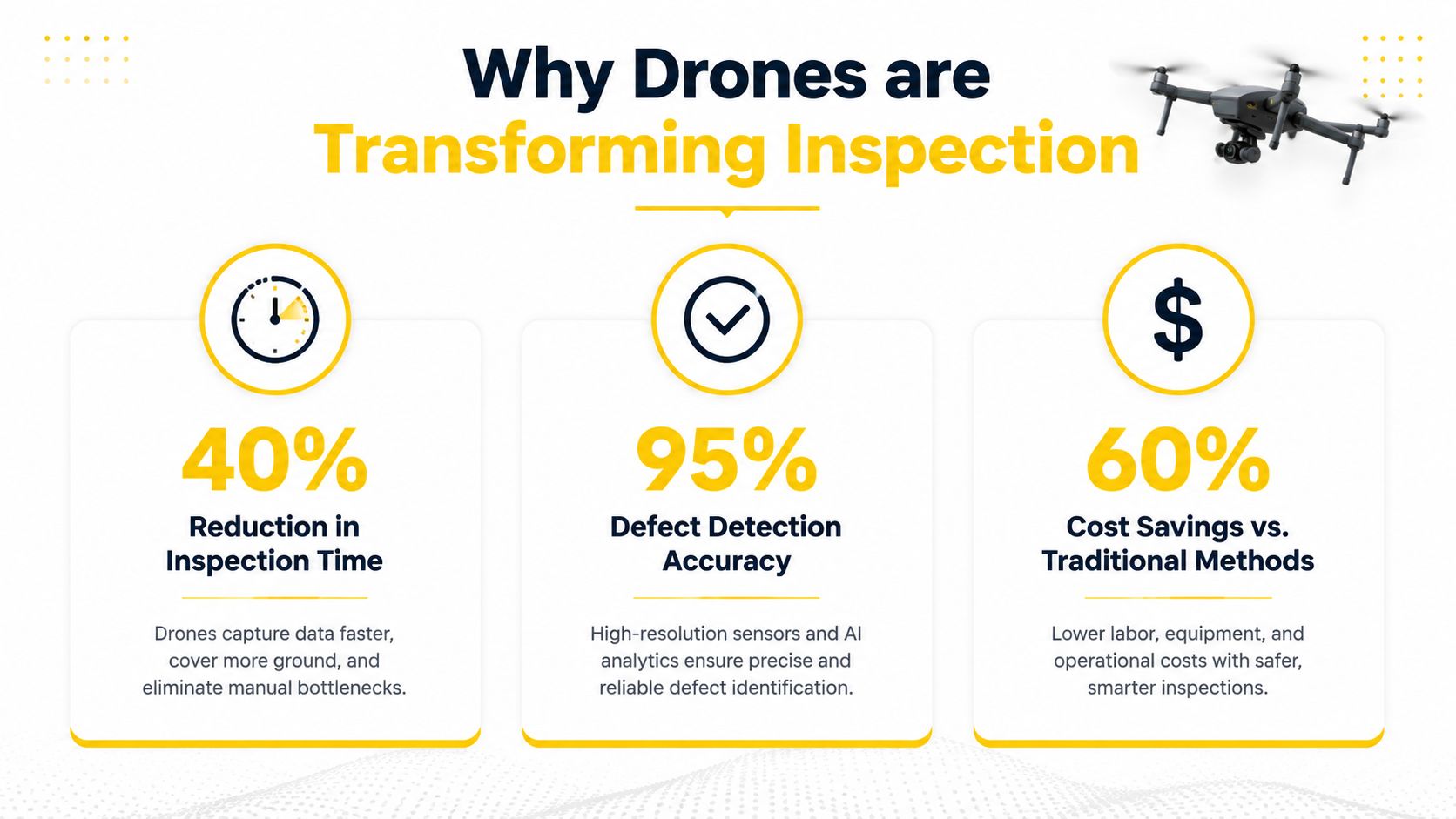
The field advantage is practical. Traditional inspection may require scaffolding, aerial work platforms, rope access, traffic controls or repeated site visits. An infrastructure inspection drone can collect close-range visual evidence while keeping personnel away from some hazardous positions and preserving a digital record for review. For organisations managing roads, bridges, rail assets, utilities or large facilities, that record can support comparisons between inspection cycles. Australian economic analysis has linked these gains with replacing slow, costly in-person practices with real-time, high-resolution video and imagery (Advitech's Australian drone analysis).
The deliverable matters more than the flight
A flight is only one part of the inspection. The useful output answers a maintenance question: where is corrosion developing, which concrete areas are spalling, has water entered the structure, are thermal anomalies present, or has a condition changed since the last survey?
That question determines the aircraft, sensor, flight geometry, lighting requirements, processing method and review process. A technically compliant flight can still produce unusable evidence if the imagery lacks scale, overlap, location control or consistent capture conditions.
The Australian drone ecosystem is expanding across industries, but adoption does not make an inspection reliable. Operators must connect flight planning with the asset owner's inspection standard, defect register and reporting workflow, while CASA requirements shape where and how the aircraft can operate.
Practical rule: If the client cannot explain how a defect will be prioritised and assigned to an asset location, the mission has not been scoped properly.
Thermal payloads add another layer of responsibility. Guidance on thermography inspections for reliability engineers shows why controlled capture conditions and competent interpretation matter. Infrastructure teams should apply the same discipline: the sensor produces evidence, while a qualified reviewer turns that evidence into a maintenance decision.
Planning Your Infrastructure Inspection Mission
A strong mission plan begins before the aircraft is unpacked. The operator and client should agree on the asset list, inspection purpose, access constraints, regulatory pathway and final deliverables before booking the flight.
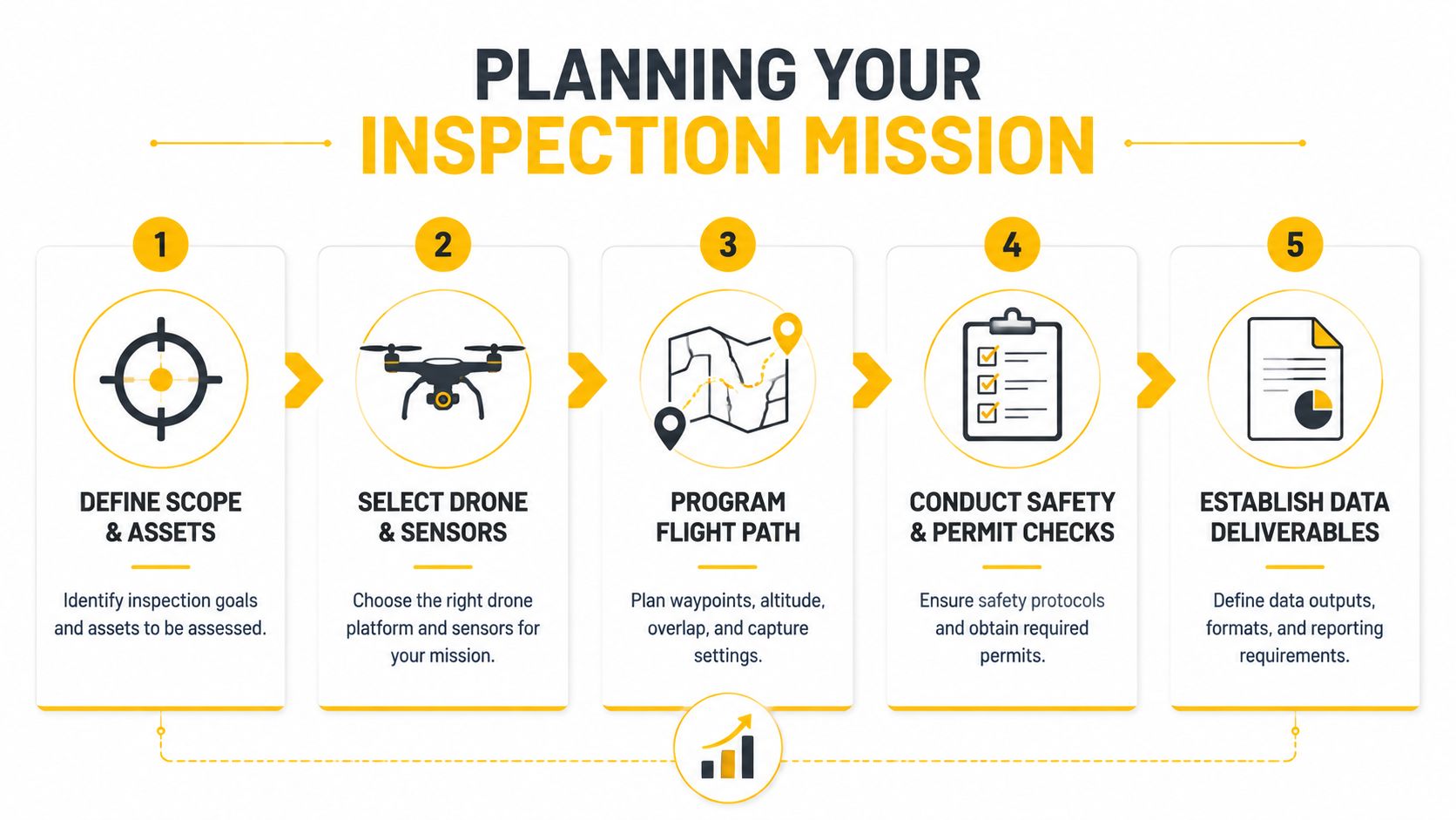
Define the inspection output first
Under-scoped deliverables are among the most persistent causes of failed inspection projects. A client may ask for “drone photos”, while the engineering team needs thermal imagery, an orthomosaic, a point cloud, a three-dimensional model, annotated defects or an engineer-reviewed condition report.
The scope should identify:
- Asset boundaries: Record exactly which structures, components, elevations, spans or corridor segments are included.
- Defect categories: List the conditions the reviewer must identify, such as cracking, corrosion, delamination, water ingress or damaged fixtures.
- Required outputs: Specify whether the final package includes high-resolution imagery, thermal data, orthomosaics, point clouds, 3D models, annotations or recommendations.
- Review responsibility: Confirm who classifies severity and whether a structural engineer, structural scientist or other qualified specialist must sign off.
- File and system requirements: Agree on naming conventions, coordinate references, client templates and integration with GIS, CAD or asset-management systems.
A technically complete flight can still be operationally useless if those decisions remain unresolved.
Build safety and airspace checks into the plan
The risk assessment should cover people, traffic, structures, electrical hazards, wildlife, weather, launch and recovery areas, battery management, communications and emergency procedures. Infrastructure often creates unusual proximity risks, especially around roads, rail corridors, power assets, public areas and confined spaces.
The operator should also confirm the applicable airspace, nearby aerodromes, operating conditions, site permissions and whether the proposed mission can be conducted within visual line of sight. A corridor that looks simple on a map may become impractical once the pilot must maintain the required visual relationship with the aircraft.
For missions that may extend beyond ordinary visual line-of-sight operations, teams should assess the approval pathway early. CASA's BVLOS guidance and operational information is relevant to programme design, but it doesn't replace a site-specific risk assessment or an approved operating framework.
Match capture conditions to the defect
The mission plan should state the required distance, viewing angles, overlap, lighting and repeatability. A bridge inspection may need underside passes and oblique views of bearings, deck edges and pier components. A facade inspection may need consistent elevation bands and controlled standoff distances. Thermal work may require suitable temperature differences and a plan for avoiding reflective surfaces or changing environmental conditions.
For beginners, ACE READY covers drone fundamentals, aviation safety, CASA regulations, flight operations and preparation for advanced RePL training in Australia. That foundation is useful, but infrastructure work also demands project-specific procedures, data standards and engineering collaboration.
Choosing the Right Sensors and Platforms for Each Asset Type
There isn't one universal infrastructure inspection drone. The correct platform depends on access, flight duration, payload requirements, environmental exposure, inspection class and the form of evidence the asset owner needs.
| Asset Type | Primary Sensor | Platform Class | Key Deliverable |
|---|---|---|---|
| Bridges | High-resolution RGB, with LiDAR where geometry or vegetation limits visual coverage | Stable multirotor with close-inspection capability | Annotated imagery, defect map and three-dimensional condition model |
| Powerlines and substations | RGB and thermal | Multirotor or other payload-capable platform suited to controlled close work | Component imagery and thermal anomaly record |
| Pipelines | RGB, thermal or LiDAR according to the defect question | Corridor-capable platform operating within the approved mission conditions | Georeferenced corridor data, asset inventory and prioritised findings |
| Rail corridors | RGB and LiDAR where repeatable mapping is required | Platform selected for corridor coverage and the authorised operating method | Repeatable asset capture, point cloud or orthomosaic and defect register |
| Roofs and facades | RGB, with thermal where water ingress or heat behaviour is relevant | Stable multirotor | Elevation imagery, marked defects and maintenance report |
| Industrial infrastructure | RGB, thermal and potentially LiDAR | Payload-capable multirotor | Integrated visual, thermal and three-dimensional inspection package |
RGB imagery remains the foundation
High-resolution visual capture is usually the starting point for cracks, corrosion, spalling, missing fasteners, coating failure and physical deformation. The camera must be paired with a flight pattern that produces consistent scale and viewing angles. A close image with no location reference may help a reviewer recognise a defect, but it won't necessarily help a maintenance team find it again.
Thermal sensors are valuable when heat differences or moisture behaviour answer a defined question. They can create confusion when the operator captures thermal imagery without accounting for surface reflectivity, sun loading, wind, emissivity or the asset's operating state. Thermal data should support, not replace, visual and engineering assessment.
LiDAR and photogrammetry solve different problems
Photogrammetry uses overlapping images to create measurable visual models, orthomosaics and related products. It works well when the asset has sufficient visual texture and the capture geometry is controlled. LiDAR can be more useful where geometry, vegetation, low light or repetitive surfaces make image matching difficult, although it creates its own processing, calibration and interpretation requirements.
The platform decision also involves weight. A larger aircraft may carry a more capable payload, but additional mass affects transport, battery planning, launch areas and approvals. CASA requires approval to fly for any drone weighing more than 25 kg, making that threshold a critical consideration for large inspection platforms (CASA drone rules).
Night work creates another planning layer. Operators considering after-dark infrastructure missions should use relevant training and procedures, including night operations training, rather than treating a low-light camera as a substitute for compliant operations.
Navigating CASA Regulations and Compliance Requirements
Commercial infrastructure inspection is aviation work, even when the aircraft is small and the task appears routine. The operator must establish the legal operating category, confirm the aircraft status, verify pilot credentials and document the risk controls before flight.
Registration applies to business operations
CASA states that any drone used for business or as part of a job must be registered, regardless of weight. The requirement covers inspections of industrial equipment, construction sites and infrastructure. Registration is free for drones weighing 500 g or less, while drones over 500 g attract a $40 levy. Flying an unregistered drone for business can result in a fine of up to $18,200, according to CASA's registration requirements.
That check belongs in mobilisation, not as an afterthought on site. The operator should verify registration before the first flight and keep the relevant records with the project documentation.
Choose the correct operating pathway
CASA's plain-English guide says small remotely piloted aircraft can be used for infrastructure inspections under the excluded-RPA pathway, but only where the controller holds valid accreditation, the aircraft is registered before its first flight, the operation remains within standard RPA operating conditions and activity records are kept (CASA's excluded-RPA guide).
The pathway isn't a blanket permission to conduct every type of inspection. Asset type, inspection class, proximity to people and structures, airspace, operating conditions and the client's engineering requirements all affect the decision.
Credentials and organisational authorisation
A Remote Pilot Licence, or RePL, is the relevant qualification for pilots conducting the categories of commercial drone work that require it. An operator may also need access to a ReOC structure, documented procedures and appropriate permissions, particularly when the work falls outside a simpler operating pathway. The distinction between a pilot's qualification and an organisation's authorisation should be clear in procurement documents.
Radio use can also matter around aerodromes or controlled airspace. Where the mission requires aviation radio communication, an Aeronautical Radio Operator Certificate, or AROC, may be relevant alongside the operational approval.
For organisations building an internal programme, ReOC consulting for Australian operators can help frame the relationship between approvals, exposition material, procedures and operational governance. It doesn't remove the need for CASA compliance or project-specific planning.
Compliance checkpoint: A registered aircraft, qualified pilot and approved organisation still need a documented mission risk assessment and airspace decision for each operation.
From Data Capture to Engineering-Grade Reports
The aircraft is only the first stage of the inspection. The useful output emerges through a chain that connects capture, processing, defect interpretation and maintenance action.
Process the data for the decision
A practical Australian workflow generally follows four stages:
- Capture: The operator collects imagery, thermal data or LiDAR using the agreed flight geometry and coverage plan.
- Process: Software converts the raw material into usable products such as orthomosaics, point clouds, digital terrain or surface models and three-dimensional representations.
- Detect and annotate: The reviewer identifies defects, marks their location and records the relevant evidence.
- Report and integrate: Findings are classified, prioritised and transferred into the client's report format or asset-management system.
Each stage can introduce failure. Poor overlap can weaken a model. Inconsistent distance can make comparisons unreliable. Unlabelled photographs can force engineers to spend time locating defects. An attractive three-dimensional model may still fail to answer whether a defect requires monitoring, repair or immediate escalation.
Combine aerial evidence with engineering review
Australian providers commonly combine aerial capture with ground-based non-destructive testing results. That combination allows structural scientists and engineers to develop a more holistic condition report, including defect mapping, severity classification and remediation recommendations (SiteOps' drone inspection workflow).
A drone can identify an apparent crack or surface anomaly, but it may not establish its depth, cause or structural significance. Ground-based NDT, direct measurement and engineering assessment remain important where the inspection question requires more than visual evidence.
The report should make the evidence traceable. Useful fields include the asset identifier, component location, capture date, sensor used, image or model reference, observed condition, severity category, recommended action and reviewer. A repeatable structure lets the owner compare future inspections without rebuilding the interpretation from scratch.
Design for downstream systems
The benchmark for a mature programme isn't image volume. It's whether the output enters the maintenance workflow. Asset owners should define the required GIS, CAD, point-cloud, report and naming conventions before capture, then test a sample deliverable with the engineering team.
Specialist aviation education can support the operational side, and specialised drone training may be relevant where an organisation needs pilots to work within a broader technical or industry-specific environment. Training doesn't replace engineering sign-off, but it can help operators understand why capture quality and documentation must serve the people making maintenance decisions.
A report that engineers can't locate, compare or defend is unfinished, even when the flight was safe and the imagery is clear.
Scaling Inspection Programs Across Large Asset Portfolios
Large programmes reveal weaknesses that a single-site demonstration can hide. Repeating a reliable method across bridges, rail assets or buildings requires consistent geometry, naming, processing and defect-priority rules. The target is not a larger image archive. It is a repeatable evidence pipeline that produces outputs engineers can compare and asset owners can use for maintenance decisions.
Australian case-study evidence shows the range possible at programme scale. National Drones reports inspections of about 38 bridges across NSW and the ACT, 3,818 rail assets across Sydney's network over 438 km of corridor, and 1,200 building inspection reports across 150 rural NSW schools in 40 days (National Drones case studies).
Those figures are project examples, not a promise that every portfolio will reach the same throughput. They show the value of organising work around repeatable asset capture rather than isolated flights.
Standardisation creates scale
A portfolio operator should establish a capture specification covering:
- Geometry: Set distance, angles, overlap, height and component coverage.
- Reference points: Use consistent asset identifiers and location conventions.
- Sensor settings: Record the camera, thermal or LiDAR configuration and relevant environmental conditions.
- Processing rules: Apply defined workflows for model creation, quality checks and file exports.
- Defect priority: Separate observations requiring urgent escalation from items suitable for monitoring or planned maintenance.
These controls also support Australian compliance records. Operators need to show what was captured, under which conditions and how the resulting evidence was reviewed. Without that structure, extra imagery creates extra review time. Teams receive duplicate views, inconsistent scale and unclear asset locations, which makes change detection and engineering comparison harder.
Throughput must include reporting
Photogrammetry and LiDAR can support repeatable capture across extensive portfolios, but processing capacity and engineering review must increase with acquisition. A programme that flies efficiently yet leaves thousands of unclassified images in a queue has not improved the maintenance cycle.
The strongest portfolios treat each mission as a structured data product. Capture templates, automated quality checks, defect taxonomies and client-aligned report formats reduce rework. Engineers can triage the evidence remotely, identify the inspection questions that remain unresolved and send field crews only where direct access or testing is justified.
The economic case extends beyond flight efficiency. Australian modelling projected government drone use could generate labour-cost savings of A$85 million to A$325 million by 2040, while projected government uptake ranged from 6,200 to 26,350 units over the same horizon (Australian infrastructure drone modelling). These are projections, not guaranteed project outcomes. Results depend on CASA compliance, suitable operating procedures, workflow integration and competent interpretation of the captured evidence.
Frequently Asked Questions About Infrastructure Inspection Drones
Can a drone replace a traditional infrastructure inspection?
Not broadly. A drone can reduce hazardous access, collect repeatable imagery and help engineers triage defects, but it doesn't automatically replace hands-on inspection, NDT or engineering judgement. Transport for NSW's inspection standard states that only Level 2 and Level 3 inspections may be carried out using remotely piloted aircraft, so the inspection class and required sign-off matter (Transport for NSW inspection standard).
What does a commercial operator need before flying?
The operator must confirm the aircraft is registered for business use, the pilot holds the required credentials, the organisation has the relevant authorisation, and the mission complies with CASA operating conditions. The project also needs airspace checks, risk controls, records and client permissions.
What deliverables should an asset owner request?
The request should reflect the maintenance decision. Depending on the asset, it may include high-resolution imagery, thermal data, orthomosaics, point clouds, 3D models, defect annotations, severity classification and an engineer-reviewed condition report. The client should specify file formats and asset-management integration before capture.
Is BVLOS necessary for corridor inspections?
Not always, but long rail, pipeline, and utility corridors may exceed practical visual line-of-sight limits. BVLOS requires a suitable approval pathway and a documented safety case, rather than only selecting a longer-range aircraft.
Does a heavier platform create extra regulatory work?
Yes. CASA requires approval to fly for drones weighing more than 25 kg. Payload capability must therefore be assessed alongside the aircraft mass, operating category, launch conditions and approval requirements.
Ace Aviation Aerospace Academy provides CASA-focused training relevant to infrastructure inspection, including the Remote Pilot Licence, Aeronautical Radio Operator Certificate, ReOC consulting and enterprise or corporate drone training. Teams and aspiring operators can review the pathways available through Ace Aviation Aerospace Academy and choose training that matches their intended inspection role.
