

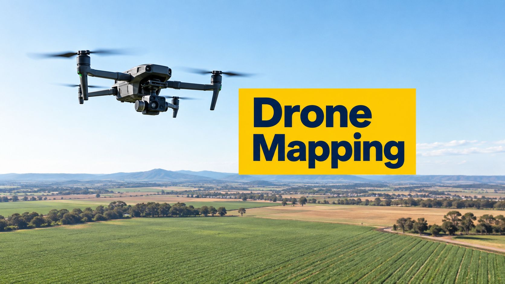
A survey team has a construction site to document, an agricultural operator needs repeatable aerial data, or a local government crew must capture an area without creating an unsafe mission. The team searches for a drone mapping app, expecting one download to handle flight planning, imagery capture, processing, exports and compliance. In practice, the app is only one part of the workflow.
A suitable system may need to produce orthomosaics, digital surface models (DSMs), digital terrain models (DTMs) or other deliverables. It may also need reliable flight planning, compatible devices and aircraft, practical export formats, appropriate data handling, transparent pricing tiers and an operational process that reflects Australian requirements. CASA states that safety apps provide guidance only, aren't for air navigation, and don't replace checks of local, state or territory rules. CASA's guidance on drone safety apps should remain part of every pre-flight process.
The supplied catalogue contains training pathways, not mapping software products. The five options below are therefore evaluated as operational-readiness choices around a mapping workflow. Software capabilities, platform support, processing methods, export formats and prices must be confirmed directly with each vendor. Readers comparing broader data-collection systems can also review these form and survey tools.
Table of Contents
- 1. ACE READY
- 2. ACE BRONZE
- 3. ACE SILVER
- 4. ACE GOLD
- 5. ACE PLATINUM
- Drone Mapping App, ACE Tier Comparison
- Turn Software Selection Into a Safe Workflow
1. ACE READY
Best starting point for mapping beginners
A beginner who has never planned a structured aerial mission shouldn't start by comparing processing engines. The immediate requirement is a safe foundation in drone fundamentals, aviation safety, CASA-related operating concepts and basic flight operations. ACE READY is positioned in the catalogue as an entry-level course for beginners, with preparation for later Remote Pilot Licence training in Australia.
That makes it relevant to a mapping workflow before a mapping app is selected. A grid mission can look simple on a tablet, but the operator still needs to understand aircraft control, launch and recovery, airspace awareness, weather considerations, site hazards and the limits of automated flight. An app can draw a flight path. It can't decide whether the proposed mission is suitable for the actual location and operating conditions.
Australia's regulatory data environment also requires more than relying on a coloured map. The federal government launched the Local Drone Rules Map in February 2024, and its first release digitised rules for 7,610 areas managed by 15 agencies. The map was designed to help operators check local restrictions before flight and can be integrated into drone software through a free API, as described by the Australian Public Service Commission. A new operator needs the judgement to treat that information as one part of a broader planning process.
What this pathway adds around an app
A mapping application becomes more useful when the pilot understands why a proposed mission might need to change. For example, a learner can begin assessing:
- Mission purpose: Whether the requested output is simple site documentation or a measurement-focused mapping product.
- Flight environment: Whether obstacles, people, property, nearby aerodromes or local restrictions affect the plan.
- Automation limits: Whether the pilot can intervene if the aircraft, controller, positioning or environment behaves unexpectedly.
- Regulatory checks: Whether the app's information must be supplemented with local authority and CASA checks.
The Australian UAV user-needs research found that Pix4Dcapture was the most popular flight-planning tool, used by 34% of participants, while users also relied on Google Earth, Google Maps, QGroundControl, Skyward, Altizure and Flyte. FrontierSI's UAV user-needs report indicates that Australian acquisition workflows are multi-tool rather than centred on one universal application. A beginner should therefore learn transferable planning principles instead of assuming that familiarity with one interface equals operational competence.
Practical rule: An automated route reduces repetitive control inputs, but it doesn't remove the pilot's responsibility to assess the mission.
When ACE READY is the sensible match
This pathway fits an aspiring operator who needs fundamentals before progressing into commercial mapping work. It also suits a business deciding whether a new staff member should first develop aviation knowledge before being assigned a mapping platform or field responsibility.
The next step is to compare the course's current progression information with the operator's intended work. The ACE starter pathway can be checked directly where a learner needs to understand how beginner preparation relates to later training. No software purchase should be treated as a substitute for that foundation.
A trainee who completes the basics can then test a mapping workflow on a controlled project, focusing first on safe planning and consistent data capture. Accuracy requirements, ground control, overlap settings and processing quality should be introduced as the operator's mapping duties become more demanding.
2. ACE BRONZE
A bridge into commercial mapping work
A commercial mapping job introduces obligations that a recreational flight may not. The operator must connect the client brief, the aircraft, the flight plan, the captured data, the site risk assessment and the intended deliverable. ACE BRONZE is listed as a foundation commercial drone course covering drone operations, flight safety, aviation theory and practical skills for students beginning the path towards becoming licensed drone pilots in Australia.
That positioning makes it a useful operational-readiness option for someone who has moved beyond basic interest but isn't yet ready to treat an app as a complete production system. The operator can assess whether a proposed mapping mission is realistic before opening the application. This distinction matters because mapping software often makes complex flights look easy to configure.
Commercial decisions an app can't make
A mapping workflow normally begins with a question such as, “What must the client receive?” The answer may involve an orthomosaic, a DSM, a DTM, a three-dimensional model or a set of georeferenced images. Each output creates different expectations around image capture, terrain, positioning, processing and validation. The app's product page may list outputs, but the operator must determine whether those outputs meet the project's technical purpose.
Australian mapping guidance highlights the need for field and processing discipline, including ground control points, 70 to 80% forward overlap, 60 to 70% side overlap and check points for accuracy verification. These figures and the distinction between legality and survey-grade reliability are discussed in NavTrak's Australian drone surveying guidance. A course at this level helps a new commercial operator recognise that a flight-planning screen doesn't prove the final map is defensible.
A practical Bronze-level review should ask:
- Deliverable definition: Has the client specified the required map, model or elevation output?
- Capture design: Does the planned altitude, overlap and route suit the site and required detail?
- Quality evidence: Will the workflow include ground control or check points where the project requires them?
- Data movement: Can the captured material reach the selected processing system in a usable format?
- Record keeping: Can the team retain the planning, flight and quality information needed for the job?
Matching training to the first paid projects
The drone licence information should be checked alongside the operator's intended work and current CASA requirements. The purpose isn't to make a software comparison stand in for licensing advice. It is to ensure that a commercial operator understands the relationship between training, authorisation, operational procedures and the mapping task.
A construction trainee might begin with repeatable site capture under supervision and compare whether the chosen application supports the required aircraft and controller. An agricultural business might focus first on consistent coverage and safe exclusion zones, rather than selecting a platform based on attractive visualisations. A surveying team may need a more disciplined workflow involving positional metadata, control and independent checks.
ACE BRONZE is therefore best understood as preparation for responsible commercial decision-making around a mapping app. It doesn't establish that any particular software produces a specific accuracy level, supports a particular operating system or includes processing at a given price. Those details remain provider questions.
3. ACE SILVER
RePL and radio capability for professional missions
A mapping crew working near controlled airspace may need more than route-following skills. The operator may require formal competency, practical flight training, aviation theory, radio knowledge and clear communication procedures. ACE SILVER is described in the catalogue as commercial Remote Pilot Licence training with classroom instruction, practical flight training, CASA-compliant certification, the Aeronautical Radio Operator Certificate and aviation English proficiency.
That combination gives an individual operator a stronger basis for assessing whether a mapping workflow suits the proposed operating environment. It does not establish that an app can secure approval, manage radio communications or replace the operator's obligations.
CASA's digital platform supports third-party applications that provide airspace-awareness maps and automated airspace authorisations, including 10 trial aerodromes and Sydney Harbour, R405 A/B. CASA also states that only existing connected app providers can deliver those automated authorisation services at the 10 trial aerodromes during the current transition. Operators should check the CASA digital platform information for current service conditions before relying on an app-based workflow.
Why AROC changes the software conversation
A drone mapping app can display a proposed route, but it cannot train a pilot in aviation radio procedures or clear communication. AROC training is a separate competency that may support operational readiness where radio use is relevant.
The app can still assist with airspace review, mission preparation and route records. CASA says verified safety apps use location-based maps to show where drones can and cannot fly under Australian aviation legislation. Those maps are guidance tools, and pilots must also check local and state or territory rules. CASA safety guidance should therefore be treated as one input to the planning process, not as a complete authorisation decision.
Relevant restrictions may include the 5.5 km controlled-aerodrome buffer, restricted or military airspace, and caution zones near uncontrolled aerodromes and helicopter landing sites. The Spatial Source coverage of CASA's drone safety app explains the visual convention of red shading for no-fly areas and orange shading for caution areas.
Selecting the workflow, not just the interface
A Silver-level operator should test the full operational chain:
- Aircraft control: Confirm that the proposed mapping app works with the aircraft and controller in use.
- Mission planning: Check whether the route can be configured for the site and required capture pattern.
- Radio readiness: Match pilot training and procedures to the operating environment.
- Data quality: Confirm that the workflow supports metadata, control and validation requirements.
- Output handoff: Verify that captured data can move into the selected photogrammetry or GIS environment.
Night work, complex sites and specialised operations create separate competency questions. They should not be treated as automatic benefits of a mapping application. Operators considering that context should review the night operations training pathway directly.
ACE SILVER suits an individual or small commercial team building a stronger connection between app-based flight planning and professional aviation practice. It does not confirm a particular platform, export format or pricing tier. The software provider must confirm those details before procurement.
4. ACE GOLD
From individual pilot to commercial operation
A mapping app can support a mission, but a commercial drone business needs an operating structure around that mission. That structure may include trained personnel, documented procedures, aircraft and equipment controls, risk management, client communication and a clear understanding of the business's regulatory responsibilities. ACE GOLD is described as an advanced commercial drone pilot programme including RePL, ReOC support, practical flight training, aviation compliance and business readiness.
This makes Gold a stronger fit where mapping is becoming a repeatable service rather than an occasional task. A construction company may need multiple staff to follow the same capture process. A mining or infrastructure operator may need consistent records across locations. A specialist mapping business may need to distinguish pilot competency from organisational control.
Why local-rule refresh matters
The Australian regulatory map layer isn't static. The Local Drone Rules Map covers 7,610 areas managed by 15 authorities, and the government describes it as a machine-readable, spatially usable dataset that can be combined with planning tools. The Department of Infrastructure's announcement explains why turning local rules into a geospatial layer matters for digital mapping workflows.
CASA's RPAS platform operating rules also introduce regularly refreshed aerodrome digital facility map data, with at least 24-hour updates for some operational layers, as reported in the government's Local Drone Rules Map announcement. An enterprise team should therefore ask each software provider how often relevant layers refresh, which authority owns the rule and how changes reach users. A map that was accurate during a previous project may not reflect a later local restriction or operational change.
A production workflow needs an update and verification process, not just a route saved in an app.
Questions for a Gold-level procurement review
The commercial team should require clear answers before standardising a platform:
- Regulatory integration: Which Australian government or authority data layers does the software use, and how are updates communicated?
- Operational ownership: Who reviews the route, confirms restrictions and authorises the mission internally?
- Data governance: Where are images, coordinates and outputs stored, and who can access them?
- Repeatability: Can separate pilots use the same planning assumptions and quality checks?
- Business continuity: What happens if the application, connection, aircraft or processing service is unavailable?
The mandatory BVLOS information should be assessed only where the proposed operation involves that regulatory context. A mapping app cannot itself grant an operational approval or replace the organisation's compliance responsibilities.
ACE GOLD suits an operator who needs RePL capability alongside support for the organisational side of commercial operations. It remains important to separate the training outcome from software evaluation. The course may improve readiness, while the vendor must still confirm the application's current aircraft support, exports, processing, platform availability and commercial terms.
5. ACE PLATINUM
Enterprise preparation around a mapping system
An enterprise mapping programme has several users and several layers of responsibility. A pilot may capture the imagery, an aviation manager may review compliance, a GIS or surveying specialist may validate the outputs, and a client or government stakeholder may consume the final data. ACE PLATINUM is the supplied enterprise pathway, including RePL, AROC, Aviation English, Express ReOC, Certificate III in Aviation, advanced operations training and preparation to operate and manage a commercial drone business.
That breadth matters when the mapping app is only one component of a wider system. An enterprise buyer shouldn't ask only whether an application can produce a visually attractive model. The buyer should ask whether staff understand the operating environment, whether the business can manage its procedures and whether the final mapping product can be checked by people with the right technical responsibilities.
Matching roles to the mapping workflow
A larger programme can separate tasks that are often bundled together by small teams:
- Pilot: Conducts the flight safely and follows the approved mission.
- Operational manager: Maintains procedures, records and compliance controls.
- Radio-qualified personnel: Apply relevant communication knowledge where the operating environment requires it.
- Mapping specialist: Reviews capture quality, positioning, control and processing.
- Business owner: Confirms the service model, client expectations and organisational responsibilities.
That separation helps expose a common procurement mistake. A platform may advertise orthomosaic, DSM, DTM or three-dimensional outputs, yet the organisation still needs to verify how those outputs are generated, what inputs they require and whether they can be exported into existing GIS, surveying or asset-management systems.
The enterprise pathway is also relevant to data governance. A government or infrastructure team may need to know where imagery is stored, how long it is retained, who can access it and whether the provider's terms suit the organisation. Those are vendor questions, not assumptions that can be inferred from an app icon or a demonstration project.
A controlled rollout is better than a full standardisation decision
A practical enterprise evaluation should begin with one controlled project. The team can define the deliverable, confirm the aircraft and devices, plan the mission, capture the data, process it, inspect the outputs and document every handoff. The review should include field conditions, connectivity, device compatibility, export quality and the time required for a competent operator to complete each stage.
The relevant specialised operations pathway should be considered separately where the enterprise's work includes advanced or industry-specific requirements. It should not be treated as evidence that any mapping application supports every specialised use case.
ACE PLATINUM is the most suitable of the supplied pathways for an organisation assessing enterprise readiness around a drone mapping app. It doesn't remove the need for technical software testing. Instead, it gives the business a framework for assigning responsibilities and identifying the training, aviation and management capabilities that must sit behind the software.
Drone Mapping App, ACE Tier Comparison
| Course | 🔄 Implementation complexity | ⚡ Resource requirements | ⭐📊 Expected outcomes | 💡 Ideal use cases | ⭐ Key advantages |
|---|---|---|---|---|---|
| ACE READY | Low, basic theory & intro flight skills | Minimal, personal drone, study time, basic practicals | Fundamental drone knowledge; prep for RePL pathway | Beginners exploring hobby or preparing for further training | Accessible intro course; publisher first‑party |
| ACE BRONZE | Moderate, foundation theory + practical sessions | Low–Medium, training drone, instructor time, practical hours | Foundational commercial skills; stepping stone toward licensing | New entrants aiming for commercial pilot training | Structured foundation for commercial pathways |
| ACE SILVER | High, CASA‑compliant RePL with assessments | Medium–High, classroom, assessed flight training, exams | RePL certification, AROC, aviation English proficiency | Candidates seeking professional remote pilot certification | Regulatory‑compliant credentialing; practical certification |
| ACE GOLD | High, advanced RePL + ReOC support and business modules | High, extended flight hours, operational guidance, admin support | RePL + ReOC support, commercial operations competence, business readiness | Pilots/operators preparing to run commercial services | ReOC support and business readiness for commercial ops |
| ACE PLATINUM | Very high, enterprise multi‑certification program | Very High, full certification suite, Cert III, extended assessments | Multiple certifications (RePL, AROC, Cert III), Express ReOC prep, enterprise capability | Organisations or individuals managing fleets and compliance | Comprehensive enterprise package with broad certification coverage |
Turn Software Selection Into a Safe Workflow
The right drone mapping app begins with the required deliverable, not the app store listing. A team should first establish whether the project needs an orthomosaic, DSM, DTM, three-dimensional model, simple inspection imagery or another output. The required product determines the capture method, overlap, positioning, control, processing and validation questions that follow.
The next step is provider verification. Each vendor should confirm current support for the intended aircraft, controller, phone or tablet, operating system, flight-planning method, imagery type, processing route, export formats and data-storage arrangements. Pricing tiers must also be checked directly because no reliable pricing information is established in the supplied evidence.
CASA's guidance should remain separate from marketing claims. A safety app may assist with location-based awareness, but CASA says it is for guidance only and isn't for air navigation. Local, state and territory restrictions still need checking, and Australia's Local Drone Rules Map shows why local-law data deserves particular attention. The team should record the date and source of each operational check rather than assuming that a previously saved mission remains suitable.
A controlled project provides the most useful comparison. The operator can test the complete workflow from planning to final export, including device compatibility, connectivity, field capture, data transfer, processing, quality checks and stakeholder delivery. The process should include ground control points and check points where the project requires defensible positional results. An app that produces a quick visual model may still be unsuitable for a measurement task if the surrounding field and processing discipline is weak.
Training should match the organisation's risk and responsibility:
- ACE READY suits a beginner who needs drone fundamentals, aviation safety, CASA-related knowledge and flight-operation preparation before advanced training.
- ACE BRONZE suits a learner building foundational commercial drone operations, aviation theory, flight safety and practical skills.
- ACE SILVER suits a professional pathway where RePL, practical training, AROC and aviation English are relevant.
- ACE GOLD suits commercial operators who need RePL capability and ReOC support alongside business and compliance preparation.
- ACE PLATINUM suits the supplied enterprise pathway, including RePL, AROC, Express ReOC, Certificate III in Aviation and advanced operations training.
The development workflow can help readers think about software as a process rather than a standalone interface. That same principle applies to drone mapping. The safest procurement decision connects the application, the aircraft, the trained operator, the organisation's procedures and the project's measurable requirements.
FAQ
Can a drone mapping app produce an orthomosaic, DSM or DTM?
Some platforms may support those outputs, but each provider must confirm the current capability, required inputs, processing method and export options. The operator should also verify whether the result is suitable for the project's accuracy requirements.
Does flight planning inside an app make a mission compliant?
No. CASA describes safety apps as guidance tools only, not air-navigation tools. Operators must also check applicable local, state or territory rules and follow the requirements relevant to the operation.
Is RePL training relevant to drone mapping?
RePL is relevant where the operator's intended commercial work requires that qualification and associated competency. A mapping app doesn't replace pilot training, practical flight skills or the organisation's operational responsibilities.
When does AROC training matter?
AROC is relevant where aviation radio knowledge forms part of the operator's intended professional work or operating environment. It should be assessed alongside the mission location, applicable procedures and the training provider's current course information.
Which pathway suits an individual operator?
ACE READY and ACE BRONZE align with beginner and foundational commercial preparation. ACE SILVER is more relevant where RePL and AROC training are required, while ACE GOLD adds ReOC support and business readiness.
Which pathway suits an enterprise team?
ACE PLATINUM is the supplied enterprise pathway, with RePL, AROC, Aviation English, Express ReOC, Certificate III in Aviation and advanced operations training. An organisation should still assign separate responsibility for piloting, compliance, mapping quality and data governance.
Ace Aviation Aerospace Academy provides Australian drone and aviation education covering pathways from fundamentals through RePL, AROC, ReOC support, Certificate III in Aviation and specialised operations training. Teams and individual operators can visit Ace Aviation Aerospace Academy to match training with the aircraft, mapping workflow and operational responsibilities being developed.
