
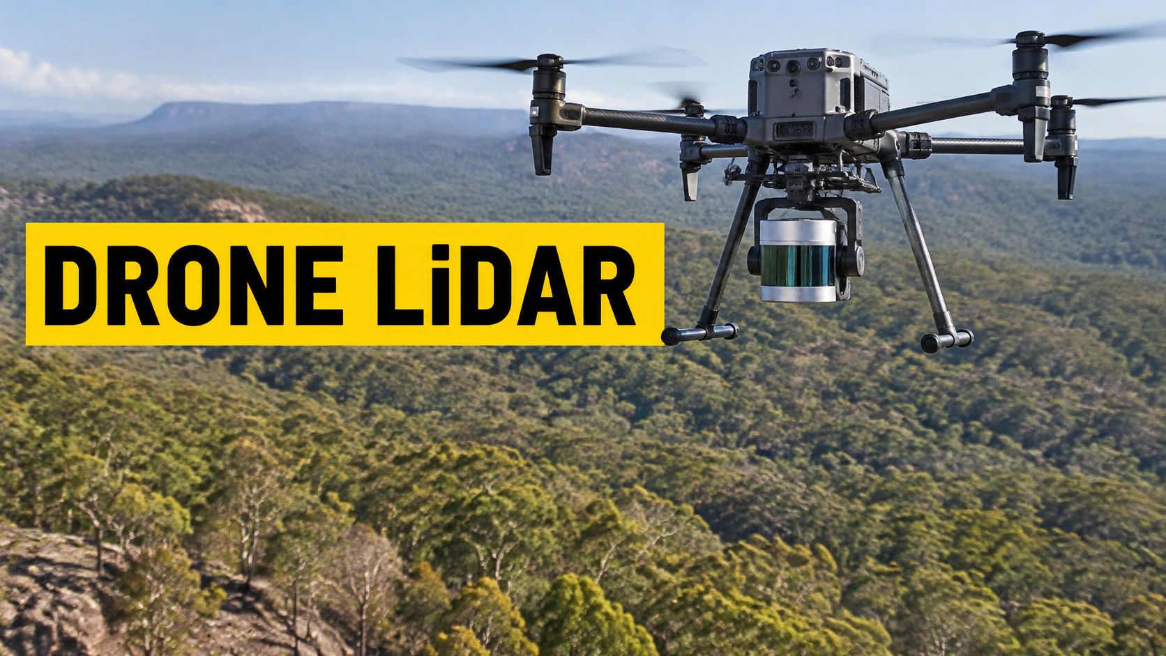
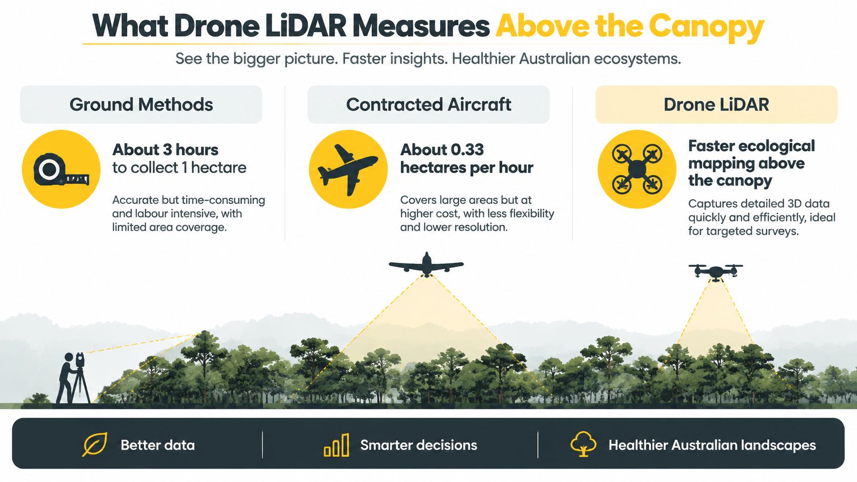
A large drone carrying LiDAR can change the field maths of an Australian ecological survey. CSIRO reported that collecting one hectare previously took approximately 3 hours by ground methods or contracted aircraft, about 0.33 hectares an hour, while a large drone mapped about 100 hectares in roughly 30 minutes, about 200 hectares an hour. That is an approximate 600-fold increase in area per unit of field time, with more than 1,000 three-dimensional points per square metre, enough for tree height, crown diameter and stem diameter, including work on red cabbage palms at Palm Valley in Finke Gorge National Park and Acacia peuce in the Matt Clark Conservation Area.
That speed does not relax the flight. A denser cloud still sits inside the same airspace, height and licensing limits as any other business flight.
Table of Contents
- What Drone LiDAR Measures Above the Canopy
- Choosing Drone LiDAR or Photogrammetry
- Hardware That Builds the Point Cloud
- Check the CASA Pathway Before You Fly
- How a Drone LiDAR Survey Is Captured
- Accuracy Australian Projects Have Measured
- Forestry Corridors and Infrastructure Uses
- Matching Drone LiDAR to the Job and the Rules
- Questions Operators Ask After the First Mission
What Drone LiDAR Measures Above the Canopy
Picture a remote valley where a crew would otherwise walk transects under a closed canopy. Drone LiDAR is a laser scanner carried on a remotely piloted aircraft. Each pulse's travel time is a range. A GNSS receiver and an inertial measurement unit place that range in coordinates. The product is a point cloud, not a photograph.
Think of a tape measure fired thousands of times a second. A return can come from a leaf, a branch or the ground, so the canopy does not fully hide the surface. Several returns from one pulse are what let a later classification separate vegetation from terrain.
What the cloud is for
That density supports individual-tree measures rather than a single average height for a stand.
- Tree height: the gap between a high canopy return and a classified ground return.
- Crown diameter: the horizontal spread of the upper returns around one stem.
- Stem diameter: inferred where the lower returns and the crown shape are dense enough to model the trunk, then checked against a field sample.
On a conservation job, the same cloud can support a population count over country that is slow to walk and expensive to cover with a crewed aircraft. The next choices are the payload that builds the cloud, the capture workflow, whether photogrammetry is the better fit, how Australian projects have measured accuracy, and the aviation rules that still apply.
Choosing Drone LiDAR or Photogrammetry
Choose the method from the deliverable, not from the aircraft. Photogrammetry builds geometry from overlapping photographs and needs light, texture and a clear view of the surface. Drone LiDAR measures range with its own laser, so pulses can return from canopy and ground and the sensor can work in low light. Rain, fog, dust and shiny or wet surfaces still scatter or absorb those pulses.
| Criterion | Drone LiDAR | Photogrammetry |
|---|---|---|
| What it measures | Laser range to surfaces the pulse hits | Geometry reconstructed from overlapping photos |
| Vegetation and ground | Multiple returns can separate canopy, understorey and ground | Leaves and canopy gaps hide the surface |
| Light and weather | Operates in low light; rain, fog and dust degrade returns | Needs usable light, contrast and surface texture |
| Typical deliverable | Classified point cloud, terrain model, canopy metrics | Orthomosaic, surface model, textured mesh |
| Best-fit sites | Forest, vegetated corridors, concealed terrain | Open ground, façades, visual inspection |
| Kit and skill | Heavier payload, GNSS and inertial unit, higher mission skill | Lighter camera payload and lower entry cost |
Apply each row to the site
Vegetation. On a forest block or a vegetated road reserve, multiple returns can separate canopy, understorey and ground. A camera only models what it sees, so leaves leave holes where the terrain model should be.
Light. A dawn flight or a shadowed gully still yields ranges. It will not yield a usable photo set if the surface is dark or flat in tone. Hold the LiDAR flight if rain, fog or dust is already cutting returns.
Deliverable. A classified cloud, a terrain model and canopy metrics come from the laser. An orthomosaic, a textured mesh or a façade record comes from imagery. LiDAR does not replace colour. Many clients still want it, so a camera or a colourised cloud is often flown as well.
Site and kit. LiDAR suits forestry, vegetated corridors, stockpiles under partial cover and terrain where the ground is hidden. Photogrammetry suits open sites, façades, visual inspection and any job where the picture of an open surface is the product and a lighter camera is enough. The laser payload is heavier and asks more of the pilot because the trajectory has to stay stable.
Both methods need ground control or a trusted GNSS workflow if the client will design from the data. Choose LiDAR when the ground or structure under vegetation is the deliverable, and photogrammetry when the picture of an open surface is.
Hardware That Builds the Point Cloud
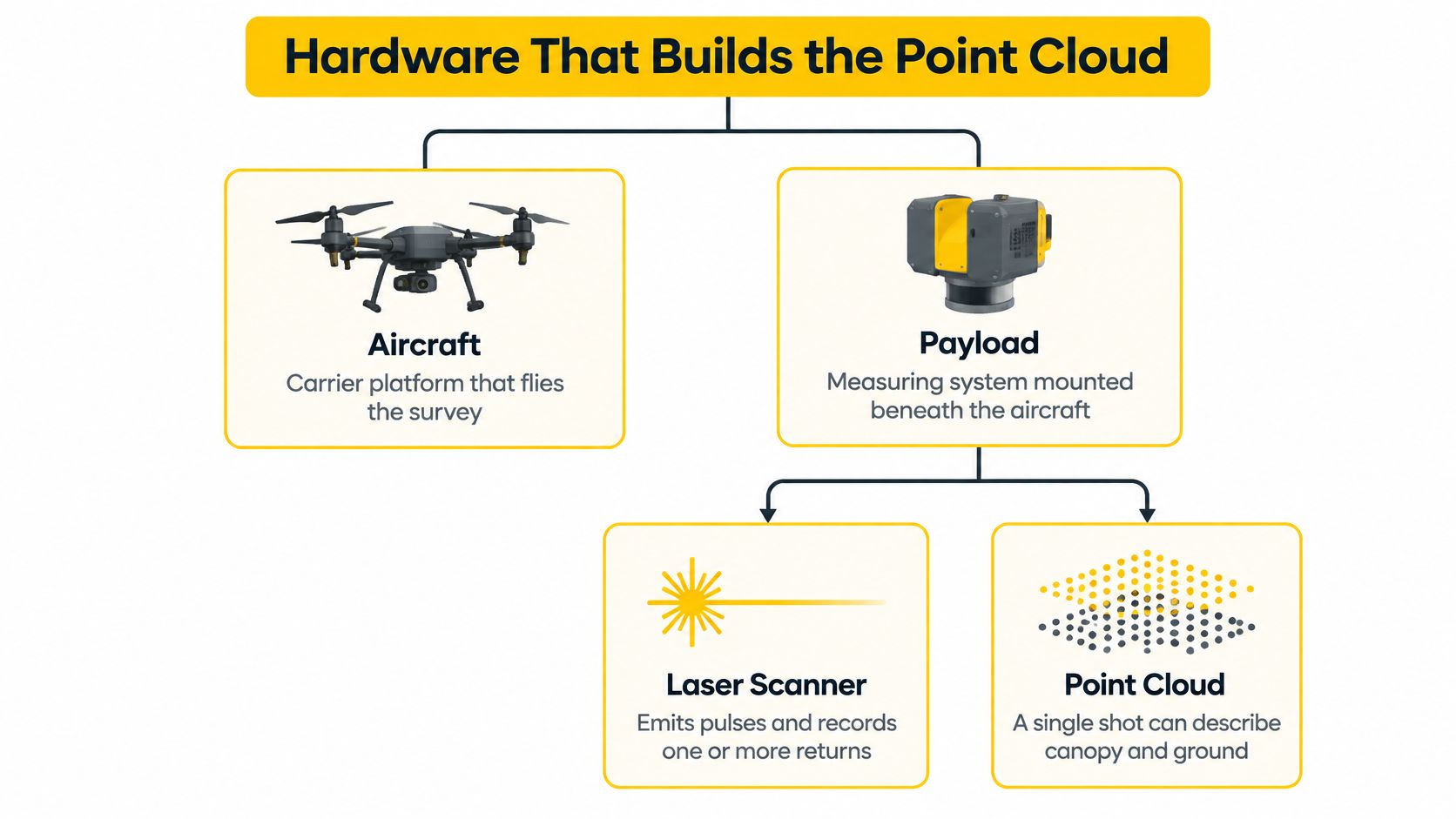
Treat the aircraft as the carrier and the payload as the measuring system. A weak trajectory will bend a cloud even when every range is good.
Payload
The laser scanner emits pulses and records one or more returns, which is why a single shot can describe canopy and ground. Wavelength and beam divergence affect how well the pulse gets through foliage and how large the footprint is at a given height. A wide beam at height smears a kerb or a stem into a blob.
A spinning or oscillating mirror, or a solid-state scan pattern, sets swath width and point spacing across the track. The GNSS receiver and IMU time-stamp position and attitude. If either drifts, the strips will not meet. Many payloads add a camera so points can be colourised, but colour is not the measurement.
Aircraft
Payload mass, endurance and vibration isolation decide the platform. A multirotor suits a small or obstructed site. A larger aircraft suits a long corridor where endurance matters more than hovering. Survey-oriented systems are commonly paired with real-time kinematic or post-processed kinematic GNSS. A low-cost unit can still be useful if the client accepts its error budget and the checkpoints prove it.
Buyer questions: Ask for pulse rate, maximum returns, stated range, IMU grade, and whether the quoted accuracy assumes control points.
Check the CASA Pathway Before You Fly
The payload does not remove Part 101 obligations. A LiDAR mission is assessed like any other business flight. CASA's drone safety rules require, for paid or business flying, drone registration and either operator accreditation or a Remote Pilot Licence, plus a check of airspace before each flight. Some sites need an approval.
The standard height limit is 120 metres, or 400 feet, above ground level. CASA's flight-approval guidance requires an authorisation above that height, and an authorisation may also be required within 5.5 kilometres, or 3 nautical miles, of a controlled aerodrome, in approach or departure paths, over a controlled aerodrome movement area, or near a non-controlled aerodrome while crewed aircraft operate. Only the chief remote pilot of a ReOC holder can apply, and a required NOTAM is generally lodged at least 48 hours before the operation. Flying higher can widen the swath, and it can also put the flight outside the standard rules. The current Australian drone law position for that site still has to be checked before the grid is locked.
A programmed survey grid is not permission for beyond visual line of sight. Part 101 treats BVLOS as a regulated operation. Higher-risk work, including flights over people, follows the advanced-operations pathway, which can include a specific operations risk assessment.
| Mission or aircraft | Pathway and requirement | Basis |
|---|---|---|
| Micro RPA, 250 g or less | May avoid RePL and ReOC when conditions are met | Excluded category |
| Excluded RPA, over 250 g to 2 kg | Registration and RPA operator accreditation; activity and location conditions apply | Excluded category |
| Aircraft over 2 kg outside excluded conditions | Remote Pilot Licence generally required | Standard operations |
| Flight above 120 m AGL or near a controlled aerodrome | CASA authorisation; only the chief remote pilot of a ReOC holder can apply | Flight approval |
| BVLOS or higher-risk operations, including flights over people | Advanced-operations pathway with a specific operations risk assessment where applicable | Advanced operations |
CASA's plain-English guide for micro and excluded RPA still prohibits autonomous operation. The pilot must be able to control the aircraft at every stage, including on a waypoint survey. Sub-2 kg aircraft can be flown commercially in the excluded category with operator accreditation. Aircraft over 2 kg flown commercially, or any flight outside the standard rules, generally needs a RePL. A ReOC is the business authorisation that lets a company run operations, hire those pilots and seek approvals for night, BVLOS or flights over people.
For a saleable service, the usual sequence is the individual Remote Pilot Licence, an Aeronautical Radio Operator Certificate where aerodrome communication applies, and a ReOC if the business will hold the approvals. Ace Aviation Aerospace Academy trains for the RePL and AROC and offers ReOC consulting plus enterprise and corporate drone training for teams that will run these missions. Beginners can start with ACE READY, which covers fundamentals, safety, CASA rules and flight operations before RePL training.
How a Drone LiDAR Survey Is Captured
A LiDAR survey is decided before the aircraft leaves the case. The sensor can collect millions of returns and still miss the product if density, geometry and control were set for the wrong question. Denser data also does not make the flight simpler: a better point cloud does not authorise a lower transit, a longer line or a mission outside the approval already held.
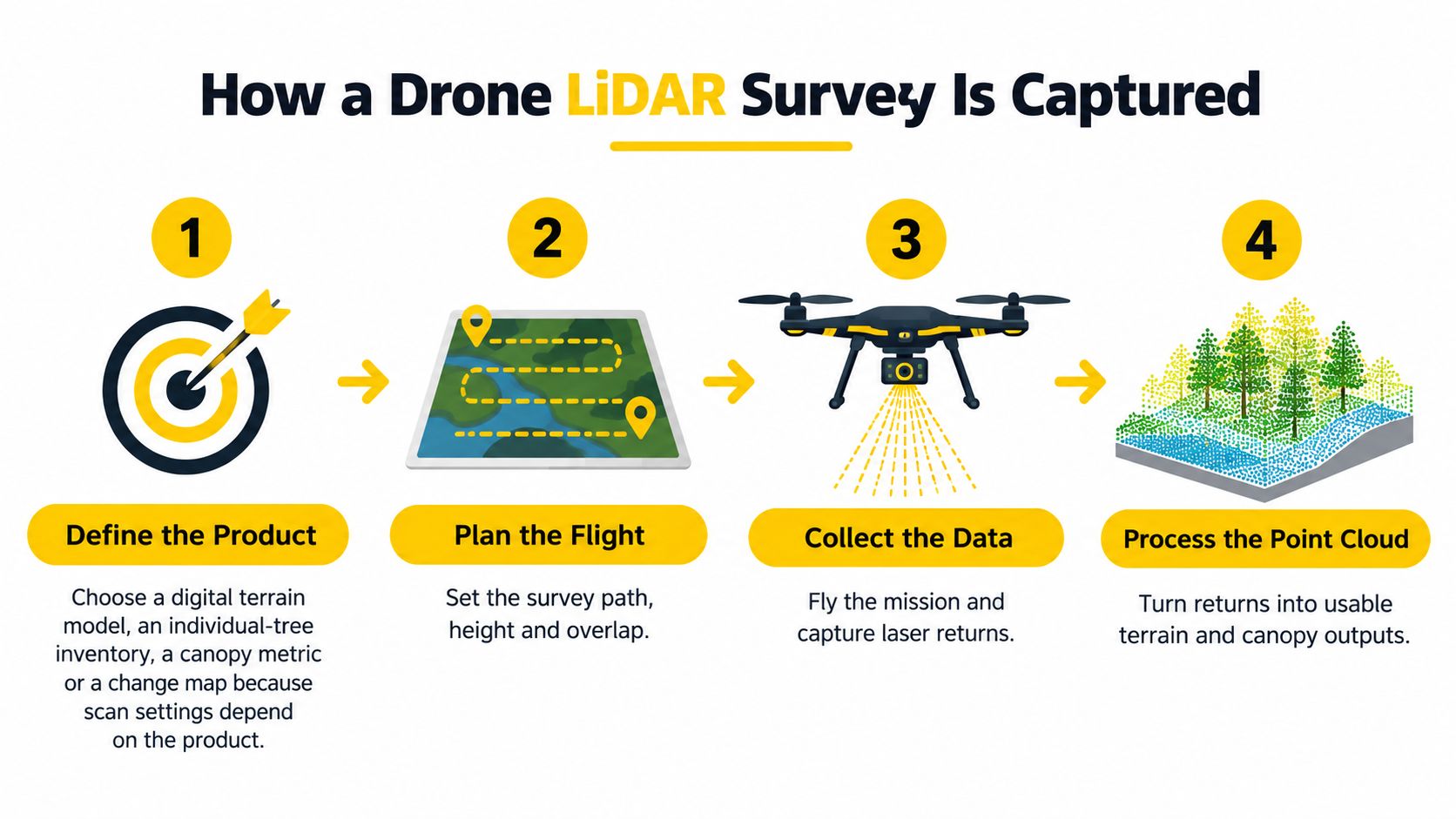
The order matters.
- Define the product. A digital terrain model, an individual-tree inventory, a canopy metric or a change map each need different scan density and flight geometry. Flying "dense" without a named product wastes endurance.
- Plan the flight. Set height, speed, scan angle, line spacing and overlap so point spacing meets the specification. Stay at or below 120 metres above ground level unless an authorisation already exists. The usual slip is raising height to finish early and then missing ground returns.
- Set the trajectory. Use a base station or a network correction, and warm up or initialise the inertial unit as the payload requires. A cold IMU is a bent strip.
- Place independent checkpoints. They must not be the same points used to fit the cloud. Open gravel alone will not prove the ground model under trees.
- Fly with a pilot who can take control. A programmed grid is not an unattended flight. Near an aerodrome or a helicopter landing site, the airport and HLS safety guide belongs in the briefing because work class, airspace and client access have to match before take-off.
- Process the trajectory, then align the strips. Register swaths before anyone classifies them. Alignment errors look like false banks and false canopy holes.
- Classify, then thin. Separate ground, vegetation and structures. Grid or thin the cloud only after classification, or the terrain model will include crowns.
- Deliver against the checkpoints. Supply the agreed LAS or LAZ point clouds, terrain raster, contours or tree metrics, then compare them with the independent checkpoints before the files leave the office.
Processing can clean structure and improve precision, but filter settings cannot rescue weak overlap, poor control or a rushed line. The defensible survey is the one where the named product, flight geometry, checkpoints and final report all agree.
Accuracy Australian Projects Have Measured
Published jobs are benchmarks, not a promise for every sensor or site.
| Example | Coverage and time | Density | Accuracy evidence |
|---|---|---|---|
| Sackville North road survey, 2023 | 10 hectares in 2 hours; over 90% time efficiency and 75% cost saving reported | 231.29 points per square metre | 34 millimetres RMSE on independent laser shots |
| Low-cost UAV study, APAS | Checkpoints against ground survey; flight settings outweighed software | Point density not published | About 94–95% of points within ±50 millimetres |
| CSIRO ecological mapping | About 100 hectares in roughly 30 minutes | More than 1,000 points per square metre | Enough for tree height, crown and stem measures, not a stated RMSE |
Read the civil job first
At Sackville North in 2023, a 10-hectare road-widening survey was captured in two hours. The client reported more than 90 per cent time efficiency and a 75 per cent cost saving against a traditional survey. The cloud averaged 231.29 points per square metre, and independent laser shots averaged 34 millimetres RMSE, as set out in the RIEGL account of the Measure Australia and Citisurv survey. That is a short window on a defined engineering site, not a blanket accuracy class.
Why the flight beats the software
An Australian Public Authority Surveyors conference paper on a low-cost UAV LiDAR system found that approximately 94–95 per cent of surveyed points fell within ±50 millimetres of the reference survey. The APAS paper found that flight parameters and sensor settings influenced spatial accuracy more strongly than post-processing algorithms. Altitude, speed, scan angle, overlap, GNSS and IMU quality, and control-point layout moved the result more than the software choice. Post-processing still cleaned structure and precision. It did not conclusively improve overall accuracy beyond the raw dataset.
The error moves for ordinary reasons. Flying higher widens the swath and enlarges the footprint. Steep scan angles stretch points. Dense wet canopy drops ground returns. Multipath near structures pulls the GNSS trajectory. Checkpoints that sit only on open gravel will not prove the model under trees.
Publish the checkpoint RMSE and the point density with the deliverable so a civil or forestry client can see whether the cloud is fit for design.
Forestry Corridors and Infrastructure Uses
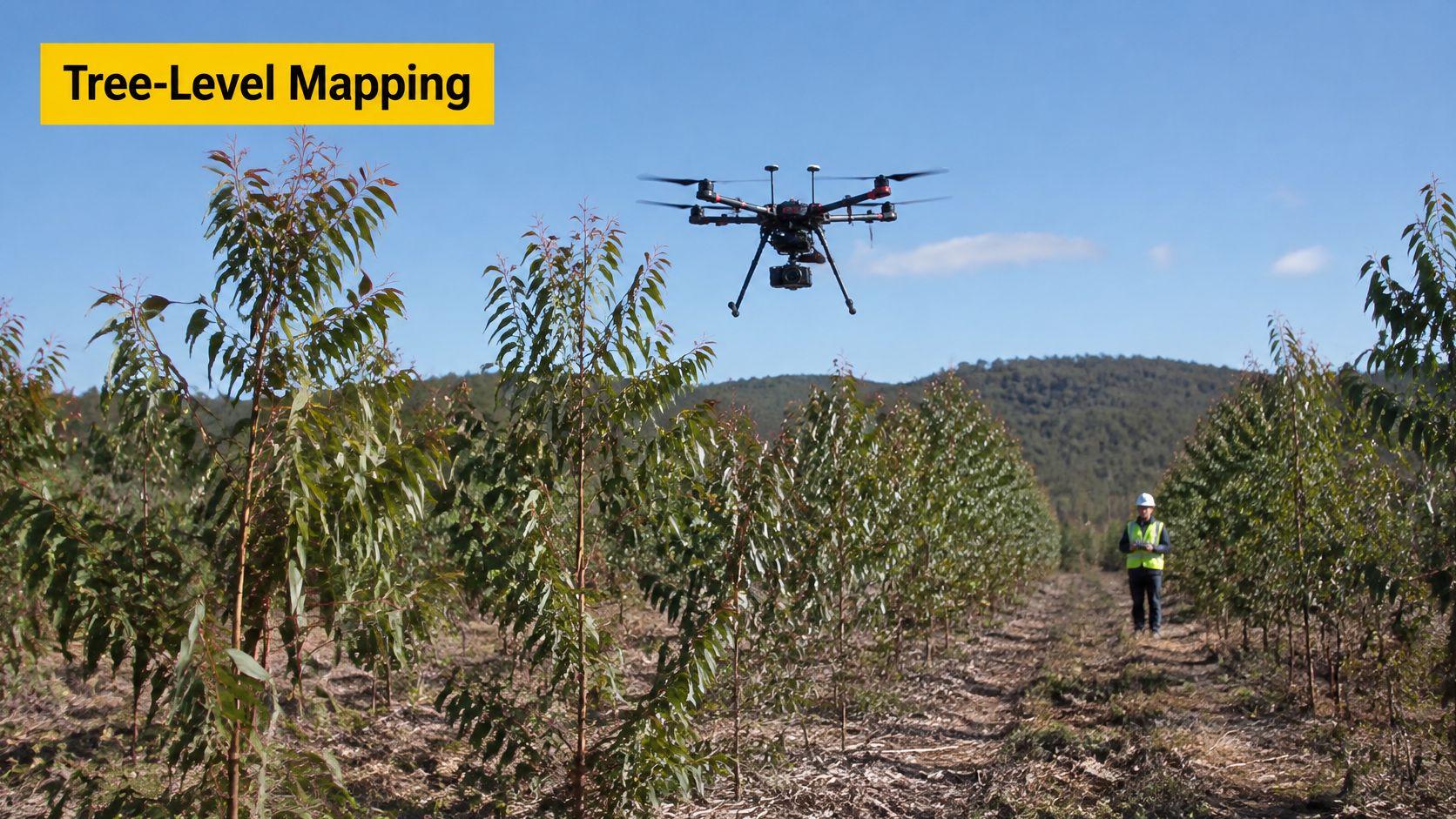
The University of Tasmania's TerraLuma project tested a multirotor UAS LiDAR system in a four-year-old eucalyptus stand. The TerraLuma research showed the system could distinguish individual trees and detect tree-level change before and after pruning. Ordinary RGB imagery cannot do that reliably under canopy. Active measurements also reach terrain under vegetation and support canopy closure, biomass and operational planning.
Match the product to the asset
Forestry. Deliver a stem map or a canopy-change layer. An individual-tree inventory needs higher scan density and a field sample of stems. A change product needs the same flight geometry repeated, not a new height and a new scan angle each visit.
Civil corridors. Deliver a terrain model for design, as on a road-widening job. Enough ground returns, plus checkpoints under canopy, matter more than a pretty intensity image.
Powerlines, rail and mine benches. Deliver clearance, stockpile or as-built geometry where walking the asset is slow or unsafe. Specify the clearance surface or the bench before anyone argues about point colour.
Cultural-heritage and environmental sites add access limits. They do not need a different sensor principle. A corridor beside a road, a mine or energised infrastructure usually raises the aviation task above a paddock grid, including where beyond visual line of sight would otherwise look like the simple way to finish a long line. Confirm weight class, height and airspace before the sensor plan is treated as permission to fly.
Matching Drone LiDAR to the Job and the Rules
Start with the deliverable, then check whether the mission is already harder than the sensor. Use the Australian results as evidence of what controlled capture can achieve, not as a specification to copy onto your site.
Run this checklist before accepting a higher-accuracy quote:
- Product: name the output first, such as terrain under canopy, clearance, stockpile volume or an individual-tree inventory.
- Evidence: ask for pulse rate, maximum returns, IMU grade, trajectory method, point density and an independent checkpoint report.
- Repeatability: if the client needs change detection, require the same height, speed, scan angle and control layout on each visit.
- Access: list corridors, heritage or environmental limits, energised assets and places where walking the site is slow or unsafe.
- Aircraft and pilot: confirm weight class, whether the work fits excluded operations or needs a RePL, and whether the job must run under a ReOC.
- Airspace and approvals: confirm height, controlled airspace, night, BVLOS and flights over people before schedule or price are fixed.
A better point cloud does not authorise a harder mission. A tighter RMSE target can mean a heavier LiDAR aircraft, lower and slower passes, denser ground control and more supervision, while the legal limits stay exactly where they were. If the operation is beyond a solo pilot credential, the guide to the ReOC pathway in Australia separates the remote pilot's licence from the business authorisation that hires pilots and seeks advanced approvals.
Accept the spec only when the product, checkpoints and CASA pathway line up. If one row fails, change the mission, the aircraft or the deliverable before the first battery goes in.
Questions Operators Ask After the First Mission
Can a sub-2-kilogram drone carry useful LiDAR? Only a very light sensor fits the excluded weight band, and business use still needs registration, accreditation and a pilot able to take control. Paths to that drone licence sit with the aircraft class, not with the sensor brand.
Is every drone LiDAR cloud survey-grade? No. Publish the checkpoint RMSE and the point density. The Australian results are project outcomes, not defaults.
Do night LiDAR flights need anything extra? The sensor can measure in the dark, but night operations are an approval matter for the ReOC holder. Confirm the requirement before scheduling.
Does a denser cloud always give a better deliverable? No. Density has to match the product, whether that is a terrain model or an individual-tree inventory.
What should the client receive? A classified LAS or LAZ point cloud, the agreed terrain or tree product, the trajectory method, the point density and an independent checkpoint report.
Ace Aviation Aerospace Academy trains pilots and teams for the Remote Pilot Licence, the Aeronautical Radio Operator Certificate, and the ReOC pathway that supports commercial drone LiDAR operations. Enterprise and corporate programs address the same CASA limits that apply when a heavier payload and a tighter accuracy spec make the mission more challenging, not simpler. Visit Ace Aviation Aerospace Academy to match a course to the aircraft and the approvals the job needs.