Short direct answer
A drone licence Australia pathway for port inspection starts with your CASA qualification and aircraft registration. You then need the port authority's permission, its access and insurance rules, and a flight plan built around vessels and live operations.
Drone licence Australia: why ports are the next big drone workstream
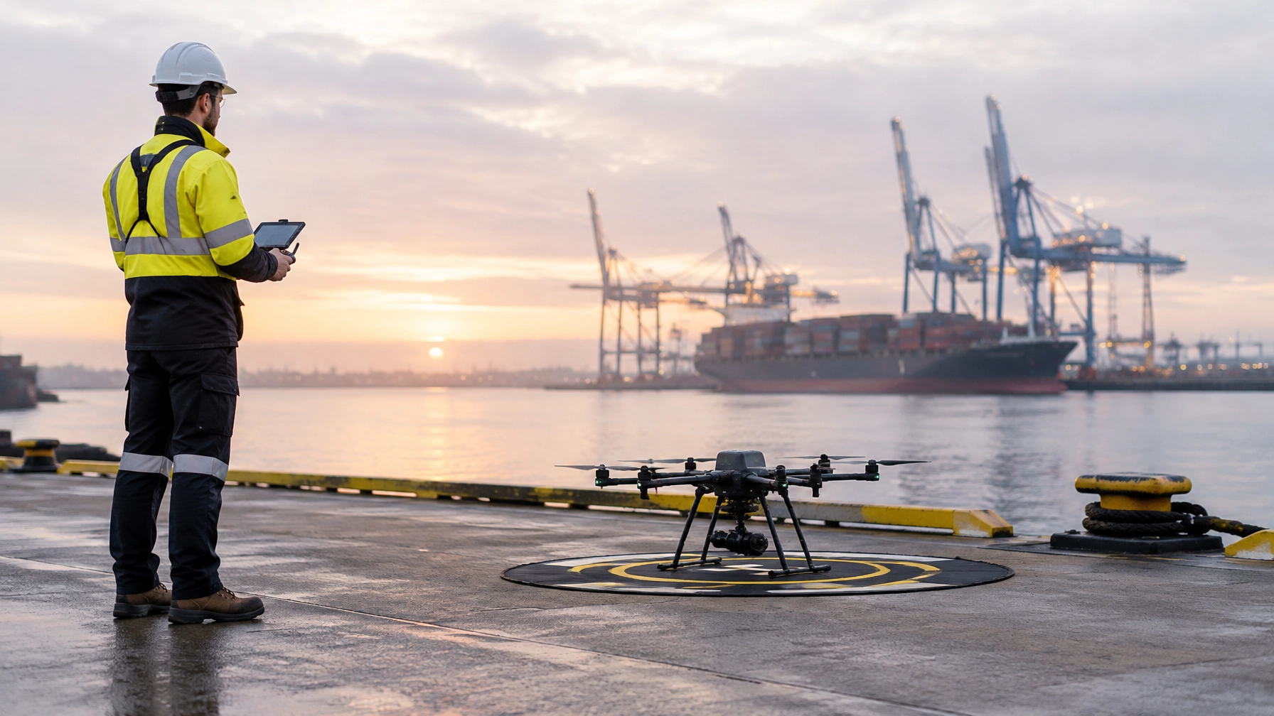
Ports pack structures, vessels, water and busy operations into one worksite. A drone reaches places that used to need rope crews, barges or a shutdown. It also builds a repeatable photographic record that engineers compare year after year.
A port job is more than piloting, though. The crew coordinates with port staff, works around shipping schedules and hands over data an engineer can act on. The commercial drone licence Australia operators hold is the entry ticket. Planning, coordination and reporting win the next job.
The work is already running across the country. At Port Botany in Sydney, drones surveyed wharf structures at Brotherson Dock. At the Port of Brisbane, inspections covered quay cranes and automated stacking cranes. Flinders Ports paired aerial and marine surveys with digital models that now sit in its asset system.
Key facts about port and marine drone work
| Workstream | Sourced example or fact |
|---|---|
| Brotherson Dock survey area | Wharf structures at berths 5 to 12 at Port Botany |
| Brotherson Dock survey period | 13 January 2026 to 31 May 2026, weather dependent |
| Below-water interface capture | A manned survey vessel captured undersides and water interfaces |
| Vessel communications | The survey vessel monitored VHF channel 12 |
| Port coordination | The survey was coordinated around port operations, shipping schedules and weather |
| Hutchison Ports inspection sites | Berths 11 and 12 at the Port of Brisbane, and Terminal 3 at Port Botany |
| Hutchison Ports assets | Quay cranes and automated stacking cranes, including spreaders and lifting attachments |
| Engineering oversight | Hutchison Ports inspections took place under supervising CPEng and RPEQ engineers |
| Flinders Ports model resolution | Above-water reality modelling at 1 mm resolution across five berths |
| Flinders Ports delivery | Models were published into the port GIS as an Infrastructure Information Model |
What actually gets inspected
Port inspection work covers a large asset estate. One project can focus on a single berth, while the next combines several survey methods across the whole port.
The usual targets are:
- Wharf soffits and fenders: capture accessible surfaces and identify areas for engineering review.
- Crane and ship-loader structures: document hard-to-reach components, such as crane spreaders and lifting attachments.
- Breakwater armour: record the condition and position of rock protection.
- Stockpile volumetrics: gather aerial data to support volume measurement.
- Port-estate roofs: record roof condition across operational buildings.
- Dredging support: provide aerial context alongside marine survey data.
- Incident documentation: capture a clear visual record for review and reporting.
The required survey method depends on the asset and the question the client needs answered. For example, the Flinders Ports work combined aerial drone capture, multibeam surveys and terrestrial laser scanning. Each method added different information to the overall asset record.

Over-water flight is the hard part
Water gives the pilot very little to work with. Flat water offers few visual references, so judging height and drift is harder than over land. The pilot watches the aircraft, the structure and the marine traffic at the same time.
Wind is the second problem. Gusts curl around wharves, cranes and ships. They move the camera at the exact moment you need a sharp frame. Salt is the third issue, because it attacks motors, gimbals and connectors. Marine crews rinse, inspect and log their aircraft far more often than land crews do.
Recovery is the third. A failure over land usually means a damaged aircraft. A failure over water usually means a lost one, plus a recovery problem for the port. Launch and recovery get tight as well, because wharf edges are restricted, exposed and busy places to work.
Plan around the conditions on the day. Check wind, launch area, vessel activity, radio traffic and recovery options before the props turn. If anything changes, pause the capture and reassess.
The approvals nobody tells you about
A port project needs two separate approvals. The first is aviation compliance: the right CASA licence or accreditation plus registration for the aircraft. The second is site access, which the port authority controls on its own terms.
TasPorts shows how strict that second layer gets. Every flight on its land, inside a port precinct or over a managed waterway needs advance approval. Requests go in at least three business days ahead and must include a flight map. The approved flight also has to fit inside a six-hour window. Hobby flights are refused outright. Read the TasPorts drone flight request requirements before you price the job.
| The pilot supplies | The operator or project supplies |
|---|---|
| CASA RPA operator accreditation or a RePL; an ARN alone is not enough | Current registration certificate for the aircraft |
| An MSIC when launching or landing inside a secure port zone | Public liability certificate showing at least $20 million cover |
| A flight plan the pilot can fly while keeping visual line of sight | Port approval lodged at least three business days ahead |
| Awareness of vessel, people and site limits | Flight map showing the area, launch and landing sites, and flight direction |
TasPorts also sets operational limits on top of the CASA rules. Its conditions include a 120 m height ceiling, 30 m separation from people, and no flight over people at any height. Visual line of sight is mandatory and controlled airspace is off limits. Its rules add vessel separation distances and stop flights during bunkering or when fuel ships are in port.
The Port of Hobart sits less than 5.5 km from an emergency helipad. Pilots must confirm the helipad is clear before and during the flight. Every port writes its own conditions, so read the one you are flying in rather than copying the last job.
A real wharf capture, step by step
The Port Botany Brotherson Dock and Flinders Ports projects illustrate the planning and delivery choices in marine inspection work. They are examples, not a single combined project.
- Define the scope. Identify the assets and the information the client needs. Brotherson Dock’s aerial survey covered wharf structures at berths 5 to 12. Hutchison Ports’ inspections focused on crane structures and attachments.
- Choose the capture method. Match the method to the structure and access need. Brotherson Dock used aerial drones and a manned survey vessel for undersides and water interfaces.
- Coordinate with the port. Set the work around port operations, shipping schedules and weather. The Brotherson Dock survey vessel monitored VHF channel 12.
- Confirm permissions and access. Gather the required aviation credentials, aircraft registration, port approval, flight map and access documents before mobilising.
- Plan the launch and recovery. Confirm the approved launch site, flight area, vessel activity and crew positions. Make sure the plan reflects the port’s conditions.
- Capture the assets. Fly the planned routes and record the agreed structures. Hutchison Ports used drone access to inspect hard-to-reach crane areas under supervising CPEng and RPEQ engineers.
- Build the survey outputs. Process the captured information into the agreed records or models. Flinders Ports combined 1 mm above-water reality modelling with multibeam surveys and terrestrial laser scanning.
- Deliver for asset use. Structure the outputs for the client’s review and systems. Flinders Ports published models into its GIS as an Infrastructure Information Model and hosted them on a 3D platform for virtual site visits.
The tech stack on a marine job
Match the aircraft and payload to the scope, the site and the report the client wants. A high-resolution photogrammetry camera builds the measurable model. Thermal imaging shows moisture, coating breakdown and delamination that a normal camera misses. LiDAR locks in geometry when a structure is too complex or too poorly lit for photogrammetry alone.
Marine work punishes ordinary kit. Salt air attacks gimbals, motors and connectors, so crews run marine-suited aircraft and reef them after every job. Launch and recovery gear matters just as much, because a wet deck or a steel edge is where aircraft get broken.
The processing stack can include reality modelling, defect registers and delivery into a client’s digital twin or asset system. Flinders Ports’ example used 42 megapixel photogrammetry cameras, drone boats and an in-house SLAM-CAM. The resulting models entered the port GIS and a 3D platform used by tenderers for virtual site visits.
Docked and BVLOS platforms now run scheduled missions across port estates. Typical missions cover perimeter security, container yards, hazardous goods areas and berth support. They also inspect wharves, cranes and gantries. These systems feed data straight into the port's own security and operations systems. Big estates make BVLOS coverage worthwhile, usually under tailored approvals.
Want the flight skills this work needs? Compare our RePL packages and the specialised and enterprise courses we run for inspection and heavy-lift crews.

What port clients check before they award the work
Port clients check credentials before they check anything else. A wharf capture tender usually asks for four things. Expect to send your pilot qualification, the operating certificate, radio competency and insurance in one pack.
| What the client asks for | ACE pathway | Price |
|---|---|---|
| RePL | Gold Pilot package | $1,499 |
| AROC | Aeronautical Radio Operator Certificate | $445, usually $495 |
| ReOC | ReOC setup, or Gold Business which bundles RePL with business setup | $2,499 setup, or Gold Business $3,499 |
| MSIC | Arranged through the port and the security regulator, not through ACE | Confirm with the port authority |
| Public liability cover | Broker or underwriter arrangement | Confirm with the port authority |
A ReOC setup is application preparation, not the certificate itself. CASA still decides what the operator is approved to do. The Gold Business package bundles RePL with ReOC business setup. It is our most popular option for pilots going out on their own.
ACE is a CASA-approved training provider, CASA.ReOC.1421, with 4,000+ students trained over 10 years. Our global footprint reaches Australia, Singapore, Dubai, Korea and Malaysia. Students also get the Altitude+ program with their training, and licensed pilots can find commercial work through DroneWork's port inspection service.
Where the work is in Australia
Every state runs port and marine assets, and each one sets its own access conditions. These five cities show where a trained pilot can put a RePL to work.
- Brisbane: Hutchison Ports runs berths 11 and 12 at the Port of Brisbane, where drone access reached crane components that are hard to inspect on foot.
- Sydney: Port Botany hosted the Brotherson Dock capture across berths 5 to 12, with vessel support for the undersides and water interfaces.
- Melbourne: wharf structures, cranes, port-estate roofs and marine interfaces all need condition records, and the port precinct sits close to controlled airspace.
- Perth: bulk export terminals and breakwaters mean stockpile volumetrics and armour surveys alongside structural capture.
- Hobart: TasPorts rules govern its managed areas, and the Port of Hobart sits within 5.5 km of an emergency helipad, so the helipad check comes first.
Common mistakes pilots make on marine jobs
Most of the errors happen before anyone drives to the wharf. The biggest is assuming a CASA credential unlocks the gate. It does not, because the port authority runs a separate approval process.
The other common ones:
- Sending a request without the flight map or registration certificate.
- Treating a general flight plan as enough for a specific vessel or berth.
- Ignoring weather, shipping schedules or port activity when setting the flight window.
- Planning to launch or recover from an unapproved or restricted surface.
- Capturing imagery without confirming how the client will use the data.
- Treating a scheduled or BVLOS mission as a routine VLOS flight.
Lock in the operator, the pilot, the aircraft, the access and the deliverables before the crew mobilises. If the site plan shifts, go back to the port and re-approve it.
CASA considerations before you accept a port job
A RePL or operator accreditation is only the first box. Before you accept the job, check the aircraft registration, the operating arrangements and the likely flight conditions. Then verify the port's own permission and security requirements.
TasPorts' conditions show how much local rules can shape a mission. They demand visual line of sight, cap height, set separation from people and vessels, and block flights near aerodromes and helipads. Bunkering and fuel-ship visits stop operations on the day. Read the CASA drone safety rules and the port's own conditions before you write the flight plan.
Estate-wide and BVLOS work needs tailored approvals before you commit to a schedule. Training teaches you what a safe operation looks like. The operator then plans and authorises each mission against the current rules.
Frequently asked questions
1. Do I need a RePL for port drone inspections?
Yes, for almost every commercial job. TasPorts accepts a RePL or RPA operator accreditation and rejects an ARN on its own. Most port work runs under a ReOC, so a RePL plus an operator certificate is the practical combination.
2. Does a RePL give me permission to fly over a port?
No. A pilot credential does not replace port authority permission. You must also follow the local site rules and submit the required information.
3. Does the drone need to be registered?
Yes. Commercial flying requires registration, and TasPorts asks for the current certificate in the request pack. Send it with the application rather than after approval.
4. What is an MSIC, and when might I need one?
An MSIC is a Maritime Security Identification Card. TasPorts asks for one when the pilot intends to launch or land inside a Secure Port Zone.
5. How far ahead should I apply to TasPorts?
At least three business days before the flight. The approved flight also has to fit inside a six-hour window.
6. What should a TasPorts flight map show?
The whole flight area, the launch and landing sites, and the flight direction. Mark the distances from structures, vessels and the public so the reviewer can see the plan works.
7. What insurance document does TasPorts request?
TasPorts requests a current certificate of currency or insurance certificate showing public liability cover of at least $20 million. An invoice is not sufficient.
8. Can I fly directly over a vessel?
TasPorts requires prior approval through port security before a drone flies directly over a vessel. Its rules also set separation distances from stationary vessels and vessels under steam.
9. Can I fly beyond visual line of sight over a port estate?
Only under a tailored approval. Docked platforms now run scheduled BVLOS missions across port estates, and each operator holds its own approvals for that estate. A standard RePL does not cover it.
10. What is the difference between a RePL and a ReOC?
A RePL licenses you as a pilot. A ReOC licenses a business to operate commercially and sets what it may do. Port tenders usually ask for both, and CASA issues the ReOC.
11. What does ACE's ReOC Setup include?
Application preparation, operations manual and compliance guidance, and the CASA application fee. It is priced at $2,499, and CASA still makes the final decision on scope.
12. What does Gold Business include?
Gold Business combines RePL with ReOC business setup. ACE lists the package at $3,499 and describes it as its most popular package.
13. What does AROC mean?
AROC stands for Aeronautical Radio Operator Certificate. ACE lists its AROC course at $445, usually $495.
14. Can drone images capture the underside of a wharf?
Partly. A drone covers the accessible soffit and fender faces. The Brotherson Dock job paired it with a manned survey vessel for the undersides and water interfaces. Match the method to the structure.
15. What equipment did the Flinders Ports work use?
The work included aerial drones, drone boats, 42 megapixel photogrammetry cameras and an in-house SLAM-CAM. It also used multibeam surveys and terrestrial laser scanning.
16. Does ACE offer training outside Australia?
Yes. We train across Australia, Singapore, Dubai, Korea and Malaysia. Explore the ACE training courses and ask which location suits your pathway.
17. Where can I find port inspection work?
DroneWork lists a port inspection service for commercial work. ACE also provides a jobs and opportunities page; roles and requirements vary.
Training locations
Explore ACE training in Brisbane, Sydney, Melbourne, Perth and Hobart. For course feedback, read student reviews. For advice on a pathway, request a training quote.
Summary
Port and over-water inspection work combines flight planning, site access, safe operations and useful engineering data. A successful project starts with the right CASA credentials, aircraft registration and port permission. It also needs a plan that accounts for vessels, weather, launch and recovery, and the client’s data requirements.
ACE has trained 4,000+ students and supports pathways from RePL to AROC and ReOC setup. Review the available training options and learn the rules for your target port. Prepare for the full operation, not just the flight. When you are ready, book your seat and we will map the pathway around the work you want.
Ready to start? Book your training at aaa.edu.au or call 1300 336 366.
{“@graph”:[{“@type”:”Article”,”author”:{“name”:”Ace Aviation Aerospace Academy”,”@type”:”Organization”},”headline”:”Drone Licence Australia 2026: Port, Wharf and Over-Water Inspection Work, Explained”,”publisher”:{“url”:”https://aaa.edu.au”,”name”:”Ace Aviation Aerospace Academy”,”@type”:”Organization”},”inLanguage”:”en-AU”,”description”:”Understand drone licence australia requirements for port and over-water inspection work. Explore ACE training pathways and book your course today.”},{“url”:”https://aaa.edu.au”,”name”:”Ace Aviation Aerospace Academy”,”@type”:”Organization”},{“@type”:”FAQPage”,”mainEntity”:[{“name”:”Do I need a RePL for port drone inspections?”,”@type”:”Question”,”acceptedAnswer”:{“text”:”The required credential depends on the operation and aircraft. TasPorts requires RPA operator accreditation or a RePL, and says an ARN alone is not enough. Confirm the relevant CASA and port requirements for the job.”,”@type”:”Answer”}},{“name”:”Does a RePL give me permission to fly over a port?”,”@type”:”Question”,”acceptedAnswer”:{“text”:”No. A pilot credential does not replace port authority permission. You must also follow the local site rules and submit the required information.”,”@type”:”Answer”}},{“name”:”Does the drone need to be registered?”,”@type”:”Question”,”acceptedAnswer”:{“text”:”TasPorts asks for the aircraft’s current CASA registration certificate. Include it in the request and check the rules for the specific port and operation.”,”@type”:”Answer”}},{“name”:”What is an MSIC, and when might I need one?”,”@type”:”Question”,”acceptedAnswer”:{“text”:”An MSIC is a Maritime Security Identification Card. TasPorts asks for one when the pilot intends to launch or land inside a Secure Port Zone.”,”@type”:”Answer”}},{“name”:”How far ahead should I apply to TasPorts?”,”@type”:”Question”,”acceptedAnswer”:{“text”:”Submit the request at least three business days before the flight. The proposed flight must fit within a six-hour window.”,”@type”:”Answer”}},{“name”:”What should a TasPorts flight map show?”,”@type”:”Question”,”acceptedAnswer”:{“text”:”Show the complete flight area, launch and landing sites, and flight direction. Include enough detail to show how the plan accounts for structures, vessels and the public.”,”@type”:”Answer”}},{“name”:”What insurance document does TasPorts request?”,”@type”:”Question”,”acceptedAnswer”:{“text”:”TasPorts requests a current certificate of currency or insurance certificate showing public liability cover of at least $20 million. An invoice is not sufficient.”,”@type”:”Answer”}},{“name”:”Can I fly directly over a vessel?”,”@type”:”Question”,”acceptedAnswer”:{“text”:”TasPorts requires prior approval through port security before a drone flies directly over a vessel. Its rules also set separation distances from stationary vessels and vessels under steam.”,”@type”:”Answer”}},{“name”:”Can I fly beyond visual line of sight over a port estate?”,”@type”:”Question”,”acceptedAnswer”:{“text”:”Scheduled BVLOS platforms operate across port estates under tailored approvals. Confirm the approvals and operating conditions for the specific mission before planning BVLOS coverage.”,”@type”:”Answer”}},{“name”:”What is the difference between a RePL and a ReOC?”,”@type”:”Question”,”acceptedAnswer”:{“text”:”A RePL is a pilot qualification. A ReOC relates to the operating business and its approved scope. ACE offers ReOC application setup support, but CASA determines approval.”,”@type”:”Answer”}},{“name”:”What does ACE’s ReOC Setup include?”,”@type”:”Question”,”acceptedAnswer”:{“text”:”ACE lists application preparation, operations-manual and compliance guidance, and the CASA application fee. The setup does not guarantee certificate approval.”,”@type”:”Answer”}},{“name”:”What does Gold Business include?”,”@type”:”Question”,”acceptedAnswer”:{“text”:”Gold Business combines RePL with ReOC business setup. ACE lists the package at $3,499 and describes it as its most popular package.”,”@type”:”Answer”}},{“name”:”What does AROC mean?”,”@type”:”Question”,”acceptedAnswer”:{“text”:”AROC stands for Aeronautical Radio Operator Certificate. ACE lists its AROC course at $445, usually $495.”,”@type”:”Answer”}},{“name”:”Can drone images capture the underside of a wharf?”,”@type”:”Question”,”acceptedAnswer”:{“text”:”Aerial capture can support inspection, but the Brotherson Dock example used a manned survey vessel to capture undersides and water interfaces. Plan the method around the structure and the required data.”,”@type”:”Answer”}},{“name”:”What equipment did the Flinders Ports work use?”,”@type”:”Question”,”acceptedAnswer”:{“text”:”The work included aerial drones, drone boats, 42 megapixel photogrammetry cameras and an in-house SLAM-CAM. It also used multibeam surveys and terrestrial laser scanning.”,”@type”:”Answer”}},{“name”:”Does ACE offer training outside Australia?”,”@type”:”Question”,”acceptedAnswer”:{“text”:”Yes. ACE reports training across Australia, Singapore, Dubai, Korea and Malaysia. Explore the ACE training courses and ask about the location that suits your pathway.”,”@type”:”Answer”}},{“name”:”Where can I find port inspection work?”,”@type”:”Question”,”acceptedAnswer”:{“text”:”DroneWork lists a port inspection service for commercial work. ACE also provides a jobs and opportunities page; roles and requirements vary.”,”@type”:”Answer”}}]}],”@context”:”https://schema.org”}