

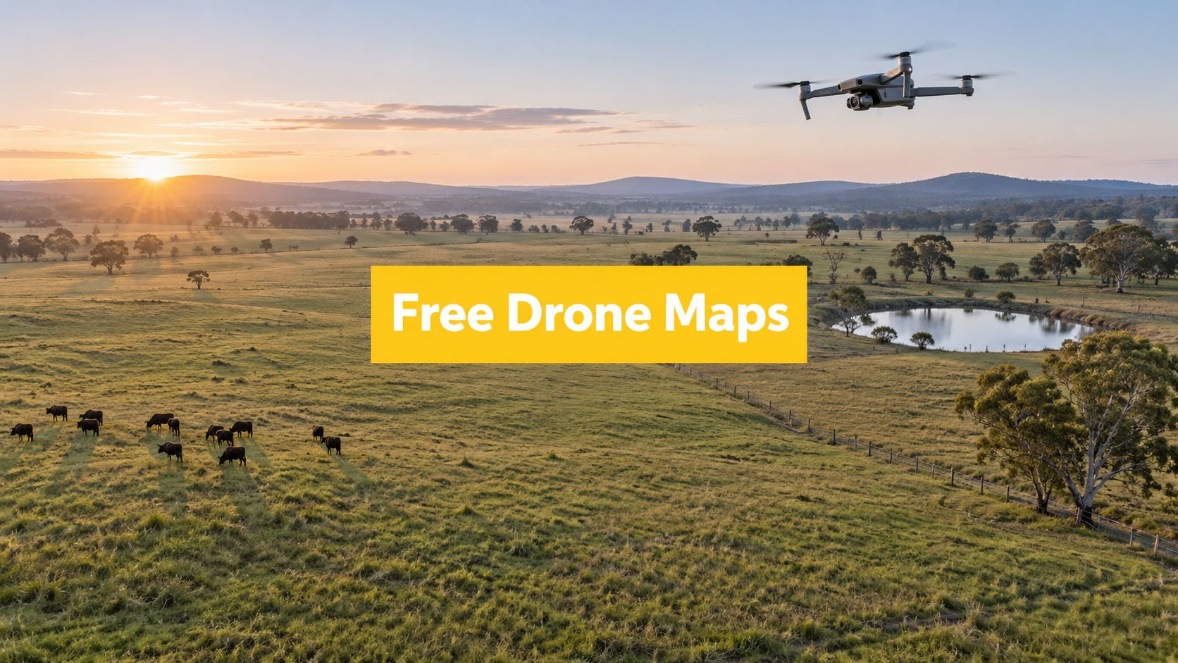
A small Australian survey or inspection job can make a free drone mapping app look like an easy choice. An operator may find one app that plans a flight, another that captures imagery, and a third that processes photographs into a map. Those functions aren't interchangeable. A tool may be free for flight planning but charge for processing, restrict exports, require an internet connection, or work only with particular aircraft and mobile devices.
The comparison below assesses five options through an Australian operating workflow: supported platforms, mission planning, image capture, processing, exports, offline readiness, data ownership, privacy, accuracy expectations and upgrade triggers. App availability and free-tier terms can change, so each provider's current conditions should be checked before client work begins. A useful drone aerial media mapping listing can help identify the intended output, but software capability doesn't replace CASA compliance, flight planning or pilot competency.
Table of Contents
- 1. ACE READY
- 2. ACE BRONZE
- 3. ACE SILVER
- 4. ACE GOLD
- 5. ACE PLATINUM
- Free Drone Mapping App, ACE Tier Comparison
- Turn a Free Trial Into a Reliable Mapping Workflow
1. ACE READY
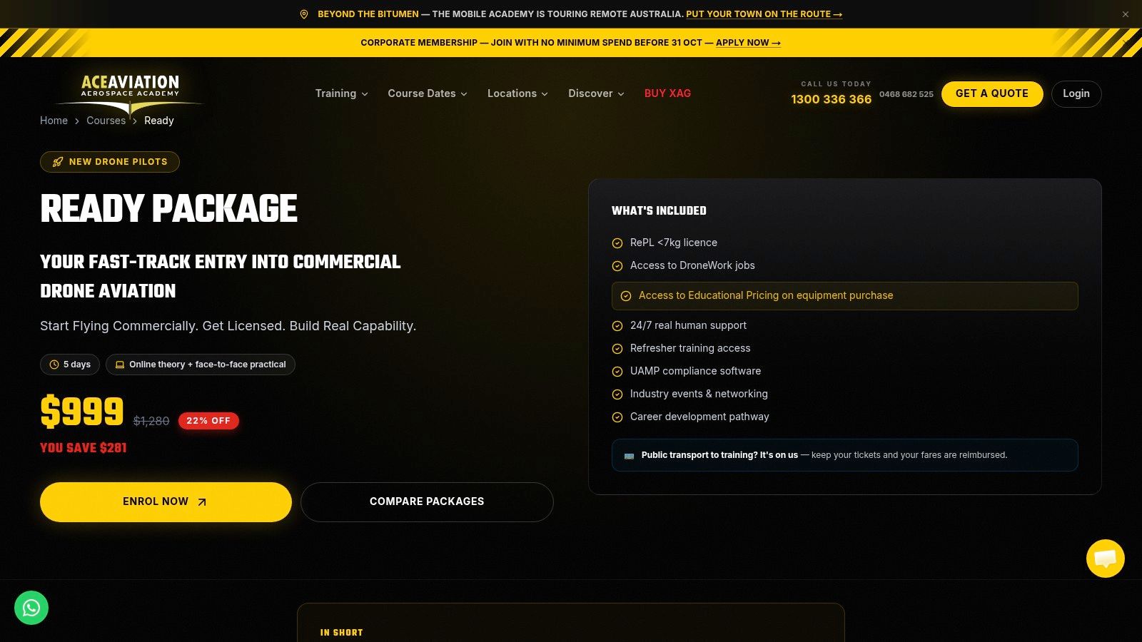
A learner may complete an automated grid flight successfully, then discover that the site, aircraft or operating conditions were unsuitable for the mission. ACE READY addresses that earlier decision. It is not a drone mapping app. It provides a foundation for understanding the aircraft, airspace and risks involved in collecting aerial data. For someone searching for a drone mapping app free of charge, that distinction matters. Flight automation does not teach an operator to assess obstacles, people, weather, battery condition or local restrictions.
The course is positioned as an entry point for beginners, covering drone fundamentals, aviation safety, CASA rules and flight operations. That makes it relevant to a learner practising basic image capture before considering more advanced commercial training. The ACE READY course is the first-party reference for checking current inclusions and the available pathway.
Where it fits in a mapping workflow
A beginner can test a free mapping tool at a controlled site by repeating a simple mission and reviewing its boundaries, altitude settings, image overlap and return-to-home behaviour. Those tests show whether the app works with the operator's aircraft and mobile platform, and whether it remains usable when connectivity is limited. They do not establish that the resulting model is accurate enough for surveying, engineering or a client deliverable.
Processing and data handling also require verification. A free app may plan the flight but leave photogrammetry to separate software, limit exports or store imagery in the cloud. Before using it for practice or client work, the learner should check file formats, download rights, storage location, account access and deletion controls.
CASA advises operators to check a CASA-verified drone safety app before each flight because these tools indicate where drones may and may not be flown under aviation legislation. That check remains separate from mapping software, even if a flight-planning app displays airspace information. Australia also has a machine-readable regulatory data layer, with digitised maps covering more than 7,500 areas managed by 15 agencies and an initial release showing restrictions for more than 7,000 areas, as reported by Unmanned Airspace's coverage of Australia's digitised drone-rule maps.
Practical rule: A free mapping app supports practice. The operator still needs a current airspace and site-risk check before every flight.
Strengths and limitations
- Beginner suitability: It establishes the aviation foundation needed to interpret mapping software and its limitations.
- Low-risk experimentation: Learners can test capture methods without treating automation as a substitute for operational responsibility.
- Upgrade trigger: More structured commercial preparation and complex operational planning become relevant as the work moves beyond supervised practice.
The ACE starter training option gives learners another pathway to compare. ACE READY belongs around the software decision, not inside it. It does not increase an app's processing capacity or export rights. It prevents an inexperienced operator from confusing a technically successful capture with a legally and operationally sound mission.
2. ACE BRONZE
ACE BRONZE suits a student moving beyond recreational experimentation and considering commercial drone work. Its relevance to free mapping software is practical. Commercial mapping involves more than producing an attractive orthomosaic. The operator needs repeatable flight preparation, aviation theory, safe aircraft handling and a clear understanding of what the customer is buying.
The course is described as a foundation commercial drone course covering drone operations, flight safety, aviation theory and practical skills. Details should be confirmed directly on the ACE BRONZE course page, particularly before a student relies on the course as a pathway for a specific operating privilege.
Testing a free app against commercial expectations
A student can assess a free or freemium tool by running the same controlled mission more than once and comparing the resulting imagery, alignment and export behaviour. That test reveals weaknesses a feature list may hide. Some tools plan the flight but leave processing to separate desktop software. Others accept photographs or video but restrict downloads, storage, collaboration or the file formats required by a client.
The agricultural context illustrates why a low-friction entry tool can be useful. An Australia-focused industry resource reports that about 10% of agricultural businesses use drones, compared with 4–8% among irrigators in 2015–2016, as documented by FarmTable's Australian farm mapping resource. That doesn't establish that a free app is suitable for every farm. It does suggest that simple planning and field-capture tools may help a business test a workflow before investing in more advanced processing.
A commercial operator should record the following during the test:
- Capture consistency: Check whether the app supports the aircraft, controller and camera combination.
- Field resilience: Test map access, device performance and recovery procedures where connectivity is limited.
- Deliverable control: Confirm whether imagery, orthomosaics, models and measurements can be exported in usable formats.
- Client protection: Review cloud storage, privacy terms, retention and ownership before uploading sensitive site data.
CASA's sub-2 kg excluded category allows an RPA weighing 2 kg or less to be flown for business or as part of a job without a RePL or ReOC, subject to the applicable conditions explained by CASA's drone weight categories and requirements. That threshold doesn't remove the need for safe operations, airspace checks or suitable competence.
The ACE licence finder can help a prospective operator examine which training direction may be relevant. ACE BRONZE is therefore a useful fit for someone asking whether a free mapping app can support early commercial learning, while recognising that the software remains only one part of the operating system.
3. ACE SILVER
A pilot testing a free mapping app may soon face a different question: can the planned mission be flown lawfully, communicated clearly and repeated for a client? ACE SILVER is aimed at that transition from software experimentation to professional RPAS work. Its stated scope includes commercial Remote Pilot Licence training, classroom and practical flight training, CASA-compliant certification, the Aeronautical Radio Operator Certificate and aviation English proficiency.
Those capabilities matter for mapping near aerodromes, controlled airspace, managed land or other operationally complex locations. An app may display a restriction, but the pilot must interpret it, determine whether the mission can proceed and recognise when an approval, alternative site or revised operating plan is required. Check the ACE SILVER course information for current delivery details and entry requirements. The ACE's drone licence pathway overview can also help place the RePL discussion within the broader training pathway.
Why AROC and aviation communication matter
CASA requires an Aeronautical Radio Operator Certificate for anyone who needs to communicate on an aviation air-band radio frequency and is not already licensed or qualified. The requirement can also apply when the person operates an unmanned aircraft. Applicants need a current aviation English language proficiency assessment, according to CASA's radio operator requirements. These obligations remain separate from the choice between free and paid mapping software.
Australia's public drone tools use aviation and aerodrome information from Airservices Australia, including no-fly and fly-with-caution zones. Spatial Source's report on CASA's Can I Fly There? app describes that integration. Operators should verify whether a mapping platform's airspace layer is authoritative, current and intended for Australian operations. A generic basemap should not be treated as the compliance source.
The strongest software workflow separates authoritative compliance checking from mission design, capture and processing.
The upgrade question
A free app becomes inadequate when it blocks the required output, prevents reliable mission repetition or leaves the workflow poorly documented. Common triggers include restricted exports, limited processing capacity, weak device compatibility, no offline plan and inadequate controls for client data. These affect field delivery and commercial suitability, rather than just adding inconvenience.
ACE SILVER fits the stage where formal training must sit alongside disciplined software evaluation. The course does not certify a particular app, and an app cannot replace RePL or AROC training. Together, they let an operator assess the software's technical limits alongside the pilot's legal and practical responsibilities.
4. ACE GOLD
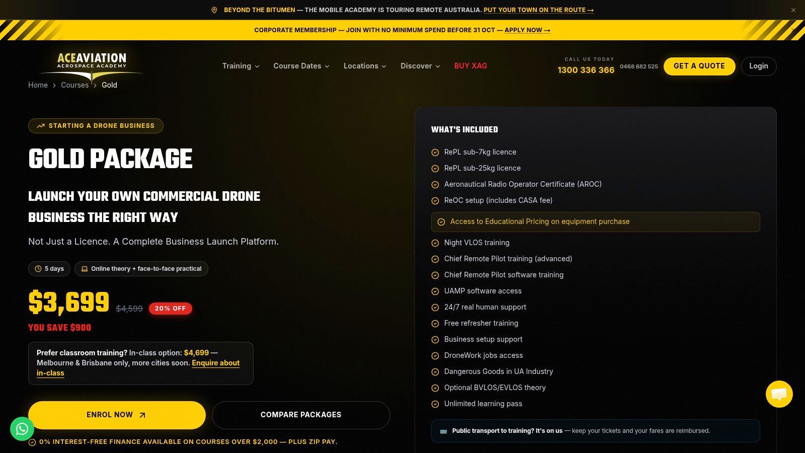
A business may begin with a free drone mapping app for one pilot and a small project. The decision changes once several operators, aircraft, sites or clients depend on the same workflow. ACE GOLD is described as covering RePL, ReOC support, practical flight training, aviation compliance and commercial business readiness. Its relevance lies in testing whether the software can support repeatable work within a documented operating system, not merely produce one acceptable map.
A free tier can support early workflow design. It may help a team compare manual capture with automated mission planning, test whether a phone or tablet works reliably in the field and identify which outputs clients use. It cannot establish that the aircraft, pilot, site, procedures and records satisfy commercial operating requirements. Confirm the current training pathway on the ACE GOLD course page.
ReOC support changes the software decision
For an organisation preparing for ReOC-related operations, mapping software belongs inside the operating procedures. Review who plans missions, who checks airspace, how hazards are recorded, where imagery is stored and how another person reviews the final output. A platform suitable for one pilot may be unsuitable when staff need consistent permissions, access and records.
Australian operators should also separate digital airspace information from the compliance decision itself. Open drone-rule data and application programming interfaces can support flight-planning tools, but a free app may not use the correct source, update information promptly or cover every operating area. Ask each provider about data origin, update frequency, Australian coverage and offline behaviour. The platform should support, not replace, the operator's own checks.
A commercial team must distinguish a trial from a continuing free tier. Product conditions can include image limits, trial windows or restricted features. Map Pilot Pro's Australian App Store listing illustrates why current limits should be checked directly before a workflow is standardised.
Questions for an enterprise pilot
- Governance: Can the organisation control user access and retain operational records?
- Platform fit: Does the app support the aircraft, controller and mobile devices used by the team?
- Remote work: Can crews plan, capture and preserve data at sites with limited connectivity?
- Data handling: Are sensitive imagery and location data stored in an acceptable jurisdiction and manner?
- Commercial continuity: What happens to active projects when a trial ends or a free tier changes?
The next upgrade trigger may be a blocked export, unreliable field performance, inadequate processing capacity or weak documentation. Those limits affect delivery and client confidence more than the presence of an extra mapping feature.
ACE GOLD fits operators who need software evaluation alongside ReOC and business-readiness planning. The specialised ReOC and commercial operations training can help place the app decision within the broader responsibilities of running a compliant drone business.
5. ACE PLATINUM
ACE PLATINUM is the broadest training option in this comparison. Its described package includes RePL, AROC, aviation English, Express ReOC, Certificate III in Aviation, advanced operations training and preparation to operate and manage a commercial drone business. For an enterprise, government agency or aviation professional, that breadth is relevant because mapping software is only one layer in a larger operational system.
An enterprise may have to support several aircraft types, different capture methods, remote field teams, controlled documents and customer-specific outputs. A free app can be useful for a proof of concept, but its limitations need to be recorded before it becomes part of a standard operating procedure. The ACE PLATINUM information should be consulted for current inclusions, eligibility and delivery arrangements.
Mapping at organisational scale
A sensible evaluation starts with the required output, not the advertised app category. A farm may need field scouting and repeatable visual records. A construction team may need progress documentation and measurements. A survey or infrastructure client may require controlled capture, defined accuracy, traceable processing and a particular export format. Each use case changes the point at which a free tool stops being suitable.
The comparison should include:
- Aircraft and controller fit: Confirm supported models, firmware dependencies and camera settings.
- Mission control: Check grid, corridor, orbit or manual capture functions against the intended site.
- Processing path: Establish whether reconstruction is cloud-based, device-based or dependent on a separate workstation.
- Offline continuity: Test what remains available without a live connection and how uploads resume.
- Evidence and records: Determine whether the team can retain flight plans, source imagery, processing settings and final exports.
- Commercial handover: Confirm that the resulting files can be opened, measured, archived and shared by the customer.
CASA's safety-app guidance states that pilots should check a CASA-verified app before each flight. The historical adoption of CASA-linked tools also shows that Australian operators have long expected field-ready mapping and rule information to work together. CASA reported that the Can I Fly? app had been downloaded over 35,000 times and its web version accessed more than 60,000 times, with an additional 60,000 app downloads reported in May 2018, as recorded on CASA's drone safety apps page. The figures are historical, but they demonstrate established local demand for accessible digital flight-planning information.
When the enterprise should upgrade
An upgrade is justified when a specific restriction affects delivery, such as processing volume, storage, export formats, team access, advanced mission control or retention. A team shouldn't upgrade merely because a paid plan appears more professional. It should document the failed free workflow, identify the operational consequence and confirm that the proposed plan resolves it.
ACE PLATINUM is most relevant when that software decision sits alongside broader training, radio, aviation management and ReOC needs. The ACE Aviation Aerospace Academy overview provides the appropriate context for organisations comparing a complete training pathway rather than a standalone mapping app.
Free Drone Mapping App, ACE Tier Comparison
| Course | Implementation complexity 🔄 | Resource requirements ⚡ | Expected outcomes ⭐📊 | Ideal use cases 💡 | Key advantages ⭐ |
|---|---|---|---|---|---|
| ACE READY | Low, basic theory and intro flights 🔄 | Low, minimal equipment, online/classroom time ⚡ | Fundamental drone knowledge; readiness for RePL prep 📊 | Beginners seeking safe introductory training 💡 | Quick entry point; regulatory fundamentals |
| ACE BRONZE | Low–Medium, foundation commercial training 🔄 | Low–Medium, practical sessions, basic drone gear ⚡ | Basic commercial operations competence; pathway to licence 📊 | New pilots aiming for commercial skills 💡 | Practical skills + safety focus |
| ACE SILVER | Medium, structured RePL course with assessments 🔄 | Medium, classroom, flight hours, testing resources ⚡ | CASA‑compliant RePL, AROC, aviation English proficiency 📊 | Aspiring professional drone pilots preparing for certification 💡 | Official RePL certification and radio competency |
| ACE GOLD | High, advanced training + ReOC support 🔄 | High, extended practical training, compliance modules ⚡ | RePL plus ReOC support and business‑ready operations capability 📊 | Pilots planning to run or scale commercial services 💡 | ReOC assistance, business & compliance emphasis |
| ACE PLATINUM | Very High, enterprise‑level integrated program 🔄 | Very High, multiple certifications, intensive training ⚡ | Enterprise readiness: RePL, AROC, Cert III, Express ReOC, advanced ops 📊 | Companies or individuals needing full commercial/management capability 💡 | Most comprehensive package; multiple official credentials ⭐ |
Turn a Free Trial Into a Reliable Mapping Workflow
A free drone mapping app can be a rational starting point, but the right choice depends on the complete workflow. The aircraft, controller, mobile device, camera, capture method and required output should be compatible before a pilot invests time in a platform. A tool that produces a visually convincing model but can't export the required file, operate reliably at the site or protect sensitive data may be unsuitable for paid work.
A controlled test should happen before client delivery. The operator should use a manageable site, record battery use, connectivity, device performance, image quality and processing behaviour, then check the exported files in the software used by the customer or internal team. The test should also identify whether the free tier limits image volume, storage, retention, processing, exports or collaboration.
The upgrade decision should be evidence-based. A paid plan makes sense when a specific restriction creates a measurable operational problem, such as repeated processing failures, inadequate storage, missing team access or an export format that prevents handover. A trial should be treated differently from a permanently free tool. The provider's current terms need checking before a project begins, because trial periods and free-tier conditions can change.
Software doesn't replace CASA compliance or pilot competency. CASA says operators should check a CASA-verified drone safety app before each flight, and the mapping platform's own airspace display shouldn't be treated as the sole legal authority. Flight planning, site assessment, aircraft limitations, privacy considerations and required qualifications remain the operator's responsibility.
Readers moving from experimentation to commercial work can assess ACE READY or ACE BRONZE for foundations, ACE SILVER for RePL-focused training, and ACE GOLD or ACE PLATINUM when broader commercial operations and ReOC support are relevant. A separate Veo 3 free access guide isn't a substitute for aviation guidance, but it reinforces the wider lesson: free access should be tested against the actual production requirement, not judged by the word “free” alone.
Frequently asked questions
Are free drone mapping apps suitable for commercial mapping?
They can support trials, small jobs or workflow development, but suitability depends on the required accuracy, outputs, data controls, reliability and regulatory setting. The operator should test the specific aircraft and site before relying on the app for client work.
Can a free mapping app work offline?
Some tools may provide offline planning, capture or local processing, while others depend on cloud services. Each provider's current offline functions should be verified, then tested at the intended operating location rather than assumed from the app description.
Can free software deliver accurate mapping?
It can produce useful imagery or models, but accuracy depends on capture quality, flight planning, camera performance, processing controls and the purpose of the deliverable. Formal surveying and engineering work may require a more controlled workflow and documented accuracy assessment.
What hardware is required?
Requirements vary by app and workflow. The operator should confirm aircraft compatibility, controller support, mobile operating system, device performance, camera settings, storage and any desktop or server requirements before standardising on a tool.
What limits commonly apply to free tiers?
Common restrictions include image or file caps, limited storage, short trial windows, reduced processing, restricted exports, fewer users and limited retention. The provider's current terms should be checked immediately before a commercial project.
Is mapping software the same as a drone licence?
No. Mapping software plans, captures or processes data. A drone licence, aviation certificate or operating approval addresses the pilot's qualifications and legal operating conditions. CASA's requirements must be assessed separately for the aircraft, operation and location.
Ace Aviation Aerospace Academy provides Australian drone training linked to real operational needs, including foundations, RePL, AROC, aviation English, advanced operations and ReOC-related pathways. Readers can review the relevant options and speak with the academy about training that supports a safe, compliant mapping workflow by visiting Ace Aviation Aerospace Academy.
