

Meta description: Explore the drone licence Australia employers value in 2026, from thermal and LiDAR to AI processing. Start your training today.
Short Direct Answer
For most commercial drone work in Australia, you need a CASA Remote Pilot Licence (RePL), registered aircraft and compliant operating procedures. Thermal, LiDAR and AI skills are not separate licences. However, employers increasingly want pilots who can collect accurate data, understand payloads and deliver useful results.
Detailed Explanation: Why Drone Technology Skills Matter in 2026
The commercial drone market is moving beyond basic aerial photography. Employers now want pilots who can gather, interpret and explain useful information.
That information may come from a thermal camera, LiDAR sensor, multispectral payload or standard RGB camera. In addition, AI-assisted software can turn raw imagery into maps, measurements and inspection reports.
Therefore, the modern drone pilot needs more than good hand skills. You need aviation knowledge, mission planning ability and an understanding of the client’s industry.
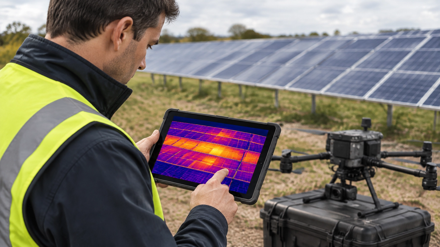
A thermal camera records heat differences. It can identify hot solar panels, overheating electrical equipment, water stress and possible livestock issues.
LiDAR, or Light Detection and Ranging, measures distance using laser pulses. It can produce highly detailed terrain models, even where vegetation makes ordinary photography less effective.
Photogrammetry uses overlapping photographs to create maps and 3D models. Surveyors use it for construction progress, stockpile measurements, earthworks and asset documentation.
Meanwhile, AI-assisted processing helps software classify objects, identify changes and flag unusual results. However, AI does not remove the pilot’s responsibility. A qualified operator must still check the data, understand limitations and report results honestly.
The commercial drone pilot is becoming a data professional
A client rarely wants “a drone flight” by itself. They usually want one of the following outcomes:
- A stockpile volume
- A crop health map
- A roof or solar fault report
- A mine pit survey
- A construction progress model
- A vegetation assessment
- A cinematic video sequence
- A safe inspection record
- A clean facade or solar panel system
As a result, employers are hiring pilots who understand the complete workflow:
- Define the client’s problem.
- Select the correct aircraft and payload.
- Plan a safe and legal mission.
- Capture consistent data.
- Process and quality-check the information.
- Present clear findings to the client.
This is why a commercial drone licence Australia pathway should include practical flying, aviation law, payload awareness and industry context.
New technology does not replace CASA compliance
CASA regulates the operation, not simply the camera attached to the aircraft. A thermal, LiDAR or multispectral payload does not automatically require a special technology endorsement.
Instead, the main questions are:
- How heavy is the aircraft?
- How close will it operate to people?
- Will it fly at night?
- Will it operate near controlled airspace?
- Will the pilot maintain visual line of sight?
- Does the operation require BVLOS approval?
- Does the aircraft need a specific type rating?
- Is the operator working under a ReOC?
Read the latest CASA drone rules and operational guidance before each new type of mission. Rules and approval pathways can change.
Ace Aviation provides CASA-approved training under CASA.ReOC.1421. The Academy has trained more than 4,000 students, with high satisfaction ratings and industry relationships that help keep its curriculum current.
Key Facts Table: Drone Technology and Career Requirements
| Technology or application | What it does | Common industries | Skills employers value | Typical compliance issues |
|---|---|---|---|---|
| Thermal imaging | Detects heat differences and temperature patterns | Solar, energy, utilities, agriculture, building inspection | Thermal interpretation, reporting and safe close inspection | Night operations, proximity to people, site permissions |
| LiDAR | Creates laser-based point clouds and terrain models | Mining, surveying, construction, forestry and infrastructure | Payload setup, ground control, data checks and GIS awareness | Aircraft weight, BVLOS, altitude and operating area |
| Photogrammetry | Builds maps and 3D models from overlapping photographs | Construction, surveying, mining and property | Flight planning, image overlap and processing | Airspace, privacy, people and site controls |
| Multispectral imaging | Measures light bands linked to plant health | Agriculture, environmental monitoring and research | Crop mapping, calibration and agronomy awareness | Chemical, environmental and land access rules |
| AI-assisted processing | Classifies, compares or flags data | Inspection, mapping, agriculture and asset management | Data validation, workflow design and client communication | Human review, privacy and data governance |
| Spraying and spreading | Applies liquids, seed or granular products | Agriculture and land management | Aircraft handling, application control and chemical safety | RePL, ReOC, aircraft category and state chemical rules |
| Aerial cleaning | Uses purpose-built aircraft for cleaning work | Facades, roofs, solar farms and industrial sites | Site risk management, equipment handling and service quality | RePL, ReOC, chemical controls and exclusion zones |
| Safety technology | Supports awareness and risk management | Enterprise, infrastructure and advanced operations | Crew coordination, detect-and-avoid awareness and procedures | CASA approvals, airspace and documented risk controls |
What Employers Are Hiring For
Agriculture and precision crop management
Agricultural drones now support more than simple crop photography. Operators can map crop variation, identify stressed areas and apply products with greater precision.
Large spraying drones may spread seed, fertiliser or approved agricultural products. They can also reach wet or difficult terrain where ground machinery may cause damage.
However, an agricultural operator needs more than a basic RePL. You may need aircraft-specific training, medium-category training, a ReOC and state-based chemical qualifications.
Ace Aviation offers agricultural drone training and XAG pathways for people who want to work with spraying and spreading systems.

Mining and resources
Mining companies use drones to capture data without sending people into unnecessary hazards. Common tasks include:
- Stockpile volumetrics
- Pit wall surveys
- Haul road mapping
- Tailings monitoring
- Rehabilitation checks
- Blast-area documentation
- Conveyor and infrastructure inspections
LiDAR can produce detailed terrain information. Photogrammetry can create repeatable site models. Thermal cameras may support electrical and mechanical inspections.
Mining work often involves complex sites, large aircraft and strict safety systems. Employers therefore look for pilots who can follow site inductions, work within permit systems and communicate with survey and safety teams.
Construction and surveying
Construction companies use drones to compare the planned site with the actual site. A weekly flight can show progress, earthworks, material movement and potential delays.
Surveying teams may use photogrammetry for orthomosaics, digital surface models and 3D point clouds. LiDAR may help map terrain, vegetation and corridors.
The pilot must capture consistent data. A poor flight plan can create gaps, distortion or unreliable measurements. Therefore, employers value pilots who understand overlap, ground control, weather and quality assurance.
Infrastructure and solar inspection
Solar farms use drones for thermal inspections. A thermal image can reveal hot spots or panels that perform differently from surrounding equipment.
The same approach can support inspections of:
- Power infrastructure
- Roofs
- Transmission assets
- Building envelopes
- Bridges
- Rail corridors
- Industrial plants
A solar panel cleaning drone is a different application. It uses a cleaning system rather than a thermal payload. Even so, operators need strong site planning, equipment control and safety procedures.
Cleaning and access services
Purpose-built aircraft are creating new service categories. A commercial cleaning drone may help wash large structures without the same level of traditional access equipment.
A façade cleaning drone can support building maintenance, while specialist systems may clean solar arrays, roofs and industrial surfaces.
These services require careful risk management. Operators must consider water pressure, overspray, public access, electrical hazards, falling debris and the effect of weather.
Training should cover both flight operations and the service itself. Ace Aviation provides drone cleaning training options for operators exploring this market.
Cinematography and media
Cinematography remains a strong market for skilled pilots. Film and television clients want smooth, repeatable movements and safe operation around people, vehicles and locations.
Technology is also changing the role. Modern pilots may need to understand:
- Camera movement
- Exposure and frame rates
- Subject tracking
- Colour workflows
- Location permissions
- Crew communication
- Safety exclusion zones
Creative work still depends on aviation discipline. A great shot is not successful if it creates an unacceptable risk.
How to Become a Drone Pilot in Australia: Step-by-Step
If you are researching how to become a drone pilot Australia, use this pathway as a practical starting point.
1. Choose your target industry
Start with the work you want to perform. Mapping, agriculture, inspection and media use different aircraft and software.
Your choice affects the RePL category, additional training and equipment budget.
2. Select the correct RePL pathway
A RePL is the individual qualification that supports most professional drone work. Training commonly covers aircraft operations, air law, meteorology, human factors and emergency procedures.
Ace Aviation delivers flexible online theory and practical assessment at locations across Australia. Review the current RePL courses and packages before choosing a pathway.
3. Add useful qualifications
Employers may value additional training such as:
- AROC aviation radio training
- Sub-25 kg or larger aircraft categories
- Night operations
- BVLOS and EVLOS pathways
- Agricultural drone training
- Cleaning drone training
- Certificate III in Aviation
- Aircraft-specific training
- Data processing and GIS skills
The right combination depends on the work you want to perform.
4. Learn the payload and the workflow
Flying is only one part of the job. Learn how to:
- Mount and balance a payload
- Configure the aircraft
- Plan data collection
- Manage batteries
- Check image quality
- Process data
- Identify errors
- Write a useful report
For example, a LiDAR pilot should understand point density, scan coverage and the difference between raw data and a usable terrain model.
5. Understand the operator’s responsibilities
A RePL belongs to the pilot. A ReOC, or Remotely Piloted Aircraft Operator’s Certificate, belongs to the operator or business.
You may work under an employer’s ReOC. If you operate your own higher-risk commercial business, you may need your own ReOC, operations manual and nominated personnel.
6. Build evidence of competence
Create a portfolio with permission from clients or training partners. Show:
- Sample maps
- Thermal inspection examples
- Before-and-after comparisons
- Safe work methods
- Site reports
- Data quality checks
- Industry-specific outcomes
Do not publish confidential or sensitive information.
7. Connect with commercial opportunities
Ace graduates can access the DroneWork job board and commercial pilot network. Opportunities may include agriculture, mapping, inspections, construction and media.
The Academy also supports a 4,000+ student community. Its Altitude+ student benefits program is designed to provide ongoing value beyond the initial course.
Examples of Real Commercial Drone Missions
Example 1: Solar farm thermal inspection
A solar operator wants to identify panels that show unusual heat patterns.
The pilot plans a consistent grid mission and captures thermal and RGB imagery. The processing team then compares the images, marks possible faults and creates a report for maintenance staff.
The pilot must still consider airspace, weather, site access, people and electrical hazards. Thermal data is a screening tool, not automatically a final engineering diagnosis.
Example 2: Mining stockpile volumetrics
A mine needs an updated stockpile volume before a monthly reconciliation.
The pilot uses a suitable mapping drone and captures overlapping images from planned flight lines. Software creates a 3D surface, which the survey team checks against control points and previous surveys.
A reliable result depends on good coverage, correct processing and accurate assumptions about the stockpile base.

Example 3: Crop stress mapping
A farm manager wants to identify areas of uneven crop growth.
The pilot collects multispectral or thermal data under suitable conditions. AI-assisted software highlights differences, but an agronomist reviews the findings before treatment decisions are made.
The drone pilot’s role is to collect consistent data and explain its limits. The pilot should not make unsupported agronomic claims.
Example 4: Construction progress reporting
A contractor wants a visual record of site progress each Friday.
The pilot repeats the same flight plan and camera settings. The client receives an updated orthomosaic, progress images and a short report.
Consistency matters more than dramatic footage. The value comes from comparing reliable data over time.
Common Mistakes New Commercial Pilots Make
Buying technology before defining the service
A costly LiDAR system does not create a business by itself. First, identify the client, problem, deliverable and expected turnaround time.
Assuming a payload creates a new licence
Thermal and LiDAR sensors do not normally create separate CASA licences. However, the aircraft weight, operation and risk profile may change your requirements.
Treating AI output as automatically correct
AI can classify images quickly. It can also produce false positives, miss defects or misread unusual conditions.
Always review outputs against source data and explain uncertainty to the client.
Ignoring aircraft category and payload weight
Payloads add weight. Batteries, accessories and safety equipment may also affect the aircraft’s operating category.
Check the aircraft’s approved configuration before accepting work.
Forgetting the client deliverable
A client may not understand technical terms such as orthomosaic or point cloud. Explain what the result means for their business.
Assuming a RePL alone approves every operation
A RePL does not automatically authorise BVLOS, night operations or every controlled-airspace flight. Additional approvals and operator systems may apply.
Underestimating insurance and site controls
Commercial clients often expect public liability insurance, equipment cover, risk assessments and documented procedures.
Flying close to people without a plan
Inspection and construction work can bring aircraft close to workers. Establish exclusion zones, communication procedures and safe stand-off distances before flight.
CASA Considerations for Thermal, LiDAR and AI Missions
Registration and accreditation
Commercial drone operators must follow CASA requirements for registration and accreditation. The exact pathway depends on the aircraft and operation.
Keep registration records current. Also, confirm that each pilot’s qualification matches the aircraft and task.
RePL and ReOC
A RePL is an individual pilot qualification. A ReOC supports the organisation’s commercial operation.
If you join an established company, you may operate under its ReOC. If you create your own operation, seek advice about the required documentation and approval pathway.
Visual line of sight and altitude
Standard operations generally require visual line of sight and a maximum altitude of 120 metres above ground level. Other limits may apply around people, aerodromes and emergency areas.
A mapping mission that needs greater distance, altitude or complexity may require a different approval pathway.
BVLOS, detect-and-avoid and advanced safety technology
BVLOS means Beyond Visual Line of Sight. It allows an aircraft to operate beyond the pilot’s unaided visual range, but it requires approval and robust procedures.
Advanced operations may use telemetry, observers and detect-and-avoid technology. These systems support safety. They do not remove the need for a CASA approval, ReOC framework or competent crew.
Remote ID and ADS-B are part of wider safety and airspace discussions. Operators should monitor official CASA and Airservices Australia updates rather than assume future technology requirements are already mandatory.
Read more about BVLOS and EVLOS operational pathways.
Night thermal inspection
Night thermal work can produce useful data because temperature differences may become clearer after dark. However, night operations sit outside ordinary daytime conditions.
The operator may need a suitable ReOC framework, risk assessment, trained crew, lighting, observer procedures and relevant approval. Completing a night training session does not independently authorise every night operation.
Ace Aviation provides advanced night operations training for pilots building this capability.
Controlled airspace and airports
Before every mission, check airspace and nearby aerodromes. Controlled airspace and controlled aerodromes can require specific permission.
This is especially important in Sydney, Melbourne, Brisbane and other metropolitan areas. An AROC may also support pilots who need aviation radio skills for particular operating environments.
City pathways across Australia
In Brisbane, drone work connects with construction, infrastructure, logistics, agriculture and the wider Toowoomba region. Explore the Brisbane drone course pathway.
In Sydney, construction, property, utilities and asset inspection create demand for pilots who can work safely around complex urban environments. See the Sydney drone course options.
In Melbourne, surveying, utilities, construction and environmental monitoring are strong applications. Learn about the Melbourne drone course.
In Perth, mining, resources, rail and large-scale infrastructure continue to drive demand for mapping and inspection capability. Review the drone pilot course Perth pathway.
In Hobart, agriculture, aquaculture, forestry and environmental work provide specialist opportunities. Consider the drone training Hobart location.
Frequently Asked Questions
1. Do I need a technology-specific endorsement for thermal or LiDAR?
No, thermal and LiDAR payloads do not normally have separate CASA licences. However, you must understand the payload, aircraft category, operating risks and client deliverable.
2. Can a RePL holder operate a thermal or LiDAR drone?
Yes, if the RePL covers the aircraft category and the operation remains within the approved operating framework. Additional aircraft, site or operational training may still be required.
3. Does BVLOS require extra approval?
Yes. BVLOS is outside standard visual-line-of-sight operations. It generally requires a suitable ReOC framework, trained pilots, documented procedures and specific CASA approval.
4. What drone do I need for mapping?
You need an aircraft that suits the required accuracy, area, payload and processing workflow. RGB cameras suit many photogrammetry jobs, while LiDAR suits certain terrain and vegetation applications.
5. How much does LiDAR cost?
LiDAR costs vary widely. The payload, aircraft, software, survey equipment and support can range from several thousand dollars to enterprise-level budgets. Define the client’s accuracy requirement before buying.
6. Is AI processing allowed for commercial drone data?
Yes, AI-assisted processing can support commercial workflows. The operator remains responsible for checking results, protecting client information and explaining the system’s limitations.
7. Do I need a ReOC for commercial drone work?
Not always. Some lower-risk operations may fit different CASA pathways. However, many heavier, complex or advanced commercial operations need a ReOC or must be performed under an employer’s ReOC.
8. Which industries pay the most for drone pilots?
Mining, resources, enterprise inspection, agriculture, infrastructure and specialised cleaning can offer higher-value work. Income depends on experience, equipment, compliance, location and business ability.
9. How do I get experience after earning my RePL?
Start with supervised work, training projects, repeatable data exercises and entry-level contracts. Build a clear portfolio and use professional networks such as DroneWork to find opportunities.
10. Can I perform thermal inspections at night?
Potentially, but night operations require additional planning and may need an appropriate ReOC framework, training, lighting, crew procedures and approval. A thermal camera does not automatically authorise night flight.
11. Can I fly near an airport?
You must check the airspace and aerodrome requirements before flying. Controlled airspace and controlled aerodromes may require permission, coordination or a different operational pathway.
12. Do commercial drone pilots need insurance?
Most professional operators carry public liability and equipment insurance. Clients may also require evidence of cover before allowing work on their site.
13. Do I need to register my drone with CASA?
Commercial operators must follow CASA registration requirements. Registration obligations can depend on the operation and aircraft, so check the current CASA guidance before flying.
14. What is the best training pathway for a new pilot?
Start with a CASA-approved RePL course. Then add AROC, aircraft category training, industry specialisation and advanced operations training based on your target work.
15. Do agricultural spraying drones need special training?
Yes. Large spraying drones require appropriate RePL and operational pathways. You may also need aircraft-specific training, a ReOC and state or territory chemical qualifications.
16. What licence is needed for a commercial cleaning drone?
Commercial cleaning work generally requires an appropriate RePL and compliant operating structure. Purpose-built aircraft training, site risk management and chemical controls are also important.
17. Is a drone course in Brisbane, Melbourne, Sydney, Perth or Hobart different?
The core CASA training outcomes are consistent. The practical location may influence local airspace, weather, industry examples and networking opportunities.
18. Are Remote ID, ADS-B and detect-and-avoid mandatory for every drone?
No single answer applies to every operation. Requirements depend on current CASA rules and the approval pathway. Advanced operators should monitor official guidance and understand how safety technology supports, rather than replaces, compliance.
Summary: Build the Skills Employers Can Use
The strongest drone licence Australia pathway combines licensing with practical industry skills. Thermal, LiDAR, photogrammetry and AI processing can create valuable work across agriculture, mining, surveying, construction, inspection and cleaning.
However, technology alone is not enough. Employers want pilots who can plan safe missions, follow CASA requirements, manage data quality and communicate useful results.
Ace Aviation is a CASA-approved training provider operating under CASA.ReOC.1421. With more than 4,000 students trained, strong student reviews and satisfaction ratings, global delivery across Australia, Singapore, Dubai, Korea and Malaysia, and support through Altitude+ and DroneWork, the Academy helps students build capability beyond the certificate.
Use the licence finder, compare current course options, or review upcoming dates on the training calendar.
Ready to start? Book your training at aaa.edu.au or call 1300 336 366.
{“@graph”:[{“@id”:”https://aaa.edu.au/#organization”,”url”:”https://aaa.edu.au/”,”name”:”Ace Aviation Aerospace Academy”,”@type”:”Organization”,”sameAs”:[“https://dronework.com.au/”],”telephone”:”+61 1300 336 366″,”areaServed”:[“Australia”,”Singapore”,”Dubai”,”Korea”,”Malaysia”],”description”:”CASA-approved aviation training provider delivering Remote Pilot Licence, AROC, Certificate III in Aviation, agricultural drone, cleaning drone and advanced operations training.”},{“@id”:”https://aaa.edu.au/blog/#drone-licence-australia-2026-thermal-lidar-ai”,”@type”:”Article”,”image”:[“https://cdn.marblism.com/f9ZYKh3q3ig.webp”,”https://cdn.marblism.com/fZ3oO9RitIP.jpeg”,”https://cdn.marblism.com/-AzXHR_IvSm.webp”],”author”:{“@id”:”https://aaa.edu.au/#organization”},”headline”:”Drone Licence Australia 2026: Thermal, LiDAR and AI — The Drone Tech Employers Are Hiring For Across Agriculture, Mining and Surveying”,”keywords”:[“drone licence australia”,”commercial drone licence australia”,”drone pilot jobs australia”,”how to become a drone pilot australia”,”thermal drone”,”LiDAR drone”,”AI drone processing”,”drone course brisbane”,”drone course melbourne”,”drone course sydney”,”drone pilot course perth”,”drone training hobart”],”publisher”:{“@id”:”https://aaa.edu.au/#organization”},”description”:”Explore the drone licence Australia employers value in 2026, from thermal and LiDAR to AI processing, precision agriculture, mining surveys and infrastructure inspection.”,”dateModified”:”2026-10-02″,”datePublished”:”2026-10-02″,”articleSection”:[“Drone Training”,”Drone Technology”,”CASA Compliance”,”Agriculture”,”Mining”,”Surveying”],”mainEntityOfPage”:”https://aaa.edu.au/blog/”},{“@id”:”https://aaa.edu.au/blog/#faq”,”@type”:”FAQPage”,”mainEntity”:[{“name”:”Do I need a technology-specific endorsement for thermal or LiDAR?”,”@type”:”Question”,”acceptedAnswer”:{“text”:”No, thermal and LiDAR payloads do not normally have separate CASA licences. However, you must understand the payload, aircraft category, operating risks and client deliverable.”,”@type”:”Answer”}},{“name”:”Can a RePL holder operate a thermal or LiDAR drone?”,”@type”:”Question”,”acceptedAnswer”:{“text”:”Yes, if the RePL covers the aircraft category and the operation remains within the approved operating framework. Additional aircraft, site or operational training may still be required.”,”@type”:”Answer”}},{“name”:”Does BVLOS require extra approval?”,”@type”:”Question”,”acceptedAnswer”:{“text”:”Yes. BVLOS is outside standard visual-line-of-sight operations. It generally requires a suitable ReOC framework, trained pilots, documented procedures and specific CASA approval.”,”@type”:”Answer”}},{“name”:”What drone do I need for mapping?”,”@type”:”Question”,”acceptedAnswer”:{“text”:”You need an aircraft that suits the required accuracy, area, payload and processing workflow. RGB cameras suit many photogrammetry jobs, while LiDAR suits certain terrain and vegetation applications.”,”@type”:”Answer”}},{“name”:”How much does LiDAR cost?”,”@type”:”Question”,”acceptedAnswer”:{“text”:”LiDAR costs vary widely. The payload, aircraft, software, survey equipment and support can range from several thousand dollars to enterprise-level budgets.”,”@type”:”Answer”}},{“name”:”Is AI processing allowed for commercial drone data?”,”@type”:”Question”,”acceptedAnswer”:{“text”:”Yes, AI-assisted processing can support commercial workflows. The operator remains responsible for checking results, protecting client information and explaining the system’s limitations.”,”@type”:”Answer”}},{“name”:”Do I need a ReOC for commercial drone work?”,”@type”:”Question”,”acceptedAnswer”:{“text”:”Not always. Some lower-risk operations may fit different CASA pathways. However, many heavier, complex or advanced commercial operations need a ReOC or must be performed under an employer’s ReOC.”,”@type”:”Answer”}},{“name”:”Which industries pay the most for drone pilots?”,”@type”:”Question”,”acceptedAnswer”:{“text”:”Mining, resources, enterprise inspection, agriculture, infrastructure and specialised cleaning can offer higher-value work. Income depends on experience, equipment, compliance, location and business ability.”,”@type”:”Answer”}},{“name”:”How do I get experience after earning my RePL?”,”@type”:”Question”,”acceptedAnswer”:{“text”:”Start with supervised work, training projects, repeatable data exercises and entry-level contracts. Build a clear portfolio and use professional networks such as DroneWork to find opportunities.”,”@type”:”Answer”}},{“name”:”Can I perform thermal inspections at night?”,”@type”:”Question”,”acceptedAnswer”:{“text”:”Potentially, but night operations require additional planning and may need an appropriate ReOC framework, training, lighting, crew procedures and approval.”,”@type”:”Answer”}},{“name”:”Can I fly near an airport?”,”@type”:”Question”,”acceptedAnswer”:{“text”:”You must check the airspace and aerodrome requirements before flying. Controlled airspace and controlled aerodromes may require permission, coordination or a different operational pathway.”,”@type”:”Answer”}},{“name”:”Do commercial drone pilots need insurance?”,”@type”:”Question”,”acceptedAnswer”:{“text”:”Most professional operators carry public liability and equipment insurance. Clients may also require evidence of cover before allowing work on their site.”,”@type”:”Answer”}},{“name”:”Do I need to register my drone with CASA?”,”@type”:”Question”,”acceptedAnswer”:{“text”:”Commercial operators must follow CASA registration requirements. Registration obligations can depend on the operation and aircraft, so check the current CASA guidance before flying.”,”@type”:”Answer”}},{“name”:”What is the best training pathway for a new pilot?”,”@type”:”Question”,”acceptedAnswer”:{“text”:”Start with a CASA-approved RePL course. Then add AROC, aircraft category training, industry specialisation and advanced operations training based on your target work.”,”@type”:”Answer”}},{“name”:”Do agricultural spraying drones need special training?”,”@type”:”Question”,”acceptedAnswer”:{“text”:”Yes. Large spraying drones require appropriate RePL and operational pathways. You may also need aircraft-specific training, a ReOC and state or territory chemical qualifications.”,”@type”:”Answer”}},{“name”:”What licence is needed for a commercial cleaning drone?”,”@type”:”Question”,”acceptedAnswer”:{“text”:”Commercial cleaning work generally requires an appropriate RePL and compliant operating structure. Purpose-built aircraft training, site risk management and chemical controls are also important.”,”@type”:”Answer”}},{“name”:”Is a drone course in Brisbane, Melbourne, Sydney, Perth or Hobart different?”,”@type”:”Question”,”acceptedAnswer”:{“text”:”The core CASA training outcomes are consistent. The practical location may influence local airspace, weather, industry examples and networking opportunities.”,”@type”:”Answer”}},{“name”:”Are Remote ID, ADS-B and detect-and-avoid mandatory for every drone?”,”@type”:”Question”,”acceptedAnswer”:{“text”:”No single answer applies to every operation. Requirements depend on current CASA rules and the approval pathway. Advanced operators should monitor official guidance and understand how safety technology supports, rather than replaces, compliance.”,”@type”:”Answer”}}]}],”@context”:”https://schema.org”}
