

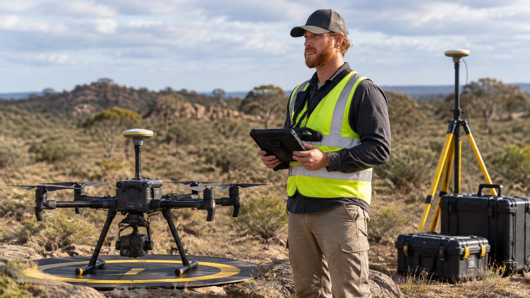
Meta description: Explore drone licence Australia pathways for surveying, LiDAR and thermal work. Build in-demand skills, plan your training with Ace Aviation.
Short Direct Answer
A drone licence in Australia helps you fly professionally, but specialist skills often set technical pilots apart. Surveying, mapping, LiDAR and thermal inspection can command higher project rates when paired with accurate data, sound aviation planning and the right approvals.
Detailed Explanation: Why Technical Drone Skills Matter
A basic drone flight captures images. A technical drone operation turns data into information that a client can use to make decisions. That difference matters in mining, construction, utilities, agriculture, rail and infrastructure.
For example, a construction manager may need more than overhead photos. They might need a measured stockpile volume, a repeatable site map, or a record of changes between project stages. Likewise, an electricity network may need thermal images that help technicians investigate possible hot spots.
These services need more than flying ability. They rely on sensor knowledge, mission planning, data processing and quality checks. Just as importantly, the operator must understand the job’s aviation risks and regulatory limits.
So, a commercial drone licence in Australia is a starting point, not a complete technical qualification. A RePL (Remote Pilot Licence) covers the pilot. A ReOC (Remotely Piloted Aircraft Operator’s Certificate) relates to the operator or business and its approved procedures. Which authorisations you need depends on the operation.
Photogrammetry: Turning Photos into Measured Maps
Photogrammetry uses many overlapping photographs to build a map or 3D model. Software matches features across images and estimates their positions. The final product may include an orthomosaic, surface model, point cloud, contours or volume report.
This approach suits open, textured areas such as earthworks, quarries and construction sites. However, trees, moving vehicles, water, reflective surfaces and uniform ground can reduce image quality or confuse processing.
RTK and PPK: Improving Position Data
RTK means real-time kinematic positioning. It uses correction data during the flight to improve the drone’s recorded position. PPK, or post-processed kinematic positioning, applies corrections after the flight.
Both methods can improve georeferencing. However, neither guarantees a particular survey accuracy on its own. The result also depends on the GNSS equipment, site conditions, coordinate system, mission design, processing and quality checks.
Ground control points (GCPs) are marked positions measured on the ground. Independent check points help test the final result. Survey-grade work may need a qualified surveyor to set or verify control and confirm that the output meets the project specification.
LiDAR: Mapping Through Gaps in Vegetation
LiDAR sends laser pulses toward the ground and measures their return. The resulting point cloud can help model terrain, structures and vegetation. Some laser pulses reach the ground through gaps in a canopy, which can make LiDAR useful where standard photographs struggle.
A LiDAR drone in Australia may support terrain mapping, mining, powerline corridors, rail and infrastructure projects. Yet LiDAR is not automatically more accurate than photogrammetry. Its performance depends on the sensor, aircraft positioning, flight pattern, calibration, ground cover and processing.
Thermal and Multispectral Sensors
A radiometric thermal camera records temperature values for image pixels. This can help assess solar equipment, electrical assets, buildings and industrial systems. Thermal imaging shows patterns that may warrant investigation; it does not, by itself, prove that an asset has a fault.
A thermal drone inspection needs careful planning. Surface temperature can change with sunlight, wind, rain, viewing angle, material emissivity and reflections. Operators should follow the client’s inspection method and document conditions and limitations.
Multispectral sensors capture selected bands of light beyond standard visible colour. Agriculture and environmental teams can use those bands to assess crop or vegetation patterns. They need sound calibration and ground context, however. An index or colour map is not a diagnosis by itself.
GSD and Accuracy: Related, but Not the Same
GSD stands for ground sampling distance. It describes the ground area represented by one image pixel. In general, flying lower or using a suitable higher-resolution camera produces a smaller GSD and more visible detail.
But GSD is not the same as positional accuracy. A sharp image can still be poorly located on a map. Before flying, agree on the required resolution and accuracy, coordinate reference system, vertical datum, control method and acceptance checks.
A practical rule of thumb is to design the flight for the client’s required detail, then verify the result with appropriate control and check points. Do not promise a generic centimetre accuracy without a defined method and evidence.
Key Facts Table
| Skill or requirement | What it does | Common applications | Important limit |
|---|---|---|---|
| Photogrammetry | Builds maps and 3D outputs from overlapping images | Construction, stockpiles, open terrain | Can struggle with canopy, glare and low-texture surfaces |
| RTK / PPK | Improves the position data used to locate images or points | Mapping and repeat surveys | Does not guarantee final accuracy without project QA |
| LiDAR | Uses laser returns to create point clouds | Vegetated terrain, corridors, mining | Requires calibration, trajectory processing and classification |
| Radiometric thermal | Records temperature values across image pixels | Solar, electrical, building and asset inspection | Results depend on conditions, method and sensor settings |
| Multispectral | Captures selected light bands | Agriculture and vegetation assessment | Needs calibration and informed interpretation |
| RePL | Qualifies an individual to pilot within their licence scope | Professional drone piloting | Does not replace operator approvals or job-specific permissions |
| ReOC | Authorises an operator under its approved operating system | Drone services and complex commercial operations | Does not automatically grant every airspace or flight approval |
| AROC | Qualifies an operator to use aviation radio where required | Relevant aviation radio communications | Not every drone flight requires an AROC |
Step-by-Step Process: From Drone Licence to Technical Work
-
Choose the kind of work you want to do.
Decide whether you are drawn to construction mapping, mining volumes, thermal inspection, agriculture or corridor surveys. Each area uses different equipment, software and reporting standards. -
Get the right pilot foundation.
Learn aviation rules, weather, risk management, aircraft handling and emergency procedures. If you are researching how to become a drone pilot in Australia, compare training that covers both theory and practical assessment. See Ace Aviation’s course options. -
Understand the operator requirements.
A business offering paid drone services may need a ReOC, depending on how it operates and which regulatory pathway applies. A ReOC also comes with operating procedures and responsibilities. Ace Aviation identifies its operator certificate as CASA.ReOC.1421. -
Build a sensor and data workflow.
Learn how to plan a safe flight, select a sensor, capture usable data and check the output. Practice with processing tools and reports. A client values a reliable deliverable, not simply flight time. -
Learn control, accuracy and QA.
Understand GSD, overlap, coordinate systems, GCPs and check points. Ask clients what accuracy they require. Where legal boundaries or engineering decisions are involved, work with appropriately qualified survey professionals. -
Confirm airspace and operational approvals.
Check current restrictions, site conditions, land access, people, nearby aerodromes and the proposed flight profile. More complex work may require separate CASA approval. -
Present a clear technical proposal.
Specify the output, sensor, flight method, accuracy checks, file formats, schedule, limitations and approvals. This helps clients compare proposals on value rather than just the hourly rate.
Training Locations
Ace Aviation provides training across Australia. If you are looking for a drone course in Brisbane, drone course in Sydney, or drone course in Melbourne, check the linked location pages for current options.
You can also explore drone pilot course options in Perth or drone training in Hobart. Training dates, course packages and availability can change, so confirm details before booking.
Examples: How Technical Skills Fit Real Projects
The following examples are illustrative. A real project’s method and accuracy depend on its specification, conditions and approvals.
Construction: Progress and Earthworks
A contractor needs a repeatable record of a large earthworks site. The pilot plans an RGB mapping flight with suitable overlap and positioning. After processing, the team receives an orthomosaic and surface model. If the client needs cut-and-fill estimates, the deliverable must state the measurement method and control checks.
Mining: Terrain and Stockpiles
A mine wants regular stockpile volumes and terrain records. Photogrammetry may suit open, textured areas. LiDAR may be a better fit where vegetation or complex terrain affects image matching. The operator agrees on survey control, reporting intervals and how the client will compare results over time.
Utilities: Thermal Inspection
An asset owner wants to screen solar or electrical equipment for unusual temperature patterns. The crew plans the route, safe standoff, camera settings and environmental conditions. The report records findings for review by qualified technical staff; it does not claim that each thermal anomaly confirms a fault.
Agriculture: Multispectral Monitoring
A grower wants to compare crop patterns across a field. A multispectral survey can highlight areas that deserve closer inspection. The operator records the sensor setup and calibration, while the grower or agronomist combines imagery with field observations before acting.
Common Mistakes That Reduce Quality or Value
- Treating image resolution as survey accuracy. A low GSD does not prove that a map is correctly positioned.
- Choosing a payload before understanding the question. LiDAR, RGB, thermal and multispectral sensors produce different kinds of evidence.
- Skipping control and independent checks. RTK or PPK can improve positioning, but clients may still require measured ground checks.
- Promising results without defining the deliverable. Agree on file types, coordinate system, acceptance criteria and limitations first.
- Ignoring weather and site conditions. Wind, glare, changing light and surface reflections can affect data and inspection quality.
- Assuming a RePL covers every operation. The pilot’s licence is only one part of a compliant operation.
- Selling an inspection as a diagnosis. Thermal or multispectral data may flag issues, but interpretation may require a suitably qualified specialist.
- Quoting only by flight time. Processing, travel, control, reporting, insurance and approvals also contribute to a professional project.
CASA Considerations: Licences, Approvals and Radio
A drone licence in Australia does not give blanket permission to fly anywhere or in any way. Pilots and operators must follow current rules, their authorisations and applicable operating procedures. Review the latest information directly on the CASA drones website.
A RePL applies to the individual pilot and the relevant aircraft category or scope. A ReOC applies to an operator and its approved system. For commercial jobs, check which rules apply to the specific operation, who holds the approvals and whether the pilot is authorised under that operator.
Some operations may need CASA approval beyond the basic rules. This can include certain airspace access, flights near people, higher altitudes or operations outside visual line of sight. BVLOS means beyond visual line of sight; it involves additional operational and approval requirements. EVLOS means extended visual line of sight and also requires the correct approval and procedures where applicable. A licence alone does not authorise either operation. See CASA’s guidance on BVLOS operations and EVLOS operations.
AROC is the Aeronautical Radio Operator Certificate. It is relevant when a pilot needs to communicate on aviation radio and is not otherwise qualified to do so. Radio needs depend on the operation and airspace. Check current requirements before flying, and train in clear radio procedures.
Technical training should therefore pair data skills with aviation decision-making. Ace Aviation has trained more than 4,000 students and delivers training in Australia, Singapore, Dubai, Korea and Malaysia. Its Altitude+ student program and DroneWork job board are part of the wider student and career ecosystem. These resources can support a pathway, but they do not guarantee work or a particular income. Rates depend on experience, equipment, qualifications and client needs.
Frequently Asked Questions
1. What is the best drone licence in Australia for surveying work?
Start with a RePL that matches the aircraft and work you plan to do. If you operate a drone business, assess whether you also need a ReOC. Technical surveying work may require extra sensor, mapping and quality-control skills.
2. Do I need both a RePL and a ReOC for commercial drone work?
Not for every operation. The requirements depend on the operating rules and business model. A RePL is a pilot qualification, while a ReOC is an operator certificate. Check the applicable CASA pathway before accepting work.
3. Does a drone mapping course qualify me as a surveyor?
No. A drone mapping course can teach flight and data skills, but it does not make someone a licensed surveyor. Legal boundary work and some engineering tasks may require a qualified surveyor.
4. What does GSD mean in drone surveying?
GSD means ground sampling distance. It indicates the ground area represented by one image pixel. It describes image detail, not the final map’s absolute positional accuracy.
5. Is RTK more accurate than PPK?
Neither method is always better. RTK applies corrections during flight; PPK applies them after the flight. Connectivity, equipment, control and project conditions affect which approach works best.
6. Does RTK mean I do not need ground control points?
Not necessarily. RTK can improve image positioning, but a project may still need GCPs or independent check points. Follow the client specification and verify the output.
7. When should I use LiDAR instead of photogrammetry?
LiDAR can be useful for complex terrain or areas with vegetation, where images may not capture the ground well. Photogrammetry can be a cost-effective option for open, textured surfaces. Choose based on the project and verify the result.
8. What is a radiometric thermal camera?
It records temperature values for pixels in a thermal image. This supports inspection work, but readings depend on sensor settings, surface properties and environmental conditions.
9. Can a drone thermal image confirm an electrical fault?
No. Thermal imagery can reveal patterns that need investigation. A qualified asset specialist should interpret findings and confirm whether maintenance is required.
10. What is multispectral drone mapping used for?
It captures selected bands of light that can help assess crops or vegetation. The images need suitable calibration and field context. A vegetation index alone is not a diagnosis.
11. Do I need AROC for every drone flight?
No. AROC is relevant when aviation radio use is required and the operator lacks another suitable qualification. Requirements depend on the aircraft, airspace and operation.
12. What is the difference between EVLOS and BVLOS?
EVLOS uses observers and approved procedures to extend the operation beyond the pilot’s direct visual monitoring. BVLOS means the drone flies beyond visual line of sight. Both involve specific requirements and approvals.
13. Can a RePL holder fly BVLOS automatically?
No. Holding a RePL does not, by itself, authorise BVLOS. The operator and pilot must meet the applicable CASA requirements and obtain the necessary approval.
14. Which industries use drone surveying in Australia?
Common users include construction, mining, utilities, agriculture, rail and infrastructure teams. They may use mapping, LiDAR, thermal or multispectral data depending on the job.
15. Does a drone licence guarantee a high-paying job?
No. A licence supports legal and safe piloting, but income depends on experience, technical ability, client demand, project responsibility and operating costs.
16. Where can I find current drone training dates?
Check the Ace Aviation booking page or the relevant location page for available options. Confirm course details and dates directly before enrolling.
Summary
Surveying, mapping, LiDAR and thermal inspection can help pilots build valuable technical capability. However, strong outcomes depend on more than specialist sensors. Operators need safe aviation practice, fit-for-purpose flight planning, sound data workflows and honest accuracy reporting.
Start with the correct RePL and assess whether your operation needs a ReOC or further approvals. Then build the technical skills that match your target industry. Ace Aviation’s training, Altitude+ program and DroneWork job board can support that journey.
Ready to start? Book your training at aaa.edu.au or call 1300 336 366.
{“@graph”:[{“@id”:”https://aaa.edu.au/#organization”,”url”:”https://aaa.edu.au/”,”logo”:”https://aaa.edu.au/assets/ace-logo-transparent.png”,”name”:”Ace Aviation Aerospace Academy”,”@type”:”Organization”,”identifier”:”CASA.ReOC.1421″,”description”:”Ace Aviation Aerospace Academy provides professional drone pilot training and certification.”},{“@id”:”https://aaa.edu.au/blog/drone-licence-australia-2026-surveying-mapping-thermal-inspection#article”,”@type”:”Article”,”image”:”https://cdn.marblism.com/juGt1Z7_CsH.webp”,”author”:{“name”:”Ace Aviation Aerospace Academy”,”@type”:”Organization”},”headline”:”Drone Licence Australia 2026: Surveying, Mapping and Thermal Inspection — The Industry Skills That Command Top Rates”,”keywords”:[“drone licence australia”,”commercial drone licence australia”,”drone surveying australia”,”lidar drone australia”,”thermal drone inspection”,”drone mapping course”],”publisher”:{“@id”:”https://aaa.edu.au/#organization”},”inLanguage”:”en-AU”,”description”:”Explore drone licence Australia pathways for surveying, LiDAR and thermal work. Build in-demand skills—plan your training with Ace Aviation.”,”dateModified”:”2026-10-13″,”datePublished”:”2026-10-13″,”articleSection”:[“Drone training”,”Drone surveying”,”Drone inspection”],”mainEntityOfPage”:”https://aaa.edu.au/blog/drone-licence-australia-2026-surveying-mapping-thermal-inspection”},{“@id”:”https://aaa.edu.au/blog/drone-licence-australia-2026-surveying-mapping-thermal-inspection#faq”,”@type”:”FAQPage”,”mainEntity”:[{“name”:”What is the best drone licence in Australia for surveying work?”,”@type”:”Question”,”acceptedAnswer”:{“text”:”Start with a RePL that matches the aircraft and work you plan to do. If you operate a drone business, assess whether you also need a ReOC. Technical surveying work may require extra sensor, mapping and quality-control skills.”,”@type”:”Answer”}},{“name”:”Do I need both a RePL and a ReOC for commercial drone work?”,”@type”:”Question”,”acceptedAnswer”:{“text”:”Not for every operation. Requirements depend on the operating rules and business model. A RePL is a pilot qualification, while a ReOC is an operator certificate. Check the applicable CASA pathway before accepting work.”,”@type”:”Answer”}},{“name”:”Does a drone mapping course qualify me as a surveyor?”,”@type”:”Question”,”acceptedAnswer”:{“text”:”No. A drone mapping course can teach flight and data skills, but it does not make someone a licensed surveyor. Legal boundary work and some engineering tasks may require a qualified surveyor.”,”@type”:”Answer”}},{“name”:”What does GSD mean in drone surveying?”,”@type”:”Question”,”acceptedAnswer”:{“text”:”GSD means ground sampling distance. It indicates the ground area represented by one image pixel. It describes image detail, not the final map’s absolute positional accuracy.”,”@type”:”Answer”}},{“name”:”Is RTK more accurate than PPK?”,”@type”:”Question”,”acceptedAnswer”:{“text”:”Neither method is always better. RTK applies corrections during flight; PPK applies them after the flight. Connectivity, equipment, control and project conditions affect which approach works best.”,”@type”:”Answer”}},{“name”:”Does RTK mean I do not need ground control points?”,”@type”:”Question”,”acceptedAnswer”:{“text”:”Not necessarily. RTK can improve image positioning, but a project may still need GCPs or independent check points. Follow the client specification and verify the output.”,”@type”:”Answer”}},{“name”:”When should I use LiDAR instead of photogrammetry?”,”@type”:”Question”,”acceptedAnswer”:{“text”:”LiDAR can be useful for complex terrain or areas with vegetation, where images may not capture the ground well. Photogrammetry can be a cost-effective option for open, textured surfaces. Choose based on the project and verify the result.”,”@type”:”Answer”}},{“name”:”What is a radiometric thermal camera?”,”@type”:”Question”,”acceptedAnswer”:{“text”:”It records temperature values for pixels in a thermal image. This supports inspection work, but readings depend on sensor settings, surface properties and environmental conditions.”,”@type”:”Answer”}},{“name”:”Can a drone thermal image confirm an electrical fault?”,”@type”:”Question”,”acceptedAnswer”:{“text”:”No. Thermal imagery can reveal patterns that need investigation. A qualified asset specialist should interpret findings and confirm whether maintenance is required.”,”@type”:”Answer”}},{“name”:”What is multispectral drone mapping used for?”,”@type”:”Question”,”acceptedAnswer”:{“text”:”It captures selected bands of light that can help assess crops or vegetation. The images need suitable calibration and field context. A vegetation index alone is not a diagnosis.”,”@type”:”Answer”}},{“name”:”Do I need AROC for every drone flight?”,”@type”:”Question”,”acceptedAnswer”:{“text”:”No. AROC is relevant when aviation radio use is required and the operator lacks another suitable qualification. Requirements depend on the aircraft, airspace and operation.”,”@type”:”Answer”}},{“name”:”What is the difference between EVLOS and BVLOS?”,”@type”:”Question”,”acceptedAnswer”:{“text”:”EVLOS uses observers and approved procedures to extend the operation beyond the pilot’s direct visual monitoring. BVLOS means the drone flies beyond visual line of sight. Both involve specific requirements and approvals.”,”@type”:”Answer”}},{“name”:”Can a RePL holder fly BVLOS automatically?”,”@type”:”Question”,”acceptedAnswer”:{“text”:”No. Holding a RePL does not, by itself, authorise BVLOS. The operator and pilot must meet the applicable CASA requirements and obtain the necessary approval.”,”@type”:”Answer”}},{“name”:”Which industries use drone surveying in Australia?”,”@type”:”Question”,”acceptedAnswer”:{“text”:”Common users include construction, mining, utilities, agriculture, rail and infrastructure teams. They may use mapping, LiDAR, thermal or multispectral data depending on the job.”,”@type”:”Answer”}},{“name”:”Does a drone licence guarantee a high-paying job?”,”@type”:”Question”,”acceptedAnswer”:{“text”:”No. A licence supports legal and safe piloting, but income depends on experience, technical ability, client demand, project responsibility and operating costs.”,”@type”:”Answer”}},{“name”:”Where can I find current drone training dates?”,”@type”:”Question”,”acceptedAnswer”:{“text”:”Check the Ace Aviation booking page or the relevant location page for available options. Confirm course details and dates directly before enrolling.”,”@type”:”Answer”}}]}],”@context”:”https://schema.org”}
