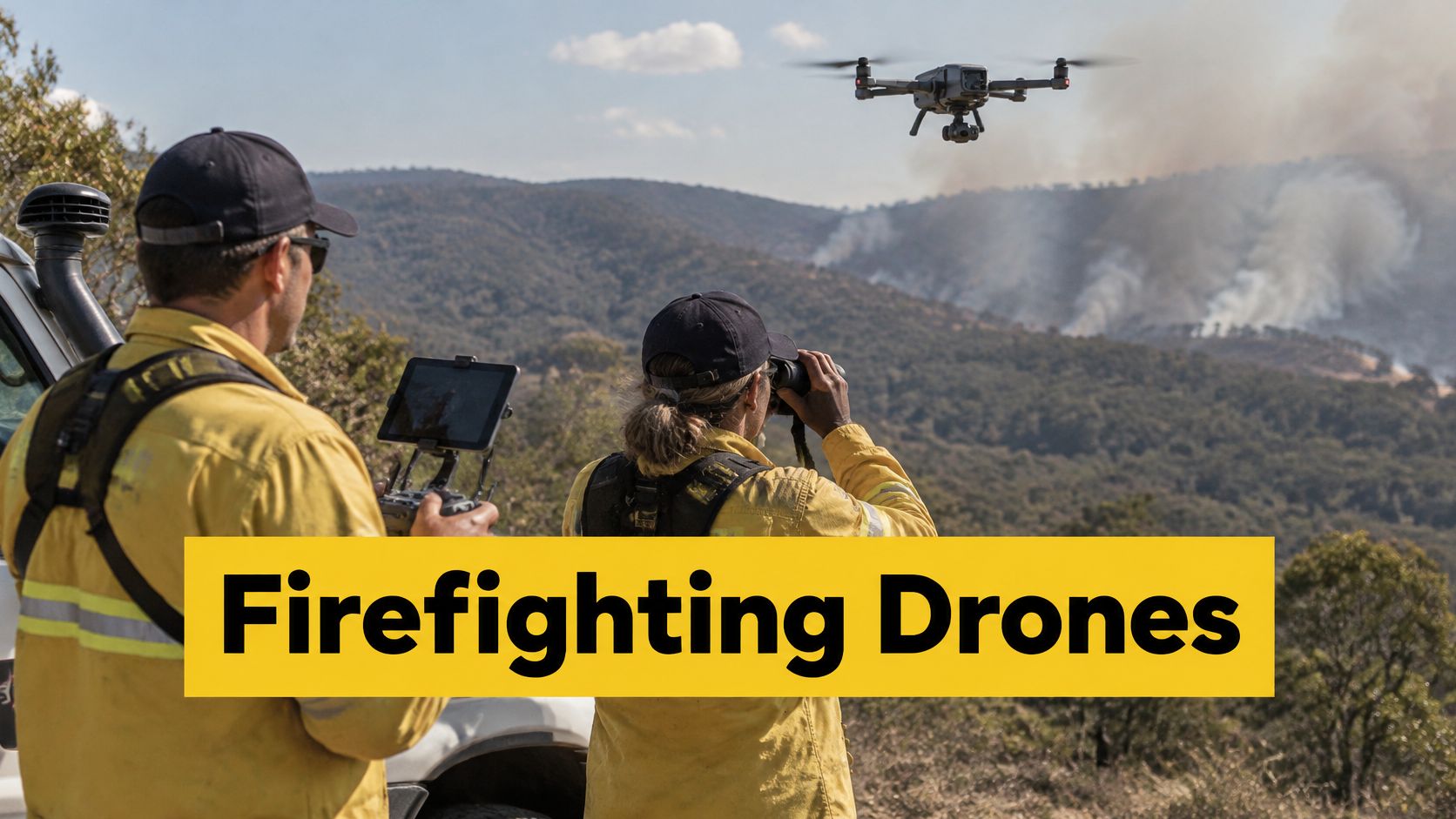
A fire is moving through scrub, smoke is lowering visibility, and crews need to know where heat remains beyond the visible flame front. A firefighting drone can give incident command an aerial view, much like a lookout on a ridge, but it isn't a water bomber. Its main value is collecting and sharing information that helps crews decide where to go and what to do.
Table of Contents
- What Firefighting Drones Do and Where They Fit
- Operational Roles of Firefighting Drones
- Choosing a Platform for the Mission
- Legal Limits Around Active Fires
- How Thermal Mapping Works on a Fireground
- Australian Agency Case Studies
- Training and Competency for Emergency Crews
- Confirm Approvals and Crew Skills Before You Deploy
- Frequently Asked Questions
What Firefighting Drones Do and Where They Fit
A firefighting drone is a remotely piloted aircraft carrying sensors, usually thermal and visual cameras, to support incident command. It can reveal heat signatures, help crews assess changing conditions and provide aerial imagery without immediately exposing personnel to the same hazards.
Australian government modelling estimated a 10% net productivity increase for the emergency-services sector, equivalent to a net economic benefit of about A$460 million. The same analysis modelled potential savings of A$1 billion to A$8 billion from using drones for early fire detection, based on conditions associated with the 2019–20 bushfire season. These are modelled estimates, not guaranteed returns for an individual agency; outcomes depend on aircraft capability, weather, communications, approvals, trained crews and integration with incident-management systems, as the Australian Government's drone research and policy material makes clear.
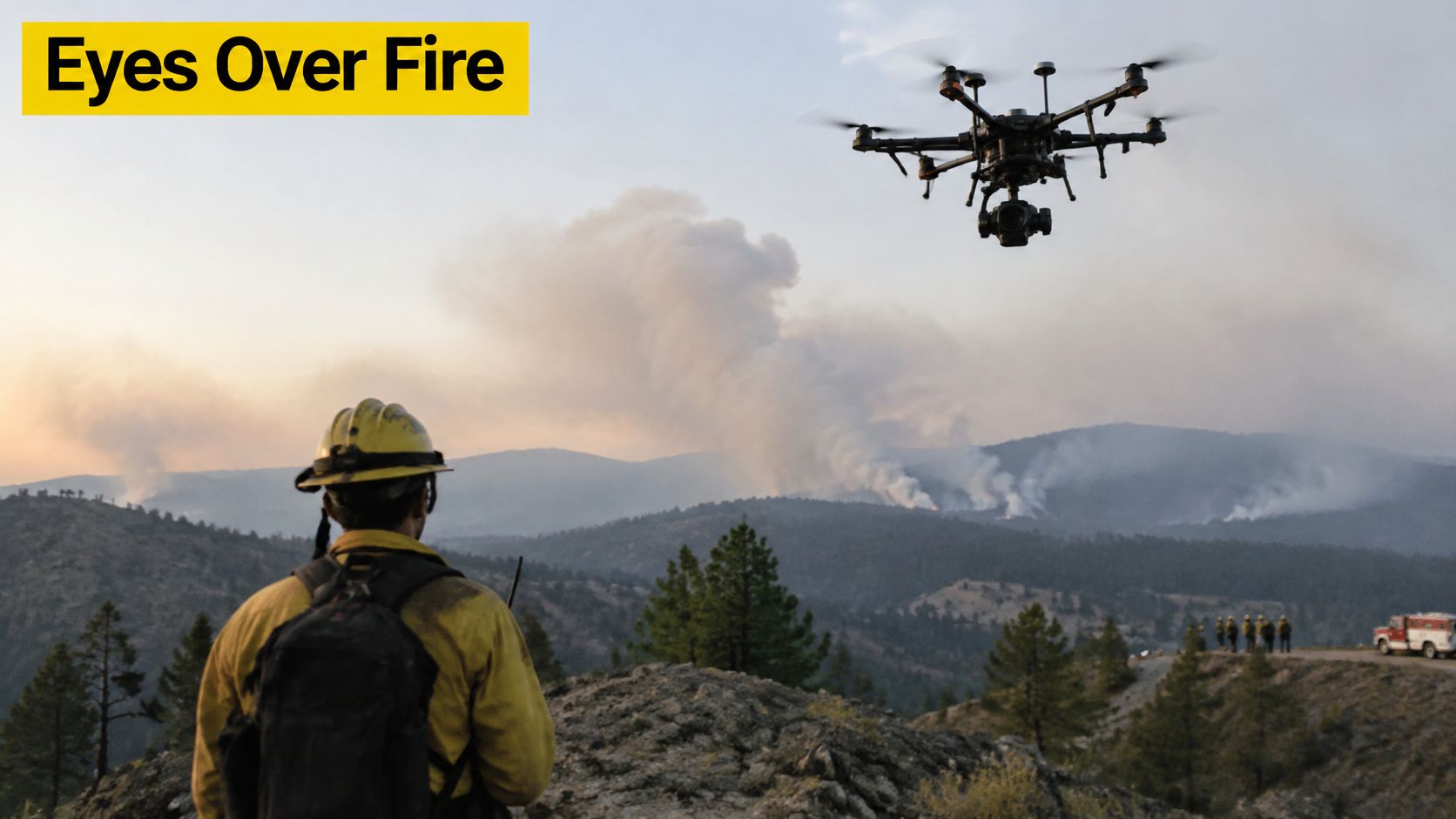
Consider a crew assessing a fire's edge after visible flames have passed. A thermal view may identify residual heat that needs checking, while geolocated imagery helps command send resources to the right place. The aircraft doesn't make the decision or replace the people carrying out the work. It gives them another source of timely information.
The sections ahead cover operational roles, platform selection, thermal mapping, legal limits, Australian agency examples and crew competencies. For agencies and operators, the central question is not which drone to buy, but whether its mission, approvals and data workflow fit the incident.
Operational Roles of Firefighting Drones
| Role | What it delivers | Typical platform | Status in Australia |
|---|---|---|---|
| Reconnaissance and situational awareness | Live video and positional awareness for incident command | Multirotor or fixed-wing | Used in agency operations and trials |
| Thermal hotspot detection | Heat signatures, including residual hotspots after flames subside | Multirotor for close work, fixed-wing for wide areas | Used in the CFA trial and by NSW RFS |
| Fireground mapping | Stitched high-resolution thermal image of a fire area | Multirotor or fixed-wing | Used by NSW National Parks |
| Communications relay | Extends a radio or data link over difficult terrain | Aircraft matched to the payload and coverage area | Emerging; requires suitable equipment and approvals |
| Payload delivery (water or retardant) | Direct suppression support | Specialised aircraft | Requires specific approvals, pilot experience and controlled airspace arrangements |
The first four roles focus on sensing and communication. A live camera feed can help incident command understand the fireground; thermal imagery can reveal hotspots that a visual camera may miss. Small drones have a specific niche: Australia's Bushfire Earth Observation Taskforce identified them as suitable for near-real-time tactical imagery over approximately 100-metre swaths, making them useful for targeted monitoring rather than a replacement for wide-area satellite or crewed-aircraft coverage, as described in NSW's account of technology supporting bushfire response.
Fireground mapping turns overlapping imagery into a larger thermal overview. The workflow is explained in How Thermal Mapping Works on a Fireground. A communications-relay mission has a different purpose: it uses an aircraft and suitable equipment to help extend a radio or data connection over difficult terrain. It's an emerging role, and operators must establish that both the equipment and the flight are suitable and approved.
Payload delivery attracts attention, but it's not a routine extension of ordinary drone work. CASA says that spotting fires or dropping water or retardant requires specific pilot experience, air-operator approvals and controlled-airspace arrangements. A camera drone can't be treated as a suppression aircraft because someone has attached a payload.
For practical guidance on coordinating aerial information and communications during emergency work, operators can consult this drone pilot emergency handbook. For a related example of how communications infrastructure can become a point of dispute in drone operations, NeoTeo covers the Ukraine Starlink dispute.
Before proposing any mission, answer three questions: What information is needed? Who will act on it? What approval does the task require?
Choosing a Platform for the Mission
Choosing a fireground drone is like choosing a vehicle. A motorbike can manoeuvre through narrow lanes, while a van suits a long regional run; neither is the right tool for every job. Start by asking how long the aircraft must stay airborne and how far it needs to travel from its ground-control station.
Fire Rescue Victoria's aviation unit provides an example of a close-range platform. It was established with four drones equipped for firefighting and other emergency services, with high-definition thermal imaging, live video streaming, approximately 30 minutes of flight endurance and a design intended for strong winds. That combination suits thermal reconnaissance where a crew needs a nearby view of a structure or hotspot.
For a different mission, the Australian Institute for Disaster Resilience's emergency-services case study describes a medium-sized drone with more than six hours of endurance operating within 100 km of its ground-control station. Thermal sensors supported day-and-night monitoring. The case illustrates the role of longer-endurance aircraft in regional surveillance, while drones complement rather than replace crewed aviation assets.
| Platform | Strength | Limitation | Best mission |
|---|---|---|---|
| Multirotor | Hovers and manoeuvres close to structures and hotspots | Shorter endurance; approximately 30 minutes for the Fire Rescue Victoria aircraft | Close thermal assessment and precise hotspot checks |
| Fixed-wing | Long endurance over large areas; more than six hours in the AIDR example | Cannot hover; needs suitable launch and recovery space | Regional surveillance and extended hotspot monitoring |
| Hybrid (VTOL) | Vertical take-off combined with efficient cruise | Greater complexity to operate and maintain | Mixed missions needing flexible launch and long range |
Endurance alone doesn't determine operational value. A long-range aircraft with an unreliable command-and-control link, no workable recovery plan or no way to send coordinates to incident command may be less useful than a shorter-flight aircraft integrated into a dependable network. Beyond-visual-line-of-sight operations also require dependable links, aviation deconfliction, contingency procedures and approval within the applicable Australian framework.
Before selecting a platform, check four practical conditions: how long it must stay up, whether it needs to hover, how far it must fly, and whether the site has suitable launch and recovery space. For a different aerial-inspection use of remotely piloted aircraft, commercial roof inspections show why the task and site access should shape platform choice. Operators considering extended operations can also review BVLOS flight requirements and considerations.
Legal Limits Around Active Fires
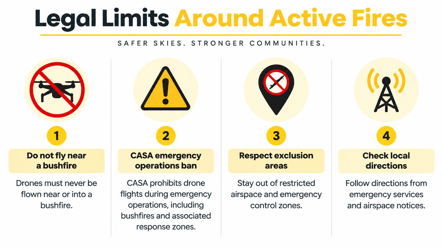
Drones must never be flown near or into a bushfire. CASA prohibits drone flights during emergency operations, including bushfires and associated firefighting activity, unless the operator has permission from the relevant emergency agency or incident commander. A drone can conflict with low-flying firefighting aircraft and create hazards for crews on the ground.
An operator who launches to film a fire front may assume a position that looks distant from the flames is safe. That assumption is not enough. The aircraft may still interfere with emergency operations or breach applicable rules, even when the operator believes the footage could help.
The 5-nautical-mile distance, approximately 9 kilometres, is guidance for crewed aircraft not involved in firefighting. It is not a safe-distance rule for drones. Small unmanned aircraft can be difficult for helicopters and aeroplanes to detect at low altitude. CASA warns that if a drone is detected, firefighting aircraft may be grounded, reducing aerial suppression and reconnaissance capability, as explained in its bushfire flight-planning guidance.
| Situation | Drone flight permitted? | Governing rule |
|---|---|---|
| Active bushfire, no agency permission | No | CASA prohibits flights without permission from the relevant emergency agency or incident commander |
| Active bushfire, with incident commander permission | Only as directed | Operations follow the commander's direction and required approvals |
| Other emergencies, such as rescue or traffic incidents | Only with incident authority permission | Drones must not interfere with the emergency response |
| Non-emergency commercial flight away from incidents | Yes, if approvals and any required RePL are in place | Standard CASA drone rules apply |
The same principle applies to other emergencies, including natural disasters, traffic accidents and rescue operations. Permission from the relevant authority doesn't remove the need to follow the commander's directions or meet the approvals and airspace arrangements that apply to the operation. A drone operator must not self-deploy just because the aircraft could provide a useful view.
Before any launch near an affected area, check: Is an active fire or incident in the area? Has the incident commander given permission? Are the required airspace and operator approvals in place? For a broader overview, see this guide to Australian drone laws.
How Thermal Mapping Works on a Fireground
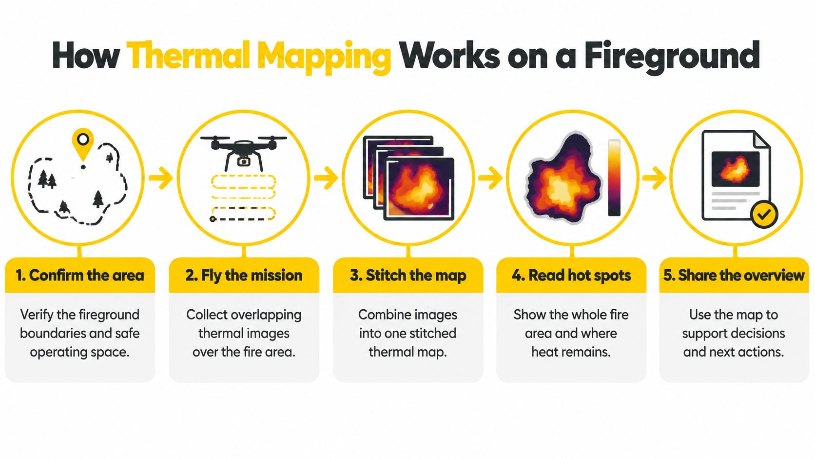
A live pilot-view image shows what the aircraft sees at one moment. A stitched thermal map can show a much larger area in one image, helping command see where heat remains and which hotspots could reignite. NSW National Parks describes a process in which a drone captures hundreds, and sometimes thousands, of photographs that software combines into a high-resolution thermal image, as outlined in its account of firefighting by drone.
Confirm the authority to fly. Check the fireground boundaries, airspace and operating conditions, and confirm permission from the emergency agency or incident commander. This prevents a data-gathering task from interfering with response operations.
Plan a grid or flight line. Set the route, altitude, image overlap and safe operating area so the aircraft captures consistent coverage. A planned pattern makes the imagery easier to stitch and interpret.
Capture overlapping thermal photographs. The aircraft may collect hundreds or, at times, thousands of images. Night operations can be particularly useful because thermal cameras can show residual heat when visible-light imagery is limited.
Stitch the images. Processing software combines the photographs into one high-resolution thermal image. The result gives the team an area-wide view rather than isolated views from the pilot's screen.
Interpret and geolocate hotspots. The data analyst identifies heat signatures that may need attention and checks their coordinates. A hotspot without a reliable location is difficult for ground crews to find.
Give the map to incident command. Send the processed product into the command workflow, rather than relying only on a live stream visible to the pilot. Commanders need the information in a form they can use to plan activity.
Use the overview to plan follow-up. Command centres can use thermal line scans to assess where danger remains and plan where ground crews or water-bombing aircraft should go, including at first light.
Two common failures are sending video without coordinates and having nobody assigned to process or interpret the imagery. Both can leave command with a feed but no practical way to act on it. Thermal mapping therefore requires flight planning, image capture, data processing, interpretation and coordination with incident command, not just basic piloting. For a related example of how fire detection systems support building safety, see fire detection for hospitality venues.
Australian Agency Case Studies
Fire Rescue Victoria's aviation unit shows what a structured capability can look like when an agency assigns aircraft and crews to emergency operations. Its drones provide thermal imagery and live video for incident use. The operational lesson is that those tools matter when crews can connect the aerial view to decisions on the ground, rather than treating flight as an isolated technical task.
The Country Fire Authority's 12-month RPAS trial used drones for thermal imaging, hotspot identification, fire investigation, impact assessment, search and rescue, and live video. During the January 2026 fire season, crews used aerial information to locate and suppress a concealed hotspot. That example shows how thermal reconnaissance can support ground operations when the people receiving the information can act on it.
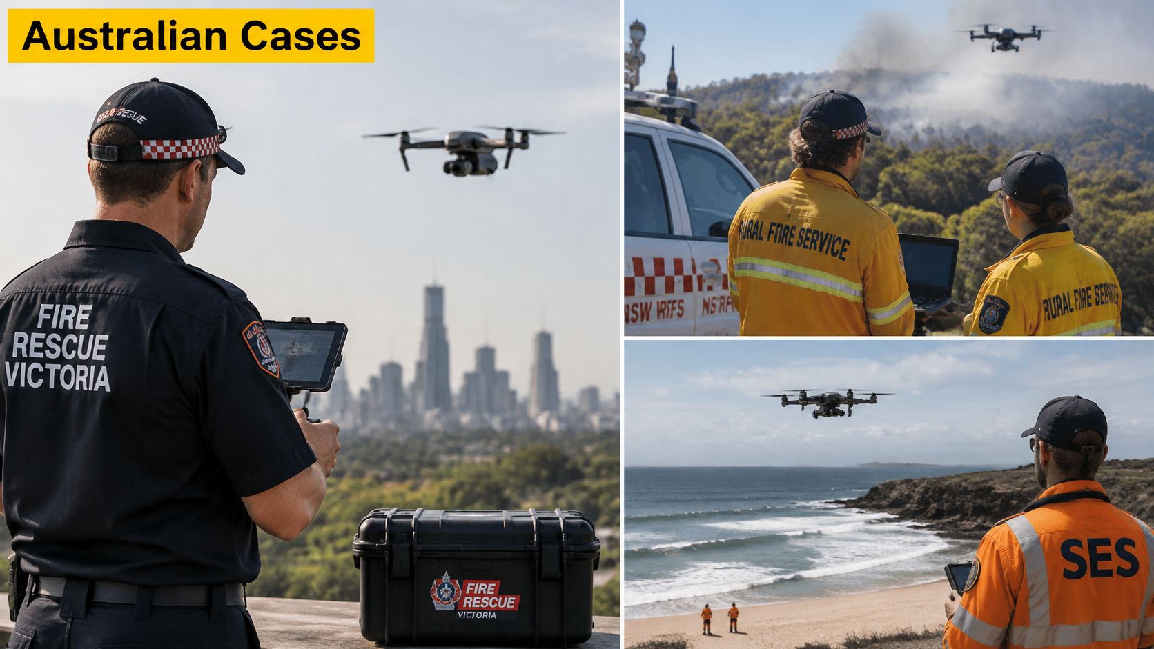
In NSW, the Rural Fire Service reported more than 50 trained drone pilots and described thermal drones primarily as tools for live fireground visibility and post-fire hotspot detection, not replacements for aircraft or ground crews. Separately, the Australian National University worked with the ACT Parks and Conservation Service and the ACT Rural Fire Service on a system intended to detect bushfires as soon as they begin and support extinguishing them within minutes. These agency and research examples are documented in the national drone validation report.
Trials also reveal the human-factors challenge. Near firefighting helicopters, crews can face workload pressures, inconsistent altitude information and technology limitations. Adding aircraft doesn't automatically reduce risk; it can increase the demands on incident controllers if crews lack clear separation procedures and shared information.
The practical lesson is to integrate RPAS crews into the command workflow. Assign who flies, who watches for conflicts, who interprets the sensor output and who passes usable information to command. An isolated pilot may collect useful footage, but a coordinated crew makes it easier for responders to act on that information safely.
Training and Competency for Emergency Crews
| Crew role | Core competencies | Qualification or evidence |
|---|---|---|
| Remote pilot | Flight planning, airspace awareness, emergency procedures, return-to-home planning | RePL for commercial operations that require it |
| Visual observer | Continuous sky scanning, aircraft conflict reporting | Agency-specific training and records |
| Sensor and data analyst | Thermal interpretation, image stitching, geolocation accuracy | Agency training and verified processing method |
| Incident liaison | Passing drone outputs into command structure and common operating picture | Agency command training |
| Radio operator | Aeronautical and emergency radio communications | AROC, where the role involves aeronautical radio operation |
Commercial drone operations generally require a Remote Pilot Licence (RePL), but requirements depend on the operation. Pilots should confirm current CASA rules and agency accreditation requirements rather than assuming one licence or training record covers every mission.
Several specialist roles are easy to overlook. A visual observer scans the sky and reports potential conflicts; a sensor and data analyst interprets thermal imagery and checks geolocation; an incident liaison makes sure drone outputs reach the common operating picture. An Aeronautical Radio Operator Certificate (AROC) is relevant when a crew member's duties involve aeronautical radio operation.
Consider one person trying to fly the aircraft, operate the thermal sensor, interpret imagery and handle radio calls. Attention shifts between the screen, the aircraft and the communication channel. Sky scanning can lapse, and command may receive data late or without usable coordinates. Assigning those tasks across a crew gives each person a clear responsibility.
Crew-planning rule: Match every role to named competencies, then keep training, currency and refresher records for each person.
For new entrants, ACE READY is an entry-level drone training course covering fundamentals, aviation safety, CASA regulations and flight operations, with preparation for advanced RePL training. Organisations developing operational leadership can also review the Chief Remote Pilot course when assigning responsibilities for procedures and oversight.
Confirm Approvals and Crew Skills Before You Deploy
Use a go/no-go gate before committing aircraft and crew time. First, confirm that the mission is a defined operational role, such as reconnaissance, thermal hotspot detection, mapping or communications relay. Then check that the aircraft's endurance, hover capability and range suit the task.
Second, establish a lawful approach to the airspace and confirm that the relevant emergency agency or incident commander has authorised the flight where required. Third, make sure each crew role has named, recorded competencies and a clear handover into incident command. If any answer is no, don't deploy.
Match training gaps to the duties. The RePL suits pilots who need the commercial qualification; the AROC is relevant to crew members with aeronautical radio duties. Enterprise Drone Training can support agency teams needing structured group training, while ReOC Consulting suits organisations planning to operate under a Remote Operator Certificate.
Ace Aviation Aerospace Academy delivers CASA-approved RePL and commercial drone courses Australia-wide. Drone pilot training is delivered across eight major locations: Brisbane, Sydney, Melbourne, Perth, Newcastle, Darwin, Cairns and Hobart. Before committing to equipment, confirm the operation's requirements with CASA and the relevant agency, and consider drone safety around airports and heliports in Australia.
Frequently Asked Questions
Can a firefighting drone drop water on a fire?
Not as a standard drone operation. Dropping water or retardant requires specific pilot experience, air-operator approvals and controlled-airspace arrangements.
Can a drone be flown near a bushfire for filming?
No. CASA prohibits drone flights during emergency operations unless the operator has permission from the relevant emergency agency or incident commander.
Is 5 nautical miles a safe distance for a drone near a bushfire?
No. That distance applies to crewed aircraft not involved in firefighting. Drones should never be flown near or into a bushfire.
Is a Remote Pilot Licence required to fly for a fire agency?
Commercial drone operations generally require a RePL. Operators should confirm current CASA requirements and their agency's rules for each operation.
Why use a stitched thermal map instead of live video?
A stitched image can show the whole mapped fire area and residual hotspots that could reignite, helping command plan ground crew and aircraft deployment.
Ace Aviation Aerospace Academy provides training in the Remote Pilot Licence, Aeronautical Radio Operator Certificate and enterprise drone operations, relevant to the crew roles used in emergency work. Visit Ace Aviation Aerospace Academy to explore training options and build the skills needed for safe, coordinated drone operations.