
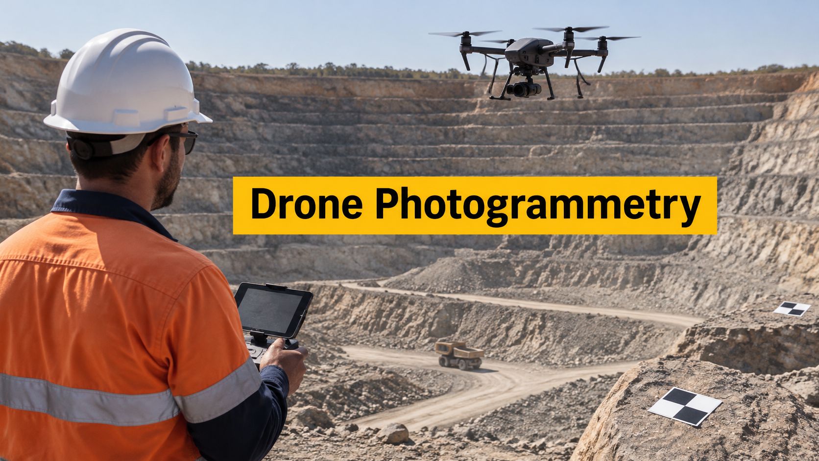
Buying a drone advertised with centimetre accuracy doesn't make its photographs a survey. Drone photogrammetry earns its accuracy through image geometry, surveyed control and independent testing, while the pilot must collect the images within the operating conditions that apply to the site. A sharp picture proves that a camera captured detail, not that a contractor can rely on its coordinates or heights.
Table of Contents
- What Drone Photogrammetry Measures on a Site
- How Overlapping Images Become a Site Model
- Accuracy Ground Control and Ground Sample Distance
- Planning Capture Processing and Legal Delivery
- Surveying Mining Agriculture and Infrastructure Uses
- Cameras Software and When LiDAR Is the Better Tool
- Questions to Settle Before the Next Mission
What Drone Photogrammetry Measures on a Site
A quarry face can look straightforward from the access road. From another position, benches overlap, loose material hides the toe, and the slope reads differently again. Walking the site with a camera records appearance, but appearance alone does not give repeatable measurements.
Drone photogrammetry uses a planned flight path and overlapping photographs to reconstruct a scaled, three-dimensional representation of visible surfaces. Software identifies the same features in different photographs and calculates their positions. With suitable control and checking, the resulting model can support measurements of distance, height, area and volume.
A photograph versus a measurement surface
A single aerial photograph contains perspective distortion. Objects nearer the camera appear larger, and the image does not independently establish the height of every visible feature.
A photogrammetric dataset combines observations from different positions. Its usefulness still depends on whether the capture and validation methods suit the intended decision. The model can be exported as an orthomosaic, a height surface, a point cloud or a textured mesh, formats defined alongside the reconstruction workflow.
The sharper risk is confusing the visible surface with the ground beneath it. A digital surface model records the top of whatever the camera can see: vegetation, buildings, stockpiles and exposed culvert headwalls. A digital terrain model represents bare earth and may need classification, editing or another measurement method where vegetation hides the ground. On a vegetated batter, the surface can follow grass over a buried culvert, so a level read straight from it describes cover rather than the channel invert.
An established Australian mapping tradition
The National Library of Australia's aerial photographs collection records aerial photographic map coverage of nearly the entire country by 1966, with only a small part of Cape York Peninsula remaining uncovered.
Drones apply that established aerial-mapping principle to individual farms, mines, construction projects and infrastructure corridors. The commissioning decision turns on four questions: which product the site needs, what accuracy must be shown, whether collection is legally achievable, and whether the photographs can reveal the surface that matters.
How Overlapping Images Become a Site Model
A surveyor who observes the same landmark from two separate stations can fix its position with crossing lines of sight. Photogrammetry does the same thing photograph by photograph: software finds shared features across the overlapping frames, then solves both the feature positions and where the camera stood for each shot. The drone contributes only the viewpoints. The geometry comes from the overlaps.
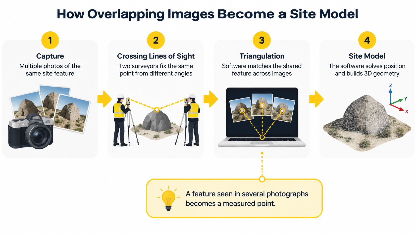
From capture to reconstruction
- Plan the camera positions. The aircraft follows a grid for broad ground coverage, or adds orbit and angled flight paths where vertical faces need attention. The grid also has to fit Australian operating rules on altitude and line of sight.
- Capture overlapping frames. Forward overlap connects photographs along a flight line. Side overlap connects neighbouring flight lines.
- Match shared features. Software identifies tie points, such as distinctive rock patterns or pavement markings, and solves the camera geometry.
- Build the point cloud. Dense image matching reconstructs additional surface detail between those tie points.
- Generate deliverables. The reconstructed geometry supports surface models, an orthomosaic and, where useful, a textured mesh.
Ground sample distance, or GSD, describes the ground width represented by a single pixel. With other camera settings unchanged, flying closer produces finer GSD but covers less ground in each frame, so the same site needs more flight lines. A longer focal length can also produce finer detail at the same distance, at the cost of a narrower field of view.
Advertised megapixels only describe image dimensions; they say nothing about positional accuracy. Motion blur, shallow viewing angles and weak feature matching can undermine a high-resolution capture even when every frame looks sharp on screen.
Photogrammetry products and what to commission
| Product | Use it for |
|---|---|
| Orthomosaic | Site plans, inspections and measured distances on visible surfaces |
| Digital surface model | Drainage checks, progress surfaces and volume context |
| Point cloud | Measurement, sections and comparison between surveys |
| Textured three-dimensional model | Asset records, stakeholder views and facade context |
For drainage decisions, the surface must represent the relevant ground rather than crop tops or roofs. For asset records, angled photography must reveal the faces being documented.
Connecting geometry to the project
Ground control points are identifiable marks with independently surveyed coordinates that constrain the reconstruction. Checkpoints are separate observations withheld from that adjustment, so they can test the finished model against something it was never fitted to. A model can fit its own control points and still drift between them; checkpoints are what demonstrate accuracy rather than assume it.
Without that referencing and checking, an attractive orthomosaic can carry the wrong scale, height or position. Sharpness is a property of the image. Accuracy is a property of the survey.
Where site geometry will inform building information modelling, remote BIM modeling professionals from HireArchitects can be a resource for downstream modelling coordination. The handover should identify the coordinate system, usable coverage and measured limitations rather than imply that a photographic mesh is already a verified BIM model.
Long corridors also require an operational decision. Beyond visual line of sight planning concerns the authority and procedures for extending operations, not a capability granted by mapping software.
Accuracy Ground Control and Ground Sample Distance
Accurate enough for which tolerance? That question belongs in the scope before aircraft selection. Published Australian specifications provide useful examples, but their figures apply to the stated classes and deliverables, not every drone survey.
Australian figures to write into a photogrammetry scope
The Main Roads entries below follow the Western Australian UAV survey imagery specification, which requires GCPs for RPA terrain surveys intended to meet its DGS classes, surface-point averages within ±0.030 m, standard deviation below 0.035 m, and identifies 10 cm GSD as the minimum for high-resolution aerial imagery.
The Water Corporation entries follow its Spatial Data Standard, with example UAV targets of 2.7–50 mm/pixel, approximately 70–85% overlap, and DGS-2 to DGS-3 horizontal and vertical accuracy classes ranging from ±10 mm to ±50 mm.
| Source and class | What it controls | Figure to specify |
|---|---|---|
| Main Roads WA terrain survey | Mean surface-point error | Average within ±0.030 m |
| Main Roads WA terrain survey | Standard deviation of surface points | Below 0.035 m |
| Main Roads WA high-resolution imagery | Minimum ground sample distance | 10 cm |
| Water Corporation UAV classes | Example GSD range | 2.7 mm/pixel to 50 mm/pixel |
| Water Corporation finest UAV class | Forward and lateral overlap | About 85% |
| Water Corporation lower-resolution classes | Forward and lateral overlap | About 70% |
| Water Corporation DGS-2 to DGS-3 | Horizontal and vertical accuracy | ±10 mm to ±50 mm |
The table distinguishes capture requirements from acceptance requirements. GSD and overlap guide image collection; surface errors and accuracy classes describe outcomes that require testing. Meeting an image-resolution target doesn't establish that the finished surface passes its accuracy test.
Relative accuracy isn't absolute accuracy
Relative accuracy concerns relationships inside the model, such as distances between features or the shape of a stockpile. Absolute accuracy concerns agreement with independently established coordinates on the specified reference system.
A model can be internally consistent yet shifted, tilted or vertically offset. That distinction matters when an earthworks surface must align with design levels, drainage assets or another contractor's survey.
Acceptance rule: Control-point residuals describe how the adjustment fits its constraints. Independent checkpoint errors provide the stronger test of performance away from those constraints.
Distribute surveyed control around the perimeter, through the site and across elevation extremes. Avoid placing every target beside the launch area just because access is convenient. Reserve checkpoints that represent the terrain and deliverable being accepted, and never use them to optimise the model.
RTK and PPK strengthen camera positioning and may allow a reduced ground-control layout where the specification permits. Neither removes the need for a declared datum, reliable height referencing or independent validation.
What the scope should require
- Coordinate reference system: Name the horizontal reference and vertical datum.
- Acceptance tolerance: Separate horizontal and vertical requirements.
- Capture geometry: State GSD, forward overlap, lateral overlap and required angled views.
- Control method: Describe survey equipment, reference control and target distribution.
- Checkpoint test: Define the independent assessment, reporting method and acceptance criteria.
There's no universal checkpoint count suitable for every site. The responsible survey professional should select a layout that can reveal the errors relevant to the project.
Planning Capture Processing and Legal Delivery
A mapping grid is only one part of a professional mission. The operator must establish aviation authority, manage the site and preserve enough evidence for the recipient to assess the output.
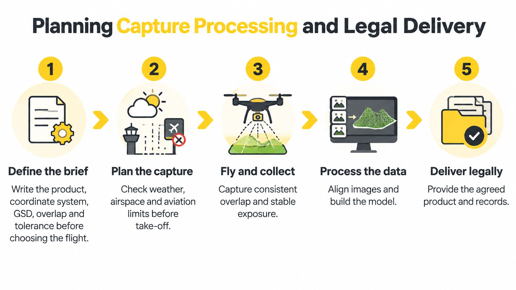
The operational workflow
Define the brief before choosing height. Record the product, coordinate system, GSD, overlap and acceptance tolerance. Identify inaccessible areas, required faces and the surfaces excluded from measurement.
Check the airspace and site. Consult a CASA-verified drone safety app before flight, then examine applicable restrictions, approval conditions, weather and emergency activity. Confirm land access and launch arrangements separately from aviation permission. Where an authorisation requires aeronautical radio use, appropriately qualified personnel and the relevant procedures must be available; an Aeronautical Radio Operator Certificate is relevant to that role.
Confirm the operating authority. Under CASA's drone registration requirements, business-use drones must be registered for 12 months; the levy is free at 500 g or less and $40 above that weight, while unregistered business operation can attract a fine up to $18,200. Sub-2 kg commercial operations can use the excluded category with free operator accreditation, subject to its conditions. Flying drones over 2 kg commercially, or outside standard rules, generally requires a Remote Pilot Licence, while a ReOC is the business authorisation for operating under that framework and seeking advanced approvals.
Fly within the applicable conditions. CASA's drone rules require standard operations to remain within visual line of sight, at or below 120 m above ground level, generally during daylight, not over people and at least 30 m from people not directly involved. Any departure needs the appropriate authority, not a revised setting in the flight application.
Collect usable evidence. Maintain suitable exposure and shutter settings, inspect sample images for blur, and check that targets remain visible and undisturbed. Record interruptions, missing coverage and changes to the planned capture.
Process against the agreed reference. Check imported coordinates and height definitions before adjustment. Use control for optimisation and retain independent observations for acceptance testing.
Deliver files with their qualification. Include coverage, achieved resolution, capture overlap, control method, checkpoint errors, processing residuals and known limitations. A viewer link alone isn't a defensible survey handover.
Commercial photography and the correct regulatory framework
CASA's aerial photography from aircraft guidance discusses remunerated aerial photography under Part 138 and its Aerial Work Certificate framework. That must not be interpreted as a blanket requirement for ordinary commercial drone mapping: remotely piloted aircraft operations generally operate under Part 101, with the relevant accreditation, RePL, ReOC and approval arrangements.
The operator should confirm the framework applicable to the actual aircraft and operation before quoting. Neither a payment for data nor an unpaid flight alone resolves the authorisation question.
The Australian drone laws overview provides additional planning context, but the operative CASA rules and approval conditions remain controlling.
A technically complete dataset doesn't excuse an unauthorised flight.
Surveying Mining Agriculture and Infrastructure Uses
A single civil project can combine an exposed cutting, an adjacent stockpile and a drainage corridor. Each area may suit drone measurement, and each demands a different deliverable and a different acceptance decision.
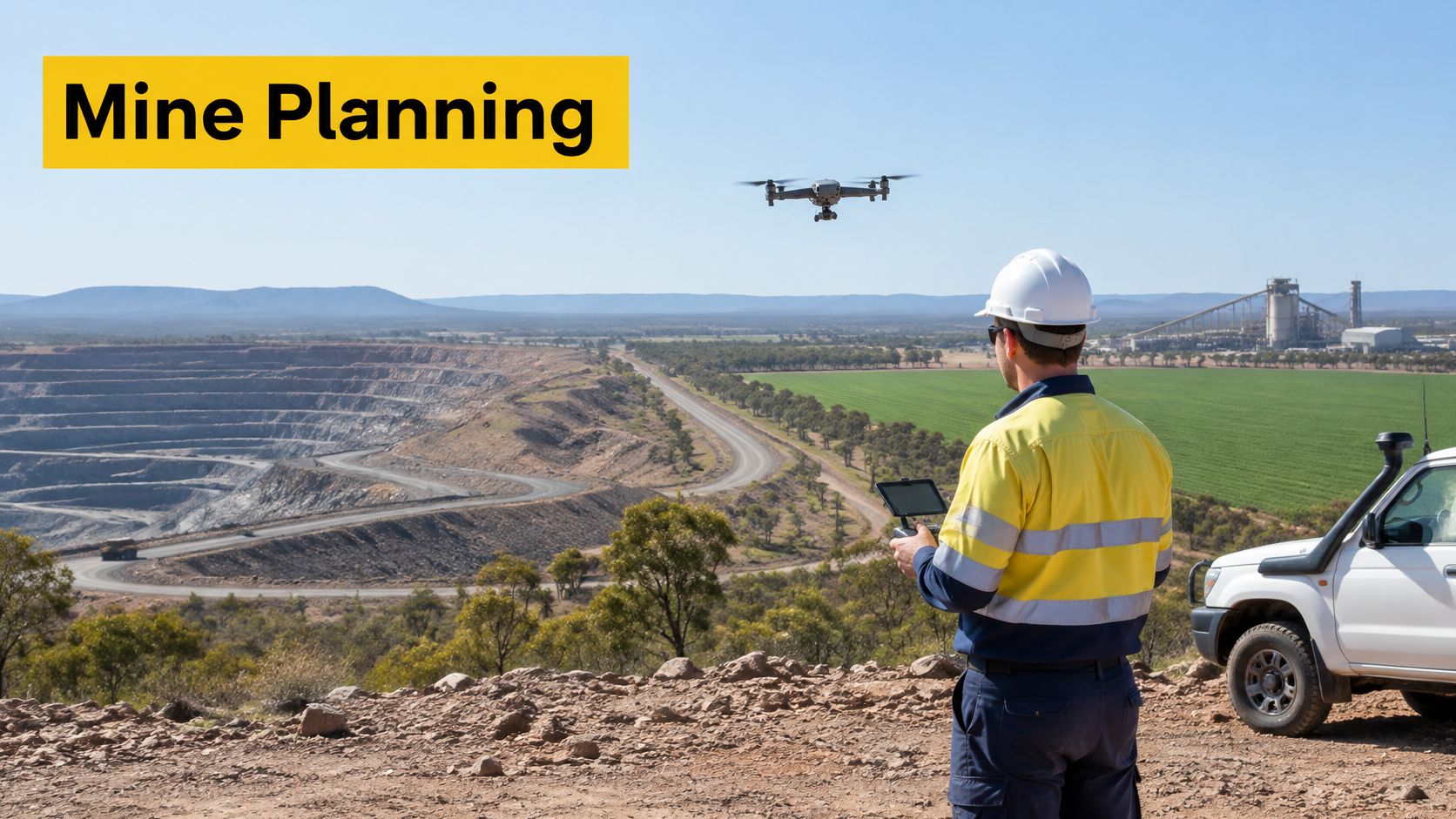
Surveying and civil construction
Steep road cuttings show the method's practical advantage: a georeferenced terrain model can be built from imagery captured over ground that is slow or unsafe to survey on foot. Geological measurement, stability assessment and remedial design can all draw on that one surface, provided the ground control and checkpoints support the tolerance the design assumes.
A University of Southern Queensland dissertation reported UAV surveying as 15 and 17 times cheaper per hectare than GPS and LiDAR methods, respectively, while maintaining relative accuracy below the investigated base survey's ±0.2 m requirement. Read those figures as one case result, and confirm the cost basis and tolerance against your own specification.
For estimating teams, the Exayard construction takeoff platform is a relevant downstream resource for construction quantity workflows. Survey-derived quantities still need compatible units, agreed measurement boundaries and a clear relationship to the documents used for takeoff.
Mining and earthworks
On an exposed stockpile, a point cloud and surface model can support progress quantities. The surveyor must define the pile boundary and base surface, because the camera can't measure material hidden beneath the pile.
Repeat surveys only compare cleanly when each flight is tied to the same control. Moving machinery, active tipping and changed pile boundaries can make two epochs disagree, so the volume is only as defensible as its control report and calculation assumptions.
Agriculture
A farm may commission an orthomosaic for paddock features and a surface model for investigating water movement. Crop-surface mapping describes visible growth patterns; working out why a patch underperforms still takes ground inspection, because many causes sit below the canopy.
Mapping is also a different job from application work. XAG P150 Max agricultural operations are configured for spraying and spreading, which carries its own operational demands alongside any imagery work the same business performs.
Infrastructure
An infrastructure owner may use orthomosaics for inspection context and point clouds for documenting construction change. A corridor can stretch the capture over kilometres, so overlap and control density have to hold along the whole alignment while access, adjacent people and airspace are managed section by section.
- For claims: Retain the measured surface, the checkpoint results and the calculation assumptions behind each quantity.
- For design: Confirm the product represents the terrain the design assumes, at the stated tolerance.
- For safety decisions: Have the responsible professional accept the survey method and its stated limitations.
Use lower coverage cost to justify evaluating the method, and keep every independent check in the scope.
Cameras Software and When LiDAR Is the Better Tool
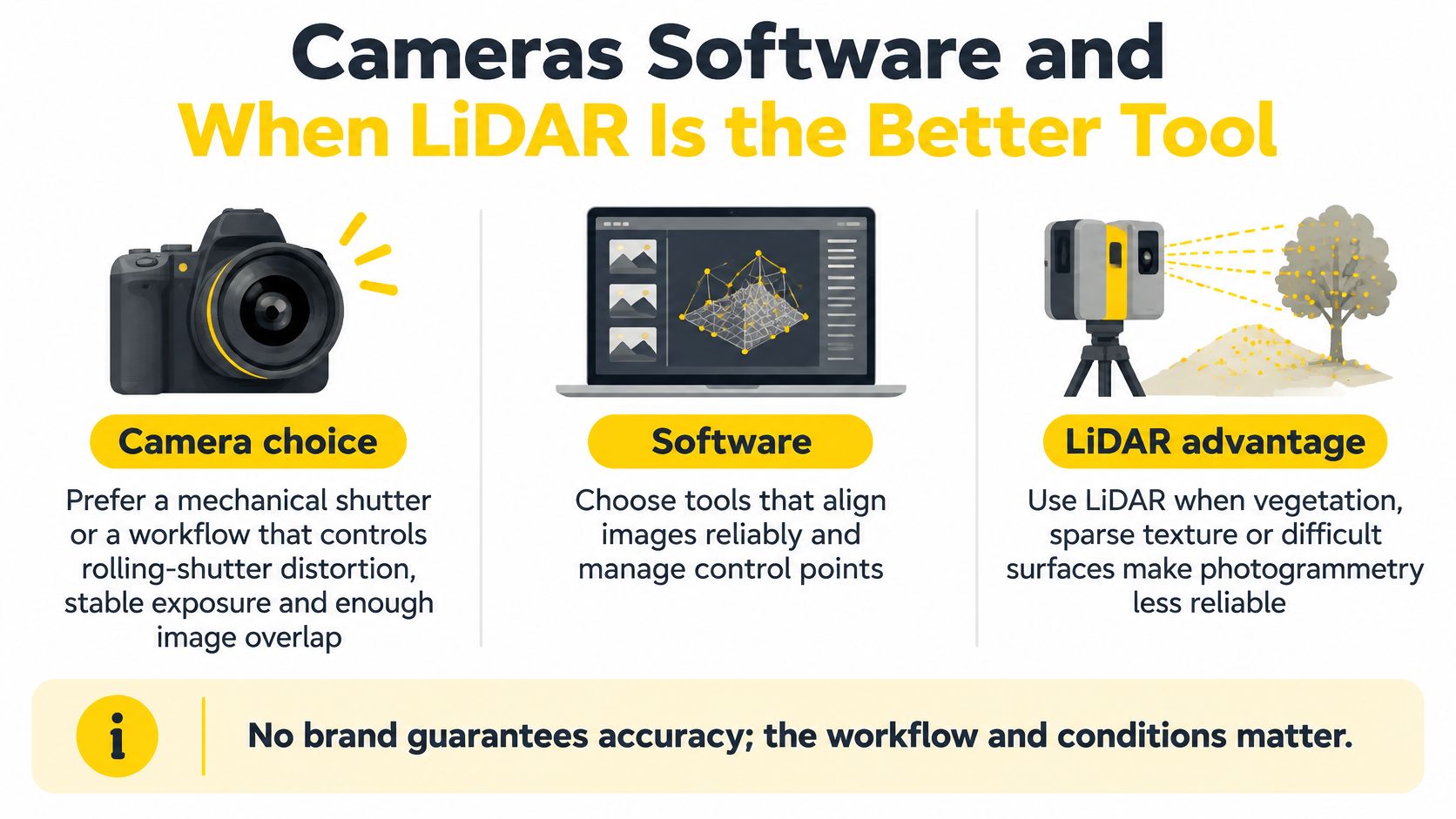
A camera should be selected for reliable measurement capture, not just image appeal. Prefer a mechanical shutter, or a validated workflow that controls rolling-shutter distortion, together with stable exposure and viewing geometry suited to the asset.
Equipment and software acceptance
Rolling shutters expose different parts of the frame at different times. Aircraft movement during that process can distort geometry, so flight speed, exposure and processing support must suit the camera.
Processing software should manage camera calibration, control observations and independent checks, then export the commissioned orthomosaic, surface, point cloud and accuracy report in the named coordinate system. Staff should inspect coverage gaps and classification decisions rather than accept an attractive default rendering.
Aircraft condition matters too. RPAS engineering and maintenance training is relevant to teams responsible for equipment serviceability, although maintenance competence doesn't itself establish mapping accuracy.
When to stay with photogrammetry or add LiDAR
| Task | Choose photogrammetry when | Choose LiDAR when |
|---|---|---|
| Repeat stockpile or progress volumes | The surface is visible and textured and checkpoints meet the tolerance | Vegetation or shadow hides the surface being claimed |
| Design or compliance terrain | Open ground can be controlled and independently checked | A bare-earth surface is required under dense vegetation |
| Facade or asset record | Overlap can see the faces and edges | The needed surface has poor texture or is obscured |
| Farm or corridor surface | Soil or low cover is visible at the planned GSD | Canopy or long grass covers the design surface |
LiDAR measures range using laser pulses rather than matching photographic texture. It may capture ground through vegetation gaps, but it can't guarantee ground returns beneath impenetrable cover or see through solid structures. Shadow alone doesn't establish that LiDAR is necessary, although severe loss of photographic detail can justify it.
An Australian comparison of RTK UAV photogrammetry and LiDAR found photogrammetric earthwork volumes at approximately 100.9% of reference values, while terrain-model RMSE in densely vegetated terrain was 0.179 m, compared with 0.165 m for LiDAR. Close agreement in total volume therefore didn't establish equally close agreement at every terrain location.
A good total volume can conceal local height errors that matter to drainage or design.
Making repeat surveys comparable
Repeat missions should use consistent height and, where practical, a similar time of day to limit changes in resolution and shadows. Archive raw photographs, survey observations and the processing report so another practitioner can examine the result.
The delivery note should identify occluded ground, edited areas and unreliable surfaces. For open, textured stockpiles, photogrammetry can be an appropriate choice; for design terrain beneath cover, the additional LiDAR workflow may be justified.
Questions to Settle Before the Next Mission
A mission that fails usually fails before take-off, in an unagreed specification or an unmatched licence. Settle these questions on paper first.
Is centimetre accuracy guaranteed?
No. Centimetre accuracy must be demonstrated for the commissioned product through ground control and independent checkpoints, as set out in the accuracy, ground control and ground sample distance requirements.
Can RTK replace ground control?
A suitable RTK workflow may reduce ground-control requirements where the project specification allows it, but a positioning-status indicator alone is not acceptance evidence.
Is a licence required to sell maps?
The licence obligation attaches to how the flight is conducted, not to the sale or to what the buyer does with the product afterward. Where the sale matters is the specification: a map bought to support a later quantity or boundary claim needs agreed accuracy evidence, surface coverage and exclusions written into the job before capture. The legal delivery workflow covers the underlying licensing distinctions.
Can photogrammetry support a contractor claim?
It can when the measurement method, surface coverage, accuracy evidence and calculation assumptions satisfy the contract. The parties should agree on stockpile bases, exclusions and comparison surfaces before collection; settling them after a quantity dispute is too late.
Where should a team train?
Training should match the role: a RePL for pilots flying commercially, an AROC for relevant radio duties, and ReOC consulting for business authorisation. For crews already working, Ace Aviation can deliver training on-site, bringing instructors, training drones and ground control gear to the client's location so the team stays on the job. Pilot qualifications alone don't establish survey competence, so pair licence training with ground-control and checkpoint practice.
Ace Aviation Aerospace Academy's ACE READY introduces beginners to drone fundamentals, aviation safety, CASA regulations and flight operations in preparation for RePL training. Its commercial training requires no prior experience, training aircraft are provided, and training is delivered across Brisbane, Sydney, Melbourne, Perth, Newcastle, Darwin, Cairns and Hobart. The drone licence pathway helps distinguish the qualification relevant to each intended role.
Before the next flight, confirm four things:
- An agreed accuracy specification and the checkpoints that will verify it
- The licence and business authorisation matched to the aircraft and operation
- Stockpile bases, exclusions and comparison surfaces agreed in writing
- Each team member's training matched to their role
Ace Aviation Aerospace Academy offers RePL and AROC training, ReOC consulting and team training relevant to commercial drone operations. Pilots and asset owners can visit Ace Aviation Aerospace Academy to discuss the training pathway that matches their aircraft, operating responsibilities and site-mapping work.