
Meta description: Learn how clients use drone data, from orthomosaics to digital twins. Explore drone licence Australia training and book with Ace today.
Short direct answer
A drone data deliverable is the organised, processed information a client receives after a drone operation. It may include a 2D map, 3D model, point cloud, progress report or inspection findings. Clients use these outputs to measure, plan, compare site conditions and make decisions.
What clients mean when they ask for drone data
A client usually needs more than photographs. They need information that helps answer a real question: Has construction progressed as planned? How much material is in a stockpile? Where is an asset showing signs of heat damage?
That difference matters to a new pilot. A drone can capture images, but the client often expects those images to become a usable product. The job may involve planning the capture, checking image quality, processing files, explaining limits and delivering the results in a format the client can use.
Raw imagery is the original set of photos or sensor files from the flight. It can be useful for archives or later analysis. However, it often needs specialist software and knowledge before a client can interpret it.
Processed outputs turn raw inputs into a clearer product. For example, a photogrammetry platform can combine many overlapping images into a map or 3D model. The pilot should agree on the output, format and intended use before the work begins.
This is not a guide to obtaining a drone licence in Australia. Instead, it explains what professional clients may expect after a flight and how a properly trained pilot can understand the work behind that expectation.
Drone licence Australia: deliverables clients may request
No single output suits every project. The right one depends on the client's question, their existing tools and the level of detail they need.
| Deliverable | What it is | Common client use |
|---|---|---|
| Raw imagery | Original photos or sensor files | Review, archive or later specialist processing |
| Orthomosaic | A corrected, joined aerial image | Site plans, progress review and visual records |
| 3D model | A textured, three-dimensional view of an area or object | Design review, visualisation and asset records |
| Point cloud | A set of measured points representing surfaces | Measurement, modelling and technical analysis |
| Digital twin input | Current site or asset data linked to digital records | Ongoing monitoring and project coordination |
| Progress imagery | Repeatable images from agreed views or dates | Construction reporting and change tracking |
| Volume report | A calculation based on modelled surfaces | Stockpile tracking and material planning |
| Thermal or inspection report | Sensor imagery with findings and context | Asset checks and maintenance planning |
These outputs overlap. A project might combine an orthomosaic, 3D model and written report. Therefore, pilots should ask what the client will do with the information before choosing a deliverable.
Orthomosaics: a useful 2D view of a site
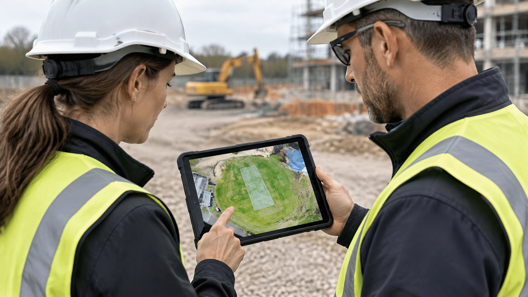
An orthomosaic is a large aerial image made by joining many overlapping photographs. Processing software corrects the images and aligns them into a consistent view. The result looks like a single map rather than a collection of separate photos.
For a construction project manager, an orthomosaic can show the layout of a site on a particular date. They may use it to review access routes, work areas or visible changes since the previous capture. A surveyor may use the image as a visual layer alongside other spatial data.
However, an orthomosaic is not automatically a survey-grade map. Its usefulness depends on capture planning, processing, ground control and quality checks. Before work starts, the pilot and client should agree on the coordinate system, required detail, intended use and any accuracy expectations.
Clients may request files that work with their mapping or design software. A GeoTIFF is one common image format, but the correct choice depends on the client's tools. Ask before delivery rather than assuming that a file will open in their system.
3D models and photogrammetry
Photogrammetry uses overlapping photographs to estimate the shape and position of surfaces. Processing software finds matching features across images and uses them to build a 3D representation.
A textured 3D model adds image detail to the surface. It can help a project team inspect a building, landform or construction area from different angles. For example, a project manager could review a model to understand site context or communicate a visible change to colleagues.
A model is not a perfect copy of the real world. Moving objects, reflective materials, uniform surfaces and hidden areas can make reconstruction difficult. As a result, the pilot should explain what the model shows and where it may be incomplete.
Clients may also ask to view models in design or building information modelling (BIM) systems. BIM is a digital process for managing information about built assets. A pilot does not need to build a client's BIM environment, but should clarify how the client expects the drone data to fit into it.
Point clouds: surface information for technical work
A point cloud is a collection of points that represent the surfaces captured during a survey. Depending on the capture method and processing, it can show ground, structures, vegetation or other visible features.
Surveyors and engineers may use point clouds to inspect geometry, build models or compare one surface with another. The client may request a particular format, coordinate reference or classification. Classification means labelling points by what they represent, such as ground or vegetation.
A point cloud can be large and technical. Therefore, it is often best delivered with supporting information: file details, a coordinate reference, a description of processing, and any agreed checks or limitations. A client may also need a simpler viewing option if they do not use specialist software.

Digital twins and the software ecosystem
A digital twin is a digital representation of a real place or asset that can be updated with current information. Drone data may provide one part of that representation, but it is not the whole twin by itself.
For example, a construction team may combine a 3D model or orthomosaic with design files, schedules, inspection notes and asset records. Likewise, an asset owner may use repeated captures to compare current conditions with earlier records.
The software process can be understood in three broad stages:
- Processing platforms combine images or sensor files into maps, models or point clouds.
- CAD and GIS tools let users work with design drawings or spatial information. CAD means computer-aided design; GIS means geographic information system.
- BIM or project platforms help teams organise asset and construction information alongside models and records.
Not every client uses the same tools. Ask what software they use, what file types they can accept and whether they need a web viewer or downloadable files. That conversation can prevent a technically good dataset from becoming difficult to use.
Progress imagery, volumes and inspections
Construction teams often need repeatable imagery rather than a one-off attractive photo. The client may ask for views from agreed positions, dates or site areas. They can then compare captures, document visible progress and share a clear record with project stakeholders.
The useful product may be a dated set of images, an orthomosaic, or an annotated report. An annotation is a note placed on an image or model to point out a feature or change. Agreeing on the capture plan makes comparisons more meaningful. For example, changing the view, coverage or timing can make it harder to compare one capture with another.
Mining and quarry clients may ask for stockpile or earthwork volumes. A volume calculation compares a modelled surface with a chosen base surface. The result depends on the quality of the data and the way the base is defined. A pilot should not promise a level of accuracy without knowing the project's control, method and requirements.
Thermal and visual inspections also need context. A thermal image shows temperature differences, but it does not by itself confirm the cause of a hot or cold area. A useful inspection report can identify the observed location, show relevant imagery and describe limitations. A qualified specialist may need to assess what the finding means.

Step-by-step: choose the right deliverable
Before accepting a job, turn the client’s request into a clear data plan.
- Ask what decision the client needs to make. Are they checking visible progress, measuring a surface, documenting an asset or sharing a site overview?
- Identify who will use the result. A project manager, surveyor, engineer and marketer may need different detail and formats.
- Confirm the intended use. A visual progress record is different from data used for design, engineering or formal measurement.
- Agree on coverage and capture timing. Define the areas, views, dates and any repeat-capture requirements.
- Discuss control and accuracy. Ask whether the project has survey control or other requirements. Do not assume the drone's positioning system alone meets them.
- Choose the output and format. Confirm whether the client needs imagery, a map, a model, a report, point-cloud data or a combination.
- Plan quality checks and exclusions. Explain what will be checked and identify areas that may be hidden, obstructed or hard to model.
- Confirm the handover. Set out file delivery, naming, coordinate information, report content and who will answer questions.
This process helps a pilot quote on the value and scope of the work, not just flight time. The effort may include client consultation, safe mission planning, data processing, quality review and clear delivery. A pilot who understands those steps can discuss the complete service with more confidence.
Examples: match the output to the client
The following examples show common ways clients may use drone outputs. They are general examples, not a promise that every project will suit the same method.
- Construction project manager: uses dated imagery and an orthomosaic to review visible site progress and share a visual update.
- Mining engineer: uses a surface model and agreed volume method to support stockpile tracking.
- Surveyor: reviews georeferenced imagery or point-cloud data alongside survey control and other project information.
- Real estate marketer: uses selected aerial imagery or a 3D view to communicate a property's appearance and setting.
- Asset owner: uses inspection images and notes to record visible conditions and help plan further assessment.
Local industries also shape demand. A pilot taking a drone course in Brisbane might encounter construction, infrastructure or property work. In Sydney, dense development can make the client's question and operating conditions especially important. Melbourne project teams may need repeatable construction records, while Perth clients may work across mining and resources. In Hobart, agriculture, forestry and environmental activity can create different mapping needs.
Common mistakes that weaken a delivery
A clean flight does not guarantee a useful result. These mistakes can lead to confusion, rework or unrealistic expectations.
- Sending raw files without asking first. Raw images may not answer the client's question. Agree on processed outputs and clarify whether the client also wants the source imagery.
- Over-promising accuracy. Avoid general claims before confirming the project method, control, conditions and intended use. State limits honestly.
- Ignoring ground control or checks. Ground control points (GCPs) are known positions used to help align or check mapping data. The project may need them, or other control and verification methods. Ask the client or survey lead.
- Failing to ask what happens next. If the client needs data in a design platform, a generic image file may not be enough. Confirm their workflow.
- Skipping quality review. Look for gaps, blurred images, poor overlap, inconsistent coverage or processing errors before delivery.
- Leaving out context. Include the capture date, coverage, file format and relevant limitations. Otherwise, users may not know how to interpret the output.
- Treating a model as ground truth. A visual model can be useful, but it may miss hidden or poorly captured areas. Explain what it can and cannot support.
These are professional habits, not just software skills. They also help a pilot set a clear scope before work begins.
CASA compliance and professional data work
The drone operation and the data deliverable are linked. A client may have a clear mapping need, but the pilot must still plan and conduct the flight within the applicable rules and approvals.
CASA's requirements depend on the operation, aircraft, location and operating model. Commercial work does not remove the need to check requirements. Pilots should consult CASA’s drone information and follow the rules that apply to their specific operation.
Data quality also depends on safe, lawful access to the site. Flight planning should consider airspace, people, property, site conditions and any permissions or approvals that may apply. If a proposed capture cannot be completed safely or within the applicable requirements, discuss an alternative with the client.
Ace Aviation is CASA-approved under CASA.ReOC.1421. The academy has trained 4,000+ students and has a global training footprint across Australia, Singapore, Dubai, Korea and Malaysia. Its courses support professional aviation training, while its Altitude+ student benefits program and DroneWork graduate job platform add support beyond the classroom.
To explore training options, see Ace Aviation courses or learn why students choose Ace. A drone licence in Australia can provide a foundation for professional work, but useful data delivery also calls for communication, planning and careful attention to client needs.
Frequently asked questions
What is a drone data deliverable?
It is the product provided to the client after a drone capture. It may include processed maps, models, imagery, point clouds or a written report.
Are raw drone photos enough for a client?
Sometimes, but not always. Raw photos may need specialist software and processing. Ask what the client will do with the files before deciding what to provide.
What is an orthomosaic used for?
An orthomosaic is a corrected aerial image assembled from multiple photos. Clients may use it to review site layout, record visible progress or share a map-like view.
What is the difference between an orthomosaic and a 3D model?
An orthomosaic shows a corrected view from above. A 3D model represents visible surfaces in three dimensions, often with image texture.
What is photogrammetry in simple terms?
Photogrammetry uses overlapping photographs to estimate the shape and position of surfaces. Software processes the images into outputs such as maps, models or point clouds.
What does a point cloud show?
A point cloud represents surfaces using many points. Depending on the capture and processing, it may show terrain, structures or other visible features.
Is a digital twin the same as a 3D model?
No. A 3D model can form part of a digital twin. A digital twin may also combine models with current records, design information and other asset data.
What data might a construction project manager request?
They may request dated progress images, an orthomosaic, a model or an annotated report. The right choice depends on what they need to review and share.
How can drone data help with stockpile work?
A modelled surface can support a volume calculation when compared with an agreed base. The method and data quality matter, so the client should define the requirements.
Can a drone pilot promise a specific accuracy?
Only when they understand the project requirements, capture method, control and quality checks. Avoid generic promises and explain the limits of the proposed data.
What are ground control points?
Ground control points are known positions used to help align or check mapping data. Ask whether the project requires them or another control and verification approach.
Do clients need a particular file format?
Often, yes. Their mapping, design or asset software may accept only certain formats. Confirm file types, coordinate information and delivery method before the work starts.
What is BIM, and why might drone data relate to it?
BIM is a way to organise information about built assets. Drone outputs may provide visual or spatial information that a client combines with other project records.
Do thermal images prove that an asset has a fault?
No. Thermal images can show temperature differences, but those differences do not confirm a cause by themselves. Further assessment may be needed.
Does a drone licence guarantee I can complete any mapping job?
No. The pilot must still assess the operation, applicable CASA requirements, client expectations and data limitations. Training is a foundation for safe professional work, not blanket permission for every task.
How does understanding deliverables help a new pilot?
It helps a pilot discuss the client's actual need, plan a suitable capture, identify processing work and explain limitations. That supports clearer scopes and value-based proposals.
Where can I learn more about professional drone training?
Explore Ace Aviation’s course options, review why Ace Aviation, or contact the team to discuss a suitable pathway.
Summary
Clients do not always want more drone photographs. They want information they can use: a map to understand a site, imagery to review progress, a model to explore surfaces, or a report to support an inspection.
The professional pilot starts by asking what decision the client needs to make. Then they agree on the capture, output, format, quality checks and limits. That approach supports useful delivery and helps pilots explain the full value of their work.
Ready to start? Book your training at aaa.edu.au or call 1300 336 366.
{“@graph”:[{“@type”:”Article”,”author”:{“name”:”Ace Aviation Aerospace Academy”,”@type”:”Organization”},”headline”:”Drone Licence Australia 2026: What Clients Actually Do With Your Drone Data — Orthomosaics, 3D Models and Digital Twins Explained”,”publisher”:{“url”:”https://aaa.edu.au/”,”name”:”Ace Aviation Aerospace Academy”,”@type”:”Organization”},”inLanguage”:”en-AU”,”description”:”Learn how clients use drone data, from orthomosaics to digital twins. Explore drone licence Australia training and book with Ace today.”,”mainEntityOfPage”:”https://aaa.edu.au/blog”},{“url”:”https://aaa.edu.au/”,”name”:”Ace Aviation Aerospace Academy”,”@type”:”Organization”,”telephone”:”+61-1300-336-366″,”description”:”CASA-approved aviation training provider with ReOC number CASA.ReOC.1421.”},{“@type”:”FAQPage”,”mainEntity”:[{“name”:”What is a drone data deliverable?”,”@type”:”Question”,”acceptedAnswer”:{“text”:”It is the product provided to the client after a drone capture. It may include processed maps, models, imagery, point clouds or a written report.”,”@type”:”Answer”}},{“name”:”Are raw drone photos enough for a client?”,”@type”:”Question”,”acceptedAnswer”:{“text”:”Sometimes, but not always. Raw photos may need specialist software and processing. Ask what the client will do with the files before deciding what to provide.”,”@type”:”Answer”}},{“name”:”What is an orthomosaic used for?”,”@type”:”Question”,”acceptedAnswer”:{“text”:”An orthomosaic is a corrected aerial image assembled from multiple photos. Clients may use it to review site layout, record visible progress or share a map-like view.”,”@type”:”Answer”}},{“name”:”What is the difference between an orthomosaic and a 3D model?”,”@type”:”Question”,”acceptedAnswer”:{“text”:”An orthomosaic shows a corrected view from above. A 3D model represents visible surfaces in three dimensions, often with image texture.”,”@type”:”Answer”}},{“name”:”What is photogrammetry in simple terms?”,”@type”:”Question”,”acceptedAnswer”:{“text”:”Photogrammetry uses overlapping photographs to estimate the shape and position of surfaces. Software processes the images into outputs such as maps, models or point clouds.”,”@type”:”Answer”}},{“name”:”What does a point cloud show?”,”@type”:”Question”,”acceptedAnswer”:{“text”:”A point cloud represents surfaces using many points. Depending on the capture and processing, it may show terrain, structures or other visible features.”,”@type”:”Answer”}},{“name”:”Is a digital twin the same as a 3D model?”,”@type”:”Question”,”acceptedAnswer”:{“text”:”No. A 3D model can form part of a digital twin. A digital twin may also combine models with current records, design information and other asset data.”,”@type”:”Answer”}},{“name”:”What data might a construction project manager request?”,”@type”:”Question”,”acceptedAnswer”:{“text”:”They may request dated progress images, an orthomosaic, a model or an annotated report. The right choice depends on what they need to review and share.”,”@type”:”Answer”}},{“name”:”How can drone data help with stockpile work?”,”@type”:”Question”,”acceptedAnswer”:{“text”:”A modelled surface can support a volume calculation when compared with an agreed base. The method and data quality matter, so the client should define the requirements.”,”@type”:”Answer”}},{“name”:”Can a drone pilot promise a specific accuracy?”,”@type”:”Question”,”acceptedAnswer”:{“text”:”Only when they understand the project requirements, capture method, control and quality checks. Avoid generic promises and explain the limits of the proposed data.”,”@type”:”Answer”}},{“name”:”What are ground control points?”,”@type”:”Question”,”acceptedAnswer”:{“text”:”Ground control points are known positions used to help align or check mapping data. Ask whether the project requires them or another control and verification approach.”,”@type”:”Answer”}},{“name”:”Do clients need a particular file format?”,”@type”:”Question”,”acceptedAnswer”:{“text”:”Often, yes. Their mapping, design or asset software may accept only certain formats. Confirm file types, coordinate information and delivery method before the work starts.”,”@type”:”Answer”}},{“name”:”What is BIM, and why might drone data relate to it?”,”@type”:”Question”,”acceptedAnswer”:{“text”:”BIM is a way to organise information about built assets. Drone outputs may provide visual or spatial information that a client combines with other project records.”,”@type”:”Answer”}},{“name”:”Do thermal images prove that an asset has a fault?”,”@type”:”Question”,”acceptedAnswer”:{“text”:”No. Thermal images can show temperature differences, but those differences do not confirm a cause by themselves. Further assessment may be needed.”,”@type”:”Answer”}},{“name”:”Does a drone licence guarantee I can complete any mapping job?”,”@type”:”Question”,”acceptedAnswer”:{“text”:”No. The pilot must still assess the operation, applicable CASA requirements, client expectations and data limitations. Training is a foundation for safe professional work, not blanket permission for every task.”,”@type”:”Answer”}},{“name”:”How does understanding deliverables help a new pilot?”,”@type”:”Question”,”acceptedAnswer”:{“text”:”It helps a pilot discuss the client’s actual need, plan a suitable capture, identify processing work and explain limitations. That supports clearer scopes and value-based proposals.”,”@type”:”Answer”}},{“name”:”Where can I learn more about professional drone training?”,”@type”:”Question”,”acceptedAnswer”:{“text”:”Explore Ace Aviation’s course options at https://aaa.edu.au/courses, review why Ace Aviation at https://aaa.edu.au/why-ace, or contact the team to discuss a suitable pathway.”,”@type”:”Answer”}}]}],”@context”:”https://schema.org”}