

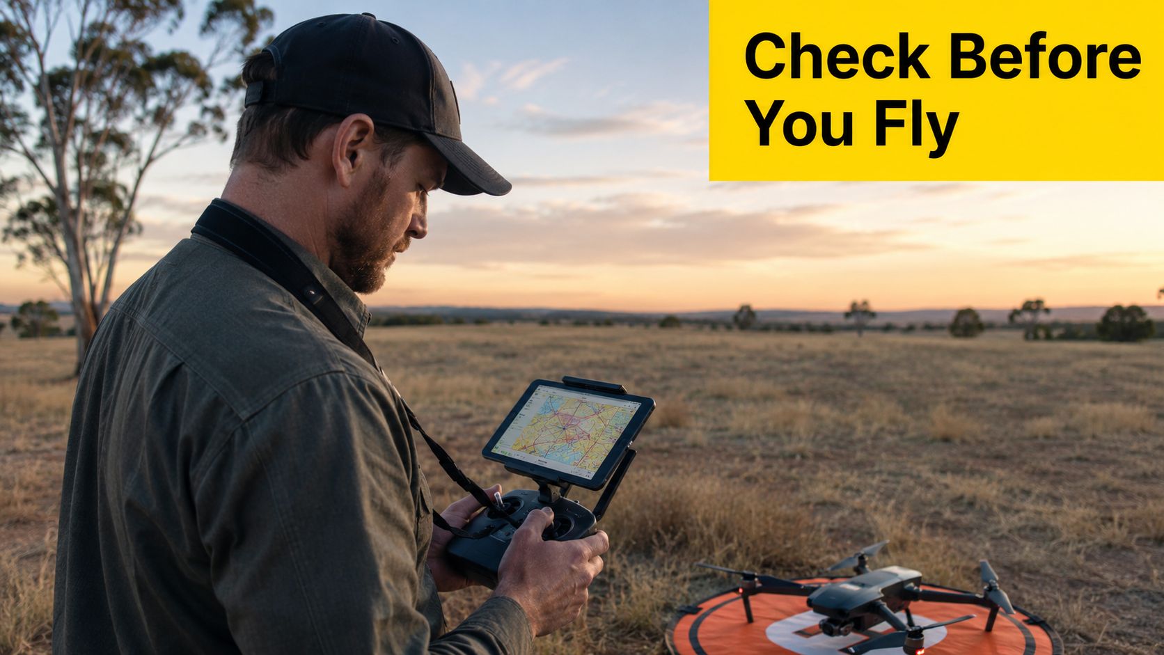
A reserve can look empty and still be unsuitable for take-off. A controlled aerodrome may sit nearby, a runway approach path may cross the planned route, and the local authority may restrict drone operations in the park. What appeared to be a simple flight is now a drone flying zone compliance task involving national aviation rules, airspace conditions and local land-management requirements.
Australian operators need to assess all three layers before take-off. CASA sets the national baseline, while aerodrome procedures, restricted airspace and local drone rules decide whether a particular site and route can be used. The same method applies to recreational pilots, commercial operators, government teams and businesses carrying out mapping, agriculture or inspection work.
A clear patch of grass does not confirm clear airspace. A pilot can stand outside an airport fence and still be under an approach corridor, within a council restriction or inside a managed environmental area. The site's appearance provides little evidence about whether the proposed operation is lawful.
Three layers shape the flight decision
The first layer is CASA's national framework. It covers altitude, separation from people, airport proximity, visual line of sight and other operating conditions. These requirements apply whether the aircraft is used for recreation, paid work or a government task.
The second layer is the aviation environment. Controlled and non-controlled aerodromes, runway procedures and restricted areas can affect a flight even when the nearest runway cannot be seen from the launch point. A map ring identifies a possible concern, not the complete operating decision. Pilots must also consider the intended route, height and relationship to aircraft movements.
The third layer is local land access and drone zoning. Australia's federal Local Drone Rule Map launched in 2022, with its first release covering 7,610 areas managed by 15 responsible authorities (CASA's announcement about the Local Drone Rule Map). Local restrictions may apply to parks, council land and other managed spaces. This newer system means an operator must check both aviation information and the rules of the land manager.
Practical rule: A legal launch site still needs a legal flight path, a suitable operating area and any required approval.
A breach can lead to enforcement action, including fines or licence suspension. The consequence depends on the conduct and applicable law. A warning in a manufacturer's app is not permission, and an empty site is not evidence that the flight is safe or lawful.
Zone awareness is an aviation skill built into the pre-flight workflow. Before each operation, identify the exact location, check official airspace information, review local rules, confirm the planned height and route, and verify that separation from people remains within the applicable conditions. This habit also prepares operators for the newer local-zone system and regulatory changes expected in 2026, where documenting each check will matter as much as viewing the map.
Table of Contents
- Three layers shape the flight decision
- Core CASA Rules That Define Australian Drone Flying Zones
- Controlled Aerodrome Exclusion Zones and Approach Paths
- How to Check Drone Flying Zone Maps and Apps Before Every Flight
- Recreational Versus Commercial Compliance Requirements
- Upcoming Regulatory Changes Affecting Drone Flying Zones in 2026
- Your Pre-Flight Drone Flying Zone Compliance Checklist
- Frequently Asked Questions About Drone Flying Zones
Core CASA Rules That Define Australian Drone Flying Zones
A pilot can stand outside a marked zone and still breach a CASA operating condition. The map describes the location. The operating conditions govern how the aircraft is flown, so both checks belong in the pre-flight process.
Start with altitude and visual control
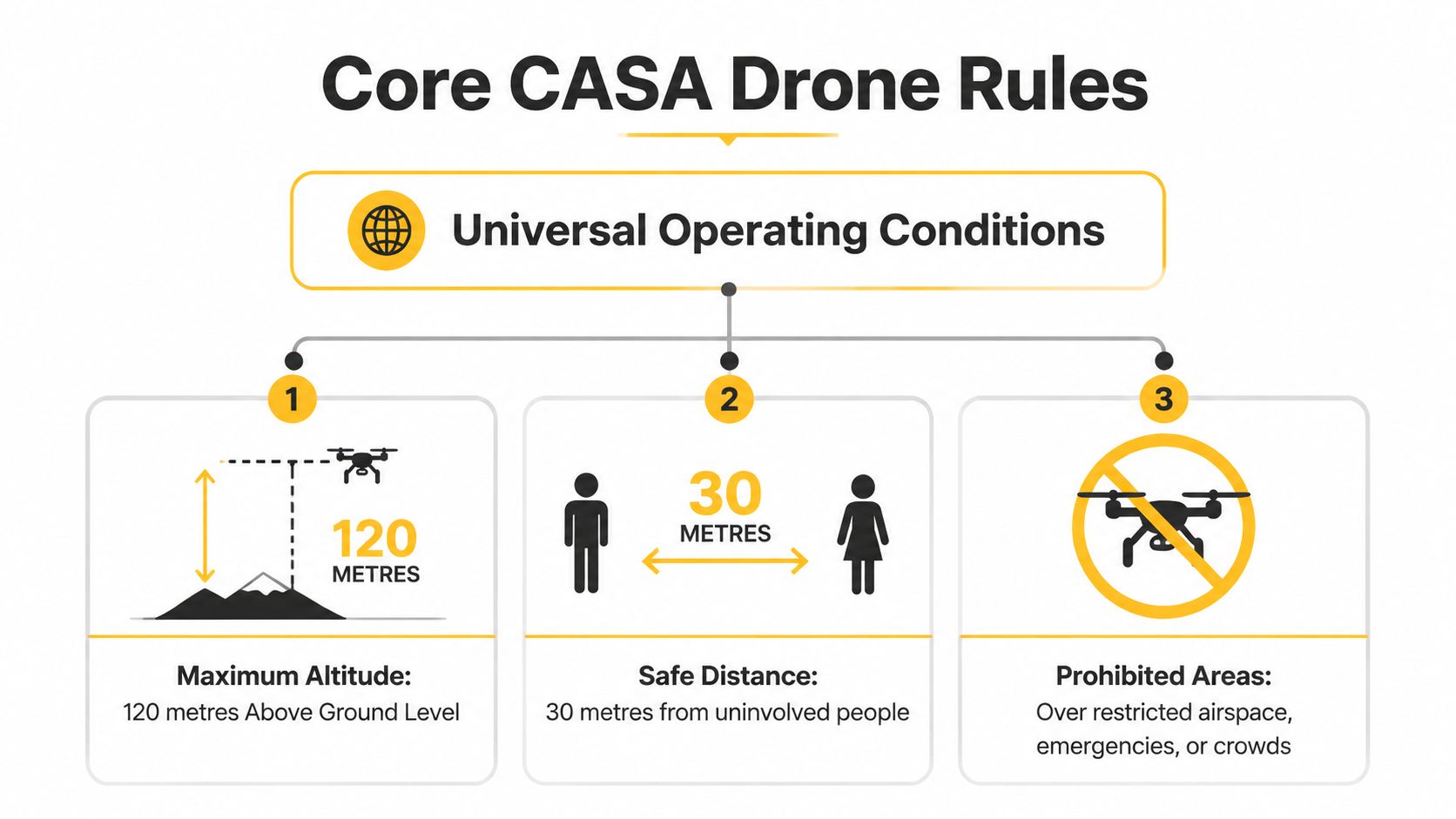
The default maximum altitude is 120 metres above ground level, also described as 400 feet (CASA operating conditions). Measure that height from the ground beneath the aircraft, rather than only from the launch point. If the terrain rises along the route, the permitted height can shrink unless the pilot keeps reassessing the aircraft's clearance from the surface.
The aircraft must remain within visual line of sight. Direct visual awareness covers the drone and nearby hazards, while a live camera feed cannot replace that view. Buildings, trees, haze, distance and poor lighting may interrupt the pilot's ability to monitor the flight safely.
Standard recreational conditions also allow only one remotely piloted aircraft at a time. A group cannot rely on each aircraft staying below the altitude limit as justification for simultaneous flights. Each pilot must consider the combined operation and the applicable conditions.
Protect people who aren't part of the operation
CASA requires at least 30 metres horizontally between the drone and people who are not involved in controlling or navigating it (CASA guidance on flying over and near people). Measure the separation from the point on the ground directly below the drone, not from the pilot or launch position.
A drone must never fly over a person, except under narrow exceptions tied to specific approvals or ReOC conditions. A crowd, queue, sporting event or busy public space therefore needs a different operating plan that addresses the crowd through approved procedures or alternative site selection.
Apply the weight threshold correctly
Drones at or below 250 grams follow different airport-zone rules, yet they still must meet all other baseline duties. That includes the requirements for people, altitude, visual line of sight and local restrictions.
For beginners, ACE READY provides entry-level training in drone fundamentals, aviation safety, CASA regulations and flight operations, with preparation for advanced RePL training in Australia. Operators planning organisational work should also understand the difference between basic operating conditions and the management systems explained in the ReOC guide for Australian operators. Those records and procedures will become increasingly relevant as local-zone workflows and the regulatory changes expected in 2026 require operators to show how each flight was checked and approved.
Controlled Aerodrome Exclusion Zones and Approach Paths
A pilot can launch outside an airport zone, follow a legal altitude and still create a problem if the planned route crosses a runway corridor. Airport operations require route-based checking, not a single distance measurement from the take-off point.
The principal controlled-airport restrictions
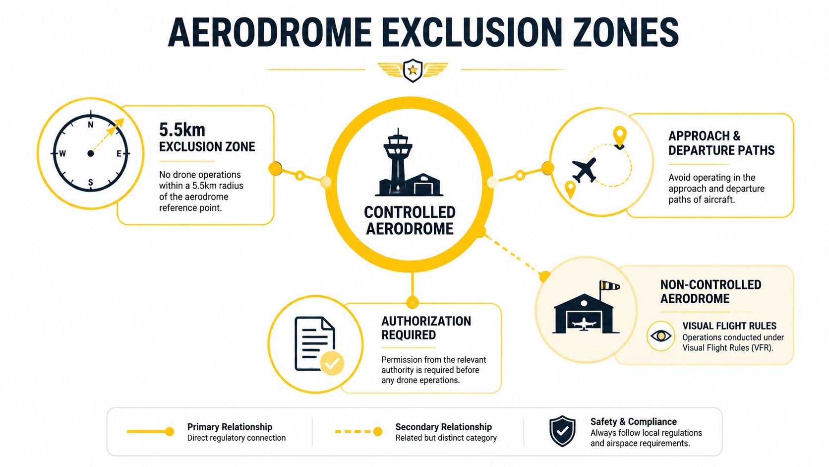
For most drones weighing more than 250 grams, CASA prohibits flight within 5.5 kilometres of a controlled airport, as explained in its guidance on flying near airports. The aircraft must also remain clear of the airport's approach and departure paths.
These paths can extend up to 7 kilometres from the runway. Between 7 kilometres and 8.5 kilometres, the permitted height is limited to 90 metres above ground level. During planning, measure the route against the runway corridor as well as checking the launch location. A flight line that begins outside the zone can still enter an approach or departure path.
CASA authorisation is required for operations within 5.5 kilometres of a controlled aerodrome, above 120 metres, over its movement area, or within a runway approach or departure path (see CASA flight approvals and permissions). Identify that requirement before departure. An approval cannot be treated as a remedy after the drone is airborne.
Why the 3 NM reference can confuse pilots
Airservices Australia describes the controlled-aerodrome restriction under CASA Manual of Standards Part 101 as airspace below 400 feet within 3 nautical miles of the runway measurement point, together with approach and departure paths that may extend beyond that distance (Airservices Australia information for unmanned aerial systems).
The 3 NM reference and the 5.5 km rule express related boundaries in different units and contexts. Treating either one as a simple safe circle can produce a faulty flight plan. Review the complete proposed track, including turns, survey lines and the recovery area.
Aviation briefing: The runway procedure matters as much as the radius. Map the proposed route, not just the take-off point.
Small drones and non-controlled aerodromes
Drones weighing 250 grams or less may operate within the 5.5 km airport zone up to 45 metres above ground level, provided they stay outside the aerodrome boundary and do not create a hazard to other aircraft, under CASA's airport guidance. The weight exemption provides a limited allowance within the airport zone, not blanket permission to operate unrestricted. People, altitude, visual line of sight, local rules and aircraft activity remain part of the assessment.
At a non-controlled aerodrome, approval is required within 5.5 kilometres when crewed aircraft are operating (see CASA's flight approvals guidance). “Non-controlled” describes the aerodrome's operating environment, not unrestricted airspace. Monitor the site and be prepared to cancel or relocate if aircraft activity changes.
Operators can compare their planning process with this Australian drone safety guide for airports. Keeping the map check, route assessment and approval record together will also support the local-zone workflows expected to matter more as regulatory changes arrive in 2026.
How to Check Drone Flying Zone Maps and Apps Before Every Flight
A flight can begin from an apparently clear location and enter restricted airspace after one turn. Before departure, identify the exact launch point, proposed route, maximum height and recovery area. A suburb name or broad address is not precise enough for this check.
Use official information before relying on convenience
CASA-verified applications and mapping tools, including OpenSky and other approved platforms, provide airspace information for planning. Enter the planned location and examine overlays for controlled airspace, restricted areas, aerodrome procedures and other aviation limitations. Manufacturer prompts can assist awareness, but operators must still consult official CASA-verified tools and obtain any required authorisations.
Local rules add a separate planning layer. The Local Drone Rule Map introduced more detailed information about places such as parks, local government areas and other managed spaces, alongside Australia's national requirements (see Local Drone Rule Map announcement above). Treat these local conditions like a site-specific operating brief: they may affect where you can launch, land or fly even when the broader airspace appears suitable.
A repeatable map-checking sequence
Identify the exact site. Mark the launch area, route, intended operating height and recovery point. A route that starts outside a zone may cross into it during the flight.
Open a CASA-verified tool. Check OpenSky or another approved mapping platform. Confirm that the displayed information covers the proposed operating area and date.
Turn on relevant layers. Review controlled and non-controlled aerodromes, runway approach and departure paths, restricted airspace and height limits. Then inspect local rules for parks, council land, national parks and wildlife areas.
Make and record the decision. Note whether standard conditions apply, the launch site is unsuitable or an approval is required. Unclear information is a stop signal. Pause until the operator obtains reliable clarification.
The AAA licence finder can help identify training pathways relevant to the proposed drone work. For commercial teams, incorporate the map review into a documented flight-planning workflow, retaining current screenshots or records under the organisation's procedures. As local-zone systems develop and regulatory changes approach in 2026, this record becomes part of showing how each operation was assessed, authorised and briefed before take-off.
Recreational Versus Commercial Compliance Requirements
A paid job does not change the national safety rules. Recreational and commercial pilots must meet the same baseline conditions for altitude, people, visual line of sight and airspace. Commercial work adds another layer: qualifications, organisational permissions and documented procedures that show how the operation will be controlled.
| Requirement | Recreational Operator | Commercial RePL/ReOC Holder |
|---|---|---|
| CASA operating conditions | Must follow applicable altitude, people, visual-line-of-sight and airspace rules | Must follow the same baseline rules unless a specific approval or operating framework applies |
| Aircraft and route planning | Check drone weight, location, height and local restrictions | Check the same factors, then apply the organisation's procedures and risk controls |
| Airport or restricted airspace | Seek authorisation where CASA requires it | Seek authorisation where CASA requires it and manage the approval within the operator's system |
| Commercial qualification | Recreational flying doesn't itself establish commercial credentials | RePL and, where applicable, ReOC arrangements support professional operations |
| Records and procedures | Sensible flight records support safe practice | Operational records, authorisations, risk assessments and procedures should support repeatable work |
| Radio communication | Use only where properly trained and authorised | An AROC may be relevant where operations require communication in controlled airspace |
Where the rules remain identical
Both pilot types must check the applicable drone flying zone, altitude limit, separation from people and aerodrome restrictions. A RePL does not provide a general exemption, and an ReOC does not replace a location check before each mission. Treat the licence or operator certificate as permission to conduct certain work within defined conditions, not as a pass for every location.
CASA authorisation is required for flights within 5.5 kilometres of a controlled aerodrome, above 120 metres, over a controlled aerodrome movement area, or in a runway approach or departure path. A paid contract and the pressure to complete a job do not substitute for the required CASA authorisation. Use the approval process described earlier whenever one of those conditions applies.
Where commercial systems become more demanding
Commercial operations need a defensible workflow. Before accepting a task, the operator should confirm the zone, pilot qualification, people and property risks, aircraft controls, task records and any required approvals. The organisation's authorisations determine the exact documents and procedures, so a one-off recreational checklist may be too limited for repeat work.
The distinction between pilot and organisation matters. An individual RePL addresses pilot competency, while an ReOC arrangement supports the operator's broader systems and permissions. AROC training becomes relevant when the operation requires aeronautical radio communication in controlled airspace.
Operators should also understand the boundaries of excluded-category drone operations before accepting a contract. Local drone flying zones are adding another decision layer alongside CASA's national rules. A sound commercial process therefore records the location, applicable rule, approval status and responsible person for every flight, making future 2026 changes easier to incorporate.
Upcoming Regulatory Changes Affecting Drone Flying Zones in 2026
A mapping job is booked for early 2026, but the crew plan still assumes one pilot can handle every visual-awareness task alone. That assumption may create a compliance gap if CASA introduces the proposed assisted visual line of sight trial.
CASA has delayed a trial that would allow RePL holders to conduct assisted visual line of sight operations with a spotter until 2026, according to CASA's regulatory update. For commercial operators, the change could affect crew planning, radio and team communications, supervision, training records and the way visual awareness is documented. A spotter is not an extra person on site. The operation needs clear responsibilities, reliable communication and a record showing how the crew maintained the required awareness.
CASA also conducted a 2025 consultation on operations above 400 feet in defined areas. This consultation signals possible future directions. Current rules remain unchanged, so operators must plan within the existing altitude limit until a formal approval or amended rule applies.
What businesses should prepare now
Agriculture, mapping and infrastructure-inspection businesses should build their process around each mission, not just the aircraft model. A practical workflow identifies:
- The operating concept: Define the route, height, people exposure, aircraft and crew roles.
- The approval path: Identify whether the mission needs airspace authorisation or another CASA approval.
- The staffing model: State who controls the aircraft, who maintains visual awareness and who communicates with relevant aviation services.
- The evidence trail: Keep the planning decision, approvals, site assessment and flight records together.
- The review point: Recheck the workflow whenever CASA changes a rule, trial or approval process.
Local drone flying zones add another layer to CASA's national rules. Operators should record the location, applicable zone rule, approval status and responsible person, much like a flight plan with an attached compliance file. Guidance on Australian drone laws in 2026 can support preparation, while current CASA information remains the controlling reference for an actual flight.
Your Pre-Flight Drone Flying Zone Compliance Checklist
A map may show where a flight appears possible, but it does not replace a site assessment. Before each operation, work through the checklist below. If any required answer is unclear, do not launch.
Location and airspace
- Define the whole flight area: Mark the launch point, route, planned height, landing area and any alternate landing location.
- Check official maps: Use CASA-verified tools such as OpenSky to review aerodromes, controlled airspace, restricted areas and relevant overlays.
- Check local requirements: Confirm rules from councils, parks, national parks, wildlife areas and other land managers. CASA's national rules and a local drone flying zone can both apply.
- Examine approach paths: Treat runway approach and departure corridors like invisible extensions of the runway. A route outside the airport boundary may still conflict with aircraft movements.
Aircraft and operating conditions
- Confirm the weight class: Check whether the aircraft is at or above the 250-gram threshold, because airport-zone conditions can differ.
- Set the height ceiling: Stay within the applicable altitude limit and account for rising ground and terrain.
- Plan visual line of sight: Ensure the pilot can maintain direct visual awareness of the aircraft throughout the operation.
- Protect uninvolved people: Keep at least 30 metres horizontally from people not involved in control or navigation, and never plan to fly over people.
- Limit aircraft activity: Standard recreational conditions allow only one RPA to be flown at a time.
Approvals and records
- Identify approval triggers: Check airport proximity, approach paths, movement areas, restricted areas and any proposed height above the standard limit.
- Confirm authorisation: Obtain required approval before departure. An app warning, map result or manufacturer override is not CASA approval.
- Brief the team: Confirm boundaries, responsibilities, emergency actions and communication methods. Everyone should know who controls the aircraft and who monitors the surrounding airspace.
- Keep the evidence trail: Retain the map review, local-zone assessment, permissions and operational notes under the operator's procedures. This record supports today's compliance and the more formal workflows expected as local systems and 2026 regulatory changes develop.
Before take-off: If the pilot cannot explain why the site, route, altitude and people separation are lawful, the aircraft is not ready to launch.
Frequently Asked Questions About Drone Flying Zones
Can a drone fly around Sydney Harbour?
Sydney Harbour and nearby areas may be no-drone or approval-required zones because helicopters and seaplanes operate at low altitude. Check current local and aviation restrictions before planning the flight, as noted in the Local Drone Rule Map discussion above.
Can drones fly in national parks?
National parks and wildlife areas may require approval from the relevant land manager. Check both CASA requirements and local access conditions. Available airspace does not automatically mean the landowner permits take-off or landing.
What's the difference between controlled and non-controlled aerodromes?
A controlled aerodrome operates with air traffic control procedures managing its surrounding airspace. A non-controlled aerodrome lacks that service, yet aircraft movements and CASA restrictions still demand a careful site assessment.
What happens after an accidental airspace entry?
Protect aviation safety first. Leave the restricted area when safe, or land if appropriate, then record what happened. Review the map check, authorisation and communication steps, and seek regulatory or professional guidance where required. The record also helps prepare operators for more formal local-zone compliance workflows under the regulatory changes expected in 2026.
Do drone flying zone rules change between states?
CASA rules apply across Australia, while councils, parks and land managers can add location-specific conditions. Each flight therefore needs two checks: national aviation requirements and the rules governing the launch site, operating area and access.
Ace Aviation Aerospace Academy provides training related to Australian drone flying zone compliance, including the Remote Pilot Licence, Aeronautical Radio Operator Certificate, ReOC consulting and enterprise or corporate drone training. Operators can review its aviation education pathways through Ace Aviation Aerospace Academy.
