

A remote asset inspection can look simple on a project plan. A pilot arrives, launches a drone, captures clean photographs and sends the files to maintenance. On an Australian oil and gas site, the difficult questions start before take-off. Can the operator legally fly the route? Can the aircraft work around hazardous infrastructure, people, airspace and communications limits? Will the thermal, LiDAR or gas data support an engineering decision, or will it sit in a folder as attractive but unusable imagery?
That's why drone inspection in oil and gas should be treated as an aviation operation and an asset-integrity workflow, not a camera purchase. The strongest programs reduce exposure, improve repeatability and move reliable evidence into the systems that control maintenance and compliance.
Table of Contents
- Why Drone Inspection Matters for Australian Oil and Gas
- Sensors and Payloads Used in Oil and Gas Drone Inspection
- CASA Approvals and the RePL ReOC Stack
- BVLOS Operations Across Remote Australian Basins
- End to End Mission Workflow and Data Handling
- Reframing the ROI of Drone Inspection in Oil and Gas
- Getting Started and Where Training Fits In
- Frequently Asked Questions
- What licence is needed for commercial oil and gas drone inspection in Australia?
- Is a RePL enough for pipeline inspection?
- Does BVLOS approval apply to remote oil and gas inspection?
- Which sensor is best for oil and gas drone inspection?
- Can drones replace rope access or shutdown inspections?
- What makes drone inspection data defensible?
Why Drone Inspection Matters for Australian Oil and Gas
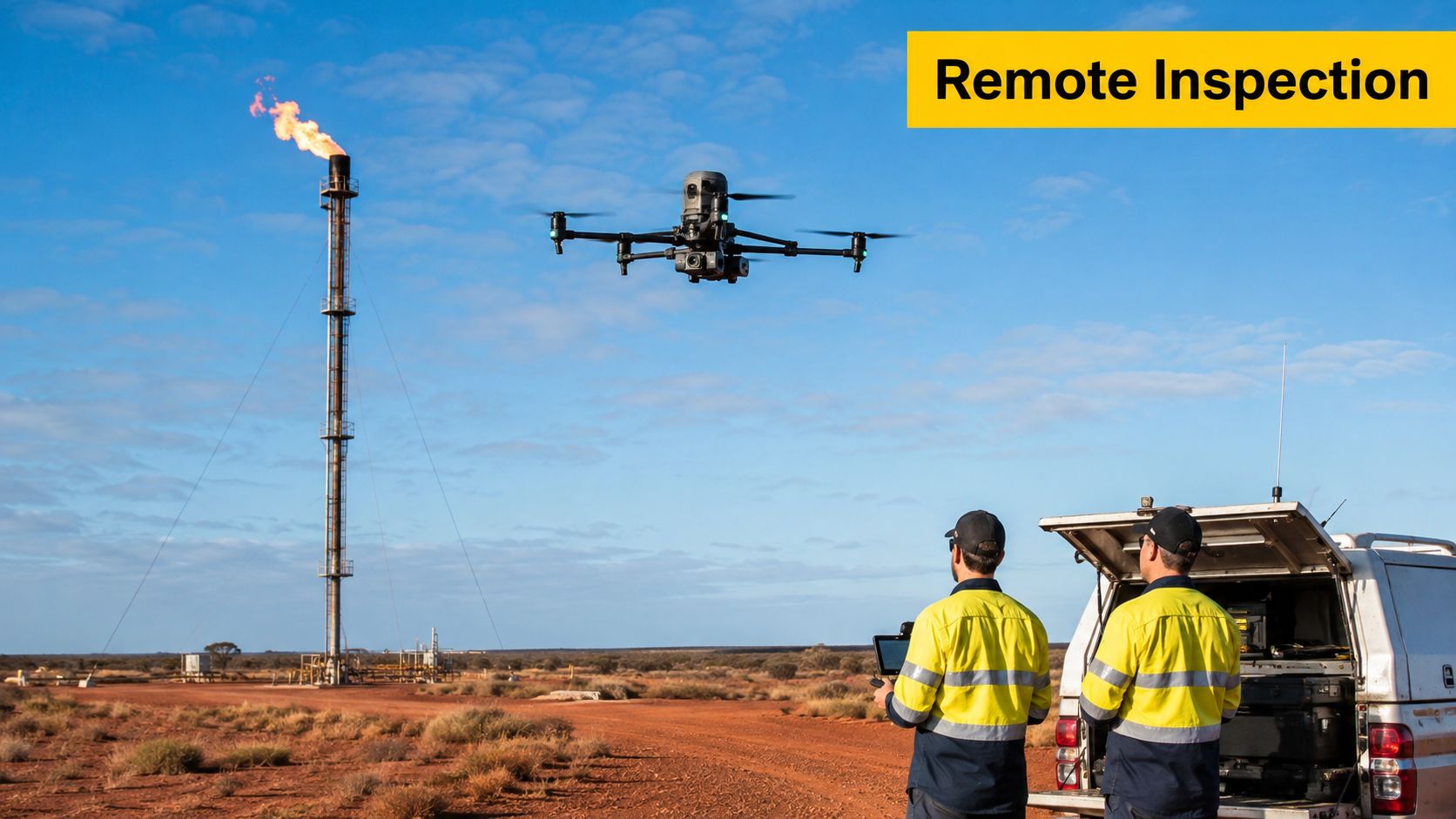
A flare stack on a remote Cooper Basin site can demand a shutdown, rope access or extensive ground logistics before an inspector reaches the work area. A planned remotely piloted aircraft operation can collect close visual and thermal evidence while keeping people farther from heat, height and hazardous equipment. That outcome depends on more than the aircraft. The operator needs a defensible scope, a safe launch location, a communications plan and a controlled path from captured data to an integrity decision.
Australian oil and gas assets fit this operating model because they are spread across large, isolated areas. Drones can inspect flare stacks, pipelines, storage tanks, offshore risers and confined-space structures, using high-resolution visual, thermal, LiDAR and optical gas imaging payloads when the mission calls for them. These applications are covered by Australian industrial drone providers through oil and gas drone inspection services.
Scope the program before selecting aircraft
A new client should settle three decisions before choosing an aircraft:
- Asset priority: Begin with assets where access creates exposure or operational disruption, including raised steelwork, tanks, remote pipeline corridors and areas affected by erosion or flooding.
- Inspection decision: Define whether the mission is checking corrosion, deformation, heat anomalies, gas emissions, encroachment or general condition.
- Data destination: Confirm how findings will be tagged, reviewed, retained and transferred into the operator's maintenance or asset-integrity platform.
The Shell-operated QGC program in the Surat Basin remains a useful Australian example. In 2017, QGC expanded CASA-approved beyond-visual-line-of-sight operations across a 7,000 square kilometre area spanning Queensland and New South Wales. The operation covered gas wells and infrastructure, and the operator said it could cut travel by up to 800,000 kilometres per year while inspecting wells, tanks, valves, pipes, vents and environmental conditions including erosion and access-road flooding.
The practical test is simple. A drone program earns its place when it reduces scaffold, rope access, shutdown activity, confined-space entry or unnecessary road travel, while producing repeatable evidence for maintenance and compliance. The inspection record must be traceable, reviewable and suitable for the decision it supports.
CASA approvals, BVLOS logistics and defensible sensor data determine whether the program works in the field. The Australian drone ecosystem provides useful context for businesses assessing where RPAS operations fit.
Sensors and Payloads Used in Oil and Gas Drone Inspection
Sensor selection should follow the decision, not lead it. An RGB camera may be enough for a visual walk-down of a valve station, while a thermal, LiDAR or gas-detection payload may be justified when the operator must identify heat behaviour, geometry or emissions. Buying every payload at the beginning usually creates more processing and calibration burden than operational value.
Match the payload to the asset question
An RGB camera supports close visual inspection, mapping and condition records. It can document coating breakdown, loose components, damaged insulation, vegetation encroachment and access-road conditions. High zoom is useful around tanks, pipe racks and wellhead equipment where the aircraft must maintain separation.
Thermal imaging adds a different layer of evidence. It can help identify abnormal heat around flare equipment, turbine exhausts, hot pipework, electrical components and tank-roof seals. Thermal results depend heavily on environmental conditions, viewing angle, emissivity and calibration, so a thermal image shouldn't be treated as a defect conclusion without suitable review.
LiDAR is appropriate when the operator needs a dense three-dimensional representation of plant, terrain or structures. It can support reconstruction around complex processing facilities, clearance assessment and volumetric work. It's less useful than a standard visual payload when the task is to confirm whether a component is present and intact.
Optical gas imaging and laser methane payloads address a higher-consequence question: whether emissions may be escaping from equipment or infrastructure. CSIRO describes UAVs carrying emission and heat sensors for leak detection and flare-stack inspection, as well as close views of offshore platforms that can be difficult to inspect safely. Its discussion of these applications is available in CSIRO's UAV oil and gas research.
| Sensor | Typical oil and gas use case |
|---|---|
| RGB visual camera | General condition surveys, component records, mapping and environmental checks |
| Thermal camera | Heat anomalies, flare equipment, hot pipework, turbine exhausts and tank-roof seals |
| LiDAR | Dense plant reconstruction, terrain modelling, clearance assessment and volumetric work |
| Optical gas imaging | Visualising potential gas emissions around process equipment and infrastructure |
| Laser methane payload | Detecting and characterising methane emissions during targeted surveys |
A sensible deployment starts with the least complex payload that can answer the question. A visual inspection can establish whether a more specialised mission is necessary. That staged approach also gives the integrity team time to define evidence standards before gas or thermal data enters a compliance workflow.
For beginners who need foundational preparation before advanced licensing, ACE READY covers drone fundamentals, aviation safety, CASA regulations and flight operations as preparation for advanced RePL training in Australia.
CASA Approvals and the RePL ReOC Stack
The licensing structure is easier to understand when each document is assigned a job. The Remote Pilot Licence, or RePL, relates to the person flying. The Remote Operator Certificate, or ReOC, relates to the organisation conducting the operation. A commercial oil and gas client normally needs both, and long-range work may require further CASA approval.
What each layer means
The sub-2 kg excluded category can permit limited operations without the same licensing structure as larger or commercial operations, but it shouldn't be confused with a free pass for an operating facility. Site rules, aviation safety duties, people, property, hazardous areas and the nature of the work still matter.
A RePL authorises an individual remote pilot to operate within the privileges and aircraft category covered by the licence and associated training. An oil and gas pilot may need competencies relevant to the aircraft, operating environment, night work or other mission conditions. A RePL doesn't authorise an entire company to conduct commercial flights.
An ReOC authorises the organisation's operating system. It links the company to documented procedures, responsibilities, training controls, maintenance arrangements, occurrence reporting and operational limitations. Australian pipeline guidance identifies the usual commercial combination as a RePL and ReOC for pipeline inspection, with additional approvals often required for long corridors or BVLOS work.
Why the operations manual is the gate
Enterprise clients generally need more than a licensed pilot. They need evidence that the organisation can control a multi-person operation, manage hazards and reproduce safe decisions across sites. The ReOC framework is therefore central to tenders, contractor reviews and mobilisation planning.
For serious remote work, the operator also needs the appropriate CASA approval for the proposed operation, including BVLOS where the aircraft will operate beyond the applicable visual limits. Night operations, work near people or property and complex producing assets must be addressed through the approved operating framework rather than assumed from the pilot's licence.
The guide to ReOC requirements in Australia helps clients separate individual pilot qualifications from organisational authorisation. That distinction prevents a common procurement mistake, appointing a qualified pilot while leaving the company without the documented system needed to conduct the work.
BVLOS Operations Across Remote Australian Basins
A remote gas field can put the inspection crew hours from the next asset. In that setting, BVLOS is not a flight feature. It is an operating model that links CASA approval, command and control, field access, emergency response and usable inspection data.
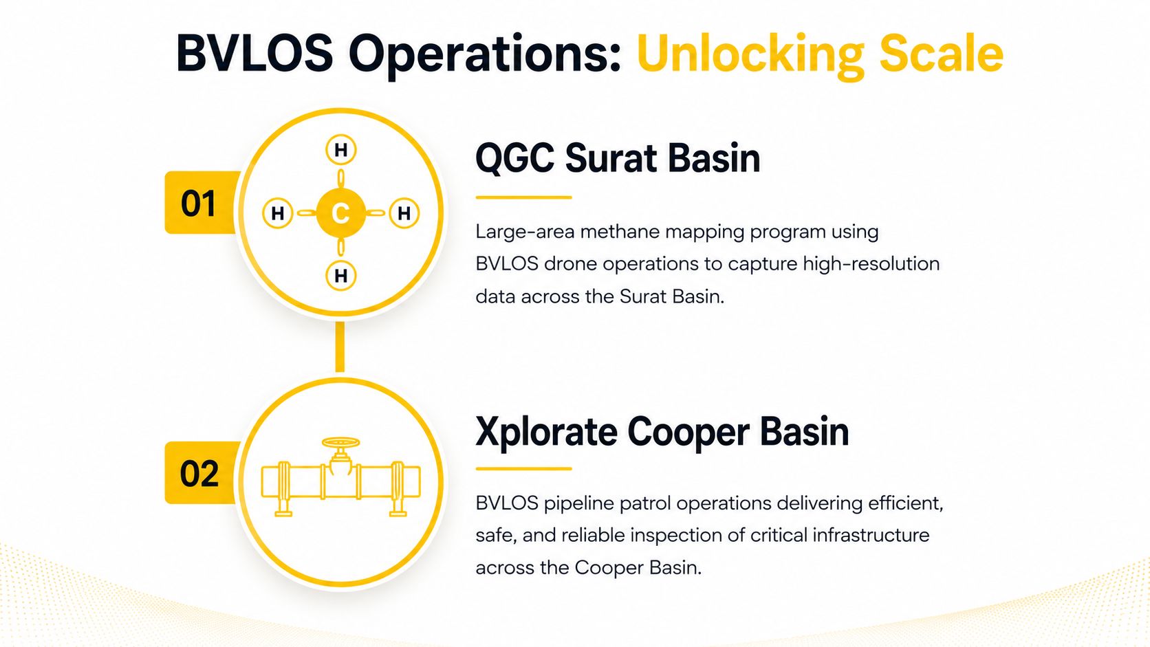
The Surat Basin example shows the scale such a model can support. QGC's CASA-approved operation covered wells, infrastructure and environmental conditions across a broad operating area, reducing the need to send crews between dispersed assets. The commercial gain came from coordinating the program, not from putting a camera on an aircraft.
That distinction matters for procurement. A client should assess how the operator will schedule repeated flights, maintain communications, manage lost-link events and preserve consistent sensor data across a distributed asset base. Pretty imagery is not enough. The records must support engineering review, maintenance decisions and an auditable safety case.
Cooper Basin approval sets a current benchmark
CASA approved Xplorate for BVLOS operations in the Cooper Basin, Australia's largest onshore petroleum region. The approval was issued on 10 December and remains valid through the end of March 2029, covering day and night flights over remote oilfields, gas pipelines, power transmission corridors and other critical assets, according to SwissDrones' announcement about the Xplorate approval.
A separate industry announcement describes the Xplorate Pacific approval as valid through 31 March 2029, with similar coverage of remote oilfields, gas pipelines and power transmission corridors. That account appears in Vertical Aerospace coverage of the Cooper Basin approval.
Remote basin work still demands disciplined field planning. The operator must set command and control arrangements, lost-link behaviour, launch and recovery areas, weather limits, emergency procedures, local airspace controls, site access and data backhaul. Long distances may require satellite communications and a clear escalation chain.
The test is whether the operation can run repeatedly under its CASA approvals and site safety system. Clients reviewing a pathway should compare the proposed concept with Ace Aviation Aerospace Academy's BVLOS training information, then confirm the aircraft, crew, procedures and evidence required for the actual operating environment.
End to End Mission Workflow and Data Handling
A defensible inspection begins at a desk. The team should identify the asset, operating hazards, airspace constraints, nearby people, hazardous zones, weather exposure, communications coverage and emergency options before a pilot travels to site. For complex operations, the risk assessment should align with the applicable CASA framework, including Part 102 requirements and SORA-aligned controls where relevant to the approval pathway.
Planning and flight execution
The desktop plan should connect the flight to the inspection question. A flare-stack mission may require controlled standoff distances, stable image geometry and thermal capture. A wellhead or tank survey may need an area grid, oblique imagery or repeatable viewpoints. Linear infrastructure needs a route that follows the asset while accounting for terrain, obstacles, power corridors and emergency landing options.
Automated flight planning can improve repeatability, but automation doesn't replace the remote pilot's judgement. Before launch, the crew should confirm aircraft condition, batteries, payload fit, firmware status, compass and navigation data, geofencing, weather, communications and the approved mission parameters. Any ground control station handover must be rehearsed, documented and understood by every crew member.
Practical rule: A repeatable mission is only useful when the aircraft, payload, weather limits and processing method remain comparable between surveys.
Processing and engineering handover
Post-flight handling should preserve the original files and their metadata, then apply the required corrections and quality checks. PPK or PPM corrections may be relevant to geospatial accuracy, while photogrammetry models should be aligned with earlier surveys when the operator needs change detection. Thermal and LiDAR data can be fused with visual records where that combination supports the engineering question.
The review team should tag each finding against a defined taxonomy. A useful record identifies the asset, location, observation, evidence type, confidence, recommended action and severity classification. The final output may then be transferred into SAP PM, Asset Health or AVEVA integrity systems, subject to the operator's own configuration and information-security controls.
Metadata deserves attention too. Flight logs, capture time, aircraft identity, payload settings and processing history can affect whether a record is auditable. Teams building a broader media-data governance process may also find it useful to compare video metadata testing tools, especially when large inspection datasets move between field, contractor and enterprise systems.
The end point isn't a folder of photographs. It's a controlled record that lets an integrity engineer understand what was inspected, how the evidence was collected and what action follows.
Reframing the ROI of Drone Inspection in Oil and Gas
The weakest business case says drones will replace helicopters. That framing is too narrow for Australian oil and gas. The stronger case values reduced exposure, better inspection cadence and faster response across assets where travel, access and hazardous work consume operational attention.
Australian providers describe drone inspections as a way to reduce scaffold, rope access, shutdown and working-at-height exposure while collecting engineering-grade data. They also emphasise inspection speed and consistency within CASA Part 101 commercial operating requirements, as explained by Sensorem's oil and gas inspection guidance.
Three levers produce the practical return
Exposure reduction is the first lever. A drone may inspect a flare stack, tank roof, offshore riser or confined structure without placing a person at the same physical access point. That doesn't eliminate all follow-up work, but it can help the operator decide whether a rope-access or shutdown intervention is justified.
Inspection cadence is the second. Repeatable visual, thermal or emissions surveys can reveal changes earlier than an infrequent manual visit. The value comes from finding a meaningful change while the operator still has choices, not from counting flights.
Response time is the third. On remote pipeline and production networks, a drone can provide targeted evidence before a crew drives to the location. That shortens the gap between an alert, an initial assessment and a maintenance decision.
| KPI Area | Legacy Method | Drone-Driven KPI |
|---|---|---|
| Worker exposure | Scaffold, rope access, confined-space entry or elevated inspection | Remote evidence first, with physical access reserved for confirmed work |
| Inspection cadence | Planned visits shaped by travel and access constraints | Repeatable missions that support more consistent comparison |
| Remote response | Ground crew mobilisation before visual confirmation | Targeted aerial assessment before dispatch |
| Environmental assurance | Ground observations across difficult terrain | Aerial records of erosion, flooding, vegetation encroachment and surface conditions |
| Data continuity | Photographs with variable viewpoints | Georeferenced visual, thermal, LiDAR or gas records aligned to the asset |
QGC's Surat Basin use case included wells, tanks, valves, vents, pipeline assets and environmental risks such as erosion, flooding and vegetation encroachment. That breadth supports a broader ROI view, where reduced travel and better situational awareness sit alongside safety and maintenance outcomes.
Drones still struggle when the inspection requires internal access, physical thickness measurement, contact testing, complex interpretation or a flight environment that the approved operating model can't support. The program should therefore measure avoided exposure, useful findings, response time and data quality, not just aircraft utilisation. Teams considering the business opportunity can also review drone business planning considerations for EOFY 2026.
Getting Started and Where Training Fits In
An oil and gas drone program should not begin with a purchase order. It should begin with a controlled operating model and a nominated person accountable for aviation compliance. The following baseline should be in place before the first production inspection.
The launch checklist
- Nominated ReOC holder: Assign organisational accountability for the approved operation and its procedures.
- Qualified pilot roster: Maintain suitably endorsed RePL pilots for the aircraft and operating conditions. Two pilots per rotation can support resilience where the roster and site model require it.
- BVLOS pathway: Obtain and maintain the CASA approval required for any beyond-visual-line-of-sight operation. Don't describe a long-range inspection as BVLOS-ready until the approval, procedures and risk controls exist.
- Safety management: Document hazards, controls, incident reporting, emergency response and contractor interfaces in a system aligned with the applicable CASA requirements.
- Payload governance: Keep sensor calibration, firmware, maintenance records and data-quality checks current.
- Integrity handover: Agree the defect taxonomy, severity rules, file naming, retention, review and export process with the asset owner.
- Training matrix: Track aircraft categories, night operations, fixed-wing or multirotor competencies and recurrent requirements relevant to the approved work.
The CASA drone licence pathway can help a new operator understand the individual qualification side. For an enterprise deployment, RePL training addresses pilot capability, while ReOC consulting addresses the organisational documentation and approval system. Enterprise Drone Training or Corporate Drone Training can then be scoped around the company's actual aircraft, sites and procedures rather than delivered as generic familiarisation.
Training content also needs to be managed like an operational asset. A structured VideoLearningAI training workflow can help teams organise instructional material, but it doesn't replace practical assessment, CASA requirements, site induction or supervised operational competency.
Ace Aviation Aerospace Academy is one Australian provider that offers RePL, AROC, ReOC consulting and enterprise-focused drone education. Its role should sit within a broader rollout that also includes the asset owner, aviation adviser, safety team, integrity engineers and site operations.
A workable six-month sequence
Week one: Nominate the accountable manager, identify priority assets, confirm the inspection questions and audit existing aviation and site procedures.
Month one: Select the operating model, confirm RePL competency needs, engage ReOC support where required, and define the data handover template with maintenance and integrity teams.
Month three: Run controlled trials on a limited asset set. Test the payload, mission repeatability, communications, defect classification and review workflow before expanding the scope.
By month six: Assess whether the operation is ready to scale across sites, add specialised sensors or pursue BVLOS. Scale only after the team can show consistent flight governance and usable inspection outputs.
Ace Aviation Aerospace Academy can help energy organisations build relevant capability through RePL training, AROC education, ReOC consulting and enterprise drone training. Visit Ace Aviation Aerospace Academy to discuss the aviation qualifications and operating support that fit an Australian oil and gas inspection program.
Frequently Asked Questions
What licence is needed for commercial oil and gas drone inspection in Australia?
Commercial operations typically require a Remote Pilot Licence for the pilot and a Remote Operator Certificate for the organisation. The exact approval pathway depends on the aircraft, location, people, airspace, operating conditions and mission design.
Is a RePL enough for pipeline inspection?
No. A RePL covers the individual pilot's qualification and privileges. The organisation conducting commercial work generally needs an ReOC, documented procedures and any additional CASA approvals required for the proposed operation.
Does BVLOS approval apply to remote oil and gas inspection?
It can. Long-range corridor work beyond the applicable visual limits generally requires a specific CASA approval and an operating model covering communications, lost-link response, airspace, emergency procedures and risk controls.
Which sensor is best for oil and gas drone inspection?
There isn't one universal payload. RGB suits general visual condition work, thermal supports heat-related assessment, LiDAR supports three-dimensional reconstruction, and optical gas imaging or laser methane sensors address emissions questions. The asset decision should determine the sensor.
Can drones replace rope access or shutdown inspections?
They can reduce the need for some preliminary access, working-at-height exposure and unnecessary shutdown activity. They won't replace every physical inspection, especially where contact measurements, internal access or specialist testing is required.
What makes drone inspection data defensible?
The record should link the approved mission, pilot, aircraft, payload, conditions, capture settings, processing method, quality checks, finding classification and maintenance action. Without that chain, high-resolution imagery may not support a reliable integrity decision.
