

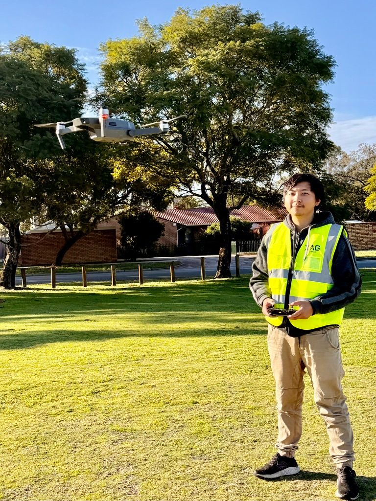
Direct answer: A drone licence Australia pathway usually includes a CASA Remote Pilot Licence (RePL) for most commercial work. However, a licence alone is not enough. Commercial pilots must also understand GNSS limits, radio interference, lost-link procedures, weather, batteries and aircraft automation.
Short Direct Answer
Technology makes commercial drone work safer and more efficient. It does not remove the pilot’s responsibility.
A professional pilot must know what the aircraft can do, what it cannot do and how it may fail. That means checking the airspace, weather, aircraft condition, control link, battery state and operating environment before every flight.
For many commercial operations, the correct pathway includes:
- A CASA Remote Pilot Licence, or RePL.
- Aircraft registration where required.
- Operation under a Remotely Piloted Aircraft Operator’s Certificate, or ReOC.
- Relevant aircraft category training.
- A documented risk assessment and safe operating procedure.
- Additional approvals for complex work, such as night operations or BVLOS flights.
The RePL is therefore the starting point. Sound judgement is what makes a pilot employable.
Meta description: Learn what a drone licence Australia requires in 2026, including GPS, RF safety and CASA rules. Start your commercial pilot journey today.
Why Technology Matters After You Get a Drone Licence Australia
Modern drones can hold position, avoid some obstacles, return home and follow pre-planned routes. These features are useful. However, each one depends on sensors, software, radio links and correct setup.
A pilot who trusts the screen without checking the environment can create a serious risk. For example, a return-to-home function may climb into a powerline if the height is set incorrectly. A geofence may not show a temporary restriction. An obstacle sensor may fail to detect a thin wire.
Consequently, technology should support a safety decision. It should never replace one.
Ace Aviation Aerospace Academy trains pilots to connect technical knowledge with practical procedures. The academy operates under CASA.ReOC.1421 and has trained more than 4,000 students. Training is available across Australia, with a broader global footprint that includes Singapore, Dubai, Korea and Malaysia.
The drone licence and RePL pathway explains the qualification options, practical training and commercial requirements.
Key Facts Table
| Technology or requirement | What it does | Main limitation | Pilot action |
|---|---|---|---|
| GPS and GNSS | Supports navigation, position hold and return-to-home | Signals can be weak, blocked, jammed or spoofed | Monitor GNSS status and remain ready for manual control |
| Control link | Sends commands between the controller and aircraft | Buildings, terrain and RF congestion can reduce range | Survey the site and set a suitable lost-link response |
| Geofencing | Warns about some airspace or site restrictions | Databases may be incomplete or outdated | Check official airspace information before flight |
| Obstacle avoidance | Detects some objects and assists with avoidance | Thin wires, darkness, glare and water can defeat sensors | Keep visual line of sight and plan a clear route |
| Remote ID | Can identify an aircraft electronically where required | Australian requirements may change | Check current CASA and aircraft requirements |
| Weather sensors | Show wind, temperature and aircraft conditions | Forecasts may not reflect local gusts | Use conservative limits and monitor conditions |
| Smart batteries | Estimate charge, health and flight time | Payload, cold, heat and age reduce endurance | Inspect batteries and plan a reserve |
| Automation | Follows routes or performs repeatable tasks | Software can make incorrect assumptions | Review the route and keep the ability to intervene |
| Thermal payloads | Detect heat differences | Reflections and incorrect settings affect results | Calibrate and understand the data |
| LiDAR payloads | Produces accurate 3D mapping data | Adds weight and depends on GNSS and IMU quality | Confirm aircraft limits, approvals and survey controls |
GPS and GNSS Limitations Commercial Pilots Must Understand
GPS is one part of the wider Global Navigation Satellite System, or GNSS. Depending on the aircraft, a drone may use signals from GPS, Galileo, GLONASS or other satellite systems.
GNSS supports:
- Position hold.
- Automated flight routes.
- Return-to-home.
- Mapping and surveying.
- Some geofencing functions.
- Flight logs and location data.
However, GNSS is not a guarantee of position accuracy.
Signal blockage and multipath
Buildings, dense trees, cliffs and large metal structures can block satellite signals. In cities, signals may bounce from buildings before reaching the receiver. This is called multipath. It can create inaccurate position information.
Therefore, a pilot should check satellite count, positioning quality and home-point status before take-off. The pilot should also consider the environment around the launch site, not just the number displayed on the controller.
Jamming and spoofing
Radio-frequency interference can disrupt satellite navigation. Intentional jamming is possible near sensitive sites. Accidental interference can also occur around industrial equipment, communication infrastructure and large events.
Spoofing is different. It involves false signals that may make the aircraft calculate the wrong position. A drone may appear stable while its reported location is inaccurate.
If GNSS becomes unreliable, the aircraft may enter an attitude mode. In that mode, it may no longer hold its position automatically. A commercial pilot must be ready to fly manually and land safely.
RF Interference and the Control Link
The control link carries commands and telemetry between the remote controller and aircraft. Many drones use radio bands that may also contain Wi-Fi, cellular and other signals.
RF interference may cause:
- Delayed commands.
- Reduced video quality.
- Telemetry warnings.
- Reduced control range.
- Intermittent connection.
- Complete loss of the control link.
The surrounding environment matters. A building can block the signal. Terrain can create a shadow. High-voltage infrastructure and communication equipment may add local interference.
A professional pre-flight survey should identify:
- Nearby radio towers.
- Wi-Fi-heavy locations.
- Large metal buildings.
- Power infrastructure.
- Industrial machinery.
- Terrain that blocks line of sight.
- The safest launch and recovery location.
The pilot should also keep the controller antennas correctly oriented. Small changes in aircraft direction can affect signal quality. In addition, the pilot should avoid flying behind obstructions simply because the video feed still appears normal.

Lost-Link Procedures and Failsafe Settings
A lost-link event occurs when the aircraft can no longer communicate reliably with the controller. Every commercial operation needs a planned response.
Most aircraft allow the pilot to select a failsafe action, such as:
- Return to home.
- Hover.
- Land.
- Continue a programmed mission.
No single setting suits every site.
For example, return-to-home may be suitable in an open rural area. It may be unsafe near cranes, bridges, powerlines or tall buildings. Hover may preserve the aircraft’s position, but it can drain the battery. Landing may be safer than returning across a busy road.
Before launch, confirm:
- The home point is correct.
- The return-to-home height clears known obstacles.
- The lost-link action suits the site.
- The aircraft has enough battery to complete the response.
- The crew understands what to do if the aircraft disappears from view.
- The procedure matches the operator’s manual or standard operating procedure.
A lost-link event should be recorded. A safety-critical event may also require internal reporting under the operator’s safety management system.
Geofencing Is a Warning, Not Permission
Geofencing uses software to show or limit flight near selected areas. These areas may include airports, helipads, restricted zones or other sensitive locations.
Geofencing is helpful, but it is not the legal source of permission. A drone may have:
- An outdated geofence database.
- An incomplete map.
- A warning that does not reflect a temporary restriction.
- No warning for a local hazard.
- A warning that can be unlocked without proper approval.
As a result, pilots must check current airspace information and local restrictions. They must also understand the difference between a software warning and a lawful authorisation.
The CASA drone rules and safety guidance should be checked before commercial operations. Pilots should also consider emergency operations, temporary events, private site restrictions and the presence of other aircraft.
Obstacle Avoidance and Human Oversight
Obstacle avoidance systems may use cameras, radar, LiDAR or ultrasonic sensors. They can help the aircraft detect larger objects. Yet they do not see everything.
Performance can reduce in:
- Low light.
- Strong glare.
- Fog or rain.
- Featureless walls.
- Reflective surfaces.
- Dense vegetation.
- Thin wires and branches.
- Water and glass.
- Fast or sideways flight.
Some aircraft only detect obstacles in certain directions. Others may not detect an object when moving quickly. Sensors can also become dirty, damaged or blocked by a payload.
This is why obstacle avoidance does not replace visual line of sight. The remote pilot remains responsible for the aircraft’s path, separation and landing area.
Automation should be treated in the same way. A waypoint mission can improve consistency. It cannot understand every changing hazard. People, vehicles, birds and temporary structures may enter the route after the mission is planned.
Weather, Battery and Power Management
Weather affects aircraft performance, image quality and operational safety. A forecast is useful, but it does not show every local condition.
Wind and gusts
Wind increases power use. Gusts near buildings, trees and hills can be stronger than the general forecast. A drone may use more battery while flying into the wind and struggle to return against it.
Before launch, check:
- Sustained wind.
- Gust speed.
- Wind direction.
- Temperature.
- Rain probability.
- Visibility.
- Cloud and smoke.
- Thunderstorm activity.
- Local turbulence.
Set a conservative limit for the aircraft, payload and site. Manufacturer limits are not always the same as a sensible commercial operating limit.
Battery temperature and age
Most professional drones use lithium-ion or lithium-polymer batteries. They provide high energy in a compact package. They also require careful handling.
A pilot should inspect every battery for:
- Swelling.
- Cracks.
- Impact damage.
- Water exposure.
- Connector damage.
- Abnormal heat.
- Unusual voltage behaviour.
Cold weather can reduce capacity. Hot weather can increase battery stress. Heavy payloads and strong wind also reduce endurance.
Do not rely only on the percentage shown on the controller. Plan a reserve for wind, delays, landing and an unexpected return. Use approved chargers and follow manufacturer storage guidance.

Thermal and LiDAR Payloads
Payloads expand the type of work a drone can perform. They also add risk and complexity.
Thermal imaging
Thermal cameras are used for:
- Solar panel inspections.
- Electrical asset checks.
- Roof inspections.
- Search and rescue.
- Agricultural monitoring.
- Fire and infrastructure assessments.
Thermal data is not the same as ordinary photographic data. Reflections, sunlight, wind, emissivity and surface material can affect the result.
A competent operator should understand:
- How to calibrate the sensor.
- When to perform a non-uniformity correction.
- How surface material changes readings.
- Why reflective surfaces may show false temperatures.
- How height and distance affect detail.
- How to protect client data and personal privacy.
The aircraft may be safe while the information is misleading. Therefore, payload training is part of professional competence.
LiDAR
LiDAR uses laser pulses to measure distance. It can create point clouds and support:
- Terrain surveys.
- Forestry work.
- Mining.
- Infrastructure mapping.
- Corridor surveys.
- Stockpile measurement.
LiDAR systems can add significant weight. The payload may also affect flight time, balance and aircraft handling. In addition, mapping accuracy depends on GNSS quality, inertial measurement unit performance, flight speed and mission design.
A pilot should confirm the aircraft’s maximum take-off weight and payload limits. The operator must also use the correct approvals, procedures and data controls.

Step-by-Step Process for Safe Commercial Drone Operations
1. Confirm the legal pathway
First, identify the type of operation. Consider the aircraft weight, location, purpose, altitude, proximity to people and airspace.
A small operation may fit a limited pathway. However, many professional jobs require a RePL and operation under a ReOC. Complex work may require further training or approval.
Use the Ace course options to compare RePL, AROC, BVLOS and specialist pathways.
2. Review the site
Visit the site or complete a robust remote assessment. Identify:
- People and vehicle movements.
- Buildings and structures.
- Powerlines and towers.
- Launch and landing areas.
- Emergency access routes.
- Wildlife.
- Airspace restrictions.
- Radio interference risks.
3. Check the aircraft and payload
Complete the manufacturer’s pre-flight checklist. Confirm that the aircraft, controller, propellers, batteries and payload are serviceable.
Update firmware only through a controlled process. Do not introduce an update immediately before a high-risk job without testing it first.
4. Plan the mission
Set the route, altitude, speed and battery reserve. Review return-to-home behaviour. Consider what happens if the aircraft loses GNSS, loses the control link or encounters an unexpected person.
5. Brief the crew
Every crew member should understand their role. The observer, visual observer and site contact should know how to report hazards and stop the operation.
6. Fly and monitor
Keep watching the aircraft and the environment. Monitor battery, signal strength, GNSS status, wind and warnings.
Do not continue simply because the client wants the shot. A professional pilot can pause, relocate or cancel the flight.
7. Record and review
Complete the required flight records. Save relevant logs, maintenance information and payload data. After the flight, record defects, delays and near misses.
Examples from Commercial Drone Work
Example 1: Roof inspection in Melbourne
A pilot is inspecting a commercial roof in Melbourne. The aircraft has an obstacle sensor and a thermal camera.
The pilot still needs to assess reflective roof surfaces, wind around the building and the separation from people below. Return-to-home height must also clear rooftop plant and nearby structures.
The thermal sensor can identify unusual heat. It cannot determine the cause without further inspection.
Example 2: Construction progress in Sydney
A construction client requests an automated mapping mission in Sydney. The route passes near cranes and temporary fencing.
The pilot should not assume the waypoint mission will avoid the crane. The pilot must update the route, check the GNSS environment and maintain visual oversight.
Automation helps collect repeatable data. The pilot remains responsible for the flight.
Example 3: Agricultural mapping near Brisbane
A pilot working near Brisbane is using a multispectral or thermal payload. The aircraft carries extra equipment, so battery endurance is lower.
The pilot should recalculate the reserve. Wind over open paddocks can also be stronger than expected. Data quality depends on consistent altitude, speed, lighting and sensor settings.
Example 4: LiDAR work in Perth
A LiDAR project near Perth requires accurate corridor mapping. The pilot must consider payload weight, satellite visibility and the performance of the inertial system.
The mission should be delayed if GNSS quality is poor or wind creates unstable flight. Accurate data is not a reason to accept unsafe conditions.
Example 5: Coastal inspection in Hobart
A coastal inspection near Hobart may involve cold temperatures, wind and rapidly changing weather.
The pilot should protect batteries from cold exposure, watch for gusts and plan a clear recovery area. The sea also creates a difficult background for vision sensors.
Common Mistakes Commercial Pilots Make
Mistake 1: Treating GPS as a safety guarantee
GNSS improves navigation. It does not prevent collisions. Always maintain awareness of obstacles, people and changing conditions.
Mistake 2: Trusting the geofence
A geofence is a technology feature. It is not a complete airspace check. Review official sources and local restrictions.
Mistake 3: Setting return-to-home too low
Trees, cranes and buildings may be taller than expected. Check the route between the aircraft and home point.
Mistake 4: Ignoring RF conditions
A strong video feed at launch does not prove that the link will remain strong across the entire site. Survey the route and keep line of sight.
Mistake 5: Flying to the battery percentage
Battery percentage is an estimate. Wind, payload, temperature and battery age can change the result.
Mistake 6: Using obstacle avoidance as an observer
Sensors do not replace a trained person. Keep watching the aircraft and its surroundings.
Mistake 7: Automating a poorly planned mission
Automation repeats the plan. It does not correct a bad plan. Review every waypoint before starting.
Mistake 8: Choosing the cheapest training pathway
The lowest advertised CASA RePL cost may not reflect the full support needed for commercial work. Compare aircraft category, practical training, assessment, fees and post-course support.
Mistake 9: Failing to record a near miss
Near misses reveal weaknesses before an accident occurs. Record and review them.
CASA Considerations for 2026
CASA requirements can change. Always check current rules before operating, especially for registration, airspace, night operations, BVLOS, controlled areas and operations near people.
For most professional pathways, the RePL is the pilot qualification. The ReOC applies to the organisation conducting the operation. A pilot may work under an employer’s ReOC rather than holding an individual operator certificate.
Technology does not change those responsibilities. A drone with obstacle avoidance still needs a lawful flight plan. A drone with Remote ID capability still requires proper registration and airspace compliance where applicable.
Australia’s Remote ID position may develop as regulation and technology mature. Pilots should not assume that a particular aircraft feature is legally required or sufficient. Check current CASA drone registration and operational information before relying on it.
Ace Aviation’s training is designed around practical compliance, not only a certificate. The academy’s ecosystem includes:
- CASA-approved RePL and aviation training.
- CASA.ReOC.1421 operational experience.
- More than 4,000 students trained.
- Locations across Australia.
- Global training across Singapore, Dubai, Korea and Malaysia.
- Altitude+ student benefits and ongoing support.
- DroneWork access for commercial opportunities and drone pilot jobs Australia.
- Industry pathways in inspection, mapping, agriculture, mining, construction and public safety.
Students can review the Ace Aviation approach before choosing a training provider.
Frequently Asked Questions
1. What is a drone licence in Australia?
A drone licence usually refers to a CASA Remote Pilot Licence, or RePL. It allows a person to operate remotely piloted aircraft in approved commercial settings, subject to aircraft category, airspace and operator requirements.
2. Do I need a commercial drone licence Australia pathway to get paid?
For most paid drone work, you need the appropriate pilot qualification and must operate under the correct organisation and approvals. A RePL is the common starting point for professional work.
3. Is a RePL the same as a drone licence?
Yes. “Drone licence”, “commercial drone licence” and “RePL” are common terms. RePL is the formal name for the Remote Pilot Licence.
4. What is the usual CASA RePL cost?
The cost depends on the aircraft category, training format, assessment and inclusions. Some Ace Aviation packages include CASA application fees. Check the current course pricing and packages before enrolling.
5. Does GPS make a drone safe to fly?
No. GPS and GNSS support navigation, but signals can be inaccurate or unavailable. A pilot must understand manual flight, satellite limitations and safe recovery procedures.
6. What should I do if GNSS is lost?
Maintain control, assess the aircraft’s behaviour and follow the approved procedure. Be ready to fly manually if the aircraft enters an attitude mode. Land in a safe area when practical.
7. What causes RF interference?
Common sources include Wi-Fi, cellular infrastructure, industrial equipment, power infrastructure and obstructions. The control link may also weaken behind buildings or terrain.
8. What is a lost-link procedure?
It is the planned response when the aircraft loses communication with the controller. The response may be return-to-home, hover or land, depending on the aircraft and operating environment.
9. Is return-to-home always safe?
No. It is only as safe as its settings and route. The return height must clear obstacles, and the aircraft must have enough battery to complete the return.
10. Can I rely on geofencing near an airport?
No. Geofencing is an aid. You must check current airspace information and follow CASA requirements. A missing warning does not mean the flight is permitted.
11. Does obstacle avoidance prevent collisions?
No. Obstacle avoidance can miss wires, branches, glass, water and objects in poor light. It should support, not replace, pilot judgement and visual line of sight.
12. What is Remote ID?
Remote ID is electronic identification technology that can share information about an aircraft and its operation. Requirements may change, so pilots should check current Australian rules and aircraft obligations.
13. How does weather affect commercial drone work?
Wind, gusts, rain, cold, heat, fog and storms can affect control, visibility, battery life and data quality. Pilots must set conservative limits and stop when conditions become unsafe.
14. How can I manage drone batteries safely?
Use approved chargers, inspect batteries before use and follow storage guidance. Retire batteries with swelling, damage, abnormal heat or unreliable voltage behaviour.
15. Can thermal cameras be used for inspections?
Yes. Thermal cameras support roof, solar, electrical, agricultural and public safety work. However, readings depend on calibration, surface material, reflections, weather and sensor settings.
16. Does LiDAR require a special licence?
LiDAR itself is a payload, not a pilot licence. However, the aircraft weight, operation type, data work and environment may require specific training, approvals or operating procedures.
17. Where can I find drone pilot jobs Australia?
Opportunities exist in construction, agriculture, mining, mapping, infrastructure, utilities, media and public safety. Ace graduates can explore commercial opportunities through DroneWork and the Ace jobs pathway.
18. Can I complete a drone course in Brisbane, Sydney or Melbourne?
Yes. Ace Aviation provides location-based training options in Brisbane, Sydney and Melbourne, with other Australian locations also available.
19. Is training available in Perth and Hobart?
Yes. Students can review the Perth training location and Hobart training location for current delivery details and dates.
20. Do I need more than a RePL for advanced drone work?
Often, yes. Night operations, BVLOS, heavier aircraft, controlled airspace and specialist payload work may require extra training, approvals or operator procedures. Discuss the planned operation with an approved training provider.
Summary
A drone licence Australia pathway gives you the foundation for commercial work. Yet safe professional flying requires more than passing an assessment.
Commercial pilots must understand how GNSS, RF links, failsafe settings, geofencing and obstacle sensors can fail. They must also plan for weather, battery limits and payload effects. Most importantly, they must keep control of the safety decision instead of handing it to automation.
Ace Aviation combines CASA-approved training with practical technology awareness, compliance support and career pathways. With CASA.ReOC.1421, more than 4,000 students trained, global delivery and support through Altitude+ and DroneWork, the academy helps students move from qualification to professional capability.
Ready to start? Book your training at aaa.edu.au or call 1300 336 366.
{“@graph”:[{“@id”:”https://aaa.edu.au/blog/drone-licence-australia-2026-gps-rf-interference-safety-technology”,”@type”:”Article”,”about”:[“Drone licence Australia”,”Commercial drone operations”,”GPS and GNSS safety”,”RF interference”,”CASA drone regulations”],”image”:[“https://cdn.marblism.com/B1ZZ_sb1RnK.jpg”,”https://cdn.marblism.com/7HXmPbo7hS2.jpg”,”https://cdn.marblism.com/2YYzv_jGTKz.jpeg”,”https://cdn.marblism.com/f3yvCbfsurr.jpeg”],”author”:{“url”:”https://aaa.edu.au/”,”name”:”Ace Aviation Aerospace Academy”,”@type”:”Organization”},”headline”:”Drone Licence Australia 2026: GPS, RF Interference and Safety Technology Every Commercial Pilot Must Understand”,”publisher”:{“url”:”https://aaa.edu.au/”,”logo”:{“url”:”https://aaa.edu.au/assets/ace-logo-transparent.png”,”@type”:”ImageObject”},”name”:”Ace Aviation Aerospace Academy”,”@type”:”Organization”},”inLanguage”:”en-AU”,”description”:”Learn what a drone licence Australia requires in 2026, including GPS, RF safety and CASA rules. Start your commercial pilot journey today.”,”dateModified”:”2026-09-04″,”datePublished”:”2026-09-04″,”mainEntityOfPage”:{“@id”:”https://aaa.edu.au/blog/drone-licence-australia-2026-gps-rf-interference-safety-technology”,”@type”:”WebPage”}},{“@id”:”https://aaa.edu.au/#organization”,”url”:”https://aaa.edu.au/”,”logo”:{“url”:”https://aaa.edu.au/assets/ace-logo-transparent.png”,”@type”:”ImageObject”},”name”:”Ace Aviation Aerospace Academy”,”@type”:”Organization”,”sameAs”:[“https://dronework.com.au/”],”telephone”:”+61-1300-336-366″,”areaServed”:[“Australia”,”Singapore”,”Dubai”,”Korea”,”Malaysia”],”description”:”Ace Aviation Aerospace Academy provides CASA-approved drone pilot training, RePL, AROC and aviation education across Australia and internationally.”},{“@id”:”https://aaa.edu.au/blog/drone-licence-australia-2026-gps-rf-interference-safety-technology#faq”,”@type”:”FAQPage”,”mainEntity”:[{“name”:”What is a drone licence in Australia?”,”@type”:”Question”,”acceptedAnswer”:{“text”:”A drone licence usually refers to a CASA Remote Pilot Licence, or RePL. It allows a person to operate remotely piloted aircraft in approved commercial settings, subject to aircraft category, airspace and operator requirements.”,”@type”:”Answer”}},{“name”:”Do I need a commercial drone licence Australia pathway to get paid?”,”@type”:”Question”,”acceptedAnswer”:{“text”:”For most paid drone work, you need the appropriate pilot qualification and must operate under the correct organisation and approvals. A RePL is the common starting point for professional work.”,”@type”:”Answer”}},{“name”:”Is a RePL the same as a drone licence?”,”@type”:”Question”,”acceptedAnswer”:{“text”:”Yes. Drone licence, commercial drone licence and RePL are common terms. RePL is the formal name for the Remote Pilot Licence.”,”@type”:”Answer”}},{“name”:”What is the usual CASA RePL cost?”,”@type”:”Question”,”acceptedAnswer”:{“text”:”The cost depends on the aircraft category, training format, assessment and inclusions. Some Ace Aviation packages include CASA application fees. Current pricing should be checked on the courses page.”,”@type”:”Answer”}},{“name”:”Does GPS make a drone safe to fly?”,”@type”:”Question”,”acceptedAnswer”:{“text”:”No. GPS and GNSS support navigation, but signals can be inaccurate or unavailable. A pilot must understand manual flight, satellite limitations and safe recovery procedures.”,”@type”:”Answer”}},{“name”:”What should I do if GNSS is lost?”,”@type”:”Question”,”acceptedAnswer”:{“text”:”Maintain control, assess the aircraft’s behaviour and follow the approved procedure. Be ready to fly manually if the aircraft enters an attitude mode. Land in a safe area when practical.”,”@type”:”Answer”}},{“name”:”What causes RF interference?”,”@type”:”Question”,”acceptedAnswer”:{“text”:”Common sources include Wi-Fi, cellular infrastructure, industrial equipment, power infrastructure and obstructions. The control link may also weaken behind buildings or terrain.”,”@type”:”Answer”}},{“name”:”What is a lost-link procedure?”,”@type”:”Question”,”acceptedAnswer”:{“text”:”It is the planned response when the aircraft loses communication with the controller. The response may be return-to-home, hover or land, depending on the aircraft and operating environment.”,”@type”:”Answer”}},{“name”:”Can I rely on geofencing near an airport?”,”@type”:”Question”,”acceptedAnswer”:{“text”:”No. Geofencing is an aid. You must check current airspace information and follow CASA requirements. A missing warning does not mean the flight is permitted.”,”@type”:”Answer”}},{“name”:”Does obstacle avoidance prevent collisions?”,”@type”:”Question”,”acceptedAnswer”:{“text”:”No. Obstacle avoidance can miss wires, branches, glass, water and objects in poor light. It should support, not replace, pilot judgement and visual line of sight.”,”@type”:”Answer”}},{“name”:”What is Remote ID?”,”@type”:”Question”,”acceptedAnswer”:{“text”:”Remote ID is electronic identification technology that can share information about an aircraft and its operation. Requirements may change, so pilots should check current Australian rules and aircraft obligations.”,”@type”:”Answer”}},{“name”:”How does weather affect commercial drone work?”,”@type”:”Question”,”acceptedAnswer”:{“text”:”Wind, gusts, rain, cold, heat, fog and storms can affect control, visibility, battery life and data quality. Pilots must set conservative limits and stop when conditions become unsafe.”,”@type”:”Answer”}},{“name”:”How can I manage drone batteries safely?”,”@type”:”Question”,”acceptedAnswer”:{“text”:”Use approved chargers, inspect batteries before use and follow storage guidance. Retire batteries with swelling, damage, abnormal heat or unreliable voltage behaviour.”,”@type”:”Answer”}},{“name”:”Can thermal cameras be used for inspections?”,”@type”:”Question”,”acceptedAnswer”:{“text”:”Yes. Thermal cameras support roof, solar, electrical, agricultural and public safety work. Readings depend on calibration, surface material, reflections, weather and sensor settings.”,”@type”:”Answer”}},{“name”:”Does LiDAR require a special licence?”,”@type”:”Question”,”acceptedAnswer”:{“text”:”LiDAR is a payload, not a pilot licence. However, aircraft weight, operation type, data work and environment may require specific training, approvals or operating procedures.”,”@type”:”Answer”}},{“name”:”Where can I find drone pilot jobs Australia?”,”@type”:”Question”,”acceptedAnswer”:{“text”:”Opportunities exist in construction, agriculture, mining, mapping, infrastructure, utilities, media and public safety. Ace graduates can explore commercial opportunities through DroneWork and the Ace jobs pathway.”,”@type”:”Answer”}},{“name”:”Can I complete a drone course in Brisbane, Sydney or Melbourne?”,”@type”:”Question”,”acceptedAnswer”:{“text”:”Yes. Ace Aviation provides location-based training options in Brisbane, Sydney and Melbourne, with other Australian locations also available.”,”@type”:”Answer”}},{“name”:”Is training available in Perth and Hobart?”,”@type”:”Question”,”acceptedAnswer”:{“text”:”Yes. Students can review the Perth and Hobart training locations for current delivery details and dates.”,”@type”:”Answer”}},{“name”:”Do I need more than a RePL for advanced drone work?”,”@type”:”Question”,”acceptedAnswer”:{“text”:”Often, yes. Night operations, BVLOS, heavier aircraft, controlled airspace and specialist payload work may require extra training, approvals or operator procedures.”,”@type”:”Answer”}}]}],”@context”:”https://schema.org”}
