

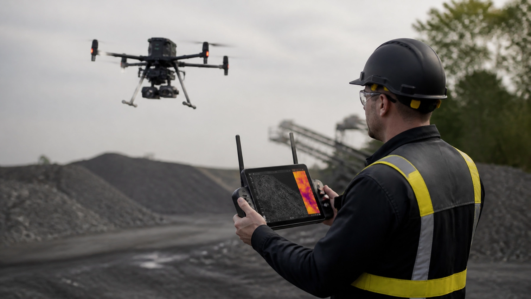
Short direct answer: A drone licence in Australia remains the foundation for professional work, but employers now seek pilots who can manage sensors, automated missions, AI data, aviation radios and risk. A RePL, AROC and suitable advanced training can help you move into higher-value commercial roles.
Meta description: Discover how a drone licence Australia prepares pilots for LiDAR, thermal and AI jobs. Explore training pathways and book your course.
Drone Licence Australia: What Is Changing in 2026?
The Australian drone industry is moving beyond simple aerial photography. A professional drone licence Australia pathway now often leads to work with LiDAR, thermal cameras, multispectral sensors and AI-assisted mapping.
However, technology does not replace aviation competence. A sensor can collect valuable data, but it cannot make a poor flight plan safe. Pilots still need to understand airspace, weather, human factors, radio procedures and emergency actions.
That is why a CASA-approved RePL remains important. It gives pilots the foundation to operate commercial remotely piloted aircraft safely. An AROC adds aviation radio capability, while advanced training supports specialist and more complex missions.
Ace Aviation Aerospace Academy has trained more than 4,000 students. Its training and operational ecosystem supports graduates across Australia and internationally, including Singapore, Dubai, Korea and Malaysia.
The Academy also operates under CASA.ReOC.1421. Its Altitude+ program, advanced courses and DroneWork jobs network connect training with ongoing development and commercial opportunities.
Key Facts for Commercial Drone Pilots
| Topic | What it means in practice |
|---|---|
| RePL | An individual Remote Pilot Licence for professional drone operations |
| AROC | Training and certification for aviation radio communication |
| ReOC | An organisation-level approval for specified commercial operations |
| LiDAR | Uses laser pulses to create accurate 3D maps and point clouds |
| Thermal imaging | Detects heat differences for inspection, safety and emergency work |
| Multispectral sensors | Capture crop and vegetation information beyond normal colour |
| AI-assisted mapping | Helps process imagery, identify features and detect changes |
| Automated flight planning | Creates repeatable routes and consistent data capture |
| Remote ID | Supports identification and accountability; it is not a detect-and-avoid system |
| Detect-and-avoid | Uses technology and procedures to reduce collision risk |
| Data security | Protects flight records, imagery, client information and sensitive infrastructure |
| Common city pathways | RePL and commercial training are available in Brisbane, Sydney, Melbourne, Perth and Hobart |
CASA rules can change. Therefore, pilots should confirm current requirements before every operation. Review the official CASA drone safety rules before planning a commercial mission.

How New Drone Technology Is Changing Pilot Jobs in Australia
LiDAR is creating demand for accurate mapping skills
LiDAR means light detection and ranging. The sensor sends laser pulses towards the ground or an object. It then measures the return time to create a detailed 3D representation.
Surveying, mining, construction and infrastructure companies use LiDAR to collect:
- Terrain models
- Stockpile measurements
- Tree and vegetation profiles
- Rail and road corridor data
- Quarry and mine-site information
- Digital elevation models
- Building and structure measurements
A LiDAR pilot must do more than fly a straight grid. The pilot needs to consider terrain, overlap, weather, battery limits and ground control. They must also understand how the payload affects aircraft weight and flight time.
For example, a mine may need a repeatable survey of a stockpile. The pilot plans the route, checks the operating area, manages the launch point and records the mission. Afterward, a survey specialist processes the point cloud.
This creates several roles. A pilot may operate the aircraft, while a GIS technician processes the data. In smaller businesses, one person may perform both tasks.
Thermal cameras are expanding inspection and emergency work
Thermal cameras show heat differences that normal cameras cannot see. They do not see through walls. Instead, they reveal temperature patterns on surfaces and objects.
Thermal drone work is growing across:
- Solar panel inspections
- Electrical infrastructure checks
- Roof and building assessments
- Fireground support
- Search and rescue
- Industrial plant inspections
- Livestock and agricultural monitoring
A thermal image can highlight a hot solar cell or electrical connection. It may also help emergency teams find a person in low-visibility conditions. However, the pilot must understand the limits of the data.
Sun angle, wind, reflective surfaces and emissivity can affect results. Emissivity describes how efficiently a surface emits thermal energy. Consequently, a pilot needs both flight skills and basic sensor knowledge.
A client may ask for “a thermal inspection.” The professional response is to define the purpose first. Is the client looking for electrical faults, water damage or heat loss? Each purpose needs a different flight plan and reporting method.
Multispectral sensors are improving agricultural decisions
Multispectral sensors capture wavelengths outside the visible range. These images can help identify plant stress, moisture patterns and changes in crop health.
Agricultural operators may use multispectral data to:
- Locate stressed crop areas
- Compare paddocks over time
- Monitor irrigation performance
- Support fertiliser decisions
- Identify weed pressure
- Plan targeted field inspections
The pilot still needs to understand weather, wind, sun angle and timing. A flight conducted after rain may not be comparable with a dry-season flight. Therefore, consistent mission planning is critical.
This technology also creates work for pilots who understand agriculture. A RePL is the aviation foundation. Specialist agriculture training then adds practical knowledge about heavy-lift aircraft, spraying systems, chemical handling and field procedures.
AI-assisted mapping is speeding up data processing
Artificial intelligence can process large volumes of aerial imagery faster than a person working manually. It may help classify objects, identify changes or highlight possible defects.
Common AI-assisted tasks include:
- Counting trees or poles
- Detecting roof damage
- Identifying stockpile boundaries
- Comparing construction progress
- Finding standing water
- Flagging possible solar defects
- Mapping road or rail assets
AI is an assistant, not a qualified surveyor, engineer or pilot. Its results must be checked against the original imagery and the client’s requirements.
This changes the pilot’s value. Employers increasingly want people who can collect clean, consistent data and understand its limitations. A pilot who knows how to explain confidence levels, image quality and gaps in coverage is more useful than someone who only presses “start mission”.
Automated Flight Planning Does Not Remove Pilot Responsibility
Automated flight planning helps pilots repeat a mission accurately. It can maintain speed, altitude, overlap and camera settings. This is valuable for mapping and inspection programs.
Yet automation introduces its own risks. A programmed route may cross a new obstacle, enter restricted airspace or place the drone too close to people. The pilot remains responsible for monitoring the aircraft and stopping the mission when conditions change.
A sound workflow includes:
- Reviewing the automated route.
- Checking airspace and local restrictions.
- Confirming the aircraft and payload weight.
- Identifying people, roads, buildings and obstacles.
- Setting safe return-to-home behaviour.
- Confirming battery and weather limits.
- Monitoring the mission continuously.
- Checking the captured data before leaving site.
RePL training supports this judgement. It teaches pilots to manage the whole operation rather than treating software as a safety system.
Remote ID and Detect-and-Avoid: What Pilots Need to Know
Remote ID and detect-and-avoid are related to safer airspace, but they are not the same thing.
Remote ID is designed to help identify a drone and its operator. It supports accountability, enforcement and airspace awareness. As at August 2026, Australia is still developing its approach, and Remote ID is not a substitute for the pilot maintaining visual line of sight.
Detect-and-avoid, or DAA, addresses collision risk. It may use radar, cameras, transponders, traffic information, geofencing and operational procedures. DAA becomes especially important in complex or beyond visual line-of-sight operations.
Remote ID does not automatically make a flight BVLOS compliant. Likewise, an obstacle sensor on a consumer drone does not create a CASA-approved detect-and-avoid system.
Pilots moving towards BVLOS work need advanced training and a strong understanding of safety cases, operational limitations and ReOC procedures. These are operational approvals, not simple software upgrades.

Data Security Is Becoming a Core Aviation Skill
Drone missions now produce valuable and sensitive information. A single flight may collect thermal images of an electrical substation, a detailed mine survey or imagery of private property.
Professional pilots should protect data from capture to delivery. Practical controls include:
- Use strong passwords and multi-factor authentication.
- Restrict access to authorised team members.
- Encrypt devices and storage where appropriate.
- Keep aircraft firmware and software current.
- Separate client files from personal accounts.
- Back up original imagery and flight records.
- Define how long data will be retained.
- Delete unnecessary copies after the agreed retention period.
- Record who receives processed information.
- Report lost devices or suspected breaches quickly.
CASA requirements focus on aviation safety and operational records. Privacy and surveillance rules can also apply under Australian, state and territory law. Therefore, data security should appear in the operator’s procedures, contracts and risk management system.
The pilot should also ask where cloud data is stored. Some clients, including government and critical infrastructure organisations, may require Australian hosting or strict access controls.
Practical Examples Across Commercial Drone Work
Surveying, mining and infrastructure
A LiDAR aircraft can map a construction corridor or mine bench. AI can then compare the new survey with previous data. The pilot’s role is to produce safe, repeatable and complete coverage.
Agriculture
A multispectral mission can identify crop stress. A heavier aircraft may then apply a targeted treatment. These operations require suitable RePL ratings, ReOC procedures and awareness of state chemical rules.
Solar panel inspection
A thermal camera can identify abnormal heat patterns across a solar farm. The pilot must maintain consistent altitude, camera angle and overlap. The report should explain that thermal anomalies require qualified technical investigation.
Emergency response
Thermal sensors can support search and rescue or post-fire assessment. Conditions may change quickly. Pilots need strong briefings, radio discipline, human-factor awareness and clear coordination with emergency services.
Cinematography
Professional film work depends on safe, repeatable movement. Automated flight modes may help, but the pilot must still manage people, obstacles, changing light and the production schedule.
Façade and solar cleaning
Cleaning aircraft use spray systems and heavier payloads. The job involves more than controlling the drone. Pilots must manage exclusion zones, hose or tether risks, chemical handling and building interfaces.
The same principle applies to solar panel cleaning. The technology may reduce the need for height access, but it does not remove aviation, site safety or environmental responsibilities.
What Training Supports These New Roles?
A RePL develops the foundation for commercial drone work. Training commonly covers:
- CASA regulations
- Airspace and aeronautical charts
- Meteorology
- Navigation
- Human factors
- Aircraft systems
- Batteries and payloads
- Risk management
- Emergency procedures
- Flight planning
- Practical operation
An AROC supports radio communications in aviation environments. This becomes valuable when operating near aerodromes, within structured teams or under more formal procedures.
Advanced training can add:
- Sub-25 kg or larger aircraft pathways
- Night VLOS operations
- BVLOS and EVLOS theory
- Agriculture
- Heavy-lift platforms
- Chief Remote Pilot responsibilities
- ReOC preparation
- Data and compliance systems
Ace’s course pathways range from entry-level RePL and AROC training to commercial business and enterprise options. The Gold pathway includes ReOC setup support, Chief Remote Pilot training, UAMP access, Night VLOS training and DroneWork access.
Eligible students can also receive Altitude+ benefits. These may support ongoing learning, refresher access and broader student development. Confirm current inclusions before enrolling, as package benefits can change.
City pathways for future drone pilots
Technology demand differs by location, although the core aviation skills remain the same.
- Brisbane: Construction, agriculture, infrastructure and energy create varied commercial opportunities.
- Sydney: Urban inspection, media, infrastructure and property work require careful airspace and people management.
- Melbourne: Surveying, construction, utilities, cinematography and asset inspection are strong pathways.
- Perth: Mining, resources, energy and remote-area operations drive demand for mapping and inspection skills.
- Hobart: Agriculture, forestry, conservation, infrastructure and emergency response can benefit from specialist sensors.
Local work still requires national CASA compliance. A city does not create a separate drone licence. Instead, the operating environment determines the planning, approvals and risk controls needed.
Step-by-Step Process: From Drone Licence to Technology-Ready Pilot
1. Choose a target industry
Start with the work you want. Mapping, mining, agriculture, inspection and media use different aircraft and sensors.
2. Check the aircraft category
Confirm the drone’s maximum take-off weight. Add the battery, payload and accessories. This affects the RePL category and operating requirements.
3. Complete a CASA-approved RePL pathway
Choose training that includes theory, practical flying and assessment. A good course should teach judgement, not only aircraft control.
4. Add AROC training
An AROC can strengthen your aviation communication skills. It is particularly useful for pilots working around aerodromes or in structured operations.
5. Build sensor capability
Learn how to operate the relevant payload. Practise camera settings, calibration, overlap, data quality checks and client reporting.
6. Understand ReOC operations
If you plan to operate your own commercial business, investigate ReOC requirements. This includes manuals, key personnel, procedures and safety management.
7. Add advanced training
Consider night operations, BVLOS theory, agriculture, heavy-lift systems, Chief Remote Pilot training or specialist inspection skills.
8. Create a secure data workflow
Decide how you will capture, store, process, transfer and delete client data. Document the process before accepting sensitive work.
9. Build a professional portfolio
Show sample maps, inspection reports and mission plans. Explain the business result, not only the drone model.
10. Find supervised or commercial opportunities
Ace graduates can access DroneWork opportunities. Experience helps you build confidence, references and industry relationships.

Common Mistakes New Commercial Pilots Make
Buying the sensor before defining the service
A LiDAR system is expensive. First confirm what clients need and what accuracy they expect.
Treating automation as permission
An automated route does not authorise a flight. The pilot must still check airspace, people, obstacles and weather.
Assuming a small drone avoids all compliance
Commercial use can trigger registration and operating obligations. Weight is important, but purpose and operating conditions also matter.
Confusing Remote ID with detect-and-avoid
Remote ID supports identification. It does not provide a complete collision-avoidance system.
Ignoring data quality
A visually attractive image may still be unusable. Confirm overlap, ground coverage, resolution and metadata.
Failing to plan for sensor limitations
Thermal imagery can be affected by weather and surface materials. Multispectral data needs consistent conditions. LiDAR can be affected by vegetation and processing settings.
Starting work without a clear client brief
Define the asset, deliverable, accuracy, location, timing and privacy expectations before flying.
Forgetting maintenance and batteries
Professional operations depend on battery health, firmware checks, propeller inspections and reliable logs.
Believing a RePL equals a business approval
A RePL is an individual pilot credential. A ReOC is an organisation-level approval. They serve different purposes.
Choosing training based only on price
The cheapest course may not prepare you for sensors, radio work, ReOC operations or real client demands. Compare support, practical training and post-course pathways.
CASA Considerations for 2026
CASA’s standard operating conditions remain central to most commercial work. Pilots should pay close attention to:
- Maximum operating height.
- Visual line of sight.
- Separation from people.
- Controlled and restricted airspace.
- Aerodrome proximity.
- Night operations.
- Emergency response areas.
- Aircraft registration.
- Pilot competency.
- ReOC privileges and limitations.
- Flight and maintenance records.
- Privacy and site permissions.
LiDAR, thermal and AI payloads do not create an automatic licence category. However, they can change aircraft weight, battery performance, visibility, mission duration and operational risk.
A complex operation may require a documented safety case or additional CASA approval. This is especially relevant for BVLOS, night work, operations near populated areas or missions involving critical infrastructure.
Pilots should also understand the difference between a capability and an approval. A drone may technically fly autonomously, but the operator must still comply with the approved operating framework.
Ace Aviation helps students overcome these regulatory hurdles through structured education. Its CASA-approved training, ReOC support, advanced pathways and operational ecosystem are designed for pilots who want to work professionally.
Frequently Asked Questions
1. Do I need a drone licence for commercial work in Australia?
It depends on the aircraft and operation. Many professional roles require a RePL, particularly when using larger drones or working under a ReOC.
2. What is the best drone licence Australia pathway for beginners?
Most beginners start with a CASA-approved RePL course. Adding AROC training can improve aviation communication skills and career options.
3. What is a commercial drone licence Australia employers recognise?
The RePL is the primary individual qualification for many commercial drone roles. Employers may also require aircraft ratings, AROC, site inductions and industry experience.
4. How much does a RePL cost in Australia?
The cost varies by provider, location and inclusions. Ace course packages displayed in 2026 range from entry-level training to business-ready pathways. Check the current course options before enrolling.
5. Does a RePL cover LiDAR operations?
A RePL supports the pilot competency needed to operate the aircraft. LiDAR work also requires payload training, mission planning, data quality and client reporting skills.
6. Do thermal cameras require a special CASA licence?
Thermal cameras do not create a separate CASA licence category. The aircraft, operating conditions, payload and mission risk determine the required pathway.
7. Are multispectral sensors used in Australian agriculture?
Yes. They can support crop health monitoring, irrigation checks and targeted field management. The pilot must also understand consistent data collection and agricultural procedures.
8. Can AI fly my drone without a pilot?
AI and automation can assist with navigation and data processing. They do not remove the pilot’s responsibility for safe operation and compliance.
9. Is Remote ID mandatory in Australia in 2026?
Australia is developing its approach to Remote ID. As at August 2026, pilots should not treat Remote ID as a replacement for current CASA operating requirements.
10. Is Remote ID the same as detect-and-avoid?
No. Remote ID supports identification and accountability. Detect-and-avoid systems help reduce collision risk during complex operations.
11. Do I need a ReOC to get drone pilot jobs Australia?
Not always. You may work under an employer’s or contractor’s ReOC. If you run your own operation, you may need your own ReOC.
12. What drone pilot jobs Australia offers the strongest technology exposure?
Surveying, mining, infrastructure inspection, agriculture, emergency response and energy work often use advanced sensors and data systems.
13. Can I work in drone mapping without being a surveyor?
You can collect aerial data within your competency and operating approval. However, regulated surveying and professional sign-off may require a qualified surveyor.
14. Is data security part of drone pilot training?
Basic aviation training covers operational records and risk management. Professional operators should add specific controls for client data, cloud storage, privacy and access.
15. Can a thermal drone inspect solar panels?
Yes. Thermal imaging can identify unusual heat patterns. The results should be reviewed by a suitably qualified technical professional before maintenance decisions are made.
16. Can I use a drone for mining surveys?
Yes, subject to the aircraft, operation, site rules and CASA requirements. Mining work often requires RePL competency, ReOC operations, inductions and strong data controls.
17. What training helps with façade or solar cleaning?
Start with the appropriate RePL pathway. Then add specialist equipment, site safety, payload, chemical and operational training for the cleaning system.
18. Where can I train for a drone course in Australia?
Ace Aviation delivers training pathways in Brisbane, Sydney, Melbourne, Perth and Hobart, along with other Australian locations. Check the training calendar for current dates.
19. Does Ace Aviation help graduates find work?
Ace graduates can access DroneWork, which connects qualified pilots with commercial tasks and opportunities across Australia.
20. What makes Ace Aviation different from a basic drone school?
Ace combines CASA-approved training with AROC, ReOC support, advanced aircraft pathways, Altitude+ benefits, practical experience and DroneWork career access. It has trained more than 4,000 students and maintains a global footprint across Singapore, Dubai, Korea and Malaysia.
Summary: Build Skills Beyond the Flight Controller
The strongest commercial pilots in 2026 will do more than fly safely. They will understand sensors, automated planning, AI outputs, aviation radios, data security and operational risk.
LiDAR is expanding mapping work. Thermal cameras are improving inspections and emergency response. Multispectral systems are supporting agriculture. AI is speeding up data processing, while Remote ID and detect-and-avoid are shaping future airspace management.
A RePL gives you the foundation. AROC, advanced training and ReOC knowledge help you work at a higher professional level. With the right pathway, your skills can support surveying, mining, agriculture, infrastructure, emergency response, cinematography and specialist services.
Ace Aviation brings together training, compliance, industry relationships, Altitude+ student benefits and DroneWork opportunities. That gives aspiring pilots a practical route from licence to career.
Ready to start? Book your training at aaa.edu.au or call 1300 336 366.
{“@graph”:[{“@id”:”https://aaa.edu.au/blog/drone-licence-australia-2026-lidar-thermal-ai#article”,”@type”:”Article”,”image”:”https://cdn.marblism.com/PCbhuOuussY.webp”,”author”:{“url”:”https://aaa.edu.au/”,”name”:”Ace Aviation Aerospace Academy”,”@type”:”Organization”},”headline”:”Drone Licence Australia 2026: How LiDAR, Thermal Cameras and AI Are Changing Pilot Jobs”,”keywords”:[“drone licence australia”,”commercial drone licence australia”,”drone pilot jobs australia”,”LiDAR drone training”,”thermal drone inspection”,”AI drone mapping”],”publisher”:{“@id”:”https://aaa.edu.au/#organization”},”description”:”Discover how a drone licence Australia prepares pilots for LiDAR, thermal and AI jobs. Explore training pathways and book your course.”,”dateModified”:”2026-08-19″,”datePublished”:”2026-08-19″,”articleSection”:”Industry/Tech”,”mainEntityOfPage”:”https://aaa.edu.au/blog/drone-licence-australia-2026-lidar-thermal-ai”},{“@id”:”https://aaa.edu.au/#organization”,”url”:”https://aaa.edu.au/”,”logo”:{“url”:”https://aaa.edu.au/assets/ace-logo-transparent.png”,”@type”:”ImageObject”},”name”:”Ace Aviation Aerospace Academy”,”@type”:”Organization”,”sameAs”:[“https://dronework.com.au/”],”telephone”:”+61-1300-336-366″,”description”:”CASA-approved professional drone pilot training provider offering RePL, AROC, ReOC and advanced aviation pathways.”},{“@id”:”https://aaa.edu.au/blog/drone-licence-australia-2026-lidar-thermal-ai#faq”,”@type”:”FAQPage”,”mainEntity”:[{“name”:”Do I need a drone licence for commercial work in Australia?”,”@type”:”Question”,”acceptedAnswer”:{“text”:”It depends on the aircraft and operation. Many professional roles require a RePL, particularly when using larger drones or working under a ReOC.”,”@type”:”Answer”}},{“name”:”What is the best drone licence Australia pathway for beginners?”,”@type”:”Question”,”acceptedAnswer”:{“text”:”Most beginners start with a CASA-approved RePL course. Adding AROC training can improve aviation communication skills and career options.”,”@type”:”Answer”}},{“name”:”What is a commercial drone licence Australia employers recognise?”,”@type”:”Question”,”acceptedAnswer”:{“text”:”The RePL is the primary individual qualification for many commercial drone roles. Employers may also require aircraft ratings, AROC, site inductions and industry experience.”,”@type”:”Answer”}},{“name”:”How much does a RePL cost in Australia?”,”@type”:”Question”,”acceptedAnswer”:{“text”:”The cost varies by provider, location and inclusions. Ace course packages displayed in 2026 range from entry-level training to business-ready pathways.”,”@type”:”Answer”}},{“name”:”Does a RePL cover LiDAR operations?”,”@type”:”Question”,”acceptedAnswer”:{“text”:”A RePL supports the pilot competency needed to operate the aircraft. LiDAR work also requires payload training, mission planning, data quality and client reporting skills.”,”@type”:”Answer”}},{“name”:”Do thermal cameras require a special CASA licence?”,”@type”:”Question”,”acceptedAnswer”:{“text”:”Thermal cameras do not create a separate CASA licence category. The aircraft, operating conditions, payload and mission risk determine the required pathway.”,”@type”:”Answer”}},{“name”:”Are multispectral sensors used in Australian agriculture?”,”@type”:”Question”,”acceptedAnswer”:{“text”:”Yes. They can support crop health monitoring, irrigation checks and targeted field management.”,”@type”:”Answer”}},{“name”:”Can AI fly my drone without a pilot?”,”@type”:”Question”,”acceptedAnswer”:{“text”:”AI and automation can assist with navigation and data processing. They do not remove the pilot’s responsibility for safe operation and compliance.”,”@type”:”Answer”}},{“name”:”Is Remote ID mandatory in Australia in 2026?”,”@type”:”Question”,”acceptedAnswer”:{“text”:”Australia is developing its approach to Remote ID. As at August 2026, pilots should not treat Remote ID as a replacement for current CASA operating requirements.”,”@type”:”Answer”}},{“name”:”Is Remote ID the same as detect-and-avoid?”,”@type”:”Question”,”acceptedAnswer”:{“text”:”No. Remote ID supports identification and accountability. Detect-and-avoid systems help reduce collision risk during complex operations.”,”@type”:”Answer”}},{“name”:”Do I need a ReOC to get drone pilot jobs Australia?”,”@type”:”Question”,”acceptedAnswer”:{“text”:”Not always. You may work under an employer’s or contractor’s ReOC. If you run your own operation, you may need your own ReOC.”,”@type”:”Answer”}},{“name”:”What drone pilot jobs Australia offers the strongest technology exposure?”,”@type”:”Question”,”acceptedAnswer”:{“text”:”Surveying, mining, infrastructure inspection, agriculture, emergency response and energy work often use advanced sensors and data systems.”,”@type”:”Answer”}},{“name”:”Can I work in drone mapping without being a surveyor?”,”@type”:”Question”,”acceptedAnswer”:{“text”:”You can collect aerial data within your competency and operating approval. Regulated surveying and professional sign-off may require a qualified surveyor.”,”@type”:”Answer”}},{“name”:”Is data security part of drone pilot training?”,”@type”:”Question”,”acceptedAnswer”:{“text”:”Basic aviation training covers operational records and risk management. Professional operators should add specific controls for client data, cloud storage, privacy and access.”,”@type”:”Answer”}},{“name”:”Can a thermal drone inspect solar panels?”,”@type”:”Question”,”acceptedAnswer”:{“text”:”Yes. Thermal imaging can identify unusual heat patterns. The results should be reviewed by a suitably qualified technical professional before maintenance decisions are made.”,”@type”:”Answer”}},{“name”:”Can I use a drone for mining surveys?”,”@type”:”Question”,”acceptedAnswer”:{“text”:”Yes, subject to the aircraft, operation, site rules and CASA requirements. Mining work often requires RePL competency, ReOC operations, inductions and strong data controls.”,”@type”:”Answer”}},{“name”:”What training helps with façade or solar cleaning?”,”@type”:”Question”,”acceptedAnswer”:{“text”:”Start with the appropriate RePL pathway. Then add specialist equipment, site safety, payload, chemical and operational training for the cleaning system.”,”@type”:”Answer”}},{“name”:”Where can I train for a drone course in Australia?”,”@type”:”Question”,”acceptedAnswer”:{“text”:”Ace Aviation delivers training pathways in Brisbane, Sydney, Melbourne, Perth and Hobart, along with other Australian locations.”,”@type”:”Answer”}},{“name”:”Does Ace Aviation help graduates find work?”,”@type”:”Question”,”acceptedAnswer”:{“text”:”Ace graduates can access DroneWork, which connects qualified pilots with commercial tasks and opportunities across Australia.”,”@type”:”Answer”}},{“name”:”What makes Ace Aviation different from a basic drone school?”,”@type”:”Question”,”acceptedAnswer”:{“text”:”Ace combines CASA-approved training with AROC, ReOC support, advanced aircraft pathways, Altitude+ benefits, practical experience and DroneWork career access.”,”@type”:”Answer”}}]}],”@context”:”https://schema.org”}
